


Geography teaching resources for Canada


Japanese Vocabulary and Phrase Posters
, Not Grade Specific,
Introduce Japanese numbers, greetings and everyday vocabulary with eight reference posters. Japanese script, romanised readings and English meanings appear together.
Author E & R Publications
Rating
Tags

Label the 7 Continents – World Map Worksheet
, Not Grade Specific,
A blank world map asks students to write in the names of the seven continents, paired with a second page presenting the completed answer map.
Author Elementary Resources 4 U
Rating
Tags Geography, Continents, World Map, Identify, Label
Labelling Latitude and Longitude Worksheet
, Not Grade Specific,
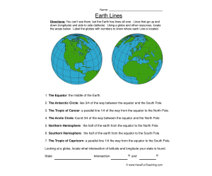
The page introduces invisible Earth lines by contrasting vertical longitude with horizontal latitude. Seven named regions or parallels are located and numbered on globe illustrations, including the equator, hemispheres, circles, and tropics. A coordinate extension asks learners to use the intersection of latitude and longitude to identify locations. The combined task develops both global reference vocabulary and the practical idea that two coordinates pinpoint a place.
Author Have Fun Teaching
Rating
Tags Maps, Longitude And Latitude Worksheet, Latitude And Longitude Worksheet, Latitude Longitude Worksheet, World Latitude And Longitude Worksheets
Land and Water Features: Match the Definitions
, Not Grade Specific,
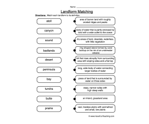
Match ten geographical terms with descriptions of features such as canyons, bays and peninsulas.
Author Have Fun Teaching
Rating
Tags

US States, Capitals and Abbreviations: Reference Table
, Not Grade Specific,
Look up all fifty US states, their capitals and postal abbreviations in an alphabetically arranged table.
Author MultiLingual Grammar Lab
Rating
Tags

Louisiana State Symbols: Picture Sheet
, Not Grade Specific,
Explore seven Louisiana symbols on one printable illustration sheet.
Author Teacher's Clipart
Rating
Tags
World Map Labelling Packet – Continents, Oceans, Mountains
, Not Grade Specific,
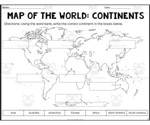
Blank world maps for labelling the seven continents, five oceans, and four major mountain ranges, with a completed answer-key map for each of the three topics.
Author Sarah Miller Tech
Rating
Tags Map Skills, Geography, Labeling, Continents, Mountains
Map of the World – Labelling Worksheets
, Not Grade Specific,
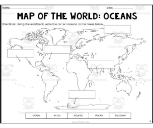
Blank world outline maps ask students to label continents, oceans and mountain ranges by name, each topic backed by its own answer key.
Author Sarah Miller Tech
Rating
Tags Map Of The World, Labeling, Geography, Oceans, Mountains, World Map Worksheets

Map Symbols Worksheet – Label & Identify
, Not Grade Specific,
Maps communicate location through small pictures, and this page asks learners to reason about what several unlabeled symbols could mean. Each illustration receives a student-created map label rather than being matched to a fixed bank. A final open prompt invites an original symbol, extending recognition into visual design. The activity supports discussion about why a useful symbol must be simple, distinctive, and understandable to another map reader.
Author Have Fun Teaching
Rating
Tags Maps, Geography Map Symbols
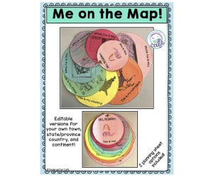
Me On The Map Book Companion + Lesson Plan Activity
, Not Grade Specific,
Students record where they live at expanding scales, from home and street up to country, continent, and world, building a flip-book keyed to reading the picture book Me on the Map by Joan Sweeney.
Author Kindergarten Cafe
Rating
Tags Social Studies Activity, Geography Activity, Geography Lesson Plan, Book Companion, Map Activity

Michigan State Symbols: Colouring Sheet
, Not Grade Specific,
Explore Michigan through a single colouring sheet with its outline and six state-symbol illustrations. Add your own research or discussion activity.
Author Teacher's Clipart
Rating
Tags

Nebraska State Symbols: Illustration Sheet
, Not Grade Specific,
Explore six Nebraska plant and animal symbols alongside the state outline on one printable page.
Author Teacher's Clipart
Rating
Tags

Nevada State Symbols: Picture Sheet
, Not Grade Specific,
Explore a Nevada state outline and symbol pictures on one black-and-white PDF page.
Author Teacher's Clipart
Rating
Tags

New Hampshire State Symbols: Illustration Sheet
, Not Grade Specific,
Use New Hampshire state-symbol artwork with a teacher-planned report, display or discussion.
Author Teacher's Clipart
Rating
Tags
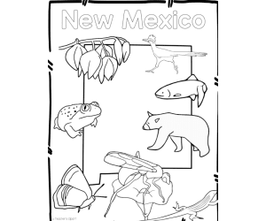
New Mexico State Symbols: Picture Sheet
, Not Grade Specific,
Name, describe or colour New Mexico symbols such as the roadrunner, black bear and yucca on a one-page reference sheet.
Author Teacher's Clipart
Rating
Tags
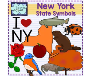
New York State Symbols: Picture Sheet
, Not Grade Specific,
Explore eight illustrated subjects, the state outline and an I ♥ NY label on a one-page New York reference sheet.
Author Teacher's Clipart
Rating
Tags

Ohio State Symbols: Picture Sheet
, Not Grade Specific,
Explore nine outlined Ohio symbols, including the cardinal, buckeye and white-tailed deer, on one printable sheet.
Author Teacher's Clipart
Rating
Tags
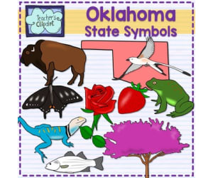
Oklahoma State Symbols: Picture Sheet
, Not Grade Specific,
Explore Oklahoma symbols such as the scissor-tailed flycatcher, redbud and buffalo on a one-page printable sheet.
Author Teacher's Clipart
Rating
Tags

Oregon State Symbols: Illustration Sheet
, Not Grade Specific,
Use a single-page Oregon outline and state-symbol illustrations as a reference for your own research, captions or discussion.
Author Teacher's Clipart
Rating
Tags
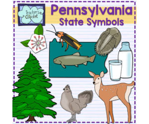
Pennsylvania State Symbols: Picture Sheet
, Not Grade Specific,
Explore Pennsylvania symbols on one printable illustration sheet.
Author Teacher's Clipart
Rating
Tags
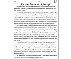
Physical Features of Georgia Reading Packet
, Not Grade Specific,
Two versions of the informational reading span multiple pages and explain the location and significance of key Georgia landforms, rivers, and geographic regions. Follow-up work asks learners to connect feature names with descriptions and answer questions based on the passage. The structure combines state geography with reading comprehension rather than serving as a standalone map. It can support a Grade 8 Georgia studies unit or evidence-based review.
Author Sarah Miller Tech
Rating
Tags Geography, Graphic Organizers, Mapping Skills, Economics, Writing Tasks, Georgia Physical Features Map, Georgia's Physical Features, Physical Features Of Georgia, 6 Major Physical Features Of Georgia, Physical Features In Georgia, Georgia Physical Map
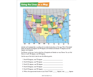
Reading a Map Worksheets – Social Studies Practice
, Not Grade Specific,
Compass directions, hemispheres, longitude and latitude, and five map types (political, physical, road, transportation, and scale/distance) are taught and practised across a sequence of illustrated town, park, and airport maps.
Author Twin Sisters Digital Media
Rating
Tags Compass, Globe, Map, Scale, Legends, Map Scale Practice Worksheets, Reading A Map Worksheet, Worksheets
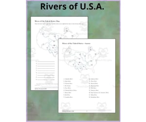
US Rivers: Identification Map and Answer Key
, Not Grade Specific,
Match eighteen numbered rivers with the alphabetised word bank, then check the full answer map.
Author TheBrightestKid
Rating
Tags
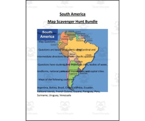
South America Map Scavenger Hunt Bundle
, Not Grade Specific,
Fourteen individual country map scavenger hunts across South America each pair a labelled outline map with direction-based find-and-mark questions and a matching answer key.
Author Mr. Matthews Teacher Store
Rating
Tags South America, Geography, Map Skills, Middle School