search
user.png
vertical menu

Ancient Indian Geography Interactive Notebook

Ancient Indian Geography Interactive Notebook preview
Ancient Indian Geography Interactive Notebook preview 2
Ancient Indian Geography Interactive Notebook preview 3
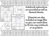
Ancient Indian Geography Interactive Notebook preview 4
Ancient Indian Geography Interactive Notebook preview 5

Look Inside · 10 pages

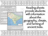
Indian geography reading on Gondwana, the Himalayas, the Indus and Ganges, farming, the monsoons and the Deccan Plateau
Background reading to share before students build their notebook pages
Map of India showing dry and wet monsoon winds, rivers, mountains and plateaus, above a reading on elephants and tigers
Reference map to project while discussing seasonal wind patterns
Indian geography reading split under headings: The Himalayas, The Indus & Ganges, Farming and The Monsoons
Version with section headings for readers who need clear chunking
Monsoon map of India with red dry-season and blue wet-season wind arrows, then an Animals section on endangered wildlife
Pairs with the headed reading as its second page
Map labeling on shaded relief of India: students place 16 cut-out names such as Thar Desert, Himalayas and Western Ghats
Notebook map activity to check place knowledge after the reading
Outline map of India with rivers; students cut out and glue 16 place names like Ganges Delta, Indus and Sri Lanka
Plain outline alternative to the shaded map activity
Himalayas foldable cut-out: a mountain flap over panels Gondwana, Moving and Collision for sequencing how the range formed
Students write or draw each stage on the panels
The Ganges & Indus fold-out flap for writing about the rivers, plus a Farming chart with eight spaces to fill in
Follow-up to the Indus & Ganges and Farming sections of the reading
Monsoon cut-out pieces: a rain cloud labeled The Summer Monsoon and a sun over mountains labeled The Winter Monsoon
Students explain each season's winds on these notebook flaps
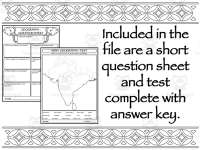
Geography question sheet: nine short-answer questions on Gondwana, the Himalayas, rivers, crops, beef and the monsoons
Exit ticket or homework to check reading comprehension
Attributes
Add To Collection
Add to collection Add to collection

About This Product

The Ancient Indian Geography Interactive Notebook engages middle school students with various activities to help them learn about the geography, climate, and farming of ancient India. Students will find reading sheets that provide informative facts in a straightforward manner best suited for grades 7-8. The notebook contains short question sheets to assess understanding, along with element sheets and images to bring interactive learning to life. Teachers can utilize the PowerPoint presentation to guide students through lessons in this comprehensive unit. Whether for whole class, small groups, or individual work, this informative and concise resource equips students to master concepts related to ancient Indian geography.

What's Included

1. A Presentation

2. Preview Sheets as PDF and JPEG files

3. Element Images

4. Sheet Sets

0 Reviews

Explore related searches
you may also like...

Check out these other great products