Bhutan Map Resources


About This Product
Bhutan Map Resources
This teaching resource, known as "Bhutan Map Resources", is a detailed collection of mapping tools intended for educational use. It's an incredibly versatile tool, suitable for teaching Social Studies or Geography at any grade level.
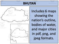
The package features six individual map sheets available in three convenient formats: pdf, jpeg, and png. This offers adaptability based on the user's technical abilities and preferences.
Map Details: The included maps provide both blank outlines and complex depictions of water bodies and major settlements in Bhutan. Teachers can use these to focus on Bhutan alone or its connections with neighbouring countries, offering opportunities to discuss geopolitical relationships in context of geographical features.
Creative Permissions: Beyond just being instructional materials, purchasers are allowed to leverage these maps for creative purposes - like projects or presentations. This may involve using them as foundational elements onto which they can layer their own designs. However, certain usage rules must be followed (see preview sheet).
All files are neatly packed into a simplified zip format available for instant download upon purchase completion.
Lastly but importantly: Beyond focusing on Geography, these maps can boost creativity skills – making it equally valuable resource not only for geography teachers but all imparting education across disciplines!
0 Reviews
Check out these other great products