The Americas, Africa & Japan Mapping Worksheet

About This Product
If your history students are studying ancient civilizations, this is a great resource that will help students organize their thoughts, take notes, and review their learning in engaging ways.
This is a The Americas, Africa & Japan Mapping Worksheet. This was designed for your high school history students. It is a 2-page resource that emphasizes important aspects of these locations.
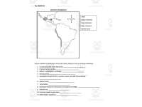
On the first page, there is a map of the Americas. Students will label the Mayan Civilization, Incan Civilization, Aztec Civilization, Atlantic Ocean, Pacific Ocean, and Andes Mountains. Then students will answer 11 questions.
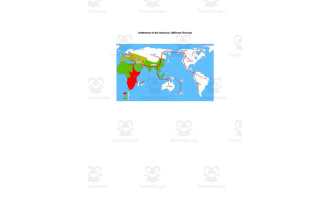
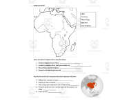
On the second page, there is a map of Africa and Japan. Students will label the Sahara, Atlantic Ocean, Niger River, Great Zimbabwe, and Axum. Then students will answer 9 questions.
This worksheet can be used for independent work, homework, an assessment and more. You may even have students complete it together in partners or small groups.
I hope you enjoy!
Take A Look at My Best Sellers:
Age of Absolutism Essentials Sheet
Independence Movements Cheat Sheet
Who Am I? World History II Review
You can find more resources at my storefront here: https://teachsimple.com/contributor/history-with-delong
What's Included
An editable 2-page Word doc
Resource Tags
0 Reviews
Check out these other great products