Using an Ordnance Survey Map
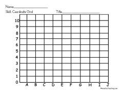
Ordnance Survey map practice in both directions: students name the feature at a given grid reference, then find the grid reference for a named feature, before moving on to symbols and compass directions.


- Year levels
- Years 3–5
- Pages
- 1
- File type
- Preparation
- Print ready


- Subject
- Geography, Social Studies
- Topic
- Ordnance Survey Maps, Map Skills
- Resource types
- Worksheets
- Preparation
- Print ready
From the author
About this resource
Using an Ordnance Survey Map is a 1-page social studies worksheet that teaches Years 3–5 students how to read and utilise information from ordnance survey maps. Students will gain experience identifying map symbols, grid references, and other common map features. The worksheet provides definitions and examples that allow students to practise reading an ordnance survey map. Knowledge checks throughout the worksheet enable students to apply their new mapping skills. In the end, students will have a stronger grasp on reading and using ordnance survey maps. This social studies resource can be used individually or in small groups to build students' geography and mapping abilities. Answer key included.
Related resources
More resources teachers may find useful
More resources on the same subject and topic.

In the classroom
Teaching tips & learning objectives

Learning objectives
Identify what Ordnance Survey symbols stand for and draw the symbols for a bridge and a golf course
Describe the direction a river or road runs using compass points

No reviews yet
Downloaded this resource? Tell other teachers how it went.
Resource details
Concepts & topics
Core concepts
 Core concepts
Ordnance Survey maps
Grid references
Map symbols
 Topics
Explore more
Categories this resource belongs to
Explore related searches



More to explore