Cut and Paste World Map – 7 Continents Activity


- Pages
- 2
- File type
- Answer key
- Included


- Subject
- Geography, Social Studies
- Topic
- Map, Continents
- Resource types
- Activities
- Answer key
- Included
From the author
About this resource
Cut and Paste Continents - World Map Continents
Cut and Paste Continents - World Map Continents is a fun and interactive worksheet that helps improve fine motor skills and promotes knowledge of the world's continents. Students are encouraged to actively participate in discovering and identifying the various Continents on a global world map through this practical exercise.
Students will carefully cut out the labels for the continents of the world Europe, North America, South America, Africa, Antarctica, Asia, and Australia, and then carefully paste them onto the appropriate regions of the blank globe map on the worksheet. This tactile method improves manual dexterity and hand-eye coordination in addition to reinforcing geography information.
Students are more likely to remember facts about the Continents of the world and their locations if they actively participate in the cutting and pasting process.
The seven continents of the world : Europe, North America, South America, Africa, Antarctica, Asia, and Australia.
Answer key is provided to allow for self-assessment and immediate feedback, encouraging students to take ownership of their educational journey.
Implementation Format: Letter size, landscape.
File types: pdf
Number of Pages: 2
Grades or ages: Grade 3, Grade 4, Grade 5, Grade 6, Grade 7, and Grade 8.
Related resources
More resources teachers may find useful
More resources on the same subject and topic.


In the classroom
Teaching tips & learning objectives

Learning objectives
Name all seven continents and locate each one on a world map
Distinguish North America from South America and Europe from Asia by position rather than by name alone
Place Antarctica correctly at the foot of the map, where it is easily overlooked
Read a world map as a set of separate landmasses rather than as a single picture

Teaching tips
Cut the strip apart before handing it out to younger children — seven small boxes along one edge are fiddly for early scissor skills, and cutting is not the point of the task
The seven names are printed in a scrambled order rather than alphabetically or by size, so students cannot work through the strip in sequence and have to match each one
Europe and Asia share a landmass, which is the placement most classes argue over; it is worth settling the boundary before the labels go down
Hand out the labels one at a time for a whole-class version, so the map fills in together and each continent gets discussed as it is placed
Because the completed page carries the same layout, it can be projected as a check while students hold their own copy

Skills covered
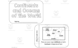
Continent identification — students match seven printed names to seven landmasses on a world map with nothing else labelled.
Map reading — the map carries no borders, country names or compass, so position and shape are the only cues available.
Cutting and placing — the labels are printed as boxes to snip apart and paste down, making the task physical rather than written.
Self-checking — a completed version of the same page lets a student or a partner compare placements once the paste is dry.
Good to know
Questions teachers ask about this resource
What is printed on the map itself?
The landmasses only. No continent names, country borders, ocean names or compass rose appear on the working page, so students place their labels by recognising the shape and position of each continent rather than by reading anything on the map.
Are the labels ordered in a way that gives the answer away?
They are scrambled. The strip reads Australia, Africa, Antarctica, Europe, South America, Asia, North America — neither alphabetical nor arranged left to right across the map — so each label has to be matched individually.
Which continents are hardest to place on this map?
Europe and Asia, which share one landmass with no border drawn between them, and Antarctica, which sits along the bottom edge and is easy to miss. The completed page settles all three, showing Europe above Africa, Asia to its right and Antarctica along the foot.

No reviews yet
Downloaded this resource? Tell other teachers how it went.
Resource details
Concepts & topics
Core concepts
 Core concepts
Continents
World map
Geography
Map skills
Topics
 Topics
Explore more
Categories this resource belongs to
Explore related searches


More to explore