2,776 products added recently
Page 29 - Social Studies Worksheets
Enhance your social studies curriculum with worksheets covering geography, history, civics, and cultures. These resources include maps, timelines, and critical thinking exercises. Use them to deepen understanding of societal structures and encourage informed citizenship.
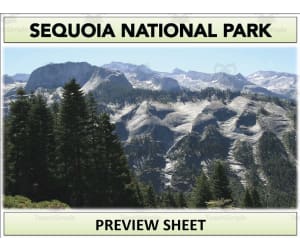
Sequoia National Park Geography Unit
Social Studies, ELA, Geography, Reading, Reading Comprehension, Grade 6, 7, 8, 9, Teacher Tools, Lesson Plans, Presentations, Worksheets & Printables, Worksheets
Sequoia National Park Geography Unit Transport students to Sequoia National Park with this engaging geography unit. Through informative reading passages, vibrant images, and interactive activities like crosswords and videos, middle schoolers will become immersed in the park's captivating history, wildlife, climate, and landscapes. The complete set of materials equips educators to guide a comprehensive study on this iconic landmark. It includes condensed and extended reading sheets, QR code links to supplementary videos, worksheets for further analysis, eye-catching visuals for projects, an accompanying PowerPoint presentation to facilitate instruction, and templates to help students synthesize their knowledge into presentations or booklets. This versatile and multi-faceted unit brings Sequoia National Park’s unique geography alive and makes learning memorable.
Author Mr Gray History
Tags National Park Services, Sequoia National Park, Landmarks, Monuments, Geography Unit, Wildlife, Climate Lesson, Climate Activity

Nicaragua Map Resources
Social Studies, Geography, Not Grade Specific, Worksheets & Printables, Worksheets
Nicaragua Map Resources Designed with educators in mind, the Nicaragua Map Resources is a comprehensive teaching aid that offers versatility and adaptability. This resource provides users with twelve separate maps of Nicaragua in varying detail levels. Available formats for each map encompass pdf, jpeg, and png to ensure compatibility and use across different platforms. These sizable resources display both blank outlines as well as fully detailed sketches of the Central American country's topography. They feature significant natural elements such as bodies of water while also highlighting major settlements. Additionally, some versions display Nicaragua isolated to provide a concentrated view of the nation's geography. Others show it contextually within its surrounding nations, promoting a more comprehensive understanding of regional dynamics. An added advantage for purchasers is that these resources are customizable for different needs- Whether you're planning an interactive lesson or preparing educational materials on geography or social studies in general, these maps can add substantial value. This product makes no restrictions regarding grade levels – teachers instructing at any stage can benefit from incorporating these versatile resources into their curriculum while focusing on subjects like Social Studies or particularly Geography. These easily accessible files come as downloadable Zip format types geared towards streamlining your prep work process while enhancing your instructional efficiency and effectiveness by leaps! Please note we also offer a free download link for U.S Maps. With this expansion pack options, teachers possess complete discretion over geographic focus area enabling them to adapt according to diverse learner needs!
Author Mr Gray History
Tags Nicaragua, Geography Resources, Map Pack, Central America, Topography

Quotes From William Shakespeare Copywork : Set 11
Social Studies, History, History: British, Grade 2, 3, 4, 5, 6, 7, 8, Worksheets & Printables, Worksheets
This Copywork Notebook set walks your student through daily bite-sized portions from works by Shakespeare. This product includes regular spaced lines for older students. It also includes activities for extending the vocabulary lesson for each passage. Copywork Notebooks are designed to help your children to learn spelling, punctuation, sentence structure, and vocabulary while copying from historical information. The idea is that your student will actually begin to imitate the elements in his or her own writing. This product is an ebook in PDF format. Keywords: Shakespeare, William Shakespeare, Shakespeare Copywork, Copywork, Charlotte mason
Author Knowledge Box Central
Tags Shakespeare, William Shakespeare, History, Copywork, Spelling
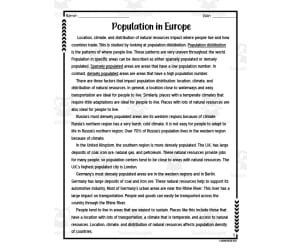
Population Distribution in Europe Reading Packet
Social Studies, Geography, Grade 6, Worksheets & Printables, Worksheets
Population Distribution in Europe Reading Packet is an insightful resource for sixth grade social studies. Students will read an informative passage about population distribution across Europe and apply key geography terms from the reading. The packet includes reading comprehension activities such as multiple choice questions and graphic organizers . Educators can utilize this printable PDF packet for whole class instruction, small group work, or as an independent homework assignment. By engaging with the real-world content and vocabulary building exercises, students will build their understanding of geography and economics in an approachable way. This practical resource saves teachers' time while allowing them flexibility to best support each learner's needs.
Author Sarah Miller Tech
Tags Population Distribution, Writing Prompts, Geography, Europe, Graphic Organizers

Eritrea Map Resources
Social Studies, Geography, Not Grade Specific, Worksheets & Printables, Worksheets
Eritrea Map Resources The Eritrea Map Resources is an invaluable teaching tool for individuals seeking a comprehensive collection of map sheets particularly tailored to geographic coursework. This product is adaptable and serves as a flexible asset for public school teachers and homeschoolers alike due to the fact that it's not grade specific, making it useful across different education levels. Content: In terms of content, the package encompasses six distinct map sheets that come in pdf, jpeg, and png formats. These offer versatility for various learning needs or instruction methods. Covering an expansive range of detail, the maps capture blank outlines , which provide room for note taking or labeling practices to support student comprehension. Additionally, they illustrate bodies of water and major settlements in order to provide detailed insight into geographical features unique to Eritrea. Apart from just focusing on the standalone country's topography ––the resource also puts Eritrea within its broader context by offering maps presenting it alongside surrounding nations. This could aid students in developing their knowledge about regional geography relationships or comparative studies between countries. Educational Use: Educators looking forward to creating personalized lesson materials can make use of these maps as per instructions specified on the preview sheet. Accomplishing so will enable them incorporate well-suited elements into their customized instructional resources accordingly enhancing pedagogical approaches. The product file type stands out since presented as zip format ensuring easy downloading while maximizing storage space efficiency.. The Eritrea Map Resources, evidently put together with the practical needs of educators at its core provides users with a tool suite capable enhancing social studies lessons particularly those emphasizing geography subtopics.
Author Mr Gray History
Tags Eritrea, Geography, Map Resources, Social Studies, Lesson Planning

Crash Course Government Episode Worksheet | 12 - Presidential Powers 2
Social Studies, Government, Grade 7, 8, 9, 10, Worksheets & Printables, Worksheets
Crash Course Government Episode Worksheet | 12 - Presidential Powers 2 Help students deepen their understanding of the US government and the role of the president with this informative worksheet . Paired with the Crash Course Government video on presidential powers, this 2-page handout features 15 short answer questions to guide students in analyzing key concepts from the 7-minute video. Topics covered include checks and balances, executive orders, veto power, and more. An answer key is included for student self-checking after completion. This versatile resource can be used individually or in groups in social studies classes or as a supplemental activity. Applicable for grades 7-10, it promotes critical thinking skills in an engaging way. Check out other US government learning materials for well-rounded coverage of this important subject.
Author Ed Dynamic
Tags Presidential Powers, Presidential Elections, Government Video, Crash Course Episode, Comprehension Questions, U.S. Constitution, American History, Executive Orders Worksheet Answers

Imperialism Review Sheet
Social Studies, History, History: World, Grade 9, 10, 11, 12, Worksheets & Printables, Worksheets
Imperialism Review Sheet: An Excellent Pedagogical Resource The Imperialism Review Sheet, a premier teaching resource designed specifically for high school students - from Grade 9 to Grade 12. A key tool for Social Studies instruction, concentrating especially on World History with an emphasis on the topic of Imperialism. A Comprehensive Learning Tool: This educational material provides two pages of informative fill-in-the-blank exercises. This is inclusive of carefully chosen images and political cartoons that foster understanding and broad perspectives on historical instances of imperialism. Promoting Proactive Learning: These interactive activities spark critical thinking, greatly benefiting visual learners who prefer image-based explanations over conventional teaching methods. The flexible format allows for wide-ranging use encompassing group work in classrooms, or as a component of individual studies or homework assignments. Easily Adaptable Format: The resource comes in an easily editable Microsoft Word file type which cuts across specific classroom requirements or learning needs. Allowing teachers to integrate them into lesson plans smoothly based on varying student abilities. Inclusive Answer Key: An integral part of this pack is an answer key geared towards facilitating swift marking while also providing timely feedback about student comprehension levels during review periods. It can also be used by students themselves for self- assessment purposes - fostering independent learning growth among learners. In Conclusion: The Imperialism Review Sheet ensures enhanced learning experiences by uniquely dovetailing image-based analysis within diverse teaching strategies - proving it to be an indispensable tool in educating high school grades nine through twelve.
Author History with DeLong
Tags Imperialism, Social Studies, World History, Critical Thinking, Visual Learning, Imperialism Lesson Plans

Countries of the World: South Africa Interactive Foldable Booklets - EBOOK
Social Studies, Geography, Grade 2, 3, 4, 5, 6, 7, 8, 9, 10, 11, 12, Worksheets & Printables, Worksheets
Countries of the World: South Africa Interactive Foldable Booklets - EBOOK This resource is a dynamic teaching tool created for public school teachers and homeschoolers. Spanning 27 pages in a downloadable PDF format, it simplifies complex Social Studies curriculum topics for students from Grade 2 through Grade 12. Highlight Features: Interactive foldables that explore South Africa's geography, economy, governance, and culture. Fits different classroom settings like group lessons or small activities. Great as homework too! Easy-to-follow process guide - cut , fold , glue , create - that sparks creativity and cognitive understanding beyond textbook constraints. The key aspects covered by the Interactive Foldable Booklets include: The rich geography of South Africa’s unique topography and geographical features. Economic facts about South Africa’s key industries and economic policies. Governance in South Africa by introducing learners to its political system. Cultural facts about South Africa which entails its vibrant history, diverse traditions and fascinating cultural norms helping understand societal differences better. In conclusion, Countries Of The World: South Africa Interactive Foldable Booklets –EBOOK , is all about ingenuity with flexibility when it comes to learning reinforcements! It makes Social Studies an enjoyable experience while still being an effective teaching tool. Ready to bring your class on board?
Author Knowledge Box Central
Tags South Africa, Geography, Economics, Governance, Culture

Country Study Research Project - Kyrgyzstan - Central Asia
Social Studies, Geography, History, History: Asian, Grade 7, 8, 9, 10, 11, 12, Worksheets & Printables, Worksheets
Country Study Research Project - Kyrgyzstan - Social Studies Report - Central Asia This Kyrgyzstan Country Study Research Project can be a perfect teacher tool box activity for your Geography and Social Studies classes, designed specifically for Middle School and High School students (Grades 7–12) . Suitable for Country Study Activities , this printable, 2-page PDF teaching resource engages learners to explore and endeepen important aspects and facts of Kyrgyzstan (Central Asia). Use this Country Study Research Project on Kyrgyzstan to guide students through the process of building a comprehensive Country Study Report , while emproving their knowledge in areas such as geography, history, economy, language, and culture . Within this Kyrgyzstan Country Study Resource, Social Studies teachers can find the following geography activities: 🌍 Interactive Map Activity A QR code linking directly to Kyrgyzstan ’s location on Google Maps. 🏔️ Geography Questions Explore Kyrgyzstan ’s terrain, climate, and notable physical features. 📜 History Questions Investigate key events and historical figures that shaped Kyrgyzstan ’s past. 🗣️ Language Exploration Learn about the official languages spoken in Kuwait : Kyrgyz + Russian 💼 Economy Questions Analyze Kyrgyzstan ’s economic system, major industries, and current challenges. 🏙️ Capital City Focus Write about 7 important sights in Kyrgyzstan ’s capital city, Bishkek 🏘️ Other Cities Identify and write about 5 additional cities across Kyrgyzstan 🎭 Culture Prompt Reflect on Kyrgyzstan ’s unique cultural identity within the Central Asia region. This Social Studies, Geography Country Study on Kyrgyzstan (Central Asia) PDF Digital Teaching Resource (2 PDF Printable Slides) is ideal for Middle School and High School students from 7th grade to 12th grade to test Kyrgyzstan and its Culture At Social Studies with Alan , we’re committed to providing fun, high-quality resources that help teachers inspire curiosity and global awareness in the classroom. Because learning should always be engaging and memorable . ➡️ Explore more Social Studies & Geography teaching tools by clicking here: Learning with Alan
Author Learning with Alan
Rating
Tags Country Study, Social Studies, Geography, Kyrgyzstan, Asia, Central Asia, Worksheets, Activity, Printable, Report

Samurai
Social Studies, History, History: Asian, History: World, Grade 9, 10, 11, 12, Worksheets & Printables, Worksheets
Samurai Interactive Notebook Distance Learning: An Educational Resource Primarily aimed at Social Studies and History students in grades nine through twelve, the Samurai Interactive Notebook Distance Learning provides an extensive examination of the fascinating history and culture of the Samurai. Focused Topics Include: The establishment and evolution of Samurai and Shogun systems Detailed information about traditional weapons, armor, hobbies The practice, realities and significance of Seppuku The romanticization during foreign resistances & conception of Bushido Code in late 1800s (with instances specifying unethical exploitations) Changes over time in female Samurais' roles–from warfare participation to domestic duties Persistent influences today even after decline from their stature—on government, businesses or societal structures. Teaching Materials: This educational resource offers seven informative reading sheets alongside a series of engaging activities such as: Specially Designed Tasks: In-depth projects. (instructions included) Notebook pages that encourage participation & interaction. An assortment practicing question sheets --including crossword puzzles designed for fun-filled comprehension tests. Apart from these details presented for teaching aid—presentations are provided supporting teachers for guiding students—with provisions available—the worksheets could be uploaded into Google classroom sites ensuring easy accessibility by all learners irrespective geographical constraints. Culture Overview Supplementary Resources: Inclusive Products: JAPANESE CULTURE COMPONENTS Series U0026U0308 Additional Resources Exploring Other Facets Of Japanese Culture Through Elements Like--F1--GeographyF2--Architecture (Castles u26 Temples) F3--Poetry u26 Art Forms (Fans u26 Ema Boards). This resource helps round off an academic journey exploring Japan's rich historical tapestry!. In a Zip file format—it truly showcases a uncomplicated storage method—an accessible quality educational tool catering to different learning styles resourced specifically within this distance learning module 'Samurai Interactive Notebook Distance Learning.'
Author Mr Gray History
Tags Samurai History, Distance Learning, Interactive Notebook, Japanese Culture, Bushido Code

Presidents’ Day ELA Worksheets
ELA, Social Studies, Reading, Reading Comprehension, History, History: USA, Grade 4, 5, 6, Worksheets & Printables, Worksheets
This Presidents’ Day encourage your 4th, 5th and 6th primary grade learners to explore the special holiday with this Presidents’ Day ELA Worksheets! This no-prep, ready-to-use set of worksheet activities are geared towards teaching students and instill the importance of Presidents’ Day and knowing the lines of presidents that shaped our nation. Through this ELA resource, the students will be able to practice and develop their English language skills as well as explore the knowledge of history, society, and learn the value of nationalism by studying about the lives and accomplishments of some of the most notable US presidents. With fun and engaging approach to the activities and exercises, this set of worksheets are also perfect for EFL / ESL and homeschoolers. The activities are summed up below: •US Presidents Recognition Test •Presidents’ Day Vocabulary Activities (matching, word search, crossword , identification) •5 sets of Presidents’ Day Reading Comprehension texts •Presidents’ Day Reading Comprehension activities for each reading text (multiple choice, cloze test, true or false, writing and cryptogram) •2 Presidents’ Day Writing Prompts •Some Presidents’ Day Worksheets Answer Keys • This resource is a perfect curriculum addition to your Presidents’ Day celebration activities for both English language subjects and Social Studies lessons as well as supplemental tool for your existing activities. These are also perfect homework or assignment activities that the students can work on by themselves to strengthen their skills and knowledge about the topic. This set is also perfect as a teacher-emergency and / or sub plan tools that is just a print away! Whatever your needs this Presidents’ Day, this Presidents’ Day ELA Worksheets are definitely a must-have!
Author It's Teacher L
Tags Presidents' Day Worksheets, Presidents Day Activities, No-prep Worksheets, ELA Resources, ELA Worksheets

Elijah McCoy Interactive Foldable Booklets - EBOOK
Social Studies, History, History: USA, Grade 2, 3, 4, 5, 6, 7, 8, 9, 10, 11, 12, Worksheets & Printables, Worksheets
Discover the life of Elijah McCoy as you create these interactive foldables for your Interactive Notebook or Lapbook. These 2 foldables cover: *Basic facts about Elijah McCoy's life *McCoy's inventions and the impact on the railroad industry This ebook format includes a downloadable PDF file. Just follow the instructions, cut, fold, glue, and create! Keywords: Elijah McCoy, Trains, Steam Engine, Locomotive, Scotland, Mechanics, Railroad, Invention, Inventor, Patent, Black History, African American, Interactive, Foldable, Amy Moses Check out all of our Black History Interactive Foldable Booklets: Alexander Miles Alice Walker Birmingham Campaign Booker T. Washington Dr. Patricia Bath Dorothy Vaughan Elijah McCoy Emancipation Proclamation Frederick Douglass George Washington Carver Harriet Tubman James Baldwin Jim Crow Laws Jan Ernst Matzeliger Jackie Robinson Katherine Johnson Langston Hughes Lewis Latimer Little Rock Nine Maya Angelou Mary Jackson Martin Luther King, Jr March on Washington Marie Van Britton Brown Octavia Butler Phillis Wheatley Richard Wright Ralph Waldo Ellison Sarah Breedlove Walker Sarah E. Goode Sojourner Truth Thurgood Marshall Terry McMillan Toni Morrison Zora Neale Hurston
Author Knowledge Box Central
Tags Elijah McCoy, Trains, Steam Engine, Black History, Invention, 5 Interesting Facts About Elijah Mccoy, Elijah Mccoy Facts, Facts About Elijah Mccoy, Interesting Facts About Elijah Mccoy
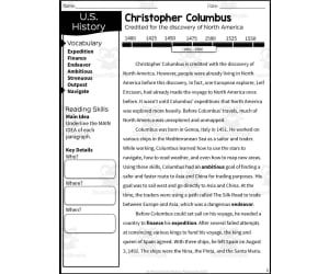
European Exploration with Christopher Columbus Reading Packet
Social Studies, History, History: World, Grade 5, Worksheets & Printables, Worksheets
European Exploration with Christopher Columbus Reading Packet Transport students back in time to join Christopher Columbus on his famous 1492 voyage across the Atlantic. This printable packet builds engagement and learning around key European exploration concepts. Students will read an informative passage detailing Columbus’s journey and apply new vocabulary terms related to 15th century seafaring. The reading is followed by multiple choice questions, graphic organizers , and short response prompts allowing learners to showcase their knowledge. Pair these materials with a whole-class Columbus simulation or small group mapping activity. Answer keys are included, making this resource easy to assign for independent practice or homework. Aligned to 5th grade state social studies standards on early exploration, it works well for both classroom and homeschool settings.
Author Sarah Miller Tech
Tags European Exploration, Christopher Columbus, North America, World History, Reading Comprehension

Geography Mazes - Set 1 (PDF)
ELA, Language Development, Vocabulary, Spelling, ESL, Resources for Teachers, Geography, Social Studies, Grade 2, 3, 4, 5, Worksheets & Printables, Worksheets, Teacher Tools, Centers, Activities, Mazes
Maze Series This maze series is designed for students in grades 2–5. Each set features a clear, kid-friendly theme with scene-based mazes that students first navigate, then complete by drawing a few target words from a simple word list. Pages come in varied styles and graduated difficulty, with an optional “color it in” step—and some themes invite quick calculations to match the task. These mazes are student-friendly, classroom-ready, and perfect for literacy warmups, seasonal units, fast-finisher bins, centers, sub plans, or home learning extensions. The playful, structured format builds problem-solving, attention to detail, and fine-motor control while reinforcing themed content in a motivating way. Note: Unlike many themed products, not all word-list words appear on the maze pages. To support full vocabulary coverage, we’ve released a companion word list you can find in the links section. Geography Set 1 Word List 1. Countries of the World Canada, Brazil, China, India, Egypt, France, Japan, Mexico 2. Famous Cities New York, Paris, London, Tokyo, Sydney, Cairo, Rome, Rio 3. Famous Landmarks Eiffel Tower, Great Wall, Statue of Liberty, Colosseum, Taj Mahal, Mount Everest, Amazon River, Grand Canyon 4. Continents and Oceans Asia, Africa, Europe, Australia, Antarctica, Pacific, Atlantic, Indian 5. Natural Wonders Niagara Falls, Grand Canyon, Mount Everest, Amazon Rainforest, Sahara Desert, Great Barrier Reef, Victoria Falls, Northern Lights 6. Landforms and Geography Terms Mountain, River, Desert, Island, Peninsula, Volcano, Valley, Glacier PDF Version Other versions will appear here when available. Follow the store for the lastest on new products. How to Use These Mazes Perfect for: Morning work or early-finisher bins Literacy or STEM centers Holiday/seasonal review lessons Independent stations, sub plans, or take-home enrichment More Geography Themed Products Geography Crosswords (Set 1) PDF Geography Crosswords (Set 2) PDF Geography Crosswords (Set 3) PDF Geography Word Searches (Set 1) PDF Geography Word Searches (Set 2) PDF Geography Word Searches (Set 3) PDF Geography Mazes (Set 2) PDF Geography Mazes (Set 3) PDF FULL CATALOG OF DOWNLOAD LINKS HERE Themed Mazes Links Addition PDF Animals PDF Around the Home PDF Birthday PDF Candy PDF Christmas PDF Cinco de Mayo PDF Clothes PDF Colors PDF Days and Months PDF Division PDF Earth Day PDF Easter PDF Easy Mazes PDF Fall PDF Father's Day PDF Food PDF Geography (Set 1) PDF Geography (Set 2) PDF Geography (Set 3) PDF Graduation PDF Health PDF History (Set 1) PDF History (Set 2) PDF History (Set 3) PDF Human Body PDF Kindness PDF Life Skills PDF Mother's Day PDF Multiplication PDF Science (Set 1) PDF Science (Set 2) PDF Science (Set 3) PDF Shapes PDF Social Skills PDF Spring PDF Sports PDF St. Patrick's Day PDF Subtraction PDF Summer PDF Thanksgiving PDF Transport PDF Valentine's Day PDF Winter PDF Mazes in Depth Structure Each maze is crafted around a focused sub-theme. Students navigate the maze, encountering branches and cul-de-sacs that build attention and planning. Most pages include a tiny follow-up box—students draw or label 2–3 target words from a small word box, add a quick count, or color in the scene—so the activity reinforces both content and skills in a highly engaging format. Each completed set includes: A themed maze page. A simple student instruction strip. An answer key showing the solved path for teacher support or self-checking Themes Included These mazes cover a wide range of fun, age-appropriate themes, including: Seasons & Holidays (e.g., Halloween, Easter, Valentine’s Day) Math-Lite Connections (e.g., quick counts, number words) Everyday Topics (e.g., Animals, Weather, School) Special Units (e.g., Health, Earth Day, Sports, Kindness) Each topic reflects students’ real-life experiences and interests while strengthening problem-solving, visual scanning, and fine-motor control in a playful, highly visual way. Easy extensions (optional): Time it: solve once in pencil, then try to beat the time in pen Retell the route using sequence words (first, next, then, finally) Count intersections or turns and graph the results Write a 1–2 sentence mini-story about the scene using the target words Design a tiny maze in the corner for a partner to solve Differentiation tips: Offer a finger-trace pass before pencils for emerging learners Highlight the borders of the correct region on first attempts Use thicker-line versions or simpler pages to build confidence Pair roles: “navigator” gives directions; “driver” traces the path For similar downloads and other frees, do check out Cored Group on TeachSimple.
Author Cored Education
Rating
Tags Vocabulary, Spelling, Geography, Countries Of The World, Famous Cities, Famous Landmarks, Natural Wonders, Continents And Oceans, Mazes, Geography Mazes
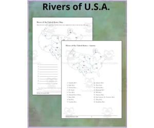
Rivers of United States Map
Social Studies, Geography, Not Grade Specific, Worksheets & Printables, Worksheets
The Rivers of United States Map is a useful resource for teaching students to identify major U.S. river systems. This map displays the continental United States with 18 prominent rivers numbered. A corresponding list prompts students to correctly label each river. Educators can use this versatile resource for independent practice, whole-class instruction, or small group collaboration. Students reinforce geography skills by accurately locating rivers like the Mississippi, Colorado, and Potomac. The numbered format scaffolds the learning process and helps assess student knowledge. The second page provides an answer key for easy self-checking. This clear and engaging map is designed for a wide range of grade levels. Use it to boost geography literacy or complement a unit on U.S. landforms, ecosystems, or transportation systems.
Author TheBrightestKid
Tags Rivers, United States, Rivers Location, Geography And Rivers, Rivers Of The Usa Map, Rivers In The United States Map, Maps Of Rivers Of The United States
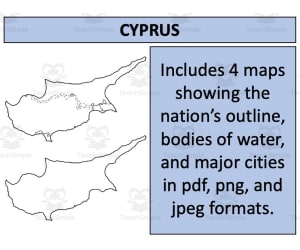
Cyprus Map Resources
Social Studies, Geography, Not Grade Specific, Worksheets & Printables, Worksheets
Cyprus Map Resources Cyprus Map Resources, a versatile and engaging teaching instrument is suitable for learners of all grades. Initially focusing on Cyprus, the geographic scope extends universally making this tool valuable in public schools as well as homeschool environments. Our primary goal entails creating a resource which enables students to interactively engage with world geography in an exciting manner. The worksheets designed with our Cyprus Map resources are crafted to stimulate student intrigue about global locations while enhancing their map reading skills. This set of Cyprus Map Resources is not restricted to specific grades but lends itself readily across various educational levels. Its flexibility allows educators to adapt these materials based on individual needs and curriculum objectives promoting both independent and group learning thus stimulating critical thinking amongst students. The standard features of Cyprus such as cities, notable landmarks amongst others are included. The tools trigger discussions about cultural diversity. Sociopolitical aspects shaping global societies are brought into focus. A comprehensive approach fostering a wider worldview extending beyond classroom textbooks is adopted. If you're scouting for high-quality educational resources that promote students' exploration into geographical studies while sharpening vital life skills such as research dexterity and valuation of cultural diversity - our aptly constructed Cyprus Map Resources make the perfect fit!
Author Mr Gray History
Tags Cyprus Geography, Map Reading, Social Studies Resources, Cultural Diversity Education, Teaching Aids

Country Study Research Project - Sri Lanka - South Asia
Social Studies, Geography, History, History: Asian, Grade 7, 8, 9, 10, 11, 12, Worksheets & Printables, Writing Prompts, Worksheets
Country Study Research Project - Sri Lanka - Social Studies Report - South Asia This Sri Lanka Country Study Research Project can be an ideal teaching activity for your Geography and Social Studies classes, designed specifically for Middle School and High School students (from 7th grade to 12th grade) . Suitable for Country Study Activities , this printable, 2 page PDF teaching resource ecourages Social Studies + Geography students and learners to explore important aspects and facts of Sri Lanka (South Asia). This Country Study Research Project on Sri Lanka can guide students through the process of building a comprehensive Country Study Report , while emproving their knowledge in areas such as geography, history, economy, language, and culture . Teachers and educators can find the following Geography + Social Studies activities and exercises in Sri Lanka Country Study Resource, Social Studies : 🌍 Interactive Map Activity A QR code linking directly to Sri Lanka 's location on Google Maps 🏔️ Geography Questions Explore Sri Lanka's terrain, climate, and notable physical features. 📜 History Questions Investigate key events and historical figures that have shaped Sri Lanka 's past till nowadays 🗣️ Language Exploration Learn about the official language spoken in Sri Lanka : Sinhala + Tamil 💼 Economy Questions Analyze Sri Lanka 's economic system, major industries, and current challenges. 🏙️ Capital City Focus Write about 7 important sights in Sri Lanka ’ capital city, Sri Jayawardenapura Kotte Identify and write 5 additional cities across Sri Lanka 🎭 Culture Prompt Writing about Sri Lanka ’s unique cultural identity within the region (South Asia) This Social Studies, Geography Country Study on Sri Lanka (South Asia) PDF Digital Teaching Resource (2 PDF Printable Slides) is ideal for Middle School and High School students from 7th grade to 12th grade to test Sri Lanka and its Culture At Social Studies with Alan , we’re committed to providing fun, high-quality resources that help teachers inspire curiosity and global awareness in the classroom. Because learning should always be engaging and memorable . ➡️ Explore more Social Studies & Geography teaching tools by clicking here: Learning with Alan
Author Learning with Alan
Rating
Tags Country Study, Social Studies, Geography, History, Asia, Sri Lanka, Tamil, Sinhala, Worksheets, Printable

Country Study Research Project - San Marino - Social Studies Report
Social Studies, Geography, History, History: Europe, Grade 7, 8, 9, 10, 11, 12, Worksheets & Printables, Worksheets
Country Study Research Project - San Marino - Social Studies Report - Southern Europe This San Marino Country Study Research Project can be a perfect teacher tool box activity for your Geography and Social Studies classes, designed specifically for Middle School and High School students (Grades 7–12) . Suitable for Country Study Activities , this printable, 2-page PDF teaching resource engages learners to explore and endeepen important aspects and facts of San Marino (Southern Europe). Use this Country Study Research Project on San Marino to guide students through the process of building a comprehensive Country Study Report , while emproving their knowledge in areas such as geography, history, economy, language, and culture . Within this San Marino Country Study Resource, Social Studies teachers can find the following geography activities: 🌍 Interactive Map Activity A QR code linking directly to San Marino ’s location on Google Maps. 🏔️ Geography Questions Explore San Marino ’s terrain, climate, and notable physical features. 📜 History Questions Investigate key events and historical figures that shaped San Marino ’s past. 🗣️ Language Exploration Learn about the official language spoken in San Marino : Italian 💼 Economy Questions Analyze San Marino ’s economic system, major industries, and current challenges. 🏙️ Capital City Focus Write about 7 important sights in San Marino ’s capital city, San Marino Città 🏘️ Other Cities Identify and write about 5 additional cities across San Marino 🎭 Culture Prompt Reflect on San Marino ’s unique cultural identity within the Southern European region This Social Studies, Geography Country Study on San Marino (Southern Europe) PDF Digital Teaching Resource (2 PDF Printable Slides) is ideal for Middle School and High School students from 7th grade to 12th grade to test San Marino and its Culture At Social Studies with Alan , we’re committed to providing fun, high-quality resources that help teachers inspire curiosity and global awareness in the classroom. Because learning should always be engaging and memorable . ➡️ Explore more Social Studies & Geography teaching tools by clicking here: Learning with Alan
Author Learning with Alan
Rating
Tags Social Studies, Geography, Country Study, Report, Europe, San Marino, Italian, Worksheets, Printable, Activity

Prince Edward Island (#1371)
Social Studies, Geography, Grade 3, 4, 5, 6, Worksheets & Printables, Worksheets
Prince Edward Island (#1371) - A Resourceful Teaching Tool This resource has been carefully designed to impart knowledge about Prince Edward Island to students from grade 3 to 6. It includes highly engaging reading activity sheets that are not only informative but also strive to strengthen the students' reading and comprehension skills effectively. Vivid Aspects Covered: Prince Edward Island's motto, area, population count, capital city name, name origin Pivotal details about its Confederation adhesion date and largest city Natural regional description along with details about the highest point at PEI, main river and centrally located lakes Insight into local sectors industries and First Native communities The document even advances into some historic exploration recounting significant events related uniquely to this island. It also serves up intriguing trivia presenting an engaging learning opportunity. A brief overview of contents: Predictive skills enrichment/pages addressing prior knowledge checks (early pages) Illustrated themed pages with focus reading strategies (9 through 12) Framework for connecting findings & personal opinions (page 14) Favourite passage selection section before concluding transformational exercises Credits for cliparts on final page The resource is in digital PDF format making it convenient for both online teaching and traditional classroom situations. Its total of seventeen pages ensure a detail-oriented colorful learning experience ideally fostering active engagement curiosity among young learners. Exploring Geography & Social Studies was never so intriguing!
Author Learn it ANY way
Tags Prince Edward Island, Teaching Tool, Reading Activity Sheets, Geography, Social Studies

Ancient Inca Interactive Foldable Booklets - EBOOK
Social Studies, History, History: Ancient, Grade 2, 3, 4, 5, 6, 7, 8, Worksheets & Printables, Worksheets
Ancient Inca Interactive Foldable Booklets The Ancient Inca Interactive Foldable Booklets is a premium quality e-book developed with the intention to impart knowledge of ancient societies to its users. Crafted by experts, this resource transforms the study of ancient history into an engaging and enlightening experience. Educational Compatibility: Group Discussions One-On-One Tutoring Supplementary Homework Assignments This digital book contains 19 pages of comprehensive information on various aspects of the ancient Inca culture. With topics ranging from basic facts about the civilization to detailed studies on elements like Machu Picchu, your students' curiosity will be piqued as they delve into ancient history. Foldables For A Visual Experience: To make learning engaging and interactive, users can print out materials from this PDF file and create foldables that promote active participation. This overcomes traditional reading methods by employing an activity -based approach. Inclusions : In addition to strictly historical data, students will encounter other significant components such as Incan art, Their iconic architecture, Machiavellian governmental structures among others within the resource. All facets are designed with informative context in order for students to gain a deeper understanding of societal organization and value systems within this impressive civilization. This e-resource is available in both full-color and black & white versions; offering versatility based upon printing possibilities at home or at school premises maintaining content quality without compromises on student engagement. In conclusion, combining innovative interactivity with expertly curated content makes The Ancient Inca Interactive Foldable Booklets an essential asset for educators tackling ancient history studies.
Author Knowledge Box Central
Tags Inca Civilization, Interactive Learning, Ancient History, Foldable Booklets, Educational Resource
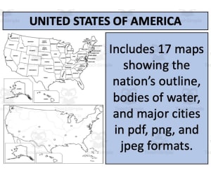
United States Map Resources
Social Studies, Geography, Not Grade Specific, Worksheets & Printables, Worksheets
United States Map Resources The United States Map Resources offer a comprehensive range of map resources for use in Geography or Social Studies classrooms. These resources are conveniently available as a downloadable ZIP file for educators teaching at any grade level. This United States Map Resources uses a detailed and all-encompassing approach to help students understand complex spatial relationships and geographic distributions within the US. The maps in this collection range from basic outlines suitable for young learners, to more advanced maps displaying key rivers and major cities. This teaching tool can be paired with bundles that cover map resources for all 194 sovereign nations worldwide, enhancing its usability and value. The worksheets are compatible with direct classroom use as well as interactive online learning platforms. Instant Downloads: Quick access enhances lesson preparation efficiency by removing delays. Versatility: These resources can be adapted to fit various learning requirements, making them suitable for elementary social studies classes through high school geography courses. The United States Map Resources not only foster engagement among learners but also make geographical education informative yet enjoyable. They serve as excellent educational supplements that simplify geographical complexity one state at a time! Visit my store for similar and other resources!!
Author Mr Gray History
Tags Geography Education, US Map Resources, Social Studies Tool, Interactive Learning, Geo-spatial Knowledge

Australia and Oceania Map Scavenger Hunt Bundle
Social Studies, Geography, Grade 7, 8, 9, 10, 11, 12, Worksheets & Printables, Worksheets
This informative 21-page Australia and Oceania Map Scavenger Hunt Bundle assists students in learning geography by having them locate key details on maps. Students will answer questions about major landforms, bodies of water, cities, capitals, national parks, and surrounding countries in Australia, New Zealand, Oceania, and Papua New Guinea. The bundle includes four separate map scavenger hunts that challenge students to carefully examine maps to find answers. As a supplementary social studies resource, this concise bundle helps reinforce map reading skills and expands geographic knowledge through active engagement. With multiple countries covered, it works well for individual practice or collaborative group work. The engaging map activities can be flexibly used as in-class practice, group projects , or independent homework.
Author Mr. Matthews Teacher Store
Tags Geography, Map Skills, Oceania, Australia, New Zealand, Papua New Guinea

Crash Course Government Episode Worksheet | 2 - The Bicameral Congress
Social Studies, Government, Grade 7, 8, 9, 10, Worksheets & Printables, Worksheets
Understanding American government can be challenging for students. Crash Course Government Worksheets break down complex civics topics into engaging 9-minute videos paired with 2-page assignments. This resource covers Congressional Bicameralism. The worksheet has 15 short answer questions that students complete while viewing the video. An answer key is included for self-checking. The entertaining Crash Course format helps cement understanding of checks and balances, the House, Senate, how bills become laws, and more. These materials are perfect for whole class instruction or individual review. Pause the video to discuss or have students re-watch it in small groups. The pairing of video + worksheet promotes active viewing, critical thinking, and retention of key civics concepts. This is an excellent supplement for any 7th-10th grade social studies or government curriculum.
Author Ed Dynamic
Tags Government Worksheet, Comprehension Questions, Politics Video, The Bicameral Congress, Small Group Work, Branches Of Government, Constitution, Congress Worksheet
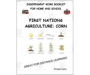
Literacy worksheets: Agriculture of the First Nations
ELA, Social Studies, Reading, Language Development, Vocabulary, Writing, Grade 3, 4, 5, Worksheets & Printables, Worksheets
Literacy Worksheets: Agriculture of the First Nations Transport students back in time to learn about the agricultural practices of First Nations people. This 28-page printable PDF teaches vocabulary and literacy skills related to early North American farming. Budding writers will create word searches, anagrams, riddles, sentences, stories, comics, and more. Compare First Nations agriculture to modern techniques with a Venn diagram. Draw farm scenes from the past. Play vocabulary games like bingo and pichenette races. Use these versatile worksheets for independent practice, small groups, or whole class instruction. Suitable for grades 3-5 language arts, reading, writing, vocabulary, and social studies. Includes vocabulary lists, answer keys, and clip art credits.
Author Learn it ANY way
Tags Agriculture, First Nations, Reading, Writing, Vocabulary, Agriculture Worksheets