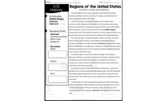
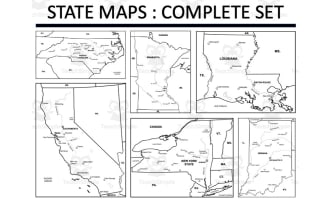
Rivers of the United States – Labeled Map


Attributes
Subject
Grades
File
Editable
No
Rating
Add To Collection
About This Product
The Rivers of United States Map is a useful resource for teaching students to identify major U.S. river systems. This map displays the continental United States with 18 prominent rivers numbered. A corresponding list prompts students to correctly label each river. Educators can use this versatile resource for independent practice, whole-class instruction, or small group collaboration.
Students reinforce geography skills by accurately locating rivers like the Mississippi, Colorado, and Potomac. The numbered format scaffolds the learning process and helps assess student knowledge. The second page provides an answer key for easy self-checking. This clear and engaging map is designed for a wide range of grade levels. Use it to boost geography literacy or complement a unit on U.S. landforms, ecosystems, or transportation systems.
What's Included
This Rivers of United States Map includes a PDF file with 2 pages ready to print and use with your students!
Resource Tags
0 Reviews
Explore related searches
you may also like...
Check out these other great products

Word Searches, Worksheets, Worksheets & Printables
Worksheets & Printables, Worksheets

Activities, Worksheets & Printables, Worksheets, Word Searches

Worksheets & Printables, Worksheets

Worksheets & Printables, Worksheets