



3,953 products added recently
Page 30 - Social Studies Worksheets
Enhance your social studies curriculum with worksheets covering geography, history, civics, and cultures. These resources include maps, timelines, and critical thinking exercises. Use them to deepen understanding of societal structures and encourage informed citizenship.

 Show filters

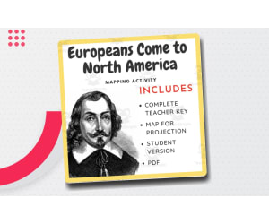
Map Activity: Europeans Come to North America
Social Studies, History, History: World, Grade 6, 7, 8, 9, Worksheets & Printables, Worksheets
This mapping activity introduces students to the land claims made by European countries around the 1700s. There are total of 7 questions that students are expected to answer using the map. This is great of review and/or as an introduction to a unit. Ready to print - no prep. The European exploration of the Americas refers to the period of exploration and colonization by various European powers in the Americas, starting in the late 15th century and continuing into the 19th century. This era of exploration had a profound impact on the history, culture, and development of the Americas. Christopher Columbus, an Italian explorer sailing under the Spanish crown, is often credited with initiating the European exploration of the Americas. In 1492, he reached the Caribbean islands, believing he had reached the eastern coast of Asia. Columbus's voyages sparked a wave of exploration by other European powers, primarily Spain and Portugal. The Spanish, led by figures like Hernán Cortés and Francisco Pizarro, explored and conquered vast territories in Central and South America. They established colonies and exploited the region's resources, particularly gold and silver. The Spanish Empire became one of the wealthiest and most powerful in the world. The Portuguese, led by explorers such as Vasco da Gama and Pedro Álvares Cabral, focused their efforts on establishing trading routes to Asia by sailing around the southern tip of Africa. However, they also claimed significant territories in South America, including Brazil. Other European powers, such as England, France, and the Netherlands, also sought to establish colonies and expand their influence in the Americas. English explorers like John Cabot and Sir Walter Raleigh ventured to North America, while French explorers, including Jacques Cartier and Samuel de Champlain, explored and settled parts of present-day Canada. The Dutch established colonies in what is now New York and other areas along the eastern coast of North America. The European exploration of the Americas led to the establishment of permanent colonies, the introduction of European diseases that devastated native populations, and the transatlantic slave trade, which forcibly brought millions of Africans to the Americas to work on plantations and in mines. The colonization and exploitation of the Americas by European powers had far-reaching consequences, including the reshaping of indigenous cultures, the establishment of new political and economic systems, and the eventual independence movements that led to the formation of modern nation-states in the Americas. It's important to note that the European exploration of the Americas was not a single, unified endeavor. Different European powers had different goals, methods, and interactions with indigenous peoples. The history of this period is complex and multifaceted, involving numerous explorers, conquistadors, and colonizers, each contributing to the overall narrative of European exploration and colonization in the Americas.
Author EduPal Learning
Tags European Colonization, New World, Exploration , Age Of Exploration, World History, Maps, Mapping Activity

50 States Word Search
Social Studies, Geography, History, History: USA, Grade 3, 4, 5, 6, Worksheets & Printables, Worksheets, Word Searches
This product is a set of four word searches for the 50 United States of America. There is one word search for each region of the country. A single word search with all 50 states is NOT included. The 50 states are broken up into geographic regions, according to the US census, hence four different words searches (for the Northeast, Midwest, South, and West). I have included an answer key for teachers. PLEASE NOTE: some of the words are BACKWARDS , going from right to left, or bottom to top. In these cases, I have indicated so with a directional arrow on the answer key. All the other words go vertically from top to bottom, or horizontally from left to right. There are NO diagonal words. This set of word searches is appropriate for later elementary school grades, or beginning middle school grades. They offer a fun activity for kids, and an easy one for teachers? As an extension, students could color each state in on a map as they find it on the word search.
Author Monaco Lane Curriculum for Early Literacy
Rating
Tags 50 States, 50 States Word Search, Use Word Search, Regions Of The United States, Usa Regions, Word Search , History Word Search , Geography Word Search

Reading Writing Games | Word Definitions 17
Special Resources, ELA, Social Studies, Special Education Needs (SEN), Speech Therapy, Reading, Reading Comprehension, Language Development, ESL, Writing, Handwriting, Vocabulary, History, Psychology, Grade 2, 3, 4, 5, Worksheets & Printables, Worksheets
This series of PDF resources focuses on identifying noun concepts, with engaging visualizations ( pictures and graphic arrangements ) of vocabulary by topic. The activity materials in this assignment are designed to help students develop their vocabulary and reading comprehension skills through interactive activities and real-life examples. It includes clear definitions of words from common categories and can also serve as discussion prompts to encourage critical and analytical thinking, deepen your understanding of the language, and improve your communication skills . This resource is designed to be accessible and engaging to all students . Ideal for teaching English as a Second Language and intervention sessions on learning difficulties. Clear and concise language, visual aids and interactive activities help students easily understand and remember information, integrating visual and kinesthetic elements. You can choose from a variety of worksheets that suit your student's level, interests, and printing preferences. Each category topic includes : 2 sets of Flash cards ( definition sentence / image, image / definition sentence ) 2 sets of Flash cards ( definition word / phrase, definition phrase / word ) 3 Anagram strings ( mixed letters of single words or in definition text ) 1 Crossword ( word definition ) 2 sets of linked activities Draw a Line ( definition / image, image / definition ) 2 sets of matching activities Draw a line ( word / definition, definition / word ) 2 series of Quizzes ( definition / image, image / definition ) 2 series of Quizzes ( word / definition, definition / word ) 3 Wheels of Fortune ( words, definitions, images ) 1 Word Search page for ( word definition ) 2 Writing Boards ( words, definitions ) 2 Blank Boards ( words, definitions ) * Use as-is or create your own board games, like Snap, Memory, Match to Sample, and Knowledge Races . Distribute it as morning exercises, quiet time and focus activities, independent workbooks, or fun homework 41 PDF Pages
Author WORDS ASIDE
Tags Esl, Word Defining, Semantics, Word Search, Anagram, Flash Cards, Centers, Crossword, Words Aside, Feelings

Declaration of Independence Handout
Social Studies, History, History: USA, Not Grade Specific, Worksheets & Printables, Worksheets
This is a Declaration of Independence Handout that focuses on where Thomas Jefferson got his ideas. There is a graphic organizer with 4 enlightenment thinkers and then an excerpt from the Declaration. Students will be able to make comparisons between the two, acknowledge their similarities and apply it to future learning.
Author Cogjogger
Tags Thomas Jefferson, U.S. History, Declaration Of Independence, Glossary, Europe
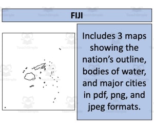
Fiji Map Resources
Social Studies, Geography, Not Grade Specific, Worksheets & Printables, Worksheets
Fiji Map Resources This Fiji Map Resources is a great resource to have handy in your classroom. It was designed to amplify geographical knowledge for both educators and students, Not grade-specific, making it versatile enough for various academic levels. Main focus is on Geography under the broader Social Studies subject area. Three separate map sheets available in pdf, jpeg and png formats for easy integration into digital platforms or physical printouts. Variety of maps ranging from blank outlines to detailed ones showcasing bodies of water and major settlements supports diverse learning objectives. Note: Users can integrate these maps into their own educational material while respecting guidelines provided in the preview sheet. These Fiji Map Resources may be a complement to a complete unit on Fiji! The Fiji Map Resources comes in Zip files, which once open, are ready to print and use. Students may use these maps one at a time, or all at once to complete projects related to Fiji. This Fiji Map Resources prove highly beneficial with strategically designed features promoting geography education. The set offers attractive visual aids resulting in interactive learning experiences suitable not only for classrooms but also homeschooling. For similar or other useful resources, visit my store here!
Author Mr Gray History
Tags Geography, Fiji Maps, Social Studies, Educational Tool, Classroom Resource

Country Study Worksheets on Bahrain - Middle East
Social Studies, Geography, Grade 7, 8, 9, 10, 11, 12, Worksheets & Printables, Worksheets
Country Study Worksheets on Bahrain - Middle East Enhance your Geography and Social Studies lessons with these comprehensive 2-page PDF Worksheet on Bahrain, designed for Middle School and High School students (7th-12th grade). This engaging teaching resource is perfect for country study activities, focusing on Bahrain's geography, history, language, economy, and culture. Ideal for testing students' knowledge and reinforcing their understanding, this printable worksheet brings the heritage of Bahrain (Middle East - Asia) to your classroom. This Bahrain Country Study Worksheet includes a variety of questions and exercises to provide a thorough assessment of students' knowledge: Interactive Geography: A QR code linked to Bahrain’s location on Google Maps helps students visualize and pinpoint the country’s geographical position. Geography Questions: Assess students' understanding of Bahrain’s physical features, including its terrain, climate, and notable geographical landmarks. History Questions: Test students on key historical events and figures that have shaped Bahrain Language Questions: Challenge students with questions about the Arabic language Economy Questions: Evaluate students’ knowledge of Bahrain’s economic structure, major industries, and economic challenges. Cultural Exercises: Encourage students to explore Bahrain’s culture by listing famous sights in Manama, the capital city, and writing about other notable cities in Bahrain. They will also be prompted to describe cultural aspects such as traditions, cuisine, and festivals. This PDF worksheet is a fantastic tool for both school activities and homework assignments, making it a valuable addition to your teacher toolkit. It’s designed to not only test students' knowledge but also to inspire curiosity and a deeper appreciation for Bahrain's cultural and historical context. This amazing Social Studies + Geography Country Study on Bahrain (Asia - Middle East) PDF Digital Teaching Resource (2 PDF Printable Slides) can be great for learners from 7th grade to 12th grade to test Bahrain and its Culture. Learning with Alan is a Brand New Teaching Resource, Educational Material Store whose aim is to help Teachers, Educators and Tutors to achieve their teaching objectives while creating a fun and stimulating environment. Never Forget! If you want to browse more of my Teaching Resources, click here Learning with Alan
Author Learning with Alan
Tags Country Study, Social Studies, Geography, Bahrain, Arabic, Middle East, Worksheets, Activity, Asia, Printable
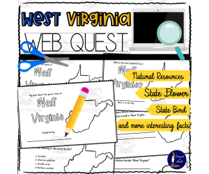
West Virginia WebQuest Printable Book
Social Studies, Geography, Grade 4, 5, 6, 7, 8, Worksheets & Printables, Worksheets
The West Virginia WebQuest allows students to build their own mini book and perform online research to learn about key details of West Virginia. This 10-page printable book prompts students to research and fill in information on West Virginia's most populated city, state capital, state bird, state flower, Native American tribes, bordering states, nicknames, and natural resources. An additional blank page is included for students to add other interesting information they find. Students will use a map to mark the capital and most populated city. The resource builds research skills as students practice using search terms to find reliable information. It also allows students to gain knowledge about their state. The book pages print two to a page for easy cutting and stacking into a handmade book students can carry on trips. Answer key included. Best for grades 4-8 social studies and geography.
Author Soumara Siddiqui
Tags West Virginia, West Virginia Worksheets, West Virginia Printables, West Virginia Book, Webquest For 4th Grade, Thanksgiving Webquest 4th Grade, 5th Grade Math Webquests
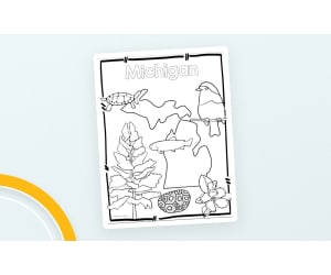
Michigan State Symbols – Clip Art Set
Social Studies, Geography, Not Grade Specific, Worksheets & Printables, Worksheets
Tree= Eastern White Pine Bird= Robin Redbreast Fish= Brook Trout Flower= Apple Blossom Reptile= Painted Turtle Stone=Petoskey Stone Michigan state
Author Teacher's Clipart
Rating
Tags Michigan, Geography, Symbols, USA, Social Studies Clip Art, Michigan State Clip Art, Michigan Symbol, State Of Michigan Symbol, State Symbols Of Michigan, Michigan State Bird And Flower, Symbol Of Michigan, Mi State Symbols, State Symbols Michigan, Michigan Symbols, Michigan State Flower And Bird

Australia Map Resources
Social Studies, Geography, Not Grade Specific, Worksheets & Printables, Worksheets
Australia Map Resources An excellent educational tool for both public school teachers and homeschoolers. The Australia Map Resources comprises of six individual sheets of Australia maps, available in diverse formats including pdf, jpeg, and png. Catering to a range of teaching requirements, the map types include: Blank outlines – to facilitate active learning. Bodies of water maps – for comprehensive introduction to aquatic geography. Major settlements maps - crucial for human geography studies. Please Note: These resources align with fair-use policies and can be integrated into your personal instructional materials provided the guidelines detailed on the preview sheet are strictly adhered. Grade applicability and Subject Focus The resource is not grade-specific but aims at a broad spectrum of learners at different stages. It mainly assists in social studies instruction with strong emphasis on geography—perfect for learners exploring continents or tackling Australian history/geographic features. Diversity & Flexibility The types offered are primarily worksheet-oriented, seamlessly weaving into existing curriculum structures while enabling opportunities for independent study. Note: Easily downloadable zip file types are included; just download and extract! In conclusion, having readily accessible tools like these offer educators an avenue to make students more engaged in understanding global geography. They equally reinforce understanding regarding Australia's distinct geographical topography applying detailed visuals coupled with interactive tasks.
Author Mr Gray History
Tags Australia Maps, Geography Resource, Social Studies, Interactive Learning, Major Settlements

Leif Erikson Dot-to-Dot PDF
Creative Arts, Math, Social Studies, History, History: World, History: Europe, History: USA, Elementary, High School, Homeschool Resources, Middle School, Worksheets & Printables, Worksheets, Dot To Dots
Connect 830 dots to complete the picture of the Leif Erikson Extreme Difficulty Dot-to-Dot! The completed scene depicts Leif Erikson (also spelled Ericson of Eiriksson), standing on a beach. Erikson was a Norse explorer and the first European to discover North America. Dot-to-dots such as this one are a relaxing activity that can both educate and entertain kids. They can be given to students in a wide range of ages, from early elementary school, to middle school and even high school. They’re also handy for homeschooling. These challenging puzzles can help improve fine motor skills, and also help kids develop patience and focus. Finally, they’re fun to color too! Let the kids grab some crayons or colored pencils and put a personal touch on their dot-to-dot. This dot-to-dot printable created by Tim van de Vall and is copyright Tim’s Printables LLC. Terms of use: May be printed/downloaded for personal and educational purposes only. The connect the dots is activity on page 1, and the answer key is on page 2. The page dimensions are: 8.5”x11”. PDF format.
Author Tim's Printables
Rating
Tags Explorer, North America, Discovery, Vinland, Printable, Norse, Dot To Dot, Connecting The Dots, Activity, Connect The Dots
All About the Marines Adapted Book, Printable, Color and BW, Special Ed
Social Studies, History, History: USA, Preschool, Kindergarten, Grade 1, Worksheets & Printables, Worksheets
All About the Marines Adapted Book, Printable , Color and BW, Special Ed All About the Marines Adapted Book is an educational resource that caters to pre-school level through first grade students including those with special needs. Engage your learners with this exciting cut-and-paste activity. This 9-page resource features: Diverse interactive lessons: Reading comprehension questions & introduction of new vocabulary. Creative Approach: Along with basic facts about the Marines, wh-questions are integrated for adding variety. Vibrant or Monochrome versions available: Suits classroom needs and student preference. Not just limited to in-class use during whole group instruction but can be assigned as individual homework too. Also perfect for small group sessions focusing on inclusive learning methods! The material is easy-to-understand thereby striking a balance between fun and imparting essential knowledge regarding our national forces. It is presented as a universally accessible PDF file ensuring compatibility across all devices. To summarize, All About The Marines Adapted Book effectively combines interactive teaching strategies + facts into one comprehensive tool! Providing young learners everything they need to know about this integral branch of our nation's defense system - The Marine Corps!
Author My Kind of Crazy
Tags Marines, Adapted Book, Special Education, Social Studies, Interactive Learning

Newfoundland and Labrador
Social Studies, Geography, Grade 3, 4, 5, Worksheets & Printables, Worksheets
Content of the information sheet: - Motto - Area - Population - Capital - Origin of name - Joined the Confédération - Largest city - Description of natural regions - The highest point - The main river - The main lakes - The industries - The First Nations - The history - Facts Content of the symbols sheet: - Shield - Coat of arms - Flag - Flower - The tree - The bird - The map and the capital - The location on a map of Canada TABLE OF CONTENTS p.4 Symbols p.5 Informations p.6 -7 Questions p.8-9 Answer key p.10 Activity : symbols p.11 Answer key p.12-13 Illustration of the history and the facts p.14 Cliparts
Author Learn it ANY way
Tags Newfoundland , Labrador, Canadian Province, Province, Geography

Experiential Learning – Community Problem-Solving Projects
Social Studies, Government, Sociology, History: USA, History, Resources for Teachers, Classroom Management, Community Building, Special Resources, Social Emotional Learning (SEL), Grade 5, 7, 8, 9, 10, 11, 12, Worksheets & Printables, Workbooks, Worksheets, Word Searches, Teacher Tools, Assessments, Lesson Plans, Quizzes and Tests, Quizzes, Tests
Utilizing the no-prep experiential learning unit on solving community issues will empower your students to be active learners and members of their community by providing them with a hands-on, project-based learning (PBL) experience that goes far beyond the traditional textbook. The complete curriculum guide and student workbook for this PBL unit will give you all the necessary information to create an engaging and effective PBL unit with your middle school students. The curriculum is built on the proven E.P.I.C framework (empathize, probe, innovate, commit), which will lead them through the entire civic action process, from identifying an authentic community issue, to conducting research about that issue, to designing a sustainable solution, to implementing their proposed solution. ● Learning Objectives For Participants: 1. Developing Systems Thinking through the use of tools like Iceberg Model and Five Whys, to identify underlying causes of issues rather than just surface level symptoms. 2. Supporting Empathetic Research by conducting interviews with Stakeholders and Mapping Community Assets through uses of Asset-Based Community Development. 3. Developing Data Analysis through differentiating and collecting data from both Qualitative and Quantitative sources in order to effectively communicate the case for change. 4. Supporting Design Thinking and Innovation by brainstorming and using a Feasibility/Impact Matrix to develop the best ideas. 5. Developing project management through Budgeting, Resources Allocation, Timelines with Milestones and Risk Mitigation. 6. Developing Persuasive Communication by learning how to "Pitch" using Ethos, Pathos and Logos to obtain Stakeholder Buy-In. 7. Developing Resilience and Reflection by gaining experience with real-world friction, by learning from successes and failures. Basic Content Summary. The following outlines the contents of the 39-page PDF document: - Part 1 is the Teacher's Theoretical Guide (approximately 11 pages in total) and provides a comprehensive overview of experiential learning's pedagogical background. The guide will give you the ability to facilitate, and confidence to use, experiential learning with your students. - Part 2 is the Student Workbook (about 16 pages total) and has worksheets that are scaffolded for each step of the project from community mapping through to summative reflection; includes 10 different worksheets. - Part 3 is comprised of Visuals & Teacher Resources (about 12 pages total). - Classroom Visuals: Contains anchor charts for The Experiential Learning Cycle, Root Cause Analysis (Fishbone Diagram), and the Strategic Intervention Matrix. - Comprehensive Answer Key & Rubrics: Contains exhibiting example rubrics at every stage (from Substandard to Advanced responses) so that grading is on the process of completion—this means your students know what to expect when working on this project! - Teacher Implementation Guide: Provides suggestions on becoming a guide on the side to your students, how to manage issues that may arise throughout the project, as well as how to create psychological safety for your students. Social Studies, Civics, Government, Leadership, Service-Learning, and Project-Based Learning (PBL) classrooms can benefit from using this resource to empower their students to positively impact the world around them. Download this resource today to begin developing the next generations of architects who will create social change! Projects Based Learning, (PBL), Experiential Learning, Civic, Social Studies, Middle School, Community Service, Servic eLearning, Problem Solving/ Critical Thinking/ Designthinking, Student Workbook (and Teacherguide). This resource also contains Rubrics, No Prep needed, Printable, Leadership and Civic engagement. What Makes It Good for Parents & Schools: Teaches 21st Century Skills Through Real-Life Scenarios: This learning experience is much more than hand memorizing; it teaches students real life skills that they will use throughout highschool, college, and their professional lives, such as budgeting, project management, public speaking, and analyzing data. Promotes Empathy and Civic Responsibility: Through class activities and community projects that are performed as a group and individulally, students will inherently develop a sense of empathy toward others and their community, realizing that they can and should take responsibility for helping bring about positive changes. Develops Resiliency & Growth Mindset: The curriculum helps students change the way they think about challenges (obstacles) and how they see their own failure (a way to collect information for growth). Students will learn to be resilient, open and flexible to the change of environment/challenges, as well as to be perseverant in overcoming obstacles into adulthood. Provides a Complete Package of A High-Quality, Cross-Curricular, and Academically Rigorou: The project consists of four major areas all integrated into one project: social studies, ie. civic mindedness; math, ie. development of budget(s); ELA, ie. persuasive writing skills; science, ie. collection of data. As a result, the project allows for multiplication of all of the classes learned as opposed to singularly focused learning. Provides Everything Needed in a Complete Turnkey Package: When teachers receive the project; it includes a teacher guide, student workbooks, and visual aids, as well as description of the method to assess the student's work is extremely organized, easy-to-understand as well as easy to implement and to grade both substantively and fairly. Intended Audience by Age Group: Age Breakdown Based on Content, Language and Express; Grades 6-8, (Middle School). Page 2 has an explicit mention of the "critical development window of grades 5-8". The task complexity (Budgeting, Stakeholder Analysis and System Thinking) fits perfectly within this age bracket particularly in 7-8 grade level. Secondary Audience: Advanced 5th grade or as part of Introductory 9th/10th grade course work. Material is substantial enough to be used as a High School Freshman/Sophomore Civics, Government or Leadership Elective Course- and, an awesome resource for Gifted and Talented (of which there are many!) in Middle School. Copyright & Terms Of Use: Syed Hammad Rizvi owns copyright on this book. The materials on this site may be used only by yourself or in your classroom (individually). You may not modify, share, or sell any part of it; therefore you are prohibited from placing it on the Internet so that someone else could download it. If you would like to share the resource with your Co-Workers, please purchase Multiple licenses through Teachsimple. Thank you for abiding by the Terms of Use. We thank you for your continued support of Syed Hammad Rizvi.
Author Creative Book Store
Rating
Tags ProjectBasedLearning, PBL, ExperientialLearning, ServiceLearning, CommunityProblemSolving, CivicEngagement, CivicAction, DesignThinking, SystemsThinking, InquiryBasedLearning
Geography Scavanger Hunt: Alaska
Social Studies, Geography, Grade 3, 4, 5, 6, Activities, Worksheets & Printables, Worksheets
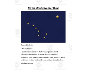
Geography Scavenger Hunt: Alaska The Geography Scavenger Hunt: Alaska is a hands-on teaching resource, designed practically for students in grades 3 through 6. This resource introduces learners effectively to geographical concepts like cardinal and intermediate directions. Coverage of the Map Activity Prompts students to answer questions using an included map of Alaska. Covers important cities, notorious bodies of water, distinct landforms, national parks and monuments. Fosters students' observational abilities as they assimilate details pertaining to each location. Versatility in Learning Scenarios This engaging scavenger hunt can be implemented across multiple learning scenarios: In whole group instruction facilitating collective learning. In small groups promoting cooperative learning. As engaging homework assignments fostering self-directed exploration. Beyond being a collection of map-related exercises, this activity becomes an enjoyable journey that ignites curiosity about Alaska's diverse geography among young learners. It lays solid groundwork for advanced geography lessons while reinforcing key geographical concepts. Suggested Related Resources for Teachers: 'US state-by-state map scavenger bundle' 'USA 5 Regions Unit Bundle': For comprehensive coverage of all five US regions including identification quizzes and activities comparing different regions. About The Resource Files: This two-page resource comes as easy-to-print PDF files that maintain quality even when shared online. Ideal both for traditional classroom setups or homeschooling scenarios.
Author Mr. Matthews Teacher Store
Tags Alaska Geography, Scavenger Hunt, Cardinal Directions, Landforms, National Parks

Nevada WebQuest Printable Book
Social Studies, Geography, Grade 4, 5, 6, 7, 8, Worksheets, Worksheets & Printables
The Nevada WebQuest Printable Book: A unique exploration tool tailored for educators and students in grades 4-8. This compact and portable mini-book, is perfect for field trips or nature walks. Its interactive design encourages active learning as students are prompted to research facts online about Nevada. The mini-book comprises of: 10 pages with engaging tasks that include identifying: Nevada's most populated city Capital city State symbol such as its bird and flower Historical content regarding native tribes that lived in Nevada. Geographical information regarding bordering states & natural resources in the area. In addition there are blank spaces intended for documenting captivating facts discovered during the research journey. Each print yields two identical pages – simply cut along the dotted lines and stack separately allowing each student to create their own travel booklet at ease. This resource can be used both collectively, leading to class-wide presentations or discussions and independently serving as an excellent practice tool to enhance research skills over time. Note: The design simplicity ensures even those new to online research can make use of this resource. The package includes an answer key providing immediate support when needed. The “Nevada WebQuest Printable Book” promises strengthened geography insights via virtual field trips right from your classroom's walls! It beautifully combines knowledge acquisition with adventure catering specifically to our young explorers' curiosity.
Author Soumara Siddiqui
Tags Nevada, WebQuest, Printable Book, Active Learning, Research Skills
World History II SOL TEIs Worksheet
Social Studies, History, History: World, Grade 10, 11, 12, Worksheets & Printables, Worksheets
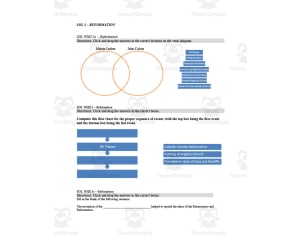
This is a World History II SOL TEIs Worksheet . This is a 15-page worksheet that reviews Cold War, Reformation, Independence Movements and so much more. There are questions, flow charts, maps and more for students to complete.
Author History with DeLong
Tags World History, Review Sheet, Study Guide, Reformation, Catholic Church
Geography Word List Posters - Set 1 (PDF)
ELA, Language Development, Vocabulary, Spelling, ESL, Resources for Teachers, Geography, Social Studies, Grade 2, 3, 4, 5, Worksheets & Printables, Worksheets, Teacher Tools, Centers, Activities, Posters, Classroom Decor
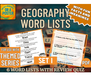
Word List Poster Series This word list poster series is designed for students in grades 2–5. Each printable focuses on a clear, kid-friendly theme and features 8 target vocabulary words with short, student-friendly meanings or fun facts. The clean layout works as both an anchor chart and a write-in sheet, giving students a quick, visual reference they can revisit during centers and independent work. These posters are student-friendly, classroom-ready, and perfect for warmups, vocabulary walls, sub plans, or take-home reference. Display a single poster to support the day’s lesson, or group several to build a themed wall across your unit. Note: Each poster is a companion piece to its matching themed product in the series—pair it with the corresponding maze, wordsearch, or activity pack for a consistent set of 8 focus words. Geography Set 1 Word List 1. Countries of the World Canada, Brazil, China, India, Egypt, France, Japan, Mexico 2. Famous Cities New York, Paris, London, Tokyo, Sydney, Cairo, Rome, Rio 3. Famous Landmarks Eiffel Tower, Great Wall, Statue of Liberty, Colosseum, Taj Mahal, Mount Everest, Amazon River, Grand Canyon 4. Continents and Oceans Asia, Africa, Europe, Australia, Antarctica, Pacific, Atlantic, Indian 5. Natural Wonders Niagara Falls, Grand Canyon, Mount Everest, Amazon Rainforest, Sahara Desert, Great Barrier Reef, Victoria Falls, Northern Lights 6. Landforms and Geography Terms Mountain, River, Desert, Island, Peninsula, Volcano, Valley, Glacier PDF Version Other versions will appear here when available. Follow the store for the lastest on new products. How to Use These Word List Posters Perfect for: Morning work or early-finisher bins Vocabulary centers or anchor walls Holiday/seasonal review lessons Independent stations, sub plans, or take-home reference More Geography Themed Products Geography Crosswords (Set 1) PDF Geography Crosswords (Set 2) PDF Geography Crosswords (Set 3) PDF Geography Word Searches (Set 1) PDF Geography Word Searches (Set 2) PDF Geography Word Searches (Set 3) PDF Geography Mazes (Set 1) PDF Geography Mazes (Set 2) PDF Geography Mazes (Set 3) PDF FULL CATALOG OF DOWNLOAD LINKS HERE Themed Word List Posters Links Addition PDF Animals PDF Around the Home PDF Birthday PDF Candy PDF Christmas PDF Cinco de Mayo PDF Clothes PDF Colors PDF Days and Months PDF Division PDF Earth Day PDF Easter PDF Easy Word List Posters PDF Fall PDF Father's Day PDF Food PDF Geography (Set 1) PDF Geography (Set 2) PDF Geography (Set 3) PDF Graduation PDF Health PDF History (Set 1) PDF History (Set 2) PDF History (Set 3) PDF Human Body PDF Kindness PDF Life Skills PDF Mother's Day PDF Multiplication PDF Science (Set 1) PDF Science (Set 2) PDF Science (Set 3) PDF Shapes PDF Social Skills PDF Spring PDF Sports PDF St. Patrick's Day PDF Subtraction PDF Summer PDF Thanksgiving PDF Transport PDF Valentine's Day PDF Winter PDF Word List Posters in Depth Structure Each poster is built around a focused sub-theme and presents 8 target words with short, student-friendly meanings or fun facts. The clean A4 portrait layout works as an anchor chart on your board or as a student reference at desks. These posters are designed as companion pieces to the matching themed products (mazes, wordsearches, activity packs), so the same vocabulary stays visible across your unit. Each poster set includes: A themed word list poster with 8 words + brief meanings/facts A clean, high-contrast layout for easy printing and display Space that can double as write-in/draw-to-show-meaning during centers Themes Included Seasons & Holidays (e.g., Halloween, Easter, Valentine’s Day) Everyday Topics (e.g., Animals, Weather, School) Math & Science Connections (e.g., Number Words, Simple Machines) Special Units (e.g., Health, Earth Day, Sports, Kindness) Each topic reflects real-life experiences and interests while strengthening vocabulary recognition and content understanding in a clear, visual way. Easy extensions (optional) Sketch it: students draw a quick icon for each word Sort it: group words by category (e.g., actions, objects) Star it: highlight “I already know” vs. “I’m learning” words Match it: point to examples in a reading, video, or picture set Say it: brief oral definition or example sentence during share-out Differentiation tips Pre-teach 2–3 anchor words; add the rest later in the week Offer picture cues or gestures for emerging readers/ELLs Let students choose 4 of 8 to focus on first, then build up Color-code by part of speech or concept family for quick scanning For similar downloads and other frees, do check out Cored Group on TeachSimple.
Author Cored Education
Rating
Tags Vocabulary, Spelling, Geography, Countries Of The World, Famous Cities, Famous Landmarks, Natural Wonders, Continents And Oceans, Word Lists, Geography Word Lists

Delaware WebQuest Printable Book
Social Studies, Geography, Grade 4, 5, 6, 7, 8, Worksheets, Worksheets & Printables
Delaware WebQuest Printable Book Students build their own mini book on Delaware and perform online research to learn key details about their state. This 10-page book contains prompts for students to research and fill in information on Delaware's most populated city, state capital, state bird, state flower, Native American tribes, bordering states, nicknames, and natural resources. An additional blank page allows students to record extra facts. Using the included map, students will mark the capital and most densely populated cities. Then, they can easily staple the printed pages together to create their book. This activity develops vital research skills as students practice using keywords and identifying reliable online sources. The inquiry process also allows students to discover new information about Delaware. With the answer key included, this book is an engaging stepping stone to more advanced research projects.
Author Soumara Siddiqui
Tags Delaware, Delaware Printables, Delaware Webquest, Delaware Worksheets, Order Of Operations Webquest

Capitalism vs Communism – Reading + Video Analysis
Social Studies, History, History: World, Government, Grade 8, 9, 10, 11, Worksheets & Printables, Worksheets
Communism and capitalism are two contrasting economic and political systems that have been the subject of much debate and comparison throughout history. Communism is a system in which all property is publicly owned and each person works and is paid according to their abilities and needs. The goal of communism is to create a classless society where wealth and resources are distributed equally among all members. Capitalism, on the other hand, is a system in which individuals and businesses own property and produce goods and services for profit. In a capitalist system, prices are determined by supply and demand, and individuals are free to pursue their own self-interest through entrepreneurship and competition. Proponents of communism argue that it is a fairer and more equitable system, as everyone is provided with the same basic necessities of life and has equal access to education and healthcare. They believe that capitalism creates inequality and promotes greed, leading to exploitation of the working class by the wealthy elite. Advocates of capitalism, however, argue that it promotes innovation, growth, and economic freedom, leading to a higher standard of living and greater prosperity for all members of society. They believe that communism stifles creativity and individual initiative, and that the government control necessary for communism leads to corruption and inefficiency. Ultimately, the debate between communism and capitalism is one of competing values and priorities. While communism values equality and social welfare, capitalism values economic growth and individual freedom. The best system for a given society may depend on a variety of factors, including cultural values, historical context, and political climate. Students start off by taking a 10 question survey. They select "agree" or "disagree" with various statements regarding economic policies. Students also look at a chart comparison of Capitalism vs Communism. At the end of the activity the students tally up their points on the questions, and they are able to see if they identify with "capitalists" or "communist" ideology based on their answers. Students then read about each economic system (reading is provided - very short and student friendly). Lastly, students connect the information to the economic effects of capitalism on the United States, and they reflect on the unequal distribution of wealth in this country after watching a short 5 minute video (video link included). Thumbnail and product Clipart Credit: By PrincePadania
Author EduPal Learning
Rating
Tags Capitalism, Communism, World History, Activities, Economics, Social Studies
Civics & US Government Bell Ringers Unit 4 - 45 Daily Warm-Ups
Social Studies, Law, Government, Grade 8, 9, 10, 11, 12, Worksheets, Worksheets & Printables
These civics and US government bell-ringers give students a calm, consistent way to begin class. Unit 4 gathers 45 short prompts on Citizen Participation, arranged as nine weekly pages a teacher can hand out each Monday and collect on Friday. Each day asks something different - a vocabulary term used in context, a few sentences to read and answer, a short document or source to interpret, a quick check, and a question that asks students to make a claim and back it with evidence. The variety keeps the routine from going stale while still reinforcing citizenship and civic duty, voting and elections, the Electoral College, political parties, campaign money and interest groups, public opinion and polling, media literacy and misinformation, public policy and the federal budget, and state and local government. Contested questions are framed so students argue both sides from evidence rather than being handed a conclusion. Everything is print-first: a clean PDF that copies well, uses little ink, and needs no accounts or devices. A full answer key and a standards page (CCSS literacy in history and social studies) are included so planning and grading stay quick. Designed for grades 8-12, the prompts work as a daily opener, a spiral review, or a settle-in task while attendance is taken. The routine is the point: the same five-minute opener every day, so students settle without being asked twice. It prints cleanly in black and white, which keeps a full class set cheap to photocopy. Each page stands alone, so a substitute can hand out the week without any briefing. The answer key makes grading quick, whether you collect the pages or review them together as a class. It works in person, hybrid, or remote, and fits a homeschool schedule just as well as a full classroom. No logins, accounts, or devices are required — just the printable PDF.
Author Response Resources
Rating
Tags Civics Bell Ringers, US Government Warm Ups, Civics And Government Bell Ringers, Daily Social Studies Warm Ups, Government Do Now, Civics Bell Work, Civics Bellringers, Social Studies Entry Ticket, No Prep Civics, Government Daily Starter
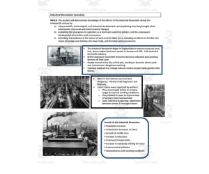
Industrial Revolution Essentials Sheet
Social Studies, History, History: World, Grade 9, 10, 11, 12, Worksheets & Printables, Worksheets
This 2-page printable is an Industrial Revolution Essentials Sheet. This is a quick guide or overview for students to serve as an introduction or review.
Author History with DeLong
Tags World History, Study Guide, Industrial Revolution, England, Communism

Iguanas Reading Comprehension Passage - Cored Ed Encyclopedia
ELA, Reading Comprehension, Reading, History, Social Studies, Science, Physics, Earth and Environmental Sciences, Life Sciences, Geography, Grade 2, 3, 4, 5, Worksheets & Printables, Worksheets, Teacher Tools, Centers, Activities, Writing Prompts, Assessments, Quizzes and Tests, Quizzes, Lesson Plans
This Iguanas reading comprehension with lesson plan includes: Visualization (on the front cover) Start your lesson by taking a minute to think and share something about the topic. Read the script aloud (slowly), perhaps prepare some music or sound effects. Student close their eyes and let their imaginations wander. Students open their eyes, read the question aloud and give them a few minutes to complete. Ask a few students to share or keep answers until the end to compare with what they learn in the passage. Quick pause—thousands of Cored Education products are included with your TeachSimple membership. Download links and encyclopedia index available here. Pre-Reading Trivia Students will write down one thing they already know about the subject and then read five more facts and discuss. These facts are fun, and the students will enjoy learning about the subject before reading more. Give 1 minute for students to write what they already know (no pressure—best guess is fine). Read the five facts together. After each fact, do ask a student for their opinion, was it surprising? Set a purpose by asking students to highlight/underline one fact they want to learn more about during the reading. Reading Passage The text is a high-interest reading passage with set paragraphs, roughly three to four paragraphs long. It contains a variety of themes about the topic, anywhere from history to technology. The passage is between 250 and 350 words in length. First, ask students to look at the headings and see what they’ll learn about today. What do they know about the topic/heading? First read options: Teacher read-aloud (best for support). Partner reading (paragraph by paragraph). While reading, students underline important details, and vocabulary words they think may come up in the questions section. Mixed Questions The first question page contains four multiple-choice questions, each with a choice of four answers, and three written response questions that require a sentence or two from the student. Students complete the mcqs first independently, then review quickly as a class. For the 3 written responses, try to get students giving the answer with some form of evidence: “I think ___ because the text says ___.” If students get stuck, send them back to check the passage. Vocabulary Questions Practice seven key words from the text in this section across two activities. First section is scrambled words where students will unscramble three words given a clue for each. The second section is a word to meaning matching activity. Before starting, have some students read out words they underlined in the passage. Ask students to say the word and read aloud the sentence(s) around each word. Ask students to do scrambled words and the matching exercise in pairs then go through answers as a class. For the scrambled spelling task, get four pairs to come up to the board and write the words for extra practice with the other student reading out the clue. For the matching task, prompt students to give full sentences: “I matched ___ with ___ because ___.” Creative Writing In this question, the student will be required to write a five to eight sentence paragraph on a question related to the topic. Before starting, ask students write down 3 key ideas they are going to include in their piece. Ask students for ideas to share around the class to help those struggling. Pro writing expectations: 5–8 sentences At least 2 facts or details from the passage At least 2 vocabulary words from the previous page Students read their paragraphs while classmates listen for facts and vocabulary words. Extension Activities This page is optional for fast finishers or to take home. There are several activities, each one requiring a different skill. Do some, do none, do all, completely optional - but you will feel reassured knowing every possibility is planned for. Includes summary writting question and additional facts. Answer Key There are answers for the multiple-choice questions, written response questions have sample answers, vocabulary answers and if there is a summary question then a sample summary will be provided as well. Lesson Plan Included Customized lesson plan for this lesson is included. Lesson Snapshot Title: Iguanas Genre: Nonfiction (informational text) Subject: Reading (Informational Text) / Life Science Primary Topic: Green vs. marine iguanas: tails, habitat, survival Estimated Guided Reading Level (A–Z): R What This Lesson Teaches Best Describes key iguana features and what they look like (dewlap, a line of spines). Explains where iguanas live and notes that most live in the Americas, with some relatives on islands. Shows how a green iguana’s long tail helps with survival (whip-like defense and strong tail strokes for swimming away). Compares two related iguanas by habitat and behavior (tree-climbing green iguana vs. sea-foraging marine iguana that eats algae and basks on dark rocks). Builds awareness of changing habitats and reasons protection matters (building on land, hunting/capturing, predators, El Niño, oil spills). Learning Goals Identify details that describe what an iguana looks like and where it lives. Explain how a green iguana uses its tail when danger comes near water. Describe how the marine iguana finds food and what it does after a cold swim. Compare the green iguana and marine iguana using evidence from the passage. Describe at least two reasons iguanas might need protection based on changes in their habitats. Key Vocabulary From the Text dewlap — loose throat skin that can hang in a fold. spines — pointed bumps that may rise along its back. forages — searches for food. predators — animals that hunt other animals. habitats — places animals need to live. FULL CATALOG OF DOWNLOAD LINKS AND ENCYCLOPEDIA INDEX HERE
Author Cored Education
Rating
Tags Vocabulary, Reading Comprehension, Reading Passages, Lesson Plans, Ela Lesson Plans, Reading Comprehension Lesson Plans, Pre-reading, History, Science Lesson Plans, Life Science

Civil Rights Act in Georgia Reading Packet
Social Studies, History, History: USA, Grade 8, Worksheets & Printables, Worksheets
Civil Rights Act in Georgia Reading Packet Transport students back in time to the Civil Rights Movement in Georgia with this informative reading packet. Through engaging passages, students will learn about key events and figures in Georgia's fight for equality. The differentiated texts and multiple choice questions allow students to strengthen literacy skills while making deeper connections to this pivotal time period. Use the accompanying graphic organizers and discussion questions to spark critical thinking about the long struggle for civil rights. This versatile resource works for whole class instruction, small groups, or independent practice. With rich content and flexible implementation, the Civil Rights Act in Georgia Reading Packet brings history to life while meeting key standards for 8th grade social studies and reading.
Author Sarah Miller Tech
Tags Georgia, Civil Rights Act, Timelines, Graphic Organizers, Text Structure
Science and Social Studies Reading Comprehension Passages & Questions
Reading Comprehension, Reading, ELA, History: Ancient, History, Social Studies, Environmental Science, Earth and Environmental Sciences, Science, Grade 3, 4, 5, Worksheets, Worksheets & Printables
Bring nonfiction reading to life with this comprehensive set of 18 engaging 3rd grade reading passages and comprehension questions ! Each passage is thoughtfully written to align with the 2024 Virginia Standards of Learning (SOLs) while remaining fully compatible with Common Core and TEKS standards , making this resource ideal for classrooms across the United States. These nonfiction science and social studies passages are designed to spark curiosity and deepen understanding of the world while helping students master essential ELA reading comprehension skills . Every passage is accompanied by five thought-provoking questions that encourage students to find text evidence, think critically, and make meaningful connections to content knowledge. Versatile and Teacher-Friendly Formats Whether you prefer printable worksheets or digital Google Slides , this resource gives you the flexibility you need for whole-group lessons, small-group instruction, independent reading, or test prep. Each passage is available in three printable formats : Passage and questions on two pages Passage and questions on separate full pages Single-page version for quick comprehension checks or homework assignments The Google Slides version of each passage makes it simple to assign and review work digitally, allowing for seamless integration into your classroom routines and learning management systems. Explore Engaging Science and Social Studies Topics Your students will journey through time and across the globe as they explore fascinating nonfiction topics that connect directly to 3rd-grade science and social studies standards. Social Studies Reading Passages Include: Roman Roads – Problem/Solution Invention of the Calendar – Description Growth of Ancient Rome – Chronological Order Ancient Egypt: Growing Food in the Desert – Cause/Effect Ancient Greece or Ancient Rome? – Compare/Contrast A History of Egypt – Chronological Order The Kingdom of Mali – Cause/Effect Contributions of Ancient China – Description Ancient Egypt on the Move – Sequence How Silk is Made – Sequence Science Reading Passages Include: Is the Tundra a Desert? – Compare/Contrast What’s the Deal with Mosquitoes? – Problem/Solution The Water Cycle – Sequence How Did You Know to Do That? – Compare/Contrast Save the Water – Problem/Solution The Six Simple Machines – Text Features Force and Motion Glossary – Text Features Force in Golf and Baseball – Description Purposeful Skill Development Each passage is intentionally structured to help students practice and recognize different nonfiction text structures , including cause and effect, problem and solution, chronological order, description, compare and contrast, and sequence . These patterns build strong comprehension strategies and align directly with 3rd grade reading informational standards . In addition to content learning, students will practice identifying main idea and details , using text features , and understanding vocabulary in context —all key components of standardized test success. Standards Alignment This resource is aligned with: Virginia Standards of Learning (SOLs) Grade 3 Reading 2024 Common Core State Standards (CCSS.ELA-LITERACY.RI.3.1–RI.3.5) Texas Essential Knowledge and Skills (TEKS) Why Teachers Love It Teachers appreciate the blend of rigorous comprehension questions, engaging topics, and flexible formats . Whether students are exploring Ancient Egypt , understanding forces in sports , or asking why mosquitoes exist , they’re practicing the literacy skills that make them stronger, more confident readers. Bring relevance, curiosity, and structure to your nonfiction instruction with these standards-aligned 3rd grade reading passages for science and social studies!
Author SchoolingSara
Rating
Tags VA SOL, Science, Reading Comprehension, Passages, Social Studies, Egypt, Rome, Simple Machines