Myanmar Map Resources


About This Product
Myanmar Map Resources
A comprehensive collection of twelve different map sheets, 'Myanmar Map Resources' offers an excellent resource for educating geography or social studies at any grade level. Spawning a spectrum of styles and focuses, these maps can be utilized in printed format as well as digitally.
Versatile Formats
PDF: Perfect to print for classroom use.
JPEG/PNG: Can seamlessly blend into your digital presentations.
Diversity lies in its Core
The 'Myanmar Map Resources' pack presents an assortment of maps. This includes:
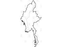
Blank Outline Maps: A great tool for testing geographical knowledge or initiating country-based projects.
Bodies of Water and Key Settlements Maps: These maps serve as accurate visual aids to understand Myanmar's geography.
Situated Among Neighbors Maps: These offer important cues when discussing regional relationships and geopolitics pertaining to Myanmar.
In conclusion, no matter what your lesson focus - from rivers flowing from mountains to seas, or city locations - The 'Myanmar Map Resources' pack serves as your go-to partner providing high-quality visuals making complex concepts easier to understand.
This Myanmar Map Resources is a ready to print and use resource. You can distribute one at a time, or as a set. Just print and go!
0 Reviews
Check out these other great products


