Burundi Map Resources


About This Product
Burundi Map Resources
The Burundi Map Resources is a comprehensive teaching tool designed particularly for educators. This resource package is not grade specific; therefore, it can be effectively utilized by both public school teachers and homeschoolers to teach any grade.
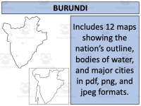
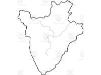
This product comes with twelve separate map sheets in different formats such as pdf, jpeg, and png for easy accessibility across varied platforms you might use when presenting your lessons. The maps highlight different geographical features of Burundi including blank outlines. It also provides an overview of bodies of water, major settlements along with the country being shown in isolation as well as juxtaposed with its neighboring nations.
Inclusions:
Burundi map resources customized for various levels and covering diverse geographies.
This tool directly addresses Social Studies curriculum requirements focused on Geography education and comes in a user-friendly ‘Zip’ file format type that facilitates easy download and handling.
Burundi Map Resources suitably blends diverse geographical information compiling them into worksheet types making lesson planning both convenient and engaging for teachers from various educational settings while fostering geography awareness among learners in an interactive fashion.
This Burundi Map Resources is a ready to print and use resource with any lesson or unit covering Burundi!
Resource Tags
0 Reviews
Check out these other great products