Spanish Speaking Countries Map – With Capitals
- Grades
- Grades 8–9, Middle School, High School
- Pages
- 5
- File type
- Answer key
- Included


- Subject
- Foreign Languages, Spanish
- Topic
- geography, Spanish-speaking countries
- Resource types
- Worksheets & Printables, Worksheets
- Answer key
- Included
About this resource
What's inside this resource
Spanish: Countries and Capitals Speaking Spanish Maps
Spanish: Countries and Capitals Speaking Spanish Maps is an instructional resource that aids educators in instructing students about the geography of Spanish-speaking nations, concentrating specifically on their capitals and domains. This educational assistance caters to middle school to high school learners studying Spanish.
Description of the Product:
This bundle offers an array of content comprising lists, maps, and versatile worksheets. It includes:
A list showcasing Spanish-speaking countries accompanied by their respective capitals, putting a spotlight on Latin America.
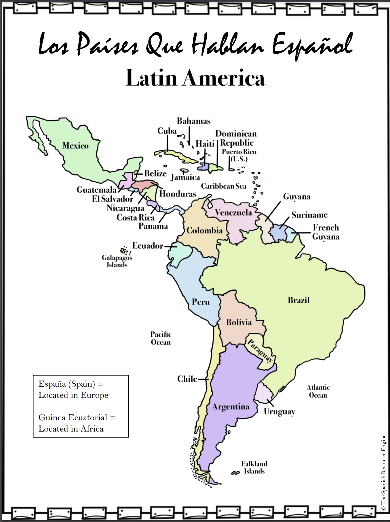
A geographic map attached labels reflecting Latin America's layout.
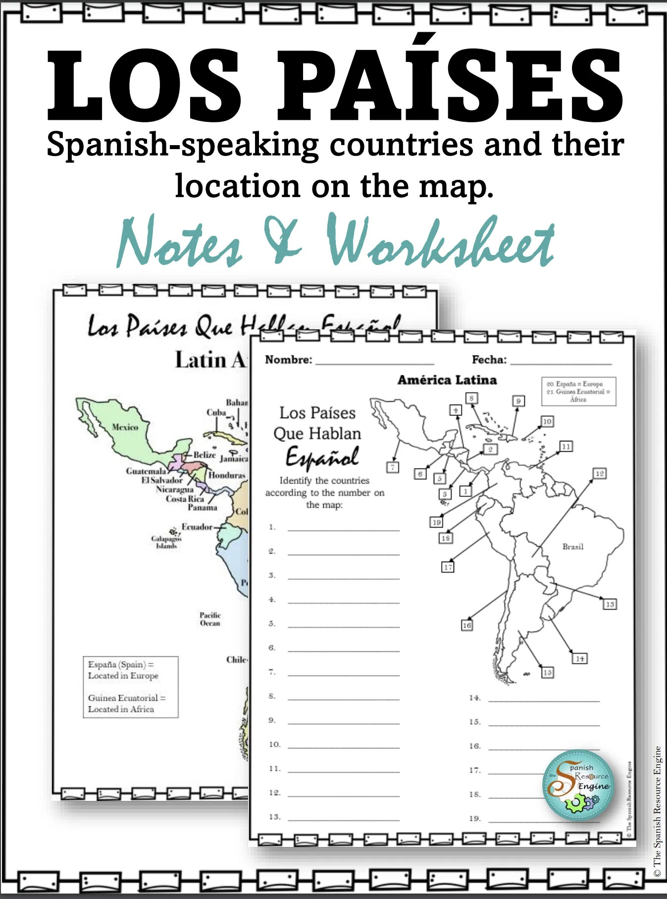
Five diverse worksheets encouraging scholars to test knowledge through distinctive methods where they can identify lands by continents; locate specific countries on a map; unscramble names of states and capitals; or fill in gaps correctly pairing each nation with its capital.
Digital Framework & Customizable Materials:
The provided resources are accessible in both printable PDF formats as well as digital form via Google Slides™ which broadens lesson planning options paired with opportunities for extended learning beyond school surroundings. Not only this, but it also contains customizable materials – teachers can adapt the default template fittingly through Google Slides™ catering to unique labeling activities or modifying extant content as needed. They offer incredible flexibility across different scenarios like whole-class instruction or small group study sessions even individual tasks either assigned during class time or for homework assignments lending further versatility within potential substitute lesson planning contexts too.
Bonus Features:
Included answer keys for simplistic self-correction/peer checking which will facilitate student initiatives alongside reducing teacher marking loads at once.
The utilization not only permits straight-forward testing measures but too boosts creative pondering while nurturing strategic insights centered around geography tied to fluency in another language – making learning engaging and fun.
In conclusion, Spanish: Countries and Capitals Speaking Spanish Maps smoothly blends practicality with creativity fostering dynamic learner immersion while erecting solid groundwork in the realms of geography paired with proficiency in the Spanish language.
Related resources
More resources teachers may find useful
24 related resources were found using this product's title, contributor, categories and tags.

In the classroom
Teaching tips & learning objectives

Learning objectives
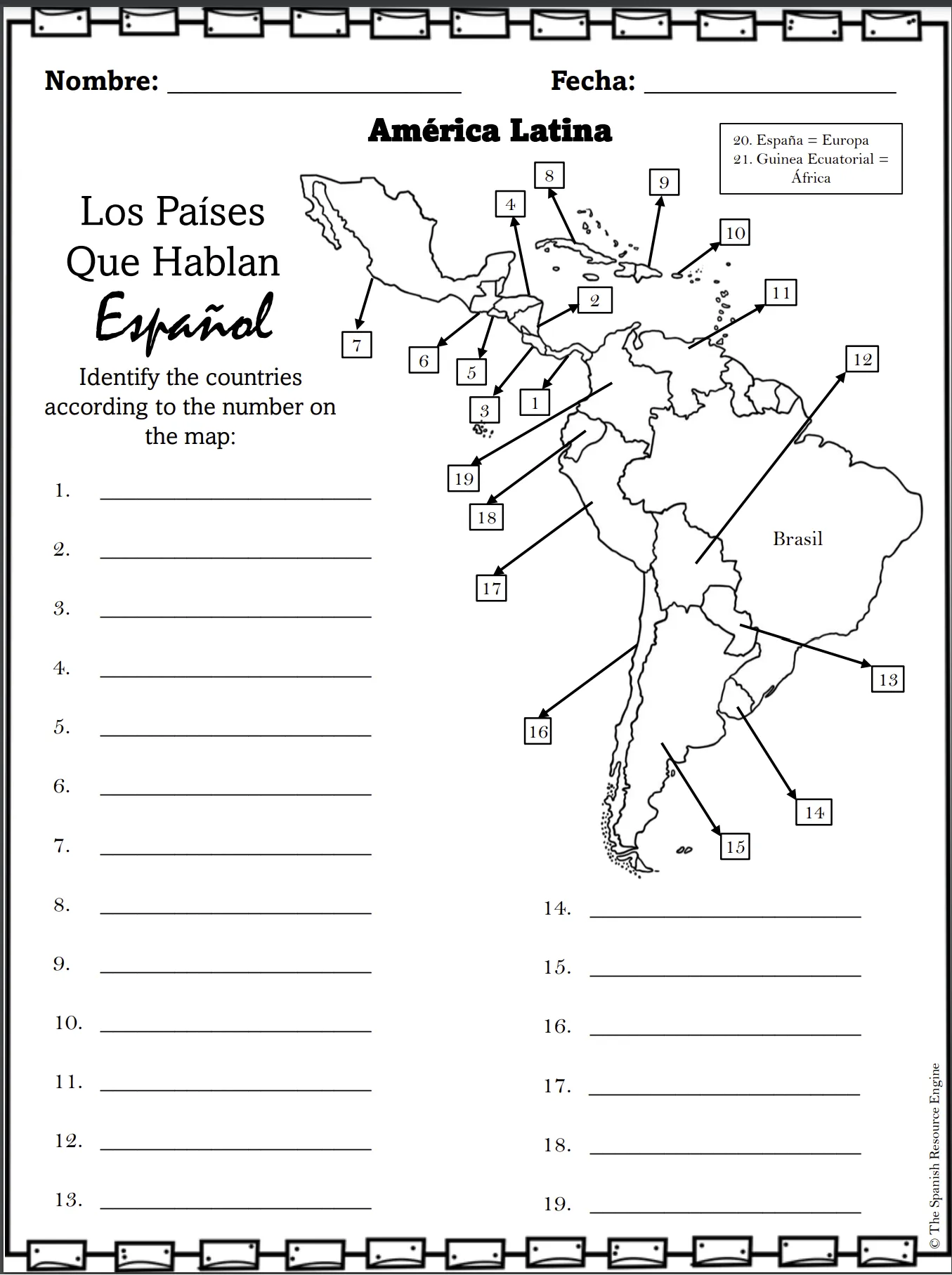
Name the nineteen Spanish-speaking countries of Latin America and place each one correctly on a map
Distinguish the Central American countries from one another by position rather than by name recall alone
Recognise that two Spanish-speaking countries - España in Europe and Guinea Ecuatorial in Africa - sit outside Latin America entirely

Teaching tips
Teach the notes page before the worksheet: it establishes España and Guinea Ecuatorial as the two countries outside the map, which is why the worksheet numbers them separately
The Central American cluster - numbers 1 to 7 - is the hardest part of the map to read, so it is worth working through those together before students continue alone
Brasil is labelled on the map but carries no number; asking students why is a quick way into the difference between Latin America and the Spanish-speaking world

Skills covered
Map identification - students match nineteen numbered positions on a Latin America map to country names without a word bank.
Spanish-speaking world knowledge - the list separates the nineteen Latin American countries from España in Europe and Guinea Ecuatorial in Africa.
Spanish orthography - the completed version writes country names with their Spanish accents, including Panamá, México, Perú and REP. DOMINICANA.
Good to know
Questions teachers ask about this resource
Which countries fall outside the map?
Two. España is printed beside the map as item 20 with the note Europa, and Guinea Ecuatorial as item 21 with África. Both are also introduced on the notes page that comes before the worksheet, so students meet them before they start numbering.
Why is Brasil drawn on the map?
As a labelled reference point rather than an answer. It sits in the middle of the South American map with its name printed and no number beside it, which marks it out as the large neighbour that is not part of the Spanish-speaking list.
How are the country names written on the completed version?
In Spanish, in capitals, with accents kept - PANAMÁ, MÉXICO, PERÚ - and the Dominican Republic abbreviated as REP. DOMINICANA. That sets the spelling standard students are expected to match.

No reviews yet
Downloaded this resource? Tell other teachers how it went.
Resource details
Concepts & topics
Core concepts
 Core concepts
Spanish-speaking countries
Latin America
Map skills
Country names in Spanish
 Topics
Explore more
Categories this resource belongs to
Explore related searches
More to explore
You may also like