Flash Cards: Provincial & Territorial Capitals


- Grades
- Grades 3–4
- Pages
- 16
- File type
- Preparation
- Print ready


- Subject
- Geography, Social Studies
- Topic
- Study, Skills
- Resource types
- Flashcards
- Preparation
- Print ready
Product description
From the author
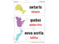
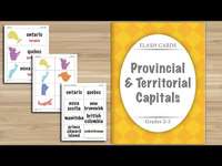
Learn the 13 Canadian Provinces and Territories and their Capitals with this resource. Flash Cards introduce concepts and promote comprehension through memorization and repetition. They can be used in a group setting or individually for practice. Additionally, use the flash cards in a matching game. Match the image of the province with its name and/or with its capital.
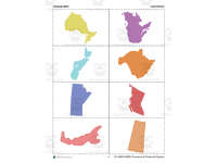
This set includes a teaching guide, the provinces and territories flash cards, geography matching cards, provinces and territories matching cards, capitals matching cards, and blank flash and matching cards.
These Flash Cards can be used to help students recognize the Canadian Provinces and Territories and identify their Capitals. Other titles included in this series are: STATE CAPITALS Flash Cards. These two titles are also available in a BUNDLE.
About this Resource:
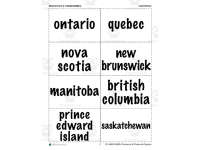
This resource includes all 13 Canadian Provinces and Territories and their capitals in a Flash Cards format. Each card shows a picture of the province or territory, its name, and its capital. Teachers can cut out each flash card for easy use with their students. An extra sheet of blank flash cards is also provided. Once students have mastered the flash cards, they can then enjoy a matching game. The province and territory images, names and capitals are also included as separate matching cards. Teachers can cut out each card and have their students match the image with its name and capital. The variety of matching activities is endless.
About Flash Cards:
Flash Cards are small cards that have a little amount of information on them. These cards are held up for students to see to help with learning. Flash Cards can be used in groups as drill activities, or alone for private study. Although Flash Cards can contain any form of information, for the purposes of this resource, each Flash Card contains an image of the Canadian Province or Territory, its name and its capital. Overall, Flash Cards are used as a learning drill to help with memorization through repetition. Students can quickly and easily learn the Canadian Provinces and Territories and their capitals by using Flash Cards in their everyday study.
Flash Cards exercise the mental processes of students’ brains. With repeated practice, students will learn to associate words with their spelling.
About the Canadian Provinces and Territories and their Capitals:
The country of Canada is separated into 13 geographic locations known as provinces and territories. During the Confederation of 1867, three provinces were united to form a federated colony. These provinces were New Brunswick (British North America), Nova Scotia and the Province of Canada, which was divided into Ontario and Quebec. From 1870 to 1949, Canada saw the rest of its provinces and territories join, the last being Nunavut in 1999. The provinces receive their power and authority from the Constitution Act of 1867. The territories receive their power from the Parliament of Canada.
Related resources
More resources teachers may find useful
24 related resources were found using this product's title, contributor, categories and tags.
In the classroom
Teaching tips & learning objectives

Learning objectives
Recall the capital city of each of Canada's 10 provinces and 3 territories.
Match each province or territory's geographic image to its correct name and capital.
Identify the 13 Canadian provinces and territories by name.

Teaching tips
- Introduce a few province or territory cards at a time.
- Use the separate images, names and capitals to adjust the matching challenge.
- Add practice cards with the blank templates when useful.

Skills covered
Canadian geography recall — students memorize the name and capital of each of the 13 provinces and territories using repeated flash card drill (pages 4-8).
Image-to-fact matching — students pair a province/territory image with its correct name and capital using three separate matching card sets (pages 10-15).
Good to know
Questions teachers ask about this resource
How can I vary the matching task?
Begin with province or territory images and their names, then add the capital cards. Use the blank templates to prepare additional practice cards if helpful.

No reviews yet
Downloaded this resource? Tell other teachers how it went.
Resource details
Concepts & topics
 Core concepts
 Topics
Explore more
Categories this resource belongs to
Explore related searches
More to explore
You may also like