Geography: Countries Bordering Austria

- Year groups
- Years 4–6 (Key Stage 2)
- File type
- Preparation
- Print ready


- Subject
- Geography, Social Studies
- Topic
- Geography, Austria
- Resource types
- Worksheets
- Preparation
- Print ready
From the author
About this resource
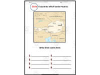
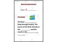
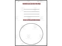
Explore Austria with three printable geography worksheets. Students circle and name eight neighbouring countries on a labelled map, identify the capital and complete Danube River facts, then list Alpine activities and draw one.
Use an atlas or another appropriate reference for abbreviated country names and the river questions. The supplied file is a three-page PDF without editable form fields or an answer key.
Related resources available separately
curriculum
Related resources
More resources teachers may find useful
More resources on the same subject and topic.

In the classroom
Teaching tips & learning objectives

Learning objectives
Identify and name the eight countries that share a border with Austria.
Recall Austria's capital city and locate the Danube River's source and mouth.
Connect a country's geography to human activity by naming and illustrating an Alpine activity.

Teaching tips
Provide a labelled map or atlas reference beforehand, since no word bank or answer key is included for the country-naming page.
Pair the Danube River page with a map showing the river's full course through Central Europe.
Use the Alps activity page as a quick creative extension after the two factual pages are complete.

Skills covered
Political map reading — students identify a country's neighbours by locating and circling them on a map.
Physical geography recall — students identify a capital city and a major river's source and mouth.

No reviews yet
Downloaded this resource? Tell other teachers how it went.
Resource details
Concepts & topics
Core concepts
 Core concepts
Geography
Map skills
Austria
 Topics
Explore more
Categories this resource belongs to
Explore related searches




More to explore