Me On The Map Book Companion + Lesson Plan Activity




- Year groups
- Years 1–3 (Key Stages 1–2)
- File type
- Preparation
- Print ready


- Subject
- Geography, Social Studies
- Topic
- Social Studies Activity, Geography Activity
- Resource types
- Workbooks
- Preparation
- Print ready
From the author
About this resource
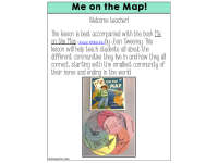
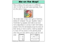
Me On The Map Book Companion + Lesson Plan Activity is a 23-page resource that will pair well with the "Me On The Map" book by Joan Sweeney. This lesson is meant to teach students all about the different communities that they live in from their home to the continent they are on. Step-by-step directions are given to create their circle maps.
Related resources
More resources teachers may find useful
More resources on the same subject and topic.

In the classroom
Teaching tips & learning objectives

Learning objectives
Identify personal address information (home, street, town) as the starting point for locating oneself on a map
Sequence nested geographic scales from home up through state/province, country, continent, and world
Distinguish between 'state' and 'province' as the correct term depending on a student's country

Teaching tips
Read Me on the Map by Joan Sweeney aloud before starting the activity, since the product is explicitly designed as its companion
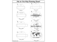
Pre-fill the planning sheet with each student's address information ahead of time if students are not yet able to spell their own street or town names
Have students write their name on the back of each cut-out circle before assembly, to avoid losing pieces before binding
Print each flip-book page on a different coloured paper so the layered circles stay visually distinct once bound

Skills covered
Nested geographic scale sequencing — students order their personal information from home up through street, town, state/province, country, continent, and world.
Personal information recall — students record their own address, town, and country using a planning sheet before transferring it to the flip-book.
Flip-book assembly — students cut, stack, and bind their circle pages in order using a brass fastener.
Good to know
Questions teachers ask about this resource
Is the picture book included?
No. The activity is designed to accompany Me on the Map by Joan Sweeney, which is used separately.

No reviews yet
Downloaded this resource? Tell other teachers how it went.
Resource details
Concepts & topics
Core concepts
 Core concepts
Community and geography scale
Map skills
Personal address
 Topics
Explore more
Categories this resource belongs to
Explore related searches




More to explore