Reading a Map Worksheets – Social Studies Practice


- Year groups
- Years 3–6 (Key Stage 2)
- File type
- Preparation
- Print ready


- Subject
- Geography, Social Studies
- Topic
- Compass, Globe
- Resource types
- Worksheets
- Preparation
- Print ready
From the author
About this resource
Reviewed, evaluated, edited, and creatively written by teaching professionals, this Social Studies-focused digital resource implements current teaching strategies and aligns with school-level standards to teach about map reading. With the ability to print the pages over and over, your child can complete the activities again and again until the skills have been mastered.
Includes activities that focus on:
• Directions
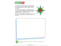
• Using a compass
• Locating objects on a map
• Globes
• Using a compass
• Scale and distance
• Hemispheres
• Latitude and longitude
• Legends
• Maps (political map, transportation map, and road map)
Related resources
More resources teachers may find useful
More resources on the same subject and topic.

In the classroom
Teaching tips & learning objectives

Learning objectives
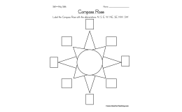
Identify cardinal and intercardinal directions using a compass rose and apply them to a map
Distinguish the Northern, Southern, Eastern, and Western Hemispheres and identify the equator and Prime Meridian
Use lines of latitude and longitude to locate a city on a map
Differentiate political, physical, road, and transportation maps and interpret each map's specific purpose
Read a map scale to estimate real-world distance between two locations

Teaching tips
Teach the compass rose and direction pages before the latitude/longitude and hemisphere pages, since later pages assume students can already read N/S/E/W
Use the amusement park and shopping-grid pages as a lower-stakes warm-up before the more abstract US political and physical maps
Pair the map-scale page with a real local map so students see the scale concept applied outside the worksheet's fictional towns
Read the trivia box on each page aloud as a hook before students attempt the direction or map-reading questions

Skills covered
Cardinal and intercardinal direction reading — students answer prompts like identifying what is northeast of a landmark on an illustrated town or amusement-park map.
Hemisphere and imaginary-line identification — students colour and label the equator, Arctic/Antarctic Circles, Prime Meridian, and International Date Line on a globe diagram.
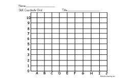
Latitude/longitude coordinate reading — students match degree coordinates such as 'north 40, west 105' to the nearest labelled city.
Map-type differentiation — students distinguish political, physical, road, and transportation maps by the specific information each one records.
Scale interpretation — students convert map-scale inches into real-world mileage between cities.
Good to know
Questions teachers ask about this resource
Why do several pages repeat the same base map with more detail added each time?
The United States map is reused for the physical, political, road, and scale pages, layering in mountains and rivers, then state boundaries and capitals, then highways, so students build up map-reading skills on a map they already recognise.

No reviews yet
Downloaded this resource? Tell other teachers how it went.
Resource details
Concepts & topics
Core concepts
 Core concepts
Map skills
Compass directions
Latitude and longitude
Hemispheres
Map types and scale
 Topics
Explore more
Categories this resource belongs to
Explore related searches




More to explore