Ireland Map Resources


About This Product
Ireland Map Resources
Our Ireland Map Resources are a comprehensive teaching tool designed for educators who seek to enhance their students' geographical understanding and knowledge about Ireland. These resources comprise high-resolution maps of Ireland in varied formats including pdf, jpeg, and png.
Detailed Assortment:
The assortment contains 12 distinctive map sheets that cater to different teaching methodologies and student learning styles. You’ll find:
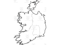
Fundamental map outlines great for groundwork lessons or examination revisions.
Maps pinpointing the major bodies of water around Ireland, along with significant settlements within the country.
An isolated image of Ireland alongside other images showcasing it amidst its surrounding nations. This feature offers unique perspectives aiding in understanding the geopolitical landscape more effectively -perfect for socio-political studies or comparative analysis lessons.
These versatile Irish Map Resources can be used across multiple grade levels making them perfect for both public school teachers and homeschoolers alike. The subjects most benefited include Social Studies majorly focusing on Geography.
Access:
As soon as you download this product all files become readily accessible via zip files – instant access to indispensable geographic education tools. If you need a hands-on way of promoting geographic literacy about Ireland amongst your pupils while retaining flexibility in lesson planning then our Irish Map Resources is what you need!
Geography classes await us!
Resource Tags
0 Reviews
Check out these other great products


