search
user.png
vertical menu

Landmarks and Landforms of North America | Continent of North America Unit Study | Geography Bundle

Landmarks and Landforms of North America | Continent of North America Unit Study |… preview
Landmarks and Landforms of North America | Continent of North America Unit Study |… preview 2
Landmarks and Landforms of North America | Continent of North America Unit Study |… preview 3
Landmarks and Landforms of North America | Continent of North America Unit Study |… preview 4

Look Inside · 10 pages

Cover of the North America postcard resource, showing sample Statue of Liberty and Peggy's Cove cards
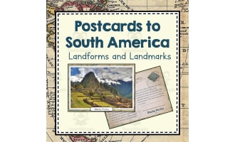
Cover of the landmark and landform postcard set
Postcard preparation directions: print, cut, match fronts and backs, glue, laminate, and organize on a ring
Preparation and presentation directions
Metric System notice before the postcards, referring to animal cards and choosing classroom measurements
Measurement-system notice before the card sheets
Grand Canyon postcard front and back: canyon photo and facts about erosion, rock layers, and wildlife
Grand Canyon postcard: matching front and back
Great Plains postcard front and back: grassland photo and facts about prairies, wheat, and wind farms
Great Plains postcard: matching front and back
Rocky Mountains postcard front and back: mountain photo and facts about formation, history, and recreation
Rocky Mountains postcard: matching front and back
Missouri River postcard front and back: river photo and facts about sediment, transportation, and dams
Missouri River postcard: matching front and back
Statue of Liberty postcard front and back: statue photo and facts about France's gift and green patina
Statue of Liberty postcard: matching front and back
Golden Gate Bridge postcard front and back: bridge photo and facts about its opening, cables, and color
Golden Gate Bridge postcard: matching front and back
Mount Rushmore postcard front and back: sculpture photo and facts about presidential faces and carving
Mount Rushmore postcard: matching front and back
Attributes
Add To Collection
Add to collection Add to collection

About This Product

12 postcards featuring famous landmarks and landforms found in North America. Set comes with worksheet for each landmark and landform so students can practice, enjoy, and reinforce skills. Each postcard is double sided with a beautiful photo on one side and a post-note on the other directed towards the students. Don't worry, I've provided both systems of measurement: the metric and imperial systems so no matter where you live- I've got you covered.


How To Use This:

Look through all the resources and decide which ones to use. Print the postcards double sided (or print and lightly glue). Laminate for re-use. Use these as resources to learn about countries, landmarks, or landforms. Use them to write reports, or give oral presentations. Color and cut out stamps to put in your "Passport" to show you've learned about that country! Play the "I have, Who has" game as review!


What You Get:

  • - 12 double-sided information cards about famous landmarks and landforms in North America using the metric measurement system.

  • - 12 double-sided information cards about famous landmarks and landforms in North America using the imperial measurement system

  • - 12 half-sheet worksheets to go along with each postcard


Want More North America Study Resources?:

*I have resources like this for every continent. So make sure to check them out if your'e trying to put together a comprehensive geography study!


Check out other resources from my store: Simply Schoolgirl!


I can be contacted for questions and concerns at simplyschoolgirl1@gmail.com

What's Included

1 zip file with:

-1 PDF with 35 ready to print pages

-Google Doc w/ product description

-Preview images

0 Reviews

Explore related searches