US States, Capitals and Abbreviations: Reference Table


- Year groups
- Years 4–6 (Key Stage 2)
- Pages
- 5
- File type


- Subject
- Geography, Social Studies
- Resource types
- Worksheets & Printables
From the author
About this resource
Introduction
If you’re teaching U.S. geography and your students are having a hard time remembering all 50 states and their capitals, this resource was made to give them extra practice in a simple and clear way. I created this after noticing that many students recognise the names but still mix up capitals or forget abbreviations. So the goal here is just to give them a clear and organised reference they can come back to while studying.
Objective:
Students will practice and reinforce their knowledge of the 50 U.S. states, capitals, and abbreviations by working with easy-to-read tables and reviewing the information regularly.
What’s Included:
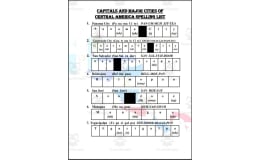
5 no-prep reference tables
All 50 U.S. states with capitals and abbreviations
Organised in groups of 10 for easier reading and memorisation
Clear and simple layout for quick study and review
Grades / Ages:
Best suited for Years 5–9 or students learning basic U.S. geography
Implementation Format:
Printable PDF
Non-editable
Easy to print and use for classwork, homework, or review
Works well as a study guide, reference sheet, or warm-up activity
Related resources
More resources teachers may find useful
More resources on the same subject and topic.


No reviews yet
Downloaded this resource? Tell other teachers how it went.
Resource details
Core concepts
Core concepts
 Core concepts
- U.S. states
- State capitals
- Postal abbreviations
Explore more
Categories this resource belongs to
Explore related searches


More to explore