2,792 products added recently
Page 40 - Social Studies Worksheets
Enhance your social studies curriculum with worksheets covering geography, history, civics, and cultures. These resources include maps, timelines, and critical thinking exercises. Use them to deepen understanding of societal structures and encourage informed citizenship.

Facts About the American Flag
Social Studies, ELA, History, History: USA, Reading, Reading Comprehension, Grade 3, 4, 5, Worksheets & Printables, Worksheets
Facts About the American Flag This resource teaches students facts about the American flag. The reading passage gives details on the flag's history, symbolism, and proper etiquette. After reading, students answer comprehension questions about the text and color a image of the flag. Educators can implement this resource in various ways. It works well for whole class instruction through a teacher-guided lesson. Students can also work independently or in small groups, making it adaptable across grade levels. Whether paired with a social studies unit or used for reading practice, the passage builds literacy skills. With a concise informative text and activity, Facts About the American Flag enhances classroom flag discussions. Students gain knowledge while practicing reading, coloring , and responding to questions. This versatile cross-curricular resource allows teachers to teach flag facts in an engaging way.
Author Life with 5 Boys
Tags American Flag, American Flag Activities, United States, United States Activities

Slang from the 20s
Social Studies, History, History: USA, Grade 9, 10, 11, 12, Worksheets & Printables, Worksheets
Slang from the 20s: An Excursion into Historical Linguistics Step into the Roaring Twenties with this enlightening assignment designed to engage students in understanding and using historical slang. Slang from the 20s is a teaching resource that guides students through delving into the rich and vibrant language of 1920s popular culture, providing an interactive experience in historical linguistics. Targeted at grade 9-12 students, this resource fits perfectly into Social Studies curriculums, particularly History focusing on America. It offers a gripping linguistic journey through time that promotes comprehensive learning about vernacular expressions of yesteryears all while adapting them to current times. The Activities Involved: The activity involves creative and reflective thinking as it encourages your pupils to create personalized license plates drawing from both eras. This thought-provoking exercise blends imagination with facts for an advanced understanding of societal changes over time, empowering them with critical analysis skills. Sure to tickle their creativity and reasoning alike while boosting engagement levels in class discussions or individuated learning sessions; this worksheet is provided as a Word Document file. Hence it is easy to print or use digitally based on your need making sure adaptability is not compromised by any means. Additional Resource Links: The assignment also provides internet links leading towards famous 1920's slang words enabling your curious minds to research sufficiently without exhausting numerous resources elsewhere; thus saving up on prep time immensely yet ensuring quality insights are delivered seamlessly. Slang from the 20s serves as a captivating look into social change over years reflected through vocabulary transformation allowing learners not just understand but experience history actively rather than passively receiving information - A personal journey script co-written by curiosity-filled young minds! Past calling present here!
Author Jason Stein
Tags Historical Linguistics, 1920s Slang, Social Studies, Cultural Evolution, Curriculum Resource

Belarus Map Resources
Social Studies, Geography, Not Grade Specific, Worksheets & Printables, Worksheets
Belarus Map Resources: An Overview The Belarus Map Resources product is a comprehensive collection of maps that focus on the Eastern European country of Belarus. The resources are designed to be flexible, offering diverse teaching possibilities for educators aiming to enhance their geography lessons with real-world reference materials. What’s included? A total of twelve distinct maps are included in this resource, each one presented in pdf, jpeg or png formats for optimal convenience and usability across multiple platforms. The following types of maps are provided: Blank outlines suitable for labeling activities or memorization assignments Detailed maps highlighting significant bodies of water and other crucial geographic features Maps charting major settlements within the nation Broad context views featuring Belarus both as an isolated entity and positioned amongst neighboring nations Note: This product allows teachers to use these resources not only in classroom instruction but also incorporate them into their original education products. All these materials are offered as a zip file download ensuring easy acquisition and organization thereby simplifying preparation efforts considerably while lending professional depth any well-rounded lesson should have. User flexibility: Open for all educators! Maintaining its non-grade-specific nature makes it adaptable across different education levels from early learning up until advanced studies allowing teachers scaling complexity based on learners’ capacity or curriculum goals. Excellent usability benefits public school teachers seeking fresh approaches towards teaching complex subjects; perfect even for dedicated homeschoolers trying to customize learning experiences around unique learner's interest.
Author Mr Gray History
Tags Belarus Geography, Map Resources, Teaching Aids, Geopolitical Study, Environment Dynamics
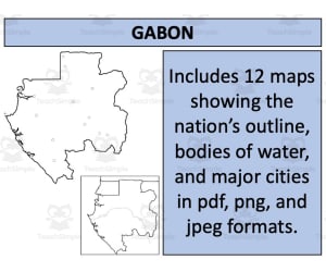
Gabon Map Resources
Social Studies, Geography, Not Grade Specific, Worksheets & Printables, Worksheets
Gabon Map Resources A practical teaching tool designed to aid social studies educators. These Gabon Map Resources come with twelve unique map sheets for geography lessons specifically about Gabon and its neighboring countries. Available in three different formats: PDF, JPEG, and PNG, tailored to be usable across various digital platforms. Makes it an ideal choice for display in classrooms or as reference material for students in a public school or homeschooling environment. Diverse Geographical Aspects Blank outlines : A useful practice tool for gaining a better understanding of the region's topography. Bodies of water maps: Depicts significant aquatic landmarks that influence Gabon's landscape and climate conditions. Settlements maps: This resource caters key human geographical factors such as population density, urbanization trends or historical aspects related to Gabon. The individual benefits of each map combined provide comprehensive geographical knowledge about Gabon. This collection doesn't limit itself with just imparting raw data but offers a meaningful analytical depth on the nation's distinctive geographical identity. Geared towards meeting diverse learning needs without grade-specific restrictions along with an uncomplicated accessibility (provided as ZIP file), this Gabon Map Resources simply elevates geography lessons! Have your students learn about Gabon with this additional Gabon Map Resources!
Author Mr Gray History
Tags Gabon, Geography Resources, Map Sheets, Teaching Tools, Human Geography
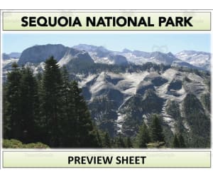
Sequoia National Park Geography Unit
Social Studies, ELA, Geography, Reading, Reading Comprehension, Grade 6, 7, 8, 9, Teacher Tools, Lesson Plans, Presentations, Worksheets & Printables, Worksheets
Sequoia National Park Geography Unit Transport students to Sequoia National Park with this engaging geography unit. Through informative reading passages, vibrant images, and interactive activities like crosswords and videos, middle schoolers will become immersed in the park's captivating history, wildlife, climate, and landscapes. The complete set of materials equips educators to guide a comprehensive study on this iconic landmark. It includes condensed and extended reading sheets, QR code links to supplementary videos, worksheets for further analysis, eye-catching visuals for projects, an accompanying PowerPoint presentation to facilitate instruction, and templates to help students synthesize their knowledge into presentations or booklets. This versatile and multi-faceted unit brings Sequoia National Park’s unique geography alive and makes learning memorable.
Author Mr Gray History
Tags National Park Services, Sequoia National Park, Landmarks, Monuments, Geography Unit, Wildlife, Climate Lesson, Climate Activity
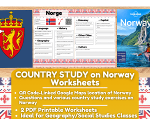
Country Study Worksheets on Norway - Europe -Scandinavia
Social Studies, Geography, Grade 6, 7, 8, 9, 10, 11, 12, Worksheets & Printables, Worksheets
Country Study Worksheets on Norway - Europe -Scandinavia Enhance your Geography and Social Studies lessons with these comprehensive 2-page PDF Worksheet on Norway, designed for Middle School and High School students (7th-12th grade). This engaging teaching resource is perfect for country study activities, focusing on Norway's geography, history, language, economy, and culture. Ideal for testing students' knowledge and reinforcing their understanding, this printable worksheet brings the rich heritage of Norway (Europe - Scandinavia) to your classroom. This Norway Country Study Worksheet includes a variety of questions and exercises to provide a thorough assessment of students' knowledge: Interactive Geography: A QR code linked to Norway's location on Google Maps helps students visualize and pinpoint the country’s geographical position. Geography Questions: Assess students' understanding of Norway’s physical features, including its terrain, climate, and notable geographical landmarks. History Questions: Test students on key historical events and figures that have shaped Norway Language Questions: Challenge students with questions about the Norwegian language Economy Questions: Evaluate students’ knowledge of Norway’s economic structure, major industries, and economic challenges. Cultural Exercises: Encourage students to explore Norway’s culture by listing famous sights in Oslo, the capital city, and writing about other notable cities in Norway. They will also be prompted to describe cultural aspects such as traditions, cuisine, and festivals. This PDF worksheet is a versatile tool for both in-class activities and homework assignments, making it a valuable addition to your teaching toolkit. It’s designed to not only test students' knowledge but also to inspire curiosity and a deeper appreciation for Norway's cultural and historical context. This amazing Social Studies + Geography Country Study on Norway (Europe - Scandinavia) PDF Digital Teaching Resource (2 PDF Printable Slides) can be great for learners from 7th grade to 12th grade to test Norway and its Culture. Learning with Alan is a Teaching Resource, Educational Material Store whose aim is to help Teachers, Educators and Tutors to achieve their teaching objectives while creating a fun and stimulating environment. Never Forget! If you want to browse more of my Teaching Resources, click here Learning with Alan
Author Learning with Alan
Tags Country Study, Social Studies, Geography, Europe, European, Scandinavia, Norway, Worksheets, Printable, Activity

Canada Map Resources
Social Studies, Geography, Not Grade Specific, Worksheets & Printables, Worksheets
Introducing our Canada Map Resources A versatile and convenient teaching tool geared towards enhancing geography education for students. This product is a comprehensive resource package comprising nine distinct map sheets, each presented in pdf, jpeg, and png formats. Catering to a diverse Educator Audience This product designed to cater to the needs of educators across different platforms – whether they are public school teachers or homeschoolers. Rich Content The set includes blank outlines along with maps highlighting significant bodies of water and major settlements in the region. The content is thoughtfully curated to represent not only Canadian surroundings but also its neighboring nations. Ease of use & Adaptability Teachers can seamlessly integrate these maps into their curriculum without additional hassle. They can be utilized within numerous projects as long as usage complies with given instructions that are part of our preview sheet. We offer resources focusing on other geographic areas too. An bundle encapsulating 194 different nations worldwide! A comprehensive United States map resource pack covering all necessary data points just like our Canadian offering. Serving educators across grade level specificity or subject focus within Social Studies – from generalists looking at global trends right through specialized Geography classes –these worksheets serve as an excellent supplement or standalone learning material. For maximum compatibility: this product comes as a zip file that can be easily extracted using standard software available on most devices. To sum it up: Canada Map Resources offers detailed illustrative aids ensuing interactive geography lessons capturing students' interest while enhancing spatial awareness about both national and international landscapes.
Author Mr Gray History
Tags Canada Map, Geography Education, Teacher Resources, Spatial Awareness, Interactive Lessons

Political + Economic Regions of the United States Reading Packet
Social Studies, Geography, Grade 5, Worksheets & Printables, Worksheets
Political + Economic Regions of the United States Reading Packet The Political + Economic Regions of the United States Reading Packet is a valuable tool for grade 5 students learning geography in social studies. Presenting a detailed exploration into America's geographical and economical regions with engaging, fact-based content. Teaching Tool: This resource simplifies complex concepts for young learners. Takes students across diverse political and economic landscapes, helping them understand factors like location advantages influencing industry distribution. Worksheets: Aid knowledge reinforcement utilizing informative passages. Create opportunities to apply vocabulary terms learnt from readings. Promote easy grasp of geography concepts thanks to real-world connectivity scenarios presented. Mutiple-dhoice Questions: To check understanding and grasp received knowledge, multiple-choice questions are provided after every passage read — offering swift feedback about areas fully grasped or parts requiring more focus. Graphic Organizers : Aptly placed graphic organizers further augment comprehension by providing visual guides that boost information retention significantly. All answer keys are included! This ensures teachers can save time they would have used up checking answers manually. This 12-page PDF requires no preparation; just print it out and begin! In Conclusion: Suitable for beginner educators teaching geography or seasoned teachers seeking new resources, this Political + Economic Regions of the United States Reading Packet is an invaluable addition to your educational library collection.
Author Sarah Miller Tech
Tags Geography, Social Studies, Political Regions, Economic Regions, Worksheets
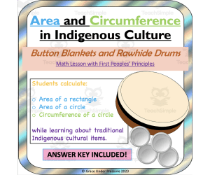
Circumference and Area of Circles (with First Peoples' Principles)
Social Studies, First Peoples (Native), Math, Geometry, Measurements, Grade 6, 7, 8, Worksheets & Printables, Word Problems, Worksheets
Circumference and Area of Circles with First Peoples' Principles is a teaching resource that combines math education with a basic introduction to two cultural traditions from indigenous groups. It is suitable for middle grades students in 6th to 8th grades. This lesson provides a practical application of geometry by instructing students on how to calculate the areas of rectangles as well as the area and circumference of circles. The lesson plan blends hands-on activities with relevant mathematics concepts, helping students to understand math theory through real-life tasks. 1) Students learn what a button blanket is and its cultural significance. They measure the area of a "blanket" and calculate the area of the "buttons." Then, they cut out the buttons and glue them on the blanket in a design. Finally, they calculate the area of the blanket that is not covered by the buttons. 2) Students learn what a drum is and its cultural significance. They calculate the circumference of the "drum." Then they determine the area and circumference of a piece of rawhide that would be needed to overhang and cover the drum. This flexible lesson can be used in whole-class sessions to guide every student step by step. It may also serve as a resource for small group work or homework assignments, promoting independent problem-solving skills outside school hours. Grades to Use With: This product is specifically designed to align with the British Columbia Mathematics 7 curriculum requirements, but it can fit into any learning environment studying circle areas & perimeters - ranging from middle school math classes, high school social studies lessons, or high school special education. The worksheets also help meet CCSSMP1 standards. What's included: An easy-to-follow four-page PDF including two student worksheets. An answer key for teachers to accurately assess student progress through each exercise. If you enjoy this math activity , check out many others in my store: Grace Under Pressure
Author Grace Under Pressure
Tags Circles, Geometry, Indigenous Culture, Area, Circumference, Radius, Diameter, Button Blanket, Drum, Area Of Circle

Branches of Government Reading Packet | Texas Social Studies
Social Studies, Government, Grade 5, Worksheets & Printables, Worksheets
Branches of Government Reading Packet - A Texas Social Studies Asset Immerse your 5th-grade students in a deep understanding of the Branches of Government with this instructive reading packet. Crafted for educators, this packet is an excellent resource that dissects government structures and roles, specifically aligned with Texas social studies curriculum expectations. As an educator, you will appreciate the sheer simplicity of this resource. Designed as a print-and-go solution, there is no intricate prep work necessary. Students can delve right into acquiring new knowledge about their governance system while encountering meaningful vocabulary terms. This Branches of Government Reading Packet includes: A total 12 pages filled robustly with educational content and engaging activities to cement understanding. Incorporated multiple-choice questions designed to test student’s retention as they progress through the learning experience. Included graphic organizer worksheets permitting students an opportunity to showcase their grasp on complex concepts in a visual format. These lend themselves perfectly for use during both group studies or individual assignment; contributing significantly towards strengthening reading comprehension skills just as much they enhance understanding of social studies. The provided worksheets make excellent homework assignments which help extend student engagement beyond classroom hours while serving as useful prompts for parental involvement too! Should students require corrections or reinforcement after completing their tasks at home, educators can simply refer to the included answer keys for clear guidance on all topics covered by these worksheets. You don't need to worry about file compatibility issues — our reliable PDF file format ensures smooth delivery and stress-free preparation on your side! The Impact Of The Branches Of Government Reading Packet : This product has been thoughtfully curated balancing education efficacy along with engaging elements that make learning exciting for Grade 5 students — perfectly tailored for any method you prefer to implement within your teaching strategies! Remember: 'Great learners become great leaders.' With this packet, your students will not only learn about the government that leads them now but also be inspired to become future influencers in our society themselves!
Author Sarah Miller Tech
Tags Branches Of Government, Reading Packet, Social Studies Asset, Texas Curriculum, Vocabulary Terms

Zambia Map Resources
Social Studies, Geography, Not Grade Specific, Worksheets & Printables, Worksheets
Zambia Map Resources: A Comprehensive Map Collection The "Zambia Map Resources" is an extensive map collection specifically developed for educators. This package includes a total of twelve separate map sheets provided in PDF, JPEG, and PNG formats so you can choose the type that suits your needs best. Caters to various learning approaches as it features not just blank outlines for drawing and labeling but also maps detailing bodies of water and major settlements. This resource shows Zambia both in isolation to focus on its geographical features, and alongside surrounding countries providing necessary context within Africa. Incorporating these maps into their own educational products is made simple with specialized guidance found on the preview sheet accompanying the resource. This Zambia Map Resources is flexible enough that whether you're homeschooling or teaching public school students at any level from elementary through high school. Note: All materials come inside a zip file; hence, unzipping capabilities must be present to access content fully. ZAMBIA MAP RESOURCES: Created specifically for social studies focusing on Geography sub-discipline—the Zambia Map Resources promises quality content helping educators foster interactive Geography lessons about Zambia which extend beyond basic rote memorization! This Zambia Map Resources is a ready to print and use resource!
Author Mr Gray History
Tags Zambia Maps, Geography Resources, Social Studies, Interactive Learning, Map Worksheets

Crash Course Sociology Episode Worksheet | 16 - Social Groups
Social Studies, Grade 10, 11, 12, Worksheets & Printables, Worksheets
Teaching Social Groups with Crash Course Sociology This 2-page worksheet accompanies the Crash Course Sociology video on social groups and has 15 short answer questions for students to answer while watching. An answer key is included for students to check their own work. The questions aim to check for understanding on topics like group dynamics, primary and secondary groups, and reference groups. This can be used as an in-class activity for high school students with devices to watch the engaging 9-minute video individually or in small groups after listening as a whole class. It works well as a homework assignment too. The questions are designed for grades 10-12 to make connections to their own social groups and society. More sociology resources available in my store to make the subject relatable.
Author Ed Dynamic
Tags Crash Course Videos, Crash Course Worksheet, Social Groups, Sociology Worksheet, Sociology Video, Comprehension Questions, Crash Course #10
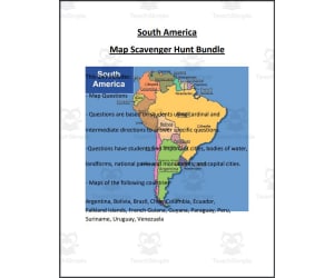
South America Map Scavenger Hunt Bundle
Social Studies, Geography, Not Grade Specific, Worksheets & Printables, Worksheets
The South America Map Scavenger Hunt Bundle is a versatile social studies resource that allows students to reinforce geography skills while learning about countries across South America. Students are challenged to locate major South American countries on detailed maps, then answer questions that encourage critical thinking. Countries featured include Argentina, Bolivia, Brazil, Chile, Columbia, Ecuador, Falkland Islands, French Guiana, Guyana, Paraguay, Peru, Suriname, Uruguay, and Venezuela. With over 50 pages of engaging map activities , this bundle enables educators to facilitate whole class instruction, small group work, or independent practice according to their students' needs and ability levels. The South America Map Scavenger Hunt Bundle is an interactive way to build middle school students' spatial awareness and knowledge of South American geography.
Author Mr. Matthews Teacher Store
Tags South America, Geography, Map Skills, Middle School
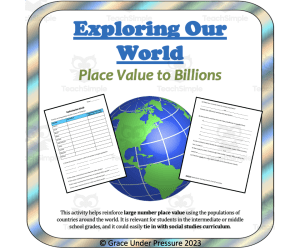
Large Number Place Value: Comparing Countries with Decimal Millions and Billions
Social Studies, Geography, Math, Addition and Subtraction, Subtraction, Decimals, Place Value, Grade 4, 5, 6, 7, 8, Worksheets & Printables, Word Problems, Worksheets
This activity helps reinforce large number place value using the populations of countries around the world. It is interesting and relevant for students in the intermediate or middle school grades, and it could easily tie in with social studies curriculum . If students have internet access, they can search for the population of each country independently. If not, you can find the populations and read them aloud for students to record. Then students need to work with the numbers: rounding, ordering, estimating, and calculating. This activity works well when completed in partners, small groups, or independently. Grades to Use With: This activity works well in the middle grades (from grades 4-8) or in a high school special education classroom. How to Use: Students need to find the populations of 10 countries: Turkey, Chile, Brazil, China, Canada, United States, Israel, Iceland, Ethiopia, and Mexico. They write each population in regular form and then round to decimal millions (for example 37.2 million). Next, they write the countries' populations in order from smallest to largest and answer some questions that compare the populations. They also write three of the populations in expanded form, and calculate the exact difference between two of the countries. Standards: CCSS4.NBT.A.2 Read and write multi-digit whole numbers using base-ten numerals, number names, and expanded form. Compare two multi-digit numbers based on meanings of the digits in each place, using >, =, and < symbols to record the results of comparisons. CCSS4.NBT.A.3 Use place value understanding to round multi-digit whole numbers to any place. CCSS5.NBT.A.1 Recognize that in a multi-digit number, a digit in one place represents 10 times as much as it represents in the place to its right and 1/10 of what it represents in the place to its left.
Author Grace Under Pressure
Tags Place Value, Rounding, Ordering, Expanded Form, Large Numbers, Population, World Geography, Applied Math, Math, Word Problems, Place Value Chart To Billions Pdf, Comparing A Million To A Billion, Place Value Millions, Place Values To Millions, Place Value Of Large Numbers, How Do You Compare Whole Numbers Through The Millions, Place Value Through Billion
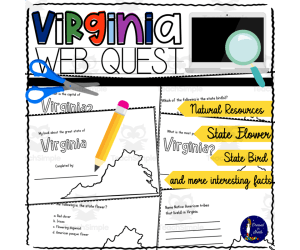
Virginia WebQuest Printable Book
Social Studies, Geography, Grade 4, 5, 6, 7, 8, Worksheets, Worksheets & Printables
Virginia WebQuest Printable Book The Virginia WebQuest Printable Book is a practical teaching material created to enhance students' understanding of their state. It serves as an engaging tool for field trips, local walks, car rides, or even in-class instruction. Grades: Geared primarily towards grades 4 through 8 Serves as a useful tool across Social Studies and Geography settings. Educational Activities: The workbook comes with built-in educational activities that engage students as they fill information about West Virginia such as: Most populated city State capital State bird Native flowers and tribes that live or have lived in the region. Natural resources, information on bordering states, and state nicknames are other areas ready to be discovered. Tailored Learning: This workbook offers each student the chance to create their unique book through these enquiries. The utility extends beyond creative data assembly; children also practice marking capitals and populous cities on maps - further enhancing geographical comprehension. Educator's Convenience: This resource is manageable in diverse environments: enabling full utilization during whole group instructions sessions yet equally effective for smaller groups explorations or even assigned homework tasks of moderate difficulty. Note:The printable nature of each page eases classroom organization – carrying two copies per printed sheet allows easy assembly by simply cutting along marked lines! We encourage students to assemble books at their own pace. A quick view into sample pages shows just how structured yet user-friendly this educational resource is. An answer key is included to aid guided learning when necessary. Virginia WebQuest Printable Book exceptionally serves growth-focused learners who are initiating their journey into independent research fields — propelling them towards future success! Potential for Future Updates: We ensure the Virginia WebQuest Printable Book adheres to current educational standards and adapts to evolving teaching dynamics, keeping students in harmony with their continually changing environment.We invite you to provide constructive feedback, shaping its progress while also earning credit for future purchases. Wishing you a happy researching!
Author Soumara Siddiqui
Tags Virginia, WebQuest, Printable Book, State Knowledge, Geography

Country Study Research Project - Zimbabwe - Social Studies - Africa
Social Studies, Geography, History, History: African, Grade 7, 8, 9, 10, 11, 12, Worksheets & Printables, Writing Prompts, Worksheets
Country Study Research Project - Zimbabwe - Social Studies Report - Southern Africa This Zimbabwe Country Study Research Project can be an ideal teaching activity for your Geography and Social Studies classes, designed specifically for Middle School and High School students (from 7th grade to 12th grade) . Suitable for Country Study Activities , this printable, 2 page PDF teaching resource ecourages Social Studies + Geography students and learners to explore important aspects and facts of Zimbabwe (Southern Africa). This Country Study Research Project on Zimbabwe can guide students through the process of building a comprehensive Country Study Report , while emproving their knowledge in areas such as geography, history, economy, language, and culture . Teachers and educators can find the following Geography + Social Studies activities and exercises in Zimbabwe Country Study Resource, Social Studies : 🌍 Interactive Map Activity A QR code linking directly to Zimbabwe' s location on Google Maps 🏔️ Geography Questions Explore Zimbabwe's terrain, climate, and notable physical features. 📜 History Questions Investigate key events and historical figures that have shaped Zimbabwe 's past till nowadays 🗣️ Language Exploration Learn about the official language spoken in Zimbabwe 💼 Economy Questions Analyze Zimbabwe 's economic system, major industries, and current challenges. 🏙️ Capital City Focus Write about 7 important sights in Zimbabwe ’s capital city, Harare 🏘️ Other Cities Identify and write 5 additional cities across Zimbabwe 🎭 Culture Prompt Writing Zimbabwe ’s unique cultural identity within the region (Southern Africa) This Social Studies, Geography Country Study on Zimbabwe (Southern Africa) PDF Digital Teaching Resource (2 PDF Printable Slides) is ideal for Middle School and High School students from 7th grade to 12th grade to test Zimbabwe and its Culture At Social Studies with Alan , we’re committed to providing fun, high-quality resources that help teachers inspire curiosity and global awareness in the classroom. Because learning should always be engaging and memorable . ➡️ Explore more Social Studies & Geography teaching tools by clicking here: Learning with Alan
Author Learning with Alan
Rating
Tags Country Study, Social Studies, Report, Research, Geography, History, Africa, Zimbabwe, Worksheets, Activity

US State Study Guide Worksheets on New Jersey
Social Studies, Economics, First Peoples (Native), Geography, History, Government, History: USA, Grade 7, 8, 9, 10, 11, 12, Worksheets & Printables, Worksheets
US State Study Guide Worksheets on New Jersey Bring the rich history, geography, and cultural identity of New Jersey to life with this US State Study Guide on New Jersey —a dynamic printable teaching resource tailored for Grades 7 through 12 . Perfect for Geography , Social Studies , and US History classes, this ready-to-use 2-page PDF worksheet pack engages students with interactive, standards-aligned activities that promote state-specific learning in a meaningful, creative way. What’s Included: ✅ 2 Printable PDF Worksheets – Easy-to-print and classroom-ready, designed with clear sections and visually engaging layouts. ✅ QR Code Integration – Instantly transport your students to New Jersey's geographic location on Google Maps to visually explore its position within the United States. ✅ Etymology Activity – Dive into the origin and meaning of the name “New Jersey” , connecting linguistic history with cultural understanding. ✅ General State Information Task – Guide students to summarize key facts about New Jersey , including nickname, motto and more. ✅ Geography-Focused Questions – Students will write down the names of the states bordering with New Jersey and they will write about its climate and territory ✅ History Timeline – Includes a blank timeline for learners to research and record major historical events , from early statehood to modern milestones. ✅ Economy Exploration – This activity lets students examine New Jersey’s economic sectors , such as agriculture, manufacturing, aerospace, and tech industries. ✅ Capital City Focus: writing the name of the capital city + 7 sights ✅ Top 5 Cities Activity – Learners will research and list five major cities in New Jersey This New Jersey US State study consists of 2 PDF printable worksheets, perfect for engaging students in grades 7th-12th as they explore the history and geography of this US State Learning with Alan is dedicated to supporting teachers, educators, and tutors in achieving their teaching goals while fostering an engaging learning environment. Learning is Fun. Never Forget! For more of my Teaching Resources, click here Learning with Alan
Author Learning with Alan
Rating
Tags USA, US History, US States, New Jersey, Worksheets, Printable, Activity, Geography, Social Studies, Study Guide
Napoleon: Tyrant or Hero? | History Review Packet
Social Studies, History, History: World, Grade 8, 9, 10, 11, 12, Worksheets & Printables, Worksheets
This resource is a Napoleon Review Packet that will work well for your students after your studies of Napoleon, the French Revolution, democracy and more. Students will read and answer comprehension questions across a 5-page worksheet. Answer key included.
Author DrDrew
Tags World History, History Review, French Revolution, Government, Napoleon, Napoleon Tyrant, Was Napoleon A Tyrant, How Was Napoleon A Tyrant, Napoleon Worksheet

Colorado State Symbols Interactive Foldable Booklets - EBOOK
Social Studies, Geography, Preschool, Grade 1, 2, 3, 4, 5, 6, 7, 8, Worksheets & Printables, Worksheets
Colorado State Symbols Interactive Foldable Booklets - EBOOK This interactive e-book provides an engaging strategy to teach students about the various state symbols of Colorado. This resource is especially useful for teachers and homeschoolers looking to enrich their geography or social studies curriculum. The eBook features: Two Unique Booklets: One showcasing vibrant colors and one with classic black-and-white images. Detailed Information: Each booklet outlines significant details like the state map, flag, flower, bird, etc. making it ideal across multiple grades from Kindergarten through Grade 8. Filling Space :The ebook includes blank pages for further exploration during advanced learning sessions or with higher grades ready for a challenge. Versatile Range of Uses: You can adapt these interactive foldable booklets as per your teaching style or classroom needs. Apply this booklet in whole-group lessons as a shared reader bringing everyone into Colorado' world together. Or deploy it with instructional small groups letting youngsters collaborate on filling out information on each page while researching resources provided within the eBook itself. Including clear cut-out and fold instructions in handy downloadable PDF format ensures ease-of-use anytime fitting perfectly not only in classrooms but at homes too importance learners understanding! But the learning doesn't stop here! The collection features more books under our State Symbols Interactive Foldables series commemorating all unique U.S states symbols - perfect to expand your class's knowledge and curiosity! Bonus Dimension ! You will find that each book's compact size (12 pages each) can even comprise an entire section in students' Interactive Notebooks or Lapbooks! Crafting Education! Our resource isn't just about imparting knowledge; it's also about sparking curiosity and making education interactive! Enrich students' learning experience today with the "Colorado State Symbols Interactive Foldable Booklet - EBOOK!
Author Knowledge Box Central
Tags Colorado, State Symbols, Interactive, Foldable Booklets

Nonfiction Reading Packet: Benjamin Franklin
Social Studies, History, History: USA, Grade 2, 3, Worksheets & Printables, Worksheets
This resource is a Nonfiction Reading Packet: Benjamin Franklin. This is a great no prep resource that all you have to do is print and go! Students will love learning history as they read an informative passage and apply vocabulary terms. Worksheets included such as multiple-choice questions and graphic organizers will allow them to show what they know. These work well for social studies or reading instruction. Answer keys included.
Author Sarah Miller Tech
Tags Benjamin Franklin, Reading Packet, Nonfiction Passages, Cross-curricular, Exit Ticket
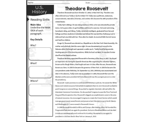
Theodore Roosevelt Reading Packet
Social Studies, Biographies, Grade 5, Worksheets & Printables, Worksheets
The Theodore Roosevelt Reading Packet is an informative resource for fifth grade students to learn about the extraordinary life of the 26th President of the United States. This engaging packet includes a passage detailing Theodore Roosevelt's early life and rise to the presidency. Students will apply key vocabulary terms and demonstrate comprehension through multiple choice questions and graphic organizers . Educators can utilize this versatile resource in various instructional settings such as whole group lessons, small group work, or as an independent assignment. Answer keys are provided for all student worksheets. This resource is an exciting way for upper elementary students to explore the biography of one of America's most popular presidents.
Author Sarah Miller Tech
Tags Theodore Roosevelt, Presidents, United States, Reading Passage, Exit Ticket, Theodore Roosevelt Reading

Pennsylvania State Symbols Interactive Foldable Booklets – EBOOK
Social Studies, Geography, Preschool, Grade 1, 2, 3, 4, 5, 6, 7, 8, Worksheets & Printables, Worksheets
Pennsylvania State Symbols Interactive Foldable Booklets – EBOOK Pennsylvania State Symbols Interactive Foldable Booklets – EBOOK is a 13-page, downloadable PDF ebook, specifically designed for the teaching needs of educators in both public schools and homeschooling. This interactive resource is best suited to students from Kindergarten to Grade 8, serving as an engaging and informative addition to any Social Studies curriculum. Through this booklet, students can explore the rich history of Pennsylvania's state symbols, all while participating in their own learning by creating something personal and meaningful. The ebook includes: A detailed representation of the state map An illustrated depiction of the flag A colorful image of the state flower amongst others Mammal/insect/fish symbols related to Pennsylvania's state history. A blank page turns learners into creators when filling with additional personal reflections or other symbolic elements associated with Pennsylvania. A list of reliable resources for additional learning about State History. The interactive booklet opens up multiple avenues for usage. It can be used as part of a whole group lesson or implemented within smaller focus groups. For individual learners or homework assignments too which offers versatility in reinforcing knowledge about Pennyslvania facts. Lapbook Projects & Interactive Notebooks: Use this product within an Interactive Notebook format. Also it can slot into any Lapbook project about US states’ histories making it more vibrant and aggregate visual aide regarding learner level comprehensions over time. Owning The Entire Set: Collecting our booklets from every one A will yield a tactile educational resource that could broaden student geographical understanding across U.S.A. It helps to lend depth to learners' educational experience. Instructions: Straight-forward, step-by-step instructions are included, guiding students (and teachers) through the process of cutting , folding , and gluing the elements of their booklet together. After completion they end up with a tangible learning resource that offers innovative application for reinforcing learning and inciting curiosity about diverse USA heritage. Reiterating Overall Value: Not only is this EBOOK incredibly educational it can also transform geographical learning into a tactile adventure that both stimulates interest and aids retention.
Author Knowledge Box Central
Tags Pennsylvania State Symbols, Interactive Booklet, Geography Learning, Homeschooling Resource, US States

Research Organizer & Essay Assignment: Cesar Chavez
Social Studies, Biographies, Science, Earth and Environmental Sciences, Life Sciences, Nature & Plants, Grade 8, 9, 10, 11, Activities, Projects, Worksheets & Printables, Worksheets
Research Organizer & Essay Assignment: Cesar Chavez Use this 6-page resource to teach middle and high school students about Cesar Chavez's impact on civil rights and labor movements in the U.S. through independent research. Students will gather facts about Chavez's life using a structured 2-page handout, then outline and write a 5-paragraph essay on his historical significance. The resource provides step-by-step scaffolding including an essay prompt, requirements checklist, research and outlining worksheets, peer review checklist, and rubric aligned to Common Core standards. Whether assigned in full or partially, it can drive a complete research lesson or support other instruction on Chavez. Editable files make tailoring grade 8-11 ELA, social studies, or science activities easy. Guidance ensures students practice informative writing while teacher prep and assessment efficiency is maximized.
Author The Language of Educational Art, LLC
Tags Essay, Rubric, Notetaking, Research, Hispanic Heritage Month, Cesar Chavez

Luxembourg Map Resources
Social Studies, Geography, Not Grade Specific, Worksheets & Printables, Worksheets
Luxembourg Map Resources The Luxembourg Map Resources is a comprehensive teaching tool that contains 12 separate map sheets in various formats such as pdf, jpeg, and png, suitable for any device usage. Versatility: Adaptable to diverse teaching methods, whether printed out or projected digitally. Detailed Representation: Features blank outlines for labelling activities; bodies of water for the study of natural resources or geographical positioning; and major settlements for discussions on population or urban development. Each map presents Luxembourg both independently and within context to its neighboring nations. User Flexibility: Users can include these maps in their own materials. Note: A standout feature is its flexibility. This product is primarily aimed towards Social Studies with focus on Geography. However, it's wide-ranging aspects make it apt not only in enhancing geographical literacy but also interdisciplinary studies involving economic, historical cultural interpretations among other realms. It’s a universal resource applicable across all grade levels given its holistic content design combined with user-friendly file types (Zip). This signifies gaining access over excellent teaching aids without undergoing complex processes -Truly an essential tool made simple yet effective!
Author Mr Gray History
Tags Luxembourg Map, Geography Teaching Resource, Interdisciplinary Studies, Labeling Activities, World Maps Bundle