3,942 products added recently
Geography Lesson Games
Integrate math and geography with lesson games that challenge students to apply numerical skills in geographical contexts. These activities promote critical thinking and make learning multidisciplinary. Use them to add excitement and variety to your lessons.
Chess Reading Comprehension Passage - Cored Ed Encyclopedia
ELA, Language Development, Reading Comprehension, Reading, Pre-Reading, Science, Social Studies, Geography, History, Technology, Grade 2, 3, 4, 5, Worksheets & Printables, Worksheets, Teacher Tools, Centers, Activities, Writing Prompts, Assessments, Quizzes and Tests, Quizzes, Lesson Plans
This chess reading comprehension with lesson plan includes: Visualization (on the front cover) Start your lesson by taking a minute to think and share something about the topic. Read the script aloud (slowly), perhaps prepare some music or sound effects. Student close their eyes and let their imaginations wander. Students open their eyes, read the question aloud and give them a few minutes to complete. Ask a few students to share or keep answers until the end to compare with what they learn in the passage. COMPANION VIDEO NOW AVAILABLE (EMBEDDED AFTER PREVIEW PICTURES IN PRODUCT DESCRIPTION) Quick pause—thousands of Cored Education products are included with your TeachSimple membership. Download links and encyclopedia index available here. Pre-Reading Trivia Students will write down one thing they already know about the subject and then read five more facts and discuss. These facts are fun, and the students will enjoy learning about the subject before reading more. Give 1 minute for students to write what they already know (no pressure—best guess is fine). Read the five facts together. After each fact, do ask a student for their opinion, was it surprising? Set a purpose by asking students to highlight/underline one fact they want to learn more about during the reading. Reading Passage The text is a high-interest reading passage with set paragraphs, roughly three to four paragraphs long. It contains a variety of themes about the topic, anywhere from history to technology. The passage is between 250 and 350 words in length. First, ask students to look at the headings and see what they’ll learn about today. What do they know about the topic/heading? First read options: Teacher read-aloud (best for support). Partner reading (paragraph by paragraph). While reading, students underline important details, and vocabulary words they think may come up in the questions section. Mixed Questions The first question page contains four multiple-choice questions, each with a choice of four answers, and three written response questions that require a sentence or two from the student. Students complete the mcqs first independently, then review quickly as a class. For the 3 written responses, try to get students giving the answer with some form of evidence: “I think ___ because the text says ___.” If students get stuck, send them back to check the passage. Vocabulary Questions Practice seven key words from the text in this section across two activities. First section is scrambled words where students will unscramble three words given a clue for each. The second section is a word to meaning matching activity. Before starting, have some students read out words they underlined in the passage. Ask students to say the word and read aloud the sentence(s) around each word. Ask students to do scrambled words and the matching exercise in pairs then go through answers as a class. For the scrambled spelling task, get four pairs to come up to the board and write the words for extra practice with the other student reading out the clue. For the matching task, prompt students to give full sentences: “I matched ___ with ___ because ___.” Creative Writing In this question, the student will be required to write a five to eight sentence paragraph on a question related to the topic. Before starting, ask students write down 3 key ideas they are going to include in their piece. Ask students for ideas to share around the class to help those struggling. Pro writing expectations: 5–8 sentences At least 2 facts or details from the passage At least 2 vocabulary words from the previous page Students read their paragraphs while classmates listen for facts and vocabulary words. Extension Activities This page is optional for fast finishers or to take home. There are several activities, each one requiring a different skill. Do some, do none, do all, completely optional - but you will feel reassured knowing every possibility is planned for. Includes summary writting question and additional facts. Answer Key There are answers for the multiple-choice questions, written response questions have sample answers, vocabulary answers and if there is a summary question then a sample summary will be provided as well. Lesson Plan Included Customized lesson plan for this lesson is included. Lesson Snapshot Title: Chess Genre: Nonfiction (informational passage with headings) Subject: Reading (Informational Text) / Social Studies (history & culture) Primary Topic: How chess works and how it changed over time Estimated Guided Reading Level (A–Z): Q What This Lesson Teaches Best Introduces key basics of the game (64 squares, 16 pieces, and the goal of checkmate). Traces chess’s spread across places and cultures (India → Persia → Muslim world → Europe). Explains how rules changed over time (the queen and bishop gaining powerful moves in the late 1400s). Uses a chronological, heading-based structure to show history in clear sections (early origins, Europe, tournaments, computers). Connects chess to modern competition and technology (international tournaments, FIDE, computers like Deep Blue). Learning Goals Students will describe the chessboard and starting pieces using details from the passage. Students will explain what “checkmate” means in the passage. Students will identify where the passage says chess traveled and what it was called in different places. Students will describe the late-1400s rule change mentioned and how it affected games. Students will summarize how chess moved into public life and became an international sport. Students will explain one way computers affected chess, based on the passage. Key Vocabulary From the Text checkmate — the king is trapped with no safe move. ancestor — something that came earlier than something else. chaturanga — an early India game linked to chess. tournament — a contest with many games. calculating — working things out by thinking ahead. FULL CATALOG OF DOWNLOAD LINKS AND ENCYCLOPEDIA INDEX HERE
Author Cored Education
Rating
Tags Vocabulary, Reading Comprehension, Reading Passages, Lesson Plans, Ela Lesson Plans, Reading Comprehension Lesson Plans, Pre-reading, Geography, Social Studies Lesson Plans, History
Chalk Reading Comprehension Passage - Cored Ed Encyclopedia
ELA, Language Development, Reading Comprehension, Reading, Pre-Reading, Life Sciences, Science, Social Studies, Earth and Environmental Sciences, Geography, Grade 2, 3, 4, 5, Worksheets & Printables, Worksheets, Teacher Tools, Centers, Activities, Writing Prompts, Assessments, Quizzes and Tests, Quizzes, Lesson Plans
This chalk reading comprehension with lesson plan includes: Visualization (on the front cover) Start your lesson by taking a minute to think and share something about the topic. Read the script aloud (slowly), perhaps prepare some music or sound effects. Student close their eyes and let their imaginations wander. Students open their eyes, read the question aloud and give them a few minutes to complete. Ask a few students to share or keep answers until the end to compare with what they learn in the passage. Quick pause—thousands of Cored Education products are included with your TeachSimple membership. Download links and encyclopedia index available here. Pre-Reading Trivia Students will write down one thing they already know about the subject and then read five more facts and discuss. These facts are fun, and the students will enjoy learning about the subject before reading more. Give 1 minute for students to write what they already know (no pressure—best guess is fine). Read the five facts together. After each fact, do ask a student for their opinion, was it surprising? Set a purpose by asking students to highlight/underline one fact they want to learn more about during the reading. Reading Passage The text is a high-interest reading passage with set paragraphs, roughly three to four paragraphs long. It contains a variety of themes about the topic, anywhere from history to technology. The passage is between 250 and 350 words in length. First, ask students to look at the headings and see what they’ll learn about today. What do they know about the topic/heading? First read options: Teacher read-aloud (best for support). Partner reading (paragraph by paragraph). While reading, students underline important details, and vocabulary words they think may come up in the questions section. Mixed Questions The first question page contains four multiple-choice questions, each with a choice of four answers, and three written response questions that require a sentence or two from the student. Students complete the mcqs first independently, then review quickly as a class. For the 3 written responses, try to get students giving the answer with some form of evidence: “I think ___ because the text says ___.” If students get stuck, send them back to check the passage. Vocabulary Questions Practice seven key words from the text in this section across two activities. First section is scrambled words where students will unscramble three words given a clue for each. The second section is a word to meaning matching activity. Before starting, have some students read out words they underlined in the passage. Ask students to say the word and read aloud the sentence(s) around each word. Ask students to do scrambled words and the matching exercise in pairs then go through answers as a class. For the scrambled spelling task, get four pairs to come up to the board and write the words for extra practice with the other student reading out the clue. For the matching task, prompt students to give full sentences: “I matched ___ with ___ because ___.” Creative Writing In this question, the student will be required to write a five to eight sentence paragraph on a question related to the topic. Before starting, ask students write down 3 key ideas they are going to include in their piece. Ask students for ideas to share around the class to help those struggling. Pro writing expectations: 5–8 sentences At least 2 facts or details from the passage At least 2 vocabulary words from the previous page Students read their paragraphs while classmates listen for facts and vocabulary words. Extension Activities This page is optional for fast finishers or to take home. There are several activities, each one requiring a different skill. Do some, do none, do all, completely optional - but you will feel reassured knowing every possibility is planned for. Includes summary writting question and additional facts. Answer Key There are answers for the multiple-choice questions, written response questions have sample answers, vocabulary answers and if there is a summary question then a sample summary will be provided as well. Lesson Plan Included Customized lesson plan for this lesson is included. Lesson Snapshot Title: Chalk Genre: Nonfiction (informational text with headings) Subject: Life Science / Earth Science / Reading (Informational Text) Primary Topic: How chalk forms and how people use it Estimated Guided Reading Level (A–Z): O What This Lesson Teaches Best Explains chalk’s origin: microscopic ocean life made calcium carbonate shells that piled up, hardened, and became chalk. Uses cause-and-effect to show how pressure, time, and weather change materials (shells → rock; waves/wind reveal cliffs). Connects a natural material to human uses (building materials, improving sour soil, writing and drawing). Builds understanding of properties of materials (chalk is soft, rubs into powder, leaves visible marks on dark boards). Highlights how tools and surfaces change over time (dark boards, colored chalk experiments, sidewalk chalk, whiteboards). Learning Goals Students will explain how chalk forms over a long time using details from the text. Students will identify what chalk is made from in the beginning of its story (shells of microscopic living things). Students will describe at least two practical uses of chalk named in the text. Students will explain why chalk worked well on dark boards, using evidence from the passage. Students will compare chalk rock and gypsum “chalk” as described in the passage. Key Vocabulary From the Text microscopic — too tiny to see without help. carbonate — part of a mineral in many shells. crumbly — easy to break into small pieces. gypsum — a mineral used to make some board “chalk.” pavement — the hard surface of a sidewalk or road. FULL CATALOG OF DOWNLOAD LINKS AND ENCYCLOPEDIA INDEX HERE
Author Cored Education
Rating
Tags Vocabulary, Reading Comprehension, Reading Passages, Lesson Plans, Ela Lesson Plans, Reading Comprehension Lesson Plans, Pre-reading, Science Lesson Plans, Earth Science, Geography

Qatar Reading Comprehension Passage - Cored Ed Encyclopedia
ELA, Language Development, Resources for Teachers, Reading Comprehension, Reading, Pre-Reading, Writing, Geography, Social Studies, History, Grade 2, 3, 4, 5, Worksheets & Printables, Worksheets, Teacher Tools, Centers, Activities, Writing Prompts, Assessments, Quizzes and Tests, Quizzes, Lesson Plans
This Qatar reading comprehension includes: Visualization (on the front cover) Start your lesson by taking a minute to think and share something about the topic. Read the script aloud (slowly), perhaps prepare some music or sound effects. Student close their eyes and let their imaginations wander. Students open their eyes, read the question aloud and give them a few minutes to complete. Ask a few students to share or keep answers until the end to compare with what they learn in the passage. Quick pause—thousands of Cored Education products are included with your TeachSimple membership. Download links and encyclopedia index available here. Pre-Reading Trivia Students will write down one thing they already know about the subject and then read five more facts and discuss. These facts are fun, and the students will enjoy learning about the subject before reading more. Give 1 minute for students to write what they already know (no pressure—best guess is fine). Read the five facts together. After each fact, do ask a student for their opinion, was it surprising? Set a purpose by asking students to highlight/underline one fact they want to learn more about during the reading. Reading Passage The text is a high-interest reading passage with set paragraphs, roughly three to four paragraphs long. It contains a variety of themes about the topic, anywhere from history to technology. The passage is between 250 and 350 words in length. First, ask students to look at the headings and see what they’ll learn about today. What do they know about the topic/heading? First read options: Teacher read-aloud (best for support). Partner reading (paragraph by paragraph). While reading, students underline important details, and vocabulary words they think may come up in the questions section. Mixed Questions The first question page contains four multiple-choice questions, each with a choice of four answers, and three written response questions that require a sentence or two from the student. Students complete the mcqs first independently, then review quickly as a class. For the 3 written responses, try to get students giving the answer with some form of evidence: “I think ___ because the text says ___.” If students get stuck, send them back to check the passage. Vocabulary Questions Practice seven key words from the text in this section across two activities. First section is scrambled words where students will unscramble three words given a clue for each. The second section is a word to meaning matching activity. Before starting, have some students read out words they underlined in the passage. Ask students to say the word and read aloud the sentence(s) around each word. Ask students to do scrambled words and the matching exercise in pairs then go through answers as a class. For the scrambled spelling task, get four pairs to come up to the board and write the words for extra practice with the other student reading out the clue. For the matching task, prompt students to give full sentences: “I matched ___ with ___ because ___.” Creative Writing In this question, the student will be required to write a five to eight sentence paragraph on a question related to the topic. Before starting, ask students write down 3 key ideas they are going to include in their piece. Ask students for ideas to share around the class to help those struggling. Pro writing expectations: 5–8 sentences At least 2 facts or details from the passage At least 2 vocabulary words from the previous page Students read their paragraphs while classmates listen for facts and vocabulary words. Extension Activities This page is optional for fast finishers or to take home. There are several activities, each one requiring a different skill. Do some, do none, do all, completely optional - but you will feel reassured knowing every possibility is planned for. Includes summary writting question. Answer Key There are answers for the multiple-choice questions, written response questions have sample answers, vocabulary answers and if there is a summary question then a sample summary will be provided as well. Lesson Plan Included Customized lesson plan for this lesson is included. Lesson Snapshot Title: Qatar Genre: Nonfiction (informational reading passage) Subject: Social Studies (Geography/History/Economics) Primary Topic: Qatar’s geography and change over time Estimated Guided Reading Level (A–Z): R What This Lesson Teaches Best How location and landforms shape a place (peninsula in the Persian Gulf; sea on three sides; sand dunes; an inlet called the Inland Sea). How a country’s economy can change over time (from pearling to oil and natural gas). Cause-and-effect in history (cultured pearls spread → pearling trade collapsed; oil/gas money → schools, hospitals, ports, neighborhoods). Connecting past and present in one place (pearl boats and tall towers sharing the same shoreline; Doha’s modern landmarks). Built-in comprehension practice (pre-reading trivia, mixed questions, vocabulary work, writing and extension activities align to passage details). Learning Goals I can describe Qatar’s location and what surrounds it using details from the passage. I can explain how pearl diving worked and why the pearling trade collapsed. I can identify how oil and natural gas changed Qatar and name what was built with that money. I can sequence key changes over time mentioned in the passage (pearling, oil discovery/exporting, independence, World Cup). I can use passage vocabulary (like peninsula, inlet, emirate) when talking about Qatar. Key Vocabulary From the Text peninsula — land with water on most sides inlet — water cutting into land from the sea seafloor — the bottom of the sea cultured — made or grown with human help emirate — a place led by an emir FULL CATALOG OF DOWNLOAD LINKS AND ENCYCLOPEDIA INDEX HERE
Author Cored Education
Rating
Tags Vocabulary, Reading Comprehension, Reading Passages, Reading, Creative Writing, Reading Strategies, Writing Prompts, Lesson Plans, Geography, Qatar

All About Himalayas | Geographical Wonders Video Lesson
Social Studies, Geography, Grade 3, 4, 5, 6, 7, Lesson Plans, Teacher Tools
All About Himalayas | Geographical Wonders Video Lesson All About Himalayas | Geographical Wonders Video Lesson brings the scenic landscapes of the Himalayas into classrooms and homeschool environments, offering a thorough comprehension of this unique geographical wonder. This teaching resource uncovers the captivating gems of the Himalayas, transporting learners on an immersive journey through its fascinating landforms. What it presents? The video lesson is an influential tool for teachers to unite their students in an interactive medium for dissecting geography. It is particularly tailored to students spanning grades 3 to 7. Whether within social studies or as part of more significant geography study units, this resource can be easily incorporated. How to use it? This multimedia resource comes as a single MP4 file delivered directly to educators for easy implementation. A twelve-minute-long video optimally catered to maintaining student concentration and fostering their curiosity about worldly vistas without sacrificing essential learning time. Purposes: Classroom Applications: Whole group exploration An integral component within smaller group work where discussions and observations stem from student-led conversations. Apart from Classroom Applications: Educators may assign The All About Himalaya video lesson as homework—engaging parental involvement while allowing student recapitulation outside school hours. Suitable for remedial purposes—revisiting informative content during review sessions before evaluations or guaranteeing struggling learners have sturdy resources framing their additional studies around. The fusion of technology with education ignites student interest without damaging academic rigor. The potential knowledge gains are just waiting—like Mount Everest—to be ascended by the students under your stewardship. So come, embark on an educational expedition through Earth's highest mountain range with the All About Himalayas | Geographical Wonders Video Lesson!
Author Educational Voice
Tags Himalayas, Geography, Landforms, Video Lesson, Interactive Medium
All About The Colosseum | Geographical Wonders Video Lesson
Social Studies, Geography, Not Grade Specific, Lesson Plans, Teacher Tools
All About The Colosseum | Geographical Wonders Video Lesson This valuable tool is perfect for educators teaching Social Studies, specifically focusing on Geography. Not grade-specific, this animated video lesson offers in-depth knowledge about one of the world's greatest geographical wonders—The Colosseum. This informative video of just 9 minutes proves education can be concise and engaging. Ideal for public school teachers managing multiple subjects or homeschoolers crafting detailed units, it requires no extensive planning or preparation. Engaging animation and detailed insights about The Colosseum Perfect as an introduction or a review material after detailed discussions Adaptable to different ability levels and age groups The resource targets various aspects of teaching routines: In whole group instruction: Include during collective viewings to promote shared insights; sparking curiosity among learners. In personalized attention periods: Leverage during small group interactions or one-on-one sessions to enhance variety while addressing individual needs. As homework assignments: In conclusion,
Author Educational Voice
Tags Colosseum, Geography Lesson, Historical Landmark, Video Resource, Interactive Learning

Yoga Reading Comprehension Passage - Cored Ed Encyclopedia
ELA, Language Development, Reading Comprehension, Reading, History, Social Studies, Pre-Reading, P.E. & Health, Yoga, Geography, Grade 2, 3, 4, 5, Worksheets & Printables, Worksheets, Teacher Tools, Centers, Activities, Writing Prompts, Assessments, Quizzes and Tests, Quizzes, Lesson Plans
This yoga reading comprehension with lesson plan includes: Visualization (on the front cover) Start your lesson by taking a minute to think and share something about the topic. Read the script aloud (slowly), perhaps prepare some music or sound effects. Student close their eyes and let their imaginations wander. Students open their eyes, read the question aloud and give them a few minutes to complete. Ask a few students to share or keep answers until the end to compare with what they learn in the passage. Quick pause—thousands of Cored Education products are included with your TeachSimple membership. Download links and encyclopedia index available here. Pre-Reading Trivia Students will write down one thing they already know about the subject and then read five more facts and discuss. These facts are fun, and the students will enjoy learning about the subject before reading more. Give 1 minute for students to write what they already know (no pressure—best guess is fine). Read the five facts together. After each fact, do ask a student for their opinion, was it surprising? Set a purpose by asking students to highlight/underline one fact they want to learn more about during the reading. Reading Passage The text is a high-interest reading passage with set paragraphs, roughly three to four paragraphs long. It contains a variety of themes about the topic, anywhere from history to technology. The passage is between 250 and 350 words in length. First, ask students to look at the headings and see what they’ll learn about today. What do they know about the topic/heading? First read options: Teacher read-aloud (best for support). Partner reading (paragraph by paragraph). While reading, students underline important details, and vocabulary words they think may come up in the questions section. Mixed Questions The first question page contains four multiple-choice questions, each with a choice of four answers, and three written response questions that require a sentence or two from the student. Students complete the mcqs first independently, then review quickly as a class. For the 3 written responses, try to get students giving the answer with some form of evidence: “I think ___ because the text says ___.” If students get stuck, send them back to check the passage. Vocabulary Questions Practice seven key words from the text in this section across two activities. First section is scrambled words where students will unscramble three words given a clue for each. The second section is a word to meaning matching activity. Before starting, have some students read out words they underlined in the passage. Ask students to say the word and read aloud the sentence(s) around each word. Ask students to do scrambled words and the matching exercise in pairs then go through answers as a class. For the scrambled spelling task, get four pairs to come up to the board and write the words for extra practice with the other student reading out the clue. For the matching task, prompt students to give full sentences: “I matched ___ with ___ because ___.” Creative Writing In this question, the student will be required to write a five to eight sentence paragraph on a question related to the topic. Before starting, ask students write down 3 key ideas they are going to include in their piece. Ask students for ideas to share around the class to help those struggling. Pro writing expectations: 5–8 sentences At least 2 facts or details from the passage At least 2 vocabulary words from the previous page Students read their paragraphs while classmates listen for facts and vocabulary words. Extension Activities This page is optional for fast finishers or to take home. There are several activities, each one requiring a different skill. Do some, do none, do all, completely optional - but you will feel reassured knowing every possibility is planned for. Includes summary writting question. Answer Key There are answers for the multiple-choice questions, written response questions have sample answers, vocabulary answers and if there is a summary question then a sample summary will be provided as well. Lesson Plan Included Customized lesson plan for this lesson is included. Lesson Snapshot Title: Yoga Genre: Nonfiction (informational text) Subject: Social Studies & Health/SEL (culture and well-being) / Informational Reading Primary Topic: Yoga’s origins, key ideas, and modern practice Estimated Guided Reading Level (A–Z): Q Support pages present: pre-reading trivia, mixed questions, vocabulary activities, creative writing, extension activities, and an answer key. What This Lesson Teaches Best Explains yoga as an old practice that began in India and grew over time. Defines what the word “yoga” can mean in the passage (“yoke” or “union,” like two things working as one). Describes key tools in yoga: body positions, steady breathing, and quiet attention (and how breathing can steady the mind). Introduces “sutras” and explains that Patanjali gathered yoga ideas into short lines meant to be remembered, including a description of yoga as a path with eight “limbs.” Traces how yoga changed in the 1900s, noting that teachers such as Tirumalai Krishnamacharya helped create modern postural yoga with flowing sequences taught in classes. Learning Goals Students will describe what the passage says the word “yoga” can mean. Students will identify tools the passage says yoga uses (body positions, steady breathing, quiet attention). Students will explain why careful breathing matters in some yoga traditions, using details from the text. Students will describe what sutras are and why they were written, according to the passage. Students will summarize how yoga changed in the 1900s based on the passage’s timeline. Key Vocabulary From the Text Sanskrit — a very old language from India. traditions — ways people practice and pass ideas over time. sutras — short lines of teaching meant to be remembered. meditation — a quiet practice to help the mind rest. asana — a steady seat for meditation, not a gym pose. FULL CATALOG OF DOWNLOAD LINKS AND ENCYCLOPEDIA INDEX HERE
Author Cored Education
Rating
Tags Vocabulary, Reading Comprehension, Reading Passages, Lesson Plans, Ela Lesson Plans, Reading Comprehension Lesson Plans, Pre-reading, Social Studies Lesson Plans, Yoga, History

All About Danxia Landform | Animated Geography Video Lesson
Social Studies, Geography, Grade 5, 6, 7, 8, Lesson Plans, Teacher Tools
This animated geography video lesson is all about the Danxia Landform. Students will love this engaging and interactive video as they learn more about geographical landforms. This video serves as a great introduction or review video for your learners. This is an 11-minute geography video lesson.
Author Educational Voice
Tags Social Studies Video, Geography Video, Geography Lesson, Landforms, Danxia

Elephants: Guided Reading Level Q with Lesson Plan
ELA, Resources for Teachers, Reading Comprehension, Reading, Science, Language Development, Life Sciences, Earth and Environmental Sciences, Geography, Social Studies, Grade 3, 4, 5, Worksheets & Printables, Worksheets, Teacher Tools, Centers, Activities, Literacy Readers, Quizzes, Quizzes and Tests, Assessments, Lesson Plans
This Elephants (level q) guided reading book with lesson plan includes: Guided Reading Color Label (front cover x1) This is a quick way to match the book’s demands to what students can generally handle.. The overall goal is to use the level/color to pick books for several smaller groups. To qualify for a certain level, a student is expected to read a book from that level with about 90–94% accuracy. If a student is consistently accurate and understands, move up a level. If the student is struggling at that level, drop down and add more support. Each student will improve at completely different rates, but it is generally one of the best ways to check progress across the class. DOWNLOAD THE CATALOG TO VIEW ALL GUIDED READING BOOKS AVAILABLE (SORTED LEVELS A-Z) Pre-Reading Question (x1) Teacher asks the prompt aloud, can be while showing the cover or first page. Students share what they already know, or make educated guesses from the cover. Prompt them to use the target vocabulary. Write some of their responses on the board to look back at during the reading. Vocabulary Words (x5) Introduce the five words, best doing it one at a time. Start by saying it, while students repeat and then see if anyone knows what it means before reading further. Read through the meaning and try to briefly connect each word to a picture or gesture so it’s meaningful. Ask students to flip through the book pages and point to where they see each of the vocabulary words. While reading the book pause upon coming across one of the vocab words or read the sentence twice to make sure students understand the word has appeared. Optional: Ask students to raise hands whenever they see/hear one of the new words. Guided Reading Pages (x10) Check the book snapshot (below) for: primary topic - do you need to prep extra reading or intro materials on this? what is taught best - decide on 1-2 bullets to focus on, use the prompt or words provided here for best results. learning goals - what you are checking for students to be able to do after the session, elicit answers using prompts or words provided. key vocabulary (see section above). questions overview - so you know what is coming up and if you need to prep extra materials to assist understanding. Run the lesson You may have already looked at a few of the pages together, but you can show them some of the pictures again first to set meaning. Depending on how much time you have and how familiar your students are with guided reading class, you may want to read the book aloud first with the group first. Students whisper or partner read, while you listen in. If time, do it as a group, one student reading a page each. Use the guided page’s prompts to coach: “Check the picture / does it make sense?” “Point under the words / try the first sound” “Reread the sentence smoothly”. Try to focus more on one student per session (rotating every time), so you can work out if they are ready to move up or need to move down a level. Comprehension Questions (back cover x3) This is your way to check that students didn’t just say the words, but actually understood the text. First, let students answer by pointing to the page/picture and saying a short sentence. After any answer, follow with: “Show me where you found that in the text.” In bigger groups, have partners answer first (10–20 seconds), then call on 2–3 students to share. Differentiation tips: Emerging speakers/struggling readers: oral + pointing On-level: oral in a full sentence Higher: one written sentence or draw + label Book Snapshot Title: Elephants Genre: Nonfiction (informational) Subject: Life Science Primary Topic: Elephant species, adaptations, behavior, and threats Estimated Guided Reading Level (A–Z): Q What This Book Teaches Best Explains that scientists recognize three distinct species of elephants and describes physical differences (like ear shape and head shape) that fit their environments. Describes key body structures and functions (trunk muscles and “fingers,” tusks as elongated incisor teeth, sensitive skin). Shows behavioral adaptations for survival , including how elephants protect themselves from heat and insects by using water or mud. Highlights social organization and communication , including matriarchal herds and vocalizations such as trumpets, rumbles, and infrasound. Connects elephants to their ecosystems and conservation by explaining seed dispersal (African Forest elephants) and current threats like habitat loss and poaching for ivory. Learning Goals Describe the three elephant species named in the text and one physical difference mentioned between African and Asian elephants. Explain how elephants use their skin and what they do to protect themselves from heat and insects. Identify how the text describes an elephant’s trunk and list at least three things elephants use it to do. Explain what tusks are and give examples from the text of how tusks help elephants survive. Describe how elephants live in groups and how a matriarch helps keep a herd safe. Explain how African Forest elephants help plant new trees in the forest, according to the text. Key Vocabulary From the Text distinct — clearly different from something else. characteristic — an important feature that helps describe something. matriarchal — led by a female (mother) in the group. vocalizations — animal sounds used to communicate. endangered — in danger of disappearing because there are not many left. Discussion Prompts Pre-reading question: What do you already know about how elephants live and survive in their habitats? Comprehension questions: What are the three species of elephants that scientists recognize in the text? Comprehension questions: What does the text say elephants do to protect themselves from heat and insects? Comprehension questions: How do African Forest elephants help plant the next generation of trees in the forest? Printing Tips 1. Best Printing Method (Recommended) “Booklet” Printing (Best if Available) If your printer or PDF viewer supports Booklet Printing , use this. Settings to use: Print mode: Booklet Paper size: Letter or A4 (either works) Orientation: Landscape Print on both sides: Yes Flip on: Short edge Scaling: Fit to printable area Booklet subset: First test: Front sides only Then: Back sides only This will automatically: Pair pages correctly Put the cover on the outside Align everything for folding After printing, fold in half and staple along the spine . 2. If “Booklet” Printing Is NOT Available You can still print this correctly with manual duplex printing . Step-by-step: Open the PDF. Choose Print . Set: Orientation: Landscape Pages per sheet: 1 Print on both sides: Yes Flip on: Short edge Print all pages . Because each PDF page already contains two facing book pages, the result will still fold cleanly into a book. Thousands of Cored Education products are included with your TeachSimple membership. Download links and encyclopedia index available here.
Author Cored Education
Rating
Tags Reading Comprehension, Reading Passages, Reading, Guided Reading, Guided Reading Lesson Plan, Guided Reading Activity, Pre-reading, Science Lesson Plans, Life Science, Geography

Plants of Antarctica | Antartica Unit Study | Geography Bundle
Social Studies, Geography, Grade 3, 4, 5, 6, 7, Lesson Plans, Teacher Tools
Explore the wonders of Antarctica with our educational product featuring 10 meticulously curated plant cards designed for an enriching learning experience. These cards serve as valuable resources for continent study boxes, centers , or comprehensive unit studies on Antarctica. Each card is a gateway to discovery, presenting a double-sided design for maximum engagement. The front showcases a realistic photograph accompanied by fundamental information, offering a visual and informative introduction to Antarctic plant life. Flip the card, and you'll find a mini-article on the back, delving into intriguing and unique details about each plant, fostering a deeper understanding of the Antarctic ecosystem. To enhance the educational journey, we provide a plant match worksheet and a plant report template at the end of the packet. These resources empower students to consolidate their knowledge through reports, summaries, or even oral presentations. The flexibility of this product extends to geography centers , where students can immerse themselves in the diverse flora of Antarctica or kickstart plant reports. Included in this comprehensive package are dual sets of cards, catering to both the metric and imperial measurement systems. Additionally, an article titled "Can Plants Even Grow in Antarctica?" sparks curiosity, accompanied by thought-provoking questions that encourage critical thinking. As a bonus, mini labeled photos of the plants are provided for placement around a classroom map of Antarctica, fostering a visually immersive learning environment. Whether you choose to print, laminate, bind, or use a book ring, this product is designed for reuse, ensuring a lasting impact on your educational endeavors. Unearth the hidden botanical treasures of Antarctica with this educational resource, ideal for sparking curiosity and facilitating in-depth exploration. What You Get: - 10 double sided plant information cards using the metric measurement system - 10 double sided plant information cards using the imperial measurement system - "Can Plants Even Grow in Antarctica?" article and questions - Mini labeled photos of plants to put around map of Antarctica - Plant match worksheet - Plant report template Want More Antarctica Study Resources?: - Continent of Antarctica: Brochure and Activities - Plants of Antarctica: Informational Cards - Animals of Antarctica: Informational Cards - Map work for Antarctica - Postcards for Antarctica: Landmarks and Landforms - Antarctica Unit Test *I have resources like this for every continent. So make sure to check them out if your'e trying to put together a comprehensive geography study! Check out other resources from my store: Simply Schoolgirl! I can be contacted for questions and concerns at simplyschoolgirl1@gmail.com
Author Simply Schoolgirl
Tags Antartica, Social Studies Lesson, Matching Worksheet, Report Template, Moss, Lichen, Plant, Fungi

Aztecs Reading Comprehension Passage - Cored Ed Encyclopedia
ELA, Language Development, Reading Comprehension, Reading, Social Studies, Writing, Vocabulary, Geography, History, History: Ancient, Grade 2, 3, 4, 5, Worksheets & Printables, Worksheets, Teacher Tools, Centers, Activities, Writing Prompts, Assessments, Quizzes and Tests, Quizzes, Lesson Plans
This Aztecs reading comprehension with lesson plan includes: Visualization (on the front cover) Start your lesson by taking a minute to think and share something about the topic. Read the script aloud (slowly), perhaps prepare some music or sound effects. Student close their eyes and let their imaginations wander. Students open their eyes, read the question aloud and give them a few minutes to complete. Ask a few students to share or keep answers until the end to compare with what they learn in the passage. Quick pause—thousands of Cored Education products are included with your TeachSimple membership. Download links and encyclopedia index available here. Pre-Reading Trivia Students will write down one thing they already know about the subject and then read five more facts and discuss. These facts are fun, and the students will enjoy learning about the subject before reading more. Give 1 minute for students to write what they already know (no pressure—best guess is fine). Read the five facts together. After each fact, do ask a student for their opinion, was it surprising? Set a purpose by asking students to highlight/underline one fact they want to learn more about during the reading. Reading Passage The text is a high-interest reading passage with set paragraphs, roughly three to four paragraphs long. It contains a variety of themes about the topic, anywhere from history to technology. The passage is between 250 and 350 words in length. First, ask students to look at the headings and see what they’ll learn about today. What do they know about the topic/heading? First read options: Teacher read-aloud (best for support). Partner reading (paragraph by paragraph). While reading, students underline important details, and vocabulary words they think may come up in the questions section. Mixed Questions The first question page contains four multiple-choice questions, each with a choice of four answers, and three written response questions that require a sentence or two from the student. Students complete the mcqs first independently, then review quickly as a class. For the 3 written responses, try to get students giving the answer with some form of evidence: “I think ___ because the text says ___.” If students get stuck, send them back to check the passage. Vocabulary Questions Practice seven key words from the text in this section across two activities. First section is scrambled words where students will unscramble three words given a clue for each. The second section is a word to meaning matching activity. Before starting, have some students read out words they underlined in the passage. Ask students to say the word and read aloud the sentence(s) around each word. Ask students to do scrambled words and the matching exercise in pairs then go through answers as a class. For the scrambled spelling task, get four pairs to come up to the board and write the words for extra practice with the other student reading out the clue. For the matching task, prompt students to give full sentences: “I matched ___ with ___ because ___.” Creative Writing In this question, the student will be required to write a five to eight sentence paragraph on a question related to the topic. Before starting, ask students write down 3 key ideas they are going to include in their piece. Ask students for ideas to share around the class to help those struggling. Pro writing expectations: 5–8 sentences At least 2 facts or details from the passage At least 2 vocabulary words from the previous page Students read their paragraphs while classmates listen for facts and vocabulary words. Extension Activities This page is optional for fast finishers or to take home. There are several activities, each one requiring a different skill. Do some, do none, do all, completely optional - but you will feel reassured knowing every possibility is planned for. Includes summary writting question and additional facts. Answer Key There are answers for the multiple-choice questions, written response questions have sample answers, vocabulary answers and if there is a summary question then a sample summary will be provided as well. Lesson Plan Included Customized lesson plan for this lesson is included. Lesson Snapshot Title: Aztecs Genre: Nonfiction (informational passage) Subject: Social Studies (Ancient Civilizations) / Reading (Informational Text) Primary Topic: Building lake-city life and what happened later Estimated Guided Reading Level (A–Z): S What This Lesson Teaches Best How a wandering Nahua group (the Mexica) chose a home based on a sign and began building a city on a lake. How people adapted to living on water using chinampas , canals, and causeways to grow food and move around. How Triple Alliance (between Tenochtitlan , Texcoco , and Tlacopan ) helped the capital grow powerful through victories and tribute. Using headings to track a sequence: founding and growth, alliance and power, then conflict and destruction, and what remains today. Connecting past to present by noting how the eagle-and-cactus story lives on and how archaeologists still uncover remains beneath modern streets. Learning Goals Identify the sign the Mexica saw that helped them choose their home. Describe how builders expanded the island and how chinampas helped crops grow near home. Explain how canals and causeways helped the city get fresh water and connect to the shore. Describe how tribute (examples named in the text) helped the capital grow powerful. Describe what the passage says happened after Spanish explorers arrived, including the year the city fell. Explain what the passage says exists today where the city once stood. Key Vocabulary From the Text chinampas — raised garden beds packed with mud. causeways — broad raised roads that connect land and water. tribute — goods sent to rulers as payment. levees — walls or banks that help stop floods. archaeologists — people who uncover and study the past. FULL CATALOG OF DOWNLOAD LINKS AND ENCYCLOPEDIA INDEX HERE
Author Cored Education
Rating
Tags Vocabulary, Reading Comprehension, Reading Passages, Lesson Plans, Ela Lesson Plans, Reading Comprehension Lesson Plans, Pre-reading, History, History Lesson Plans, Geography

Horses Reading Comprehension Passage - Cored Ed Encyclopedia
ELA, Reading Comprehension, Reading, Pre-Reading, Language Development, History, Social Studies, Geography, Life Sciences, Science, Grade 2, 3, 4, 5, Worksheets & Printables, Worksheets, Teacher Tools, Centers, Activities, Writing Prompts, Assessments, Quizzes and Tests, Quizzes, Lesson Plans
This horses reading comprehension with lesson plan includes: Visualization (on the front cover) Start your lesson by taking a minute to think and share something about the topic. Read the script aloud (slowly), perhaps prepare some music or sound effects. Student close their eyes and let their imaginations wander. Students open their eyes, read the question aloud and give them a few minutes to complete. Ask a few students to share or keep answers until the end to compare with what they learn in the passage. Quick pause—thousands of Cored Education products are included with your TeachSimple membership. Download links and encyclopedia index available here. Pre-Reading Trivia Students will write down one thing they already know about the subject and then read five more facts and discuss. These facts are fun, and the students will enjoy learning about the subject before reading more. Give 1 minute for students to write what they already know (no pressure—best guess is fine). Read the five facts together. After each fact, do ask a student for their opinion, was it surprising? Set a purpose by asking students to highlight/underline one fact they want to learn more about during the reading. Reading Passage The text is a high-interest reading passage with set paragraphs, roughly three to four paragraphs long. It contains a variety of themes about the topic, anywhere from history to technology. The passage is between 250 and 350 words in length. First, ask students to look at the headings and see what they’ll learn about today. What do they know about the topic/heading? First read options: Teacher read-aloud (best for support). Partner reading (paragraph by paragraph). While reading, students underline important details, and vocabulary words they think may come up in the questions section. Mixed Questions The first question page contains four multiple-choice questions, each with a choice of four answers, and three written response questions that require a sentence or two from the student. Students complete the mcqs first independently, then review quickly as a class. For the 3 written responses, try to get students giving the answer with some form of evidence: “I think ___ because the text says ___.” If students get stuck, send them back to check the passage. Vocabulary Questions Practice seven key words from the text in this section across two activities. First section is scrambled words where students will unscramble three words given a clue for each. The second section is a word to meaning matching activity. Before starting, have some students read out words they underlined in the passage. Ask students to say the word and read aloud the sentence(s) around each word. Ask students to do scrambled words and the matching exercise in pairs then go through answers as a class. For the scrambled spelling task, get four pairs to come up to the board and write the words for extra practice with the other student reading out the clue. For the matching task, prompt students to give full sentences: “I matched ___ with ___ because ___.” Creative Writing In this question, the student will be required to write a five to eight sentence paragraph on a question related to the topic. Before starting, ask students write down 3 key ideas they are going to include in their piece. Ask students for ideas to share around the class to help those struggling. Pro writing expectations: 5–8 sentences At least 2 facts or details from the passage At least 2 vocabulary words from the previous page Students read their paragraphs while classmates listen for facts and vocabulary words. Extension Activities This page is optional for fast finishers or to take home. There are several activities, each one requiring a different skill. Do some, do none, do all, completely optional - but you will feel reassured knowing every possibility is planned for. Includes summary writting question and additional facts. Answer Key There are answers for the multiple-choice questions, written response questions have sample answers, vocabulary answers and if there is a summary question then a sample summary will be provided as well. Lesson Plan Included Customized lesson plan for this lesson is included. Lesson Snapshot Title: Horses Genre: Nonfiction (informational text) Subject: Life Science / Social Studies (human–animal history) Primary Topic: Horse features, domestication, and partnership with people Estimated Guided Reading Level (A–Z): R What This Lesson Teaches Best Describes horses as domesticated equines (Equus ferus caballus) with single hard hooves. Explains how horse ancestors changed over millions of years from many-toed to one-toed runners. Uses archaeology clues (tooth wear from a bit; Botai culture evidence) to explain early domestication. Shows how trained horses affected human travel and power, including chariots and the development of different breeds. Highlights horse social behavior and communication (ear turns, tail swishes, shifts of weight) as part of partnership. Learning Goals Identify key physical features of horses described in the passage (hoof, muscle, equine). Describe how horse ancestors changed over time, using details from the text. Explain what clues archaeologists found that suggest humans guided horses with a bit. Describe how horses helped people with travel and power long ago (such as chariots). Explain how people created different breeds by choosing traits like strength, speed, or calm temperaments. Describe how horses communicate and stay watchful using body signals mentioned in the passage. Key Vocabulary From the Text domesticated — tamed to live and work with people. equine — related to horses. ancestors — family members from long ago. archaeologists — scientists who study the past using evidence. temperaments — typical behaviors, like calmness or energy. FULL CATALOG OF DOWNLOAD LINKS AND ENCYCLOPEDIA INDEX HERE
Author Cored Education
Rating
Tags Vocabulary, Reading Comprehension, Reading Passages, Lesson Plans, Ela Lesson Plans, Reading Comprehension Lesson Plans, Pre-reading, Social Studies Lesson Plans, Life Science, Science Lesson Plans
Camping Reading Comprehension Passage - Cored Ed Encyclopedia
ELA, Language Development, Reading Comprehension, Reading, Writing, Pre-Reading, Vocabulary, Geography, Social Studies, History, Grade 2, 3, 4, 5, Worksheets & Printables, Worksheets, Teacher Tools, Centers, Activities, Writing Prompts, Assessments, Quizzes and Tests, Quizzes, Lesson Plans
This camping reading comprehension with lesson plan includes: Visualization (on the front cover) Start your lesson by taking a minute to think and share something about the topic. Read the script aloud (slowly), perhaps prepare some music or sound effects. Student close their eyes and let their imaginations wander. Students open their eyes, read the question aloud and give them a few minutes to complete. Ask a few students to share or keep answers until the end to compare with what they learn in the passage. COMPANION VIDEO NOW AVAILABLE (EMBEDDED AFTER PREVIEW PICTURES IN PRODUCT DESCRIPTION) Quick pause—thousands of Cored Education products are included with your TeachSimple membership. Download links and encyclopedia index available here. Pre-Reading Trivia Students will write down one thing they already know about the subject and then read five more facts and discuss. These facts are fun, and the students will enjoy learning about the subject before reading more. Give 1 minute for students to write what they already know (no pressure—best guess is fine). Read the five facts together. After each fact, do ask a student for their opinion, was it surprising? Set a purpose by asking students to highlight/underline one fact they want to learn more about during the reading. Reading Passage The text is a high-interest reading passage with set paragraphs, roughly three to four paragraphs long. It contains a variety of themes about the topic, anywhere from history to technology. The passage is between 250 and 350 words in length. First, ask students to look at the headings and see what they’ll learn about today. What do they know about the topic/heading? First read options: Teacher read-aloud (best for support). Partner reading (paragraph by paragraph). While reading, students underline important details, and vocabulary words they think may come up in the questions section. Mixed Questions The first question page contains four multiple-choice questions, each with a choice of four answers, and three written response questions that require a sentence or two from the student. Students complete the mcqs first independently, then review quickly as a class. For the 3 written responses, try to get students giving the answer with some form of evidence: “I think ___ because the text says ___.” If students get stuck, send them back to check the passage. Vocabulary Questions Practice seven key words from the text in this section across two activities. First section is scrambled words where students will unscramble three words given a clue for each. The second section is a word to meaning matching activity. Before starting, have some students read out words they underlined in the passage. Ask students to say the word and read aloud the sentence(s) around each word. Ask students to do scrambled words and the matching exercise in pairs then go through answers as a class. For the scrambled spelling task, get four pairs to come up to the board and write the words for extra practice with the other student reading out the clue. For the matching task, prompt students to give full sentences: “I matched ___ with ___ because ___.” Creative Writing In this question, the student will be required to write a five to eight sentence paragraph on a question related to the topic. Before starting, ask students write down 3 key ideas they are going to include in their piece. Ask students for ideas to share around the class to help those struggling. Pro writing expectations: 5–8 sentences At least 2 facts or details from the passage At least 2 vocabulary words from the previous page Students read their paragraphs while classmates listen for facts and vocabulary words. Extension Activities This page is optional for fast finishers or to take home. There are several activities, each one requiring a different skill. Do some, do none, do all, completely optional - but you will feel reassured knowing every possibility is planned for. Includes summary writting question and additional facts. Answer Key There are answers for the multiple-choice questions, written response questions have sample answers, vocabulary answers and if there is a summary question then a sample summary will be provided as well. Lesson Plan Included Customized lesson plan for this lesson is included. Lesson Snapshot Title: Camping Genre: Nonfiction (informational text with headings) Subject: Reading (Informational Text) / Social Studies Primary Topic: How camping began, changed, and stays respectful Estimated Guided Reading Level (A–Z): N What This Lesson Teaches Best Explains what camping is and what campers might notice at night (lantern glow, smell of pine, owls, cooler air). Builds background knowledge about how camping shifted from travel/work to a fun hobby in the late 1800s. Uses a chronological structure with time markers (late 1800s, 1894, 1901, 1908, after World War I, 1960s) to show change over time. Introduces environmental responsibility through a “leave-no-trace approach,” including keeping camps small and taking trash home. Gives practice with text features (section headings) to locate information efficiently. Learning Goals Students will describe what camping is using details from the passage. Students will explain why people slept outside long ago and how camping later became a hobby. Students will identify key events and dates from the passage (1894, 1901, 1908, after World War I, 1960s). Students will use headings to find information about camping’s history, campgrounds, and “leave-no-trace.” Students will compare different ways people camp (backpacks vs. car/RV) based on the passage. Students will explain what the passage says a leave-no-trace approach means. Key Vocabulary From the Text shelter — a place that protects you. lantern — a light you can carry. demanded — needed or required. commercial — run as a business. approach — a way of doing something. FULL CATALOG OF DOWNLOAD LINKS AND ENCYCLOPEDIA INDEX HERE
Author Cored Education
Rating
Tags Vocabulary, Reading Comprehension, Reading Passages, Lesson Plans, Ela Lesson Plans, Reading Comprehension Lesson Plans, Pre-reading, Social Studies Lesson Plans, Geography, History

All About Moreno Glacier | Geographical Wonders Video Lesson
Social Studies, Geography, Grade 3, 4, 5, 6, 7, Lesson Plans, Teacher Tools
All About Moreno Glacier | Geographical Wonders Video Lesson All About Moreno Glacier | Geographical Wonders Video Lesson is an educational tool that showcases the magnificence of nature. This particular video lesson emphasizes on one unique geographical marvel—the Moreno Glacier. This animated video spans roughly 12 minutes and employs high-quality visuals along with exhaustive content to enhance understanding of geographical components. Intended for students from Grade 3 to Grade 7 , it enables a deep dive into the fascinating domain of landforms, cultivating a comprehensive perspective on world structures and honing knowledge about natural wonders such as the Moreno Glacier. The resource comes as a single MP4 file making it seamlessly integrable into varied technology setups, perfect for in-person or online teaching. With an interactive and appealing layout, it caters to diverse learning modes since its visual communication stimulates heightened student involvement. Educators can utilize this resource in multiple ways such as introducing new concepts to large classes using projectors or smartboards; Inspire discussions within small study groups; Assign it for individual revision at home post-lesson; Incorporate into exam preparations since reintroduction to interesting videos is generally well-received by students. Fuse this lesson with extracurricular activities like poster designing or essay writing revolving around geographical wonders. In harmony with wider units on social studies—particularly geography—All About Moreno Glacier doesn't just serve as an isolated teaching material, but blends perfectly in developing broader themes. This innovative instructional aid empowers educators with exciting tools that nurture not only exam-ready students but cultivate lifelong learners filled with curiosity about our wonderful planet!
Author Educational Voice
Tags Moreno Glacier, Geography, Landforms, Natural Wonders, Video Lesson
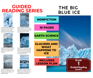
Guided Reading Level I - The Big Blue Ice (with Lesson Plan)
ELA, Resources for Teachers, Reading Comprehension, Reading, Science, Language Development, Earth and Environmental Sciences, Geography, Social Studies, Life Sciences, Grade 1, 2, 3, Worksheets & Printables, Worksheets, Teacher Tools, Centers, Activities, Literacy Readers, Quizzes, Quizzes and Tests, Assessments, Lesson Plans
This Guided Reading Book - The Big Blue Ice (Level I) with lesson plan includes: Guided Reading Color Label (front cover x1) This is a quick way to match the book’s demands to what students can generally handle.. The overall goal is to use the level/color to pick books for several smaller groups. To qualify for a certain level, a student is expected to read a book from that level with about 90–94% accuracy. If a student is consistently accurate and understands, move up a level. If the student is struggling at that level, drop down and add more support. Each student will improve at completely different rates, but it is generally one of the best ways to check progress across the class. DOWNLOAD THE CATALOG TO VIEW ALL GUIDED READING BOOKS AVAILABLE (SORTED LEVELS A-Z) Pre-Reading Question (x1) Teacher asks the prompt aloud, can be while showing the cover or first page. Students share what they already know, or make educated guesses from the cover. Prompt them to use the target vocabulary. Write some of their responses on the board to look back at during the reading. Vocabulary Words (x5) Introduce the five words, best doing it one at a time. Start by saying it, while students repeat and then see if anyone knows what it means before reading further. Read through the meaning and try to briefly connect each word to a picture or gesture so it’s meaningful. Ask students to flip through the book pages and point to where they see each of the vocabulary words. While reading the book pause upon coming across one of the vocab words or read the sentence twice to make sure students understand the word has appeared. Optional: Ask students to raise hands whenever they see/hear one of the new words. Guided Reading Pages (x10) Check the book snapshot (below) for: primary topic - do you need to prep extra reading or intro materials on this? what is taught best - decide on 1-2 bullets to focus on, use the prompt or words provided here for best results. learning goals - what you are checking for students to be able to do after the session, elicit answers using prompts or words provided. key vocabulary (see section above). questions overview - so you know what is coming up and if you need to prep extra materials to assist understanding. Run the lesson You may have already looked at a few of the pages together, but you can show them some of the pictures again first to set meaning. Depending on how much time you have and how familiar your students are with guided reading class, you may want to read the book aloud first with the group first. Students whisper or partner read, while you listen in. If time, do it as a group, one student reading a page each. Use the guided page’s prompts to coach: “Check the picture / does it make sense?” “Point under the words / try the first sound” “Reread the sentence smoothly”. Try to focus more on one student per session (rotating every time), so you can work out if they are ready to move up or need to move down a level. Comprehension Questions (back cover x3) This is your way to check that students didn’t just say the words, but actually understood the text. First, let students answer by pointing to the page/picture and saying a short sentence. After any answer, follow with: “Show me where you found that in the text.” In bigger groups, have partners answer first (10–20 seconds), then call on 2–3 students to share. Differentiation tips: Emerging speakers/struggling readers: oral + pointing On-level: oral in a full sentence Higher: one written sentence or draw + label Book Snapshot Title: The Big Blue Ice Genre: Nonfiction (informational) Subject: Earth Science + Reading (Informational Text) Primary Topic: Glaciers and what happens to ice Estimated Guided Reading Level (A–Z): I What This Book Teaches Best Defines what a glacier is and explains that it stays frozen all year long. Explains how snow can squeeze together and turn into hard ice in very cold places. Describes how glaciers move slowly like “rivers of ice” down mountain slopes. Teaches glacier features and changes, including crevasses, calving, and icebergs. Connects glaciers to living things and Earth systems (animals resting on ice, fresh water, keeping the world cool). Learning Goals Describe what a glacier is using details from the text. Explain how piled-up snow turns into hard ice in very cold places. Tell how glaciers move and where they move (down mountain slopes). Identify crevasses and describe what the text says they show. Explain what calving is and what happens when a glacier reaches the ocean. Describe two ways glaciers are important on Earth (cooling the world, holding fresh water). Key Vocabulary From the Text glacier — a huge mountain of ice. frozen — turned to ice from very cold weather. crevasses — long cracks on the glacier’s surface. calving — when big ice chunks break off into the ocean. icebergs — floating mountains of ice in cold water. Discussion Prompts Pre-reading question: What do you think a glacier is, and where might you find one? Comprehension questions: How does snow turn into hard ice, according to the book? Comprehension questions: Why do some glaciers look bright blue in the text? Comprehension questions: Where do seals rest to take a nap and stay safe from the water? Printing Tips 1. Best Printing Method (Recommended) “Booklet” Printing (Best if Available) If your printer or PDF viewer supports Booklet Printing , use this. Settings to use: Print mode: Booklet Paper size: Letter or A4 (either works) Orientation: Landscape Print on both sides: Yes Flip on: Short edge Scaling: Fit to printable area Booklet subset: First test: Front sides only Then: Back sides only This will automatically: Pair pages correctly Put the cover on the outside Align everything for folding After printing, fold in half and staple along the spine . 2. If “Booklet” Printing Is NOT Available You can still print this correctly with manual duplex printing . Step-by-step: Open the PDF. Choose Print . Set: Orientation: Landscape Pages per sheet: 1 Print on both sides: Yes Flip on: Short edge Print all pages . Because each PDF page already contains two facing book pages, the result will still fold cleanly into a book. Thousands of Cored Education products are included with your TeachSimple membership. Download links and encyclopedia index available here.
Author Cored Education
Rating
Tags Reading Comprehension, Reading Passages, Reading, Guided Reading, Guided Reading Lesson Plan, Guided Reading Activity, Pre-reading, Science Lesson Plans, Earth Science, Geography
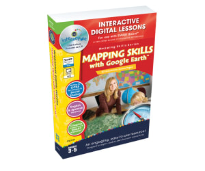
Mapping Skills with Google Earth - Digital Lesson Plan Gr. 3-5 - FLASH-MAC
Social Studies, Geography, Grade 3, 4, 5, Teacher Tools, Lesson Plans
Mapping Skills with Google Earth - Digital Lesson Plan Gr. 3-5 - FLASH-MAC Overview This is a comprehensive teaching resource specifically designed to improve the mapping skills of students in grades three to five. Spread over 80 screen-pages, this digital lesson plan offers an interactive and engaging way of learning how to read and create maps. Key Concepts Covered: Elements on a map: lines of latitude, longitude, time zones et al. Detailed exploration of geographical features via topographic maps Cultural aspects covered through choropleth maps The Mapping Skills with Google Earth - Digital Lesson Plan Gr. 3-5 - FLASH-MAC serves as both an extensive North American and international exploratory tool. Add-On Features: Incorporation of Google Earth™ components for interactive map exercises An extensive test prep section included for exam preparation (Includes memory match games) Crossword puzzles, word searches along with printable resources are included for knowledge reinforcement Suitable for whole class instruction or within small groups or even assigned as homework tasks Inclusion of English/Spanish text-to-speech feature ensuring comprehension isn't limited by language barriers. All content aligns perfectly well with State Standards following Bloom's Taxonomy writing style making it easy to meet education requirements! To gauge progress after each lesson effectively, the comprehension Quiz component fits itself perfectly well into the teaching structure playing a crucial role in students' understanding post-session thoroughly assessment. Note: This resource is mainly designed for interactive whiteboards of any brand, enhancing student engagement during lessons. It caters to both homeschooling teachers and those in public schools.
Author Classroom Complete Press
Tags Software (Mac)
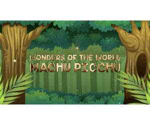
All About The Machu Picchu | Geographical Wonders Video Lesson
Social Studies, Geography, Not Grade Specific, Lesson Plans, Teacher Tools
All About The Machu Picchu | Geographical Wonders Video Lesson A valuable teaching resource that stimulates curiosity and engagement through educational animated content. This product provides an engaging animated video lesson focused on exploring the wonders of The Machu Picchu. Spanning approximately 9 minutes, your students will undertake a journey that milds learning through interactive content, even rendering complex concepts easily understood. The versatility of this resource allows for use within various age groups or classes as part of social studies modules, making it also suitable for homeschoolers seeking an interesting take on geography lessons. Use as an introduction tool to new material Ideal for serving as a review tool Inclusion in whole group sessions to promote discussion Effective within small group lessons with focus on interactive activities Possible assignment for individuals coupled with follow-up tasks An excellent choice for educators such as public school teachers and homeschoolers who aim to make Geography more appealing while ensuring a high student involvement rate. This wonderful digital resource is provided in MP4 format enabling easy integration into most platforms, thus enhancing learning about global geographical wonders such as The Machu Picchu.
Author Educational Voice
Tags Machu Picchu, Geographical Wonders, Animated Video Lessons, Geography Education, Interactive Content

All About The Taj Mahal | Geographical Wonders Video Lesson
Social Studies, Geography, Not Grade Specific, Lesson Plans, Teacher Tools
All About The Taj Mahal | Geographical Wonders Video Lesson The All About The Taj Mahal | Geographical Wonders Video Lesson is a captivating resource for educators aiming to introduce their learners to the beauty and majesty of one of the world's most iconic geographical wonders - The Taj Mahal. This video provides detailed insights through an animated geography video making it an engaging introduction or review tool for lessons surrounding geographical wonders and landforms. Features: Offered in MP4 format Makes use of colorful animations and intriguing narratives Serves as a focal point during whole-group instruction, stimulates discussion in small group sessions, or can be used independently by students at home Not grade-specific offering flexibility across different learning levels The video lesson is not only suitable for homeschooling, but its flexible nature boosts its relevance across multiple grades and learner abilities. Social Studies Education with Sub-Focus On Geography: This product aids students' understanding by taking them on an animated journey exploring landforms' intricacies using the Taj Mahal's magnificence as a focal point. It brings life lessons from textbooks into dynamic motion pictures that fuel curiosity while promoting knowledge retention. A Standout Resource: The All About The Taj Mahal | Geographical Wonders Video Lesson stands out due to its interactive nature which sparks interest amongst young minds who often respond best when text-based content is complemented with visual aids. This resource combines both educational integrity and fun-filled learning aspects ensuring value addition every step of the way.
Author Educational Voice
Tags Taj Mahal, Geographical Wonders, Landforms, Animated Video, Social Studies
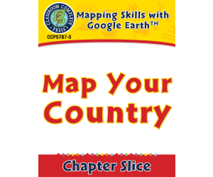
Mapping Skills with Google Earth: Map Your Country
Social Studies, Geography, Common Core, Grade 3, 4, 5, Teacher Tools, Lesson Plans
Mapping Skills with Google Earth: Map Your Country - A Comprehensive Teaching Resource An exciting teaching resource that introduces students to map reading and geographical concepts. Designed for third to fifth-grade learners, it incorporates Google Earth™ as a key feature for interactive learning. Features: Map Elements Coverage: Offers exercises on essential components of maps including latitude, longitude lines, and global time zones exploration. Cultural Aspects: Introduces various geographical and cultural aspects through topographic and choropleth maps. North America's Geopolitical Divisions: Presents clear understanding of North America's divisions with emphasis on recognition of states and provinces. Aided by interactive features like map exercises, quizzes, puzzles, at the same time it provides curriculum -based knowledge dispersion making learning cohesive yet fun-filled. Truly,"A blending pot of theory & practice". Pedagogical Inclusion & Usage: Mapped towards meeting Common Core State Standards diligently based on Bloom's Taxonomy norms assures you with an effective delivery mechanism for intended learning outcomes. It serves varied purposes – group lessons, team activities or homework assignments. Note:The user-friendly PDF format makes this product compatible across different tech-platforms optimizing its distribution inside classrooms or home surroundings alike! Final Word - Immerse your learners into the adventurous journey through continents,cities,& oceans with the gem called "Mapping Skills with Google Earth: Map Your Country". .
Author Classroom Complete Press
Tags PDF

Embracing Cultural Diversity: Egypt: A Cross-Curricular Lesson Plan
Social Studies, Geography, Grade 5, 6, Teacher Tools, Lesson Plans
Embracing Cultural Diversity: Egypt - A Cross-Curricular Lesson Plan A teaching resource that provides an deep understanding of Egypt's cultural diversity. This lesson plan, suitable for fifth to sixth-grade educators, offers engaging content and interactive learning. About the Resource This 14-page PDF effortlessly merges Social Studies and Geography, presenting comprehensive information on Egypt's history, traditions, and more. Reading comprehension activities enable students to embrace different cultures while boosting their language skills. Applying Learned Knowledge The resource facilitates hands-on learning through cross-curricular activities. Learners are encouraged to apply the learned material beyond mere memorization. The content can be used in whole group instruction or within small teams – even as homework assignments promoting independent study habits. Extension Ideas & Flexibility in Teaching Including extension ideas, this lesson plan enables continued exploration while providing room for teaching creativity. These suggestions align with curriculum requirements to ensure educational continuity. The emphasis is not only on facts but also building intercultural competency through an inside look into Egyptian society. The pages are ready-to-print easing lesson planning while enhancing students' geographical enrichment and cross-cultural understanding.
Author Classroom Complete Press
Tags Egypt, Cultural, Diversity, Traditions, Informational Text, Diversity Lesson Plans For 1st Grade
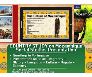
Country Study Presentation - Mozambique - Geography - East Africa
Social Studies, Economics, Geography, History, History: African, Grade 7, 8, 9, 10, 11, 12, Teacher Tools, Presentations, Lesson Plans
Country Study Presentation - Mozambique - Geography + Social Studies - East Africa Try this Teaching Resource on Mozambique (Introductory Presentation Lesson - PDF Printable), designed for Geography + African History (East Africa) + Social Studies lessons. Suitable for Grades 7–12 (Middle school and High School students), this Introductory PDF Presentation offers a ready to use lesson that requires little to no preparation. Geography and Social Studies students will learn about Mozambique ’s geography, history, culture, language and economy — making it perfect for classroom instruction, homeschooling, or online learning. 📘 Teachers can find the following topics in this Social Studies and Geograhy Teaching resource ✅ Greetings in Portuguese ✅ Geography of Mozambique (East Africa) – Key facts, borders, and an interactive Google Maps link to its location. ✅ Quick Facts – Population, capital city, currency and other essential details. ✅ Languages of Mozambique : Portuguese - introduction in the languages spoken + basic vocabuary ✅ History Overview – A concise summary of the most important events in the history of Mozambique (East Africa) ✅ Geography & Environment – Details about the country’s land area, regions, and climate zones. ✅ Mozambique's Economy – paragraph on Mozambique ’s industries, exports, currency and economic strengths (East Africa) ✅ Maputo – Explore the capital city of Mozambique , its famous landmarks, and cultural highlights. ✅ Other Major Cities – A map showcasing additional important cities in Mozambique (East Africa) ✅ Mozambique's Culture & Traditions – A look at the customs and values that define Mozambique (East Africa) ✅ Farewell in Portuguese 🎯 This Geography and Social Studies Teaching Resource can be perfect for: Geography classes Social Studies lessons World cultures units Country study projects Substitute teacher toolbox Digital learning In-class or online teaching 📂 Resource Details Format: PDF Digital Presentation Grade Levels: 7th–12th Grade (Middle School and High School students) Learning with Alan is an educational resource store created to help teachers, educators, and tutors reach their teaching goals while building a fun, engaging, and stimulating learning environment . Because learning should always be meaningful—and fun! 🎓✨ If you want to browse more of my Teaching Resources, click here Learning with Alan!!
Author Learning with Alan
Rating
Tags Social Studies, Geography, Country Study, Mozambique, East Africa, Portuguese, Africa, Lesson, Presentation, Introduction

Australia: Human and Environmental Interactions
Social Studies, Geography, Common Core, Grade 5, 6, 7, 8, Teacher Tools, Lesson Plans
Australia: Human and Environmental Interactions Designed for grades 5 through 8, this educational resource offers an intensive excursion through Australia's diverse geographical features, cities, and regions. It proves especially valuable for instructors teaching social studies with an emphasis on geography. Goal The goal of this comprehensive lesson plan is to widen students' outlook by exploring the multiple facets of Australia. This includes: Australia's relative global position Different physical landscapes Wildlife & vegetation variety Diverse demographics Climate differences between regions. Focal Point: Human-Environment Interaction in Australia Today This resource does more than just provide location maps or ecosystem descriptions. Instead, it ventures into the intriguing arena of today's human-environment interactions in Australia– a topic that carries significant implications worldwide. Versatility and Engagement This instructional content shines in various settings - from classroom whole-group instruction to smaller study groups as well as personal learning assignments at home providing educators splendid flexibility according to their needs. The interactive activities included foster student interaction while reinforcing fundamental knowledge points. Ease-of-use & Continuous Assessment Opportunities You'll find explaining geographic concepts straightforward thanks to language simplification paired effectively with meaningful vocabulary terms. You’ll be pleased by all essential resources compiled into one user-friendly PDF.The PDF includes : 29 ready-to-print pages Crossword challenge Educational Value Beyond its educational enrichment, the lesson plan follows Common Core State Standards guidelines with credibility thus solidifying the choice of your curriculum. The vibrant color-coded maps accentuate information delivery while facilitating student interaction and knowledge retention through black-and-white versions that serve as student workbooks. High-quality teaching content like this forms a valuable asset in any education toolkit. By sparing your precious time on resource creation, it equips you to execute your role with maximum competency.
Author Classroom Complete Press
Tags Reading Passage, Comprehension Questions, Geography, Australia, Social Studies

All About The Petra | Geographical Wonders Video Lesson
Social Studies, Geography, Not Grade Specific, Lesson Plans, Teacher Tools
Get ready for an enthralling digital adventure with the "All About The Petra: Geographical Wonders Video Lesson"! This digital resource, designed especially for educators, offers a marvelous way to pique students' interest in geography by exploring the breathtaking ancient city of Petra. In this top-notch 10-minute animated video lesson, your learners will be exposed to important geographical concepts such as landforms and natural wonders while uncovering the rich history behind awe-inspiring sites like Petra. Boasting lively visuals and well-researched content, this video is perfect for sparking imagination and curiosity among budding geographers. Ideal for use as a supplementary tool or review material in middle-grade geography lessons that focus on landmarks and landforms worldwide, the "All About The Petra: Geographical Wonders Video Lesson" is an indispensable part of any educator's digital resources collection. Don't miss out on this amazing chance to give your students a fresh viewpoint on one of Earth's most magnificent wonders – head over to TeachSimple.com and download it now!
Author Educational Voice
Tags Petra, Arabia, Social Studies Lesson, Geography Lesson, Artifacts

Africa: Human and Environmental Interactions Gr. 5-8
Social Studies, Geography, Grade 5, 6, 7, 8, Teacher Tools, Lesson Plans
Africa: Human and Environmental Interactions Gr. 5-8 Introducing a unique learning platform that delves into diverse geographical features and human experiences of Africa. This comprehensive resource designed for Grades 5 to 8, focuses majorly on two disciplines, Geography and Social Studies. Taking students on an exploration of areas such as the Sahara Desert, this material ensures learners become familiar with principal national capitals and significant cities. In-depth Country Knowledge & Cultural Elements A graphic organizer enables students to understand different African countries' placement. Fascinating facts about the Masai people residing in eastern parts of Africa. Awareness of Endangered Species & Special Creatures An interactive component allows learners to examine two threatened animals within Africa. The package introduces why camels are specialized desert voyagers, encouraging learners to interactively design pamphlets showcasing these creatures' adaptations. Navigating Unique Landscapes Taking learners through unique landscapes such as Nile Valley and Serengeti Plains while explaining what makes these regions geographically special. Educational Alignment and Versatile Format Premium Features: Meticulously aligned with State Standards and Five Themes of Geography—promoting understanding beyond cramming facts alone! The convenient structure suits whole group instruction, small groups sessions or even homework assignments! Bonus Supplemental Materials: Additional resources enrich learning experience beyond classroom instructions including maps (one specifying major lakes & rivers), crossword puzzles & quizzes. Arranged neatly within 42 ready-to-print pages in PDF form, this resource ensures a seamless distribution process for effective lesson planning.
Author Classroom Complete Press
Tags Africa, Social Studies, Geography, Reading Passage, Comprehension Questions, Human Environment Interaction Clipart

Mounds of Indian Mounds: Emergency Lesson Plan
Social Studies, Geography, Grade 5, 6, Teacher Tools, Lesson Plans
Mounds of Indian Mounds: Emergency Lesson Plan Tailored for Grade 5 and Grade 6 students, this innovative resource equips educators with the means to keep their classes engaged in a cross-curricular manner that covers a wide spectrum of subjects. A chief focus is on Social Studies with a key emphasis on Geography. The engagement is deepened through an exploration into Native American effigy mounds. Students imbibe knowledge as they delve into an intriguing narrative that takes them back in time. The wealth of information offered extends beyond textual confines, transforming classrooms into dynamic hubs of learning. Packaged for Convenience The lesson plan comes within seven print-ready pages primed within a single PDF file. This ensures easy use for educators seeking efficient learning solutions. It's useful not only as an emergency backup but doubles up for short intervals or during schedule gaps-say before school assemblies. Versatility and Flexibility This product has standalone capabilities making it formidable in impromptu teaching situations or home tutoring applications. In addition, it’s also engineered to harmonize within larger thematic units or broader projects if needed. Homeschooling arrangements provide another arena where this lesson plan fits snugly. Beyond Reading: Extension Activities Included Apart from mere reading, extension activities designed to embed key lessons during story reading are included in this package via practical application exercises and worksheets aiming at enhancing comprehension skills among young learners’ minds. In essence, the Mounds of Indian Mound: Emergency Lesson Plan acts as a saviour ready to fill those “I just can't teach right now" moments with purposeful learning while allowing young learners' curiosity itself to better our shared histories.
Author Classroom Complete Press
Tags Indian Mounds, Geography Reading, Social Studies, Synonyms, Map Skills