3,931 products added recently
Geography Lesson Games
Integrate math and geography with lesson games that challenge students to apply numerical skills in geographical contexts. These activities promote critical thinking and make learning multidisciplinary. Use them to add excitement and variety to your lessons.
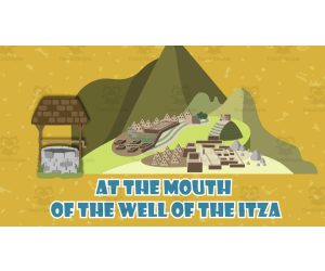
All About The Chichen Itza | Geographical Wonders Video Lesson
Social Studies, Geography, Not Grade Specific, Lesson Plans, Teacher Tools
All About The Chichen Itza | Geographical Wonders Video Lesson A dynamic resource designed to effectively explain geographical wonders with regard to a fascinating world landmark: The Chichen Itza. This MP4 formatted resource is appropriate for various learning stages. This product employs an animated approach that beautifully encapsulates the essence of this ancient Mayan city. Suitable across diverse curriculum needs and teaching styles, creates compelling connections between geography and history. Focus:Social Studies with emphasis on Geography Interdisciplinary Use:Possible incorporation into interdisciplinary lesson plans Capsule Duration:A crisp 12-minute video lesson The implementation potential ranges from whole group instruction to small study circles—even homework assignments can benefit by solidifying teachings presented during class hours. The Benefits of Incorporating in your teaching plan: Incorporates significant global landmarks imparting knowledge about geographical marvels of The Chichen Itza Paves the path for understanding macro concepts such as cultural diversity and ecological balance - Gives practical insights on Geological Concepts through bite-sized information chunks delivered via vibrant animations (easy comprehension)     This video lesson reduces extensive preparation time for educators while fostering intrigue about worldly wonders among students, making it an valuable addition in any educators' teaching kit.
Author Educational Voice
Tags Chichen Itza, Mayan City, Geographic Marvels, Cultural Diversity, Ecological Balance
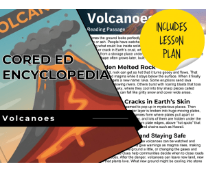
Volcanoes Reading Comprehension Passage - Cored Ed Encyclopedia
ELA, Language Development, Reading Comprehension, Reading, Pre-Reading, Earth Sciences, Earth and Environmental Sciences, Science, Geography, Social Studies, Grade 2, 3, 4, 5, Worksheets & Printables, Worksheets, Teacher Tools, Centers, Activities, Writing Prompts, Assessments, Quizzes and Tests, Quizzes, Lesson Plans
This volcanoes reading comprehension with lesson plan includes: Visualization (on the front cover) Start your lesson by taking a minute to think and share something about the topic. Read the script aloud (slowly), perhaps prepare some music or sound effects. Student close their eyes and let their imaginations wander. Students open their eyes, read the question aloud and give them a few minutes to complete. Ask a few students to share or keep answers until the end to compare with what they learn in the passage. Quick pause—thousands of Cored Education products are included with your TeachSimple membership. Download links and encyclopedia index available here. Pre-Reading Trivia Students will write down one thing they already know about the subject and then read five more facts and discuss. These facts are fun, and the students will enjoy learning about the subject before reading more. Give 1 minute for students to write what they already know (no pressure—best guess is fine). Read the five facts together. After each fact, do ask a student for their opinion, was it surprising? Set a purpose by asking students to highlight/underline one fact they want to learn more about during the reading. Reading Passage The text is a high-interest reading passage with set paragraphs, roughly three to four paragraphs long. It contains a variety of themes about the topic, anywhere from history to technology. The passage is between 250 and 350 words in length. First, ask students to look at the headings and see what they’ll learn about today. What do they know about the topic/heading? First read options: Teacher read-aloud (best for support). Partner reading (paragraph by paragraph). While reading, students underline important details, and vocabulary words they think may come up in the questions section. Mixed Questions The first question page contains four multiple-choice questions, each with a choice of four answers, and three written response questions that require a sentence or two from the student. Students complete the mcqs first independently, then review quickly as a class. For the 3 written responses, try to get students giving the answer with some form of evidence: “I think ___ because the text says ___.” If students get stuck, send them back to check the passage. Vocabulary Questions Practice seven key words from the text in this section across two activities. First section is scrambled words where students will unscramble three words given a clue for each. The second section is a word to meaning matching activity. Before starting, have some students read out words they underlined in the passage. Ask students to say the word and read aloud the sentence(s) around each word. Ask students to do scrambled words and the matching exercise in pairs then go through answers as a class. For the scrambled spelling task, get four pairs to come up to the board and write the words for extra practice with the other student reading out the clue. For the matching task, prompt students to give full sentences: “I matched ___ with ___ because ___.” Creative Writing In this question, the student will be required to write a five to eight sentence paragraph on a question related to the topic. Before starting, ask students write down 3 key ideas they are going to include in their piece. Ask students for ideas to share around the class to help those struggling. Pro writing expectations: 5–8 sentences At least 2 facts or details from the passage At least 2 vocabulary words from the previous page Students read their paragraphs while classmates listen for facts and vocabulary words. Extension Activities This page is optional for fast finishers or to take home. There are several activities, each one requiring a different skill. Do some, do none, do all, completely optional - but you will feel reassured knowing every possibility is planned for. Includes summary writting question. Answer Key There are answers for the multiple-choice questions, written response questions have sample answers, vocabulary answers and if there is a summary question then a sample summary will be provided as well. Lesson Plan Included Customized lesson plan for this lesson is included. Lesson Snapshot Title: Volcanoes Genre: Nonfiction (Informational text) Subject: Science (Earth Science) Primary Topic: What volcanoes are, how they form, and safety clues Estimated Guided Reading Level (A–Z): P What This Lesson Teaches Best What a volcano is (more than a “mountain”): Explains a volcano as an opening/vent or crack in Earth’s crust where hot melted rock, ash, and gases escape from an underground storage place called a magma chamber. Magma vs. lava: Defines melted rock as magma underground and lava once it reaches open air. How volcanic ash forms and spreads: Describes eruptions that toss bits of magma into the sky, cooling into tiny sharp pieces called volcanic ash that can fall like gritty snow and cover wide areas. Why volcanoes form where they do: Connects volcano locations to Earth’s outer layer being broken into huge moving plates (pulling apart or sliding under another), and also to “hot spots” that can form island chains such as Hawaii. Warning signs and community safety: Notes that rising magma can cause small earthquakes, ground swelling, or changes in gases and heat, and that these clues help communities decide when to close roads or move to safer places. Learning Goals Students will explain what the text says a volcano is and where the material comes from. Students will describe the difference between magma and lava using the passage’s definitions. Students will identify one way volcanic ash forms and describe what it is like when it falls. Students will describe how moving plates and hot spots help explain where volcanoes form. Students will list warning signs in the passage that may happen as magma rises. Students will explain how scientists’ observations can help communities stay safer. Key Vocabulary From the Text crust — Earth’s hard outer layer. magma — melted rock below Earth’s surface. lava — melted rock after it reaches open air. eruptions — times when a volcano sends material out. plates — huge moving pieces of Earth’s outer layer. FULL CATALOG OF DOWNLOAD LINKS AND ENCYCLOPEDIA INDEX HERE
Author Cored Education
Rating
Tags Vocabulary, Reading Comprehension, Reading Passages, Lesson Plans, Ela Lesson Plans, Reading Comprehension Lesson Plans, Pre-reading, Science Lesson Plans, Earth Science, Social Studies Lesson Plans
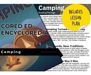
Camping Reading Comprehension Passage - Cored Ed Encyclopedia
ELA, Language Development, Reading Comprehension, Reading, Writing, Pre-Reading, Vocabulary, Geography, Social Studies, History, Grade 2, 3, 4, 5, Worksheets & Printables, Worksheets, Teacher Tools, Centers, Activities, Writing Prompts, Assessments, Quizzes and Tests, Quizzes, Lesson Plans
This camping reading comprehension with lesson plan includes: Visualization (on the front cover) Start your lesson by taking a minute to think and share something about the topic. Read the script aloud (slowly), perhaps prepare some music or sound effects. Student close their eyes and let their imaginations wander. Students open their eyes, read the question aloud and give them a few minutes to complete. Ask a few students to share or keep answers until the end to compare with what they learn in the passage. COMPANION VIDEO NOW AVAILABLE (EMBEDDED AFTER PREVIEW PICTURES IN PRODUCT DESCRIPTION) Quick pause—thousands of Cored Education products are included with your TeachSimple membership. Download links and encyclopedia index available here. Pre-Reading Trivia Students will write down one thing they already know about the subject and then read five more facts and discuss. These facts are fun, and the students will enjoy learning about the subject before reading more. Give 1 minute for students to write what they already know (no pressure—best guess is fine). Read the five facts together. After each fact, do ask a student for their opinion, was it surprising? Set a purpose by asking students to highlight/underline one fact they want to learn more about during the reading. Reading Passage The text is a high-interest reading passage with set paragraphs, roughly three to four paragraphs long. It contains a variety of themes about the topic, anywhere from history to technology. The passage is between 250 and 350 words in length. First, ask students to look at the headings and see what they’ll learn about today. What do they know about the topic/heading? First read options: Teacher read-aloud (best for support). Partner reading (paragraph by paragraph). While reading, students underline important details, and vocabulary words they think may come up in the questions section. Mixed Questions The first question page contains four multiple-choice questions, each with a choice of four answers, and three written response questions that require a sentence or two from the student. Students complete the mcqs first independently, then review quickly as a class. For the 3 written responses, try to get students giving the answer with some form of evidence: “I think ___ because the text says ___.” If students get stuck, send them back to check the passage. Vocabulary Questions Practice seven key words from the text in this section across two activities. First section is scrambled words where students will unscramble three words given a clue for each. The second section is a word to meaning matching activity. Before starting, have some students read out words they underlined in the passage. Ask students to say the word and read aloud the sentence(s) around each word. Ask students to do scrambled words and the matching exercise in pairs then go through answers as a class. For the scrambled spelling task, get four pairs to come up to the board and write the words for extra practice with the other student reading out the clue. For the matching task, prompt students to give full sentences: “I matched ___ with ___ because ___.” Creative Writing In this question, the student will be required to write a five to eight sentence paragraph on a question related to the topic. Before starting, ask students write down 3 key ideas they are going to include in their piece. Ask students for ideas to share around the class to help those struggling. Pro writing expectations: 5–8 sentences At least 2 facts or details from the passage At least 2 vocabulary words from the previous page Students read their paragraphs while classmates listen for facts and vocabulary words. Extension Activities This page is optional for fast finishers or to take home. There are several activities, each one requiring a different skill. Do some, do none, do all, completely optional - but you will feel reassured knowing every possibility is planned for. Includes summary writting question and additional facts. Answer Key There are answers for the multiple-choice questions, written response questions have sample answers, vocabulary answers and if there is a summary question then a sample summary will be provided as well. Lesson Plan Included Customized lesson plan for this lesson is included. Lesson Snapshot Title: Camping Genre: Nonfiction (informational text with headings) Subject: Reading (Informational Text) / Social Studies Primary Topic: How camping began, changed, and stays respectful Estimated Guided Reading Level (A–Z): N What This Lesson Teaches Best Explains what camping is and what campers might notice at night (lantern glow, smell of pine, owls, cooler air). Builds background knowledge about how camping shifted from travel/work to a fun hobby in the late 1800s. Uses a chronological structure with time markers (late 1800s, 1894, 1901, 1908, after World War I, 1960s) to show change over time. Introduces environmental responsibility through a “leave-no-trace approach,” including keeping camps small and taking trash home. Gives practice with text features (section headings) to locate information efficiently. Learning Goals Students will describe what camping is using details from the passage. Students will explain why people slept outside long ago and how camping later became a hobby. Students will identify key events and dates from the passage (1894, 1901, 1908, after World War I, 1960s). Students will use headings to find information about camping’s history, campgrounds, and “leave-no-trace.” Students will compare different ways people camp (backpacks vs. car/RV) based on the passage. Students will explain what the passage says a leave-no-trace approach means. Key Vocabulary From the Text shelter — a place that protects you. lantern — a light you can carry. demanded — needed or required. commercial — run as a business. approach — a way of doing something. FULL CATALOG OF DOWNLOAD LINKS AND ENCYCLOPEDIA INDEX HERE
Author Cored Education
Rating
Tags Vocabulary, Reading Comprehension, Reading Passages, Lesson Plans, Ela Lesson Plans, Reading Comprehension Lesson Plans, Pre-reading, Social Studies Lesson Plans, Geography, History

All About Himalayas | Geographical Wonders Video Lesson
Social Studies, Geography, Grade 3, 4, 5, 6, 7, Lesson Plans, Teacher Tools
All About Himalayas | Geographical Wonders Video Lesson All About Himalayas | Geographical Wonders Video Lesson brings the scenic landscapes of the Himalayas into classrooms and homeschool environments, offering a thorough comprehension of this unique geographical wonder. This teaching resource uncovers the captivating gems of the Himalayas, transporting learners on an immersive journey through its fascinating landforms. What it presents? The video lesson is an influential tool for teachers to unite their students in an interactive medium for dissecting geography. It is particularly tailored to students spanning grades 3 to 7. Whether within social studies or as part of more significant geography study units, this resource can be easily incorporated. How to use it? This multimedia resource comes as a single MP4 file delivered directly to educators for easy implementation. A twelve-minute-long video optimally catered to maintaining student concentration and fostering their curiosity about worldly vistas without sacrificing essential learning time. Purposes: Classroom Applications: Whole group exploration An integral component within smaller group work where discussions and observations stem from student-led conversations. Apart from Classroom Applications: Educators may assign The All About Himalaya video lesson as homework—engaging parental involvement while allowing student recapitulation outside school hours. Suitable for remedial purposes—revisiting informative content during review sessions before evaluations or guaranteeing struggling learners have sturdy resources framing their additional studies around. The fusion of technology with education ignites student interest without damaging academic rigor. The potential knowledge gains are just waiting—like Mount Everest—to be ascended by the students under your stewardship. So come, embark on an educational expedition through Earth's highest mountain range with the All About Himalayas | Geographical Wonders Video Lesson!
Author Educational Voice
Tags Himalayas, Geography, Landforms, Video Lesson, Interactive Medium
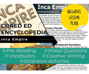
Inca Empire Reading Comprehension Passage - Cored Ed Encyclopedia
ELA, Reading Comprehension, Reading, History, Social Studies, Science, Geography, Technology, Pre-Reading, Language Development, Grade 2, 3, 4, 5, Worksheets & Printables, Worksheets, Teacher Tools, Centers, Activities, Writing Prompts, Assessments, Quizzes and Tests, Quizzes, Lesson Plans
This Inca Empire reading comprehension with lesson plan includes: Visualization (on the front cover) Start your lesson by taking a minute to think and share something about the topic. Read the script aloud (slowly), perhaps prepare some music or sound effects. Student close their eyes and let their imaginations wander. Students open their eyes, read the question aloud and give them a few minutes to complete. Ask a few students to share or keep answers until the end to compare with what they learn in the passage. Quick pause—thousands of Cored Education products are included with your TeachSimple membership. Download links and encyclopedia index available here. Pre-Reading Trivia Students will write down one thing they already know about the subject and then read five more facts and discuss. These facts are fun, and the students will enjoy learning about the subject before reading more. Give 1 minute for students to write what they already know (no pressure—best guess is fine). Read the five facts together. After each fact, do ask a student for their opinion, was it surprising? Set a purpose by asking students to highlight/underline one fact they want to learn more about during the reading. Reading Passage The text is a high-interest reading passage with set paragraphs, roughly three to four paragraphs long. It contains a variety of themes about the topic, anywhere from history to technology. The passage is between 250 and 350 words in length. First, ask students to look at the headings and see what they’ll learn about today. What do they know about the topic/heading? First read options: Teacher read-aloud (best for support). Partner reading (paragraph by paragraph). While reading, students underline important details, and vocabulary words they think may come up in the questions section. Mixed Questions The first question page contains four multiple-choice questions, each with a choice of four answers, and three written response questions that require a sentence or two from the student. Students complete the mcqs first independently, then review quickly as a class. For the 3 written responses, try to get students giving the answer with some form of evidence: “I think ___ because the text says ___.” If students get stuck, send them back to check the passage. Vocabulary Questions Practice seven key words from the text in this section across two activities. First section is scrambled words where students will unscramble three words given a clue for each. The second section is a word to meaning matching activity. Before starting, have some students read out words they underlined in the passage. Ask students to say the word and read aloud the sentence(s) around each word. Ask students to do scrambled words and the matching exercise in pairs then go through answers as a class. For the scrambled spelling task, get four pairs to come up to the board and write the words for extra practice with the other student reading out the clue. For the matching task, prompt students to give full sentences: “I matched ___ with ___ because ___.” Creative Writing In this question, the student will be required to write a five to eight sentence paragraph on a question related to the topic. Before starting, ask students write down 3 key ideas they are going to include in their piece. Ask students for ideas to share around the class to help those struggling. Pro writing expectations: 5–8 sentences At least 2 facts or details from the passage At least 2 vocabulary words from the previous page Students read their paragraphs while classmates listen for facts and vocabulary words. Extension Activities This page is optional for fast finishers or to take home. There are several activities, each one requiring a different skill. Do some, do none, do all, completely optional - but you will feel reassured knowing every possibility is planned for. Includes summary writting question and additional facts. Answer Key There are answers for the multiple-choice questions, written response questions have sample answers, vocabulary answers and if there is a summary question then a sample summary will be provided as well. Lesson Plan Included Customized lesson plan for this lesson is included. Lesson Snapshot Title: Inca Empire Genre: Nonfiction (informational passage) Subject: Social Studies (History) / Reading (Informational Text) Primary Topic: Cusco, roads, quipu records, terraces, legacy Estimated Guided Reading Level (A–Z): S What This Lesson Teaches Best How Cusco grew from a small kingdom into a larger Inca state in the 1400s under a leader named Pachacuti, and how the state was called Tawantinsuyu (the Realm of the Four Parts). How Inca engineers built a wide road system with stairs cut into rock and bridges, plus storehouses and resting places that helped the empire spread across western South America. How the Inca kept records without an English-like alphabet by using a quipu (cords with knots and colors for counts and notes). How terraces were used on hillsides to hold soil and water for crops like potatoes and corn, and how work was organized by the state as a kind of tax. How the empire ended after conflict and Spanish conquest, while people and culture continued (Quechua still spoken; terraces and stone places remain). Learning Goals Describe how Cusco changed in the 1400s and name the Inca state described in the passage. Explain how roads, bridges, and storehouses helped the Inca move messages, supplies, and armies. Explain what a quipu is and what it could record, based on the text. Describe what terraces are used for and how they helped farming on hillsides. Identify what happened in the 1500s that led to the end of the empire and one way Inca life continued afterward. Key Vocabulary From the Text Tawantinsuyu — the Inca state called the Realm of the Four Parts. chasquis — runners who carried messages from stop to stop. quipu — cords with knots and colors for records. terraces — flat steps that hold soil and water. storehouses — places along routes that kept needed supplies. FULL CATALOG OF DOWNLOAD LINKS AND ENCYCLOPEDIA INDEX HERE
Author Cored Education
Rating
Tags Vocabulary, Reading Comprehension, Reading Passages, Lesson Plans, Ela Lesson Plans, Reading Comprehension Lesson Plans, Pre-reading, History, Social Studies Lesson Plans, Geography

All About Danxia Landform | Animated Geography Video Lesson
Social Studies, Geography, Grade 5, 6, 7, 8, Lesson Plans, Teacher Tools
This animated geography video lesson is all about the Danxia Landform. Students will love this engaging and interactive video as they learn more about geographical landforms. This video serves as a great introduction or review video for your learners. This is an 11-minute geography video lesson.
Author Educational Voice
Tags Social Studies Video, Geography Video, Geography Lesson, Landforms, Danxia

All About The Taj Mahal | Geographical Wonders Video Lesson
Social Studies, Geography, Not Grade Specific, Lesson Plans, Teacher Tools
All About The Taj Mahal | Geographical Wonders Video Lesson The All About The Taj Mahal | Geographical Wonders Video Lesson is a captivating resource for educators aiming to introduce their learners to the beauty and majesty of one of the world's most iconic geographical wonders - The Taj Mahal. This video provides detailed insights through an animated geography video making it an engaging introduction or review tool for lessons surrounding geographical wonders and landforms. Features: Offered in MP4 format Makes use of colorful animations and intriguing narratives Serves as a focal point during whole-group instruction, stimulates discussion in small group sessions, or can be used independently by students at home Not grade-specific offering flexibility across different learning levels The video lesson is not only suitable for homeschooling, but its flexible nature boosts its relevance across multiple grades and learner abilities. Social Studies Education with Sub-Focus On Geography: This product aids students' understanding by taking them on an animated journey exploring landforms' intricacies using the Taj Mahal's magnificence as a focal point. It brings life lessons from textbooks into dynamic motion pictures that fuel curiosity while promoting knowledge retention. A Standout Resource: The All About The Taj Mahal | Geographical Wonders Video Lesson stands out due to its interactive nature which sparks interest amongst young minds who often respond best when text-based content is complemented with visual aids. This resource combines both educational integrity and fun-filled learning aspects ensuring value addition every step of the way.
Author Educational Voice
Tags Taj Mahal, Geographical Wonders, Landforms, Animated Video, Social Studies

Carnivals Reading Comprehension Passage - Cored Ed Encyclopedia
ELA, Language Development, Reading Comprehension, Reading, Writing, Pre-Reading, Vocabulary, Geography, Social Studies, History, Grade 2, 3, 4, 5, Worksheets & Printables, Worksheets, Teacher Tools, Centers, Activities, Writing Prompts, Assessments, Quizzes and Tests, Quizzes, Lesson Plans
This carnivals reading comprehension with lesson plan includes: Visualization (on the front cover) Start your lesson by taking a minute to think and share something about the topic. Read the script aloud (slowly), perhaps prepare some music or sound effects. Student close their eyes and let their imaginations wander. Students open their eyes, read the question aloud and give them a few minutes to complete. Ask a few students to share or keep answers until the end to compare with what they learn in the passage. Quick pause—thousands of Cored Education products are included with your TeachSimple membership. Download links and encyclopedia index available here. Pre-Reading Trivia Students will write down one thing they already know about the subject and then read five more facts and discuss. These facts are fun, and the students will enjoy learning about the subject before reading more. Give 1 minute for students to write what they already know (no pressure—best guess is fine). Read the five facts together. After each fact, do ask a student for their opinion, was it surprising? Set a purpose by asking students to highlight/underline one fact they want to learn more about during the reading. Reading Passage The text is a high-interest reading passage with set paragraphs, roughly three to four paragraphs long. It contains a variety of themes about the topic, anywhere from history to technology. The passage is between 250 and 350 words in length. First, ask students to look at the headings and see what they’ll learn about today. What do they know about the topic/heading? First read options: Teacher read-aloud (best for support). Partner reading (paragraph by paragraph). While reading, students underline important details, and vocabulary words they think may come up in the questions section. Mixed Questions The first question page contains four multiple-choice questions, each with a choice of four answers, and three written response questions that require a sentence or two from the student. Students complete the mcqs first independently, then review quickly as a class. For the 3 written responses, try to get students giving the answer with some form of evidence: “I think ___ because the text says ___.” If students get stuck, send them back to check the passage. Vocabulary Questions Practice seven key words from the text in this section across two activities. First section is scrambled words where students will unscramble three words given a clue for each. The second section is a word to meaning matching activity. Before starting, have some students read out words they underlined in the passage. Ask students to say the word and read aloud the sentence(s) around each word. Ask students to do scrambled words and the matching exercise in pairs then go through answers as a class. For the scrambled spelling task, get four pairs to come up to the board and write the words for extra practice with the other student reading out the clue. For the matching task, prompt students to give full sentences: “I matched ___ with ___ because ___.” Creative Writing In this question, the student will be required to write a five to eight sentence paragraph on a question related to the topic. Before starting, ask students write down 3 key ideas they are going to include in their piece. Ask students for ideas to share around the class to help those struggling. Pro writing expectations: 5–8 sentences At least 2 facts or details from the passage At least 2 vocabulary words from the previous page Students read their paragraphs while classmates listen for facts and vocabulary words. Extension Activities This page is optional for fast finishers or to take home. There are several activities, each one requiring a different skill. Do some, do none, do all, completely optional - but you will feel reassured knowing every possibility is planned for. Includes summary writting question and additional facts. Answer Key There are answers for the multiple-choice questions, written response questions have sample answers, vocabulary answers and if there is a summary question then a sample summary will be provided as well. Lesson Plan Included Customized lesson plan for this lesson is included. Lesson Snapshot Title: Carnivals Genre: Nonfiction (informational passage with headings) Subject: Reading (Informational Text) / Social Studies Primary Topic: What Carnival is and why it matters Estimated Guided Reading Level (A–Z): P What This Lesson Teaches Best Builds cultural background knowledge by explaining Carnival as a time right before Lent in many Christian communities. Shows how celebrations can look different in different places (Venice, France/Mardi Gras, Rio de Janeiro). Teaches multiple-meaning vocabulary by explaining that “carnival” can also mean a traveling fair with rides and games (especially in the United States). Supports comprehension of informational text structure by using headings to organize ideas (history/background, examples, traveling fairs, reasons people celebrate). Highlights theme/central message: carnivals help people “step out of ordinary life” and remember shared joy. Learning Goals Students will explain what Carnival is and when it happens, using details from the passage. Students will describe how Venice, France (Mardi Gras), and Rio de Janeiro shaped Carnival in different ways. Students will identify two meanings of the word carnival as used in the passage. Students will summarize why people “keep making carnivals,” based on the author’s explanation. Students will use headings to locate information and confirm key details in the text. Key Vocabulary From the Text fasting — not eating for a period of time. reflection — careful thinking about life. mingle — mix with other people in a group. floats — decorated platforms used in parades. routines — the usual things you do regularly. FULL CATALOG OF DOWNLOAD LINKS AND ENCYCLOPEDIA INDEX HERE
Author Cored Education
Rating
Tags Vocabulary, Reading Comprehension, Reading Passages, Lesson Plans, Ela Lesson Plans, Reading Comprehension Lesson Plans, Pre-reading, Social Studies Lesson Plans, Geography, History
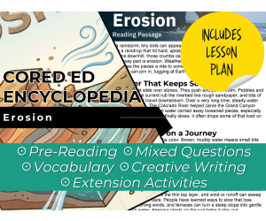
Erosion Reading Comprehension Passage - Cored Ed Encyclopedia
ELA, Reading Comprehension, Reading, Science, Technology, Language Development, Social Studies, Earth and Environmental Sciences, Geography, Life Sciences, Grade 2, 3, 4, 5, Worksheets & Printables, Worksheets, Teacher Tools, Centers, Activities, Writing Prompts, Assessments, Quizzes and Tests, Quizzes, Lesson Plans
This erosion reading comprehension with lesson plan includes: Visualization (on the front cover) Start your lesson by taking a minute to think and share something about the topic. Read the script aloud (slowly), perhaps prepare some music or sound effects. Student close their eyes and let their imaginations wander. Students open their eyes, read the question aloud and give them a few minutes to complete. Ask a few students to share or keep answers until the end to compare with what they learn in the passage. Quick pause—thousands of Cored Education products are included with your TeachSimple membership. Download links and encyclopedia index available here. Pre-Reading Trivia Students will write down one thing they already know about the subject and then read five more facts and discuss. These facts are fun, and the students will enjoy learning about the subject before reading more. Give 1 minute for students to write what they already know (no pressure—best guess is fine). Read the five facts together. After each fact, do ask a student for their opinion, was it surprising? Set a purpose by asking students to highlight/underline one fact they want to learn more about during the reading. Reading Passage The text is a high-interest reading passage with set paragraphs, roughly three to four paragraphs long. It contains a variety of themes about the topic, anywhere from history to technology. The passage is between 250 and 350 words in length. First, ask students to look at the headings and see what they’ll learn about today. What do they know about the topic/heading? First read options: Teacher read-aloud (best for support). Partner reading (paragraph by paragraph). While reading, students underline important details, and vocabulary words they think may come up in the questions section. Mixed Questions The first question page contains four multiple-choice questions, each with a choice of four answers, and three written response questions that require a sentence or two from the student. Students complete the mcqs first independently, then review quickly as a class. For the 3 written responses, try to get students giving the answer with some form of evidence: “I think ___ because the text says ___.” If students get stuck, send them back to check the passage. Vocabulary Questions Practice seven key words from the text in this section across two activities. First section is scrambled words where students will unscramble three words given a clue for each. The second section is a word to meaning matching activity. Before starting, have some students read out words they underlined in the passage. Ask students to say the word and read aloud the sentence(s) around each word. Ask students to do scrambled words and the matching exercise in pairs then go through answers as a class. For the scrambled spelling task, get four pairs to come up to the board and write the words for extra practice with the other student reading out the clue. For the matching task, prompt students to give full sentences: “I matched ___ with ___ because ___.” Creative Writing In this question, the student will be required to write a five to eight sentence paragraph on a question related to the topic. Before starting, ask students write down 3 key ideas they are going to include in their piece. Ask students for ideas to share around the class to help those struggling. Pro writing expectations: 5–8 sentences At least 2 facts or details from the passage At least 2 vocabulary words from the previous page Students read their paragraphs while classmates listen for facts and vocabulary words. Extension Activities This page is optional for fast finishers or to take home. There are several activities, each one requiring a different skill. Do some, do none, do all, completely optional - but you will feel reassured knowing every possibility is planned for. Includes summary writting question and additional facts. Answer Key There are answers for the multiple-choice questions, written response questions have sample answers, vocabulary answers and if there is a summary question then a sample summary will be provided as well. Lesson Plan Included Customized lesson plan for this lesson is included. Lesson Snapshot Title: Erosion Genre: Nonfiction (Informational Text) Subject: Science (Earth Science) / Reading (Informational Text) Primary Topic: How erosion moves Earth materials and changes land Estimated Guided Reading Level (A–Z): N What This Lesson Teaches Best Clearly distinguishes weathering (breaking rock apart in place) from erosion (moving pieces away). (Reading Passage, p. 3) Explains multiple forces that cause erosion— water, wind, waves, ice, and gravity —and what they do to Earth’s surface. (p. 3) Shows how rivers reshape land over time, including how moving water and sediment can help carve deep valleys (Colorado River/Grand Canyon example). (p. 3) Introduces sediment and connects erosion to deposition , explaining how new landforms can build up (beaches, river deltas). (p. 3) Connects science to real-world problem solving by describing ways people can slow soil loss (trees, terraces, keeping plants on soil). (p. 3) Learning Goals Students will explain how erosion is different from weathering using the text’s definitions. Students will identify forces that can cause erosion (water, wind, waves, ice, gravity). Students will describe how rivers move sediment and can change riverbeds and valleys over time. Students will explain what sediment is and how deposition happens when sediment settles. Students will describe at least two ways people can help soil “stay home,” based on the passage. Key Vocabulary From the Text weathering — breaking rock apart where it sits. erosion — moving soil and rock to a new place. sediment — tiny bits of soil and rock that travel. deposition — when sediment settles and builds up land. terraces — steps that slow water on a steep slope. FULL CATALOG OF DOWNLOAD LINKS AND ENCYCLOPEDIA INDEX HERE
Author Cored Education
Rating
Tags Vocabulary, Reading Comprehension, Reading Passages, Lesson Plans, Ela Lesson Plans, Reading Comprehension Lesson Plans, Pre-reading, Geography, Earth Science, Science Lesson Plans

Embracing Cultural Diversity: Ireland: A Cross-Curricular Lesson Plan
Social Studies, Geography, Grade 5, 6, Teacher Tools, Lesson Plans
Embracing Cultural Diversity: Ireland: A Cross-Curricular Lesson Plan "Embracing Cultural Diversity: Ireland" is a comprehensive teaching resource crafted exclusively for fifth and sixth-grade educators. This lesson plan offers students a deep dive into the rich, multi-faceted culture of Ireland, imparting nuanced knowledge on its history, cultural traditions, geography and more. This resource package is a 13-page PDF filled with meticulously prepared content that takes both tutor and learners on a captivating excavation of this European island nation. The contents are highly informative, effortless to browse through with no extra preparation required - simply print out the pages as and when necessary. Key Components: An integral piece of this name="lesson_plan" lesson plan is the included educational text. It throws light onto an array of tenets central to Irish culture in an engaging yet easy-to-teach manner. Incorporating it into existing social studies curriculums or using it as an independent class discussion topic is straightforward. Complementing this learning material are cross-curricular activities that help reinforce concepts perceived in the instructional text section. They encourage thoughtful contemplation among learners whilst cementing key points related to Ireland's distinctive cultural identity. The package also houses extension ideas which augments or open potential avenues for advanced exploration using initial dialogue topics or student queries as base points. These suggestions add elasticity across various subject areas propelling interdisciplinary understanding alongside fostering appreciation for diversity. A Versatile Resource: In short, this lesson plan acts as a cultural passport ushering learners into Irish culture through its blend of information-rich lessons and versatile activities. This proves a valuable tool for educators looking to kindle student curiosity, understanding and respect for diverse global cultures.
Author Classroom Complete Press
Tags Culture, Diversity Lesson, Ireland, Geography Worksheets, Social Studies Lesson Plan, Diversity Lesson Plans, Diversity Lesson Plan

Africa: Regions Gr. 5-8
Social Studies, Geography, Grade 5, 6, 7, 8, Teacher Tools, Lesson Plans
Africa: Regions Gr. 5-8 A comprehensive teaching resource tailored for students in grades 5-8, focusing on the detailed study of various geographies and cultures throughout Africa. Included are special features of Africa such as the Sahara Desert, well known for its stunning landscapes, ancient history and contemporary cities bustling with vibrant societies. Pivotal Features: Places emphasis on engaging students in active learning about Africa's nation-states and their capitals. Encourages critical thinking while enhancing geographical literacy through categorization tasks within a structured graphic organizer. Goes beyond geographical knowledge by introducing significant elements of African cultural diversity, with special attention to tribes like Masai located in Eastern Africa. Adds an environmental education dimension by encouraging students to explore endangered African wildlife ecosystems through independent research assignments about threatened species across the continent, advocating for biodiversity conservation awareness. Additional Resources: An array of maps centered around water bodies across Africa designed specifically to stimulate map reading skills whilst imparting understanding about collective resources dependencies over regions. Creative tasks such as designing pamphlets about why camels are native to deserts that break down complex geographical themes into engaging sections.. Riveting descriptions that bring alive renowned natural wonders like Nile Valley and Serengeti Plains are also included. This educational compendium can be easily adapted and fits seamlessly within your instruction strategy meeting varied needs whether implemented during whole-group instructions or assigned during smaller breakout sessions or as homework activities. The document is aligned with State Standards and the Five Themes Of Geography. Also provided are crosswords ,word search puzzle,a comprehension quiz followed by an answer key providing assessments pathways ensuring fruitful student engagement. In a nutshell, Africa: Regions Gr. 5-8 stands firm in its commitment to versatile, fact-based, and intriguing learning experiences that ignite the geographical curiosities of young minds while fostering a deep understanding and appreciation of African diversity.
Author Classroom Complete Press
Tags PDF
Mapping Skills with Google Earth: Mapping Cultural Features
Social Studies, Geography, Common Core, Grade 3, 4, 5, Teacher Tools, Lesson Plans
Mapping Skills with Google Earth: Mapping Cultural Features This teaching resource has been meticulously developed for third to fifth-grade educators. It is aimed at augmenting their social studies and geography course curriculum whilst instilling crucial mapping skills in pupils. Students are introduced to cardinal elements like latitude, longitude, and time zones. Gaining Insight into Geographical and Cultural Features An in-depth exploration of geographical and cultural features through topographic maps, choropleth maps, and more. A effective way to perceive global diversity across countries. An understanding of North America's provinces and states. The added feature of Google Earth visuals makes learning an interactive process. This novel approach not only enables clear comprehension but also helps students retain the information longer—an advantageous skill set applicable beyond just geography or social studies. Diverse Teaching Methods & Student Engagement Tools The product comes as a single PDF containing 27 ready-to-print pages, facilitating educators for a varied upshot: Whole group instruction:} Extensive collaborations within classrooms garnering collective ideas. Small group activities:} Enables focused groups working on pertinent modules enhancing interaction. Solo-assignments:} Encourages home-enriched study modules catering individualistic learning trajectories. In addition, the inclusion of reading passages alongside structured map-centric exercises such as crosswords and word searches aids practical knowledge assimilation in an enjoyable manner among students. Moreover, a well-crafted comprehension quiz aligned with Bloom's Taxonomy principles and Common Core State Standards helps measure students’ progress skillfully. In summary, Mapping Skills with Google Earth: Mapping Cultural Features is an invaluable asset for educators seeking to develop robust geographical acumen among their learners, blending traditional instruction methods seamlessly with visual aid technology via Google Earth.
Author Classroom Complete Press
Tags Social Studies, Geography, Mapping Skills, Cultures, Google Earth

All About Barrier Reef Chinese | Geographical Wonders Video Lesson
Social Studies, Geography, Grade 3, 4, 5, 6, 7, Lesson Plans, Teacher Tools
Product Description: All About Barrier Reef Chinese | Geographical Wonders Video Lesson. An effective teaching resource designed for pupils from Grades 3 to 7, particularly those embarking on a deeper study of geography within their social studies subject. This educational tool offers a global learning experience right within your classroom. The resource is an 11-minute video lesson, providing viewers with an in-depth look at the spectacular Great Barrier Reef through exciting and colorful animations that bring this geographical wonder to life. Applications in Various Educational Settings: In a larger classroom setting, use the video to kick-start or wrap up your lessons with an enthralling visual experience. For smaller group activities, engage students in brainstorming sessions on other geographical wonders similar to the Barrier Reef or related ecological concerns after viewing the video. This valuable tool proves useful as well for learners needing more reinforcement upon being assigned as independent study material or homework content Note: The single MP4 file included ensures seamless delivery across both traditional and digital learning platforms such as homeschooling applications. The accessible format of this file makes it easily viewable on various devices like laptops, tablets, and smartphones. Multimedia Learning Aids: A step beyond text-heavy education methods; multimedia resources are proven vehicles for engaging students' interest while effectively imparting knowledge about fascinating global landmarks like The Barrier Reef—its development process and unique aspects become tangible despite the physical distance from your class! As technology bridges gaps between continents and oceans through lessons like All About Barrier Reef Chinese | Geographical Wonders Video Lesson facilitate rich learning experiences eager learners won't forget!
Author Educational Voice
Tags Geography, Barrier Reef, Video Lesson, Geographical Wonders, Multimedia
Mighty Maps!: Facts, Fun and Trivia to Develop Map Skills
Social Studies, Geography, Grade 3, 4, Teacher Tools, Lesson Plans
About Mighty Maps!: Facts, Fun and Trivia to Develop Map Skills Mighty Maps!: Facts, Fun and Trivia to Develop Map Skills is an invaluable teaching resource that's mainly designed for educators in public schools as well as homeschooling environments. Peak interest in this package lies among third and fourth graders; making it the perfect stepping stone into the expansive world of geography. What Does Mighty Maps! Offer? Diverse Exposure: Through engagement with Mighty Maps!, learners get a taste of traditional map reading along with interaction with various types of maps including political maps, physical maps, road maps, city maps, weathermaps and product-based geographic diagrams . Comprehensive Learning: The content aims at developing competencies such as efficient compass use—an aspect that ties neatly into subjects like science–and concepts revolving around latitude and longitude. Skill Enhancement: Mighty Maps! focuses on helping students understand difficult topics like timezone comprehension through interactive instruction. It further helps develop their ability to draw map symbols—as significant step towards graph literacy. Leveraging Mighty Maps! Educators can utilize Mighty Maps! based on their specific teaching methodologies—be it group based learning or individual attention models. Assignments derived from these lessons facilitate individual practice thus enforcing core concepts taught during class hours. The Learning Adventure with Mighty Maps! The goal of Mighty Maps! , however,stretches beyond just classroom walls.It sets out to equip learners for real-life exploration; where they navigate open spaces armed with map reading skills introduced to them in school. In it's truest sense, the exciting journey of learning geography has no end—and every moment spent on Mighty Maps! nudges learners closer to that never-ending experience of learning and exploration. All content is conveniently available in a single PDF file, accessible across multiple devices without requiring complex software applications.
Author Classroom Complete Press
Tags PDF, Fun Facts About Maps
All About The Colosseum | Geographical Wonders Video Lesson
Social Studies, Geography, Not Grade Specific, Lesson Plans, Teacher Tools
All About The Colosseum | Geographical Wonders Video Lesson This valuable tool is perfect for educators teaching Social Studies, specifically focusing on Geography. Not grade-specific, this animated video lesson offers in-depth knowledge about one of the world's greatest geographical wonders—The Colosseum. This informative video of just 9 minutes proves education can be concise and engaging. Ideal for public school teachers managing multiple subjects or homeschoolers crafting detailed units, it requires no extensive planning or preparation. Engaging animation and detailed insights about The Colosseum Perfect as an introduction or a review material after detailed discussions Adaptable to different ability levels and age groups The resource targets various aspects of teaching routines: In whole group instruction: Include during collective viewings to promote shared insights; sparking curiosity among learners. In personalized attention periods: Leverage during small group interactions or one-on-one sessions to enhance variety while addressing individual needs. As homework assignments: In conclusion,
Author Educational Voice
Tags Colosseum, Geography Lesson, Historical Landmark, Video Resource, Interactive Learning
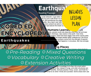
Earthquakes Reading Comprehension Passage - Cored Ed Encyclopedia
ELA, Reading Comprehension, Reading, Science, Technology, Social Studies, Earth and Environmental Sciences, Geography, Pre-Reading, Language Development, Grade 2, 3, 4, 5, Worksheets & Printables, Worksheets, Teacher Tools, Centers, Activities, Writing Prompts, Assessments, Quizzes and Tests, Quizzes, Lesson Plans
This earthquakes reading comprehension with lesson plan includes: Visualization (on the front cover) Start your lesson by taking a minute to think and share something about the topic. Read the script aloud (slowly), perhaps prepare some music or sound effects. Student close their eyes and let their imaginations wander. Students open their eyes, read the question aloud and give them a few minutes to complete. Ask a few students to share or keep answers until the end to compare with what they learn in the passage. Quick pause—thousands of Cored Education products are included with your TeachSimple membership. Download links and encyclopedia index available here. Pre-Reading Trivia Students will write down one thing they already know about the subject and then read five more facts and discuss. These facts are fun, and the students will enjoy learning about the subject before reading more. Give 1 minute for students to write what they already know (no pressure—best guess is fine). Read the five facts together. After each fact, do ask a student for their opinion, was it surprising? Set a purpose by asking students to highlight/underline one fact they want to learn more about during the reading. Reading Passage The text is a high-interest reading passage with set paragraphs, roughly three to four paragraphs long. It contains a variety of themes about the topic, anywhere from history to technology. The passage is between 250 and 350 words in length. First, ask students to look at the headings and see what they’ll learn about today. What do they know about the topic/heading? First read options: Teacher read-aloud (best for support). Partner reading (paragraph by paragraph). While reading, students underline important details, and vocabulary words they think may come up in the questions section. Mixed Questions The first question page contains four multiple-choice questions, each with a choice of four answers, and three written response questions that require a sentence or two from the student. Students complete the mcqs first independently, then review quickly as a class. For the 3 written responses, try to get students giving the answer with some form of evidence: “I think ___ because the text says ___.” If students get stuck, send them back to check the passage. Vocabulary Questions Practice seven key words from the text in this section across two activities. First section is scrambled words where students will unscramble three words given a clue for each. The second section is a word to meaning matching activity. Before starting, have some students read out words they underlined in the passage. Ask students to say the word and read aloud the sentence(s) around each word. Ask students to do scrambled words and the matching exercise in pairs then go through answers as a class. For the scrambled spelling task, get four pairs to come up to the board and write the words for extra practice with the other student reading out the clue. For the matching task, prompt students to give full sentences: “I matched ___ with ___ because ___.” Creative Writing In this question, the student will be required to write a five to eight sentence paragraph on a question related to the topic. Before starting, ask students write down 3 key ideas they are going to include in their piece. Ask students for ideas to share around the class to help those struggling. Pro writing expectations: 5–8 sentences At least 2 facts or details from the passage At least 2 vocabulary words from the previous page Students read their paragraphs while classmates listen for facts and vocabulary words. Extension Activities This page is optional for fast finishers or to take home. There are several activities, each one requiring a different skill. Do some, do none, do all, completely optional - but you will feel reassured knowing every possibility is planned for. Includes summary writting question and additional facts. Answer Key There are answers for the multiple-choice questions, written response questions have sample answers, vocabulary answers and if there is a summary question then a sample summary will be provided as well. Lesson Plan Included Customized lesson plan for this lesson is included. Lesson Snapshot Title: Earthquakes Genre: Nonfiction (Informational Text) Subject: Science (Earth Science) / Reading (Informational Text) Primary Topic: How earthquakes happen and how people prepare Estimated Guided Reading Level (A–Z): N What This Lesson Teaches Best Explains what causes earthquakes : rocks can get stuck along a fault , pressure builds, and rocks suddenly slip. Builds understanding of earthquake vocabulary and concepts (fault, seismic waves, epicenter, focus, magnitude, intensity). Shows how scientists measure and describe earthquakes using seismometers and “magnitude” vs. “intensity.” Describes where quakes happen more often (where tectonic plates meet , including the Pacific Ocean’s Ring of Fire ) and what can follow ( aftershocks , possible tsunami ). Connects science to safety and preparedness , including “ Drop, Cover, and Hold On ,” retrofits, and warning systems. Learning Goals Students will be able to describe how pressure can build along a fault and lead to an earthquake. Students will be able to identify and explain the meanings of key earthquake terms used in the text. Students will be able to explain how seismic waves relate to ground shaking and the epicenter . Students will be able to compare “magnitude” and “intensity” as described in the passage. Students will be able to describe why some places experience more earthquakes than others (plate boundaries, Ring of Fire). Students will be able to list actions people and communities take to be ready for earthquakes. Key Vocabulary From the Text fault — a crack where rocks can slip. seismic — related to shaking waves moving through Earth. epicenter — the spot above where the break happened. seismometers — tools that trace wiggly lines when waves pass. aftershocks — smaller earthquakes that can follow a big quake. FULL CATALOG OF DOWNLOAD LINKS AND ENCYCLOPEDIA INDEX HERE
Author Cored Education
Rating
Tags Vocabulary, Reading Comprehension, Reading Passages, Lesson Plans, Ela Lesson Plans, Reading Comprehension Lesson Plans, Pre-reading, Science Lesson Plans, Geography, Earth Science

Country Study Presentation - Zambia - Geography - Africa
Social Studies, First Peoples (Native), Geography, History: African, History, Grade 7, 8, 9, 10, 11, 12, Teacher Tools, Presentations, Lesson Plans
Country Study Presentation - Zambia - Geography + Social Studies - Southern Africa Try this Teaching Resource on Zambia (Introductory Presentation Lesson - PDF Printable), designed for Geography + African History (Southern Africa) + Social Studies lessons. Suitable for Grades 7–12 (Middle school and High School students), this Introductory PDF Presentation offers a ready to use lesson that requires little to no preparation. Geography and Social Studies students will learn about Zambia ’s geography, history, culture, language and economy — making it perfect for classroom instruction, homeschooling, or online learning. 📘 Teachers can find the following topics in this Social Studies and Geograhy Teaching resource ✅ Greetings in Bemba ✅ Geography of Zambia (Southern Africa) – Key facts, borders, and an interactive Google Maps link to its location. ✅ Quick Facts – Population, capital city, currency and other essential details. ✅ Languages of Zambia : Bemba - introduction in the languages spoken + basic vocabuary ✅ History Overview – A concise summary of the most important events in the history of Zambia (Southern Africa) ✅ Geography & Environment – Details about the country’s land area, regions, and climate zones. ✅ Zambia's Economy – paragraph on Zambia ’s industries, exports, currency and economic strengths (Southern Africa) ✅ Lusaka – Explore the capital city of Zambia , its famous landmarks, and cultural highlights. ✅ Other Major Cities – A map showcasing additional important cities in Zambia (Southern Africa) ✅ Zambia's Culture & Traditions – A look at the customs and values that define Zambia (Southern Africa) ✅ Farewell in Bemba 🎯 This Geography and Social Studies Teaching Resource can be perfect for: Geography classes Social Studies lessons World cultures units Country study projects Substitute teacher toolbox Digital learning In-class or online teaching 📂 Resource Details Format: PDF Digital Presentation Grade Levels: 7th–12th Grade (Middle School and High School students) Learning with Alan is an educational resource store created to help teachers, educators, and tutors reach their teaching goals while building a fun, engaging, and stimulating learning environment . Because learning should always be meaningful—and fun! 🎓✨ If you want to browse more of my Teaching Resources, click here Learning with Alan!!
Author Learning with Alan
Rating
Tags Country Study, Social Studies, Geography, Africa, Zambia, Lesson, Introduction, History, Southern Africa, African

Passport Series: Asia
Social Studies, Geography, Grade 5, 6, 7, 8, 9, Teacher Tools, Lesson Plans
The Passport Series: Asia The Passport Series: Asia is a comprehensive teaching resource aimed to arouse world exploration in students. The curriculum encompasses eight detailed study books, covering more than 50 countries across all seven continents, from North America to Australia. This dynamic approach caters specifically to middle and high school levels, making it an ideal fit for public and homeschool educators teaching Social Studies with a heavy emphasis on Geography. This meticulously crafted unit incorporates deep studies into each country's history, culture, language, cuisine and much more. The educational journey starts with Asia as the starting destination. These insights about Asian countries go far beyond general trivia; enabling learners to dive into different geographic regions from a position of familiarity rather forum distant observers. Features of The Passport Series: Cross-curricular reinforcements: Includes reproducible pages that are filled with content that reinforces knowledge across different areas of study. Cultural immersion: Provides not just information but also cultural immersion by including recipes and games related to the locale being studied. Educational flexibility: Offers unique ideas for extension activities which can be used in whole group instructions or small group learning - even as homework assignments! A distinguishing aspect of the Passport Series: Asia is its gorgeous illustrations and photographs. These visual aids give students a tangible sense of each location they're studying – almost like they're travelling half-way around the globe! If you're an educator aiming at showcasing various cultures and landscapes worldwide - The Passport Series: Asia is one series you won't want your pupils to miss! Allowing them to become educated travellers who appreciate global diversity!
Author Classroom Complete Press
Tags PDF

Europe: Movement Gr. 5-8
Social Studies, Geography, Grade 5, 6, 7, 8, Teacher Tools, Lesson Plans
The Europe: Movement Gr. 5-8 The Europe: Movement Gr. 5-8 is a resourceful teaching tool formulated to help educators curate an insightful perspective into the geographical and cultural facets of Europe for students. Introduction This tool chiefly drives learners in Grades 5 through 8 to gain deep understanding about various ecosystems existing within the geographical boundary of Europe via realistic climate maps A Learning Journey Helps in developing orientation skills among learners by enabling them to recognize numerous European cities located in both western and eastern hemispheres. Makes use of a tangible research approach that sparks curiosity among learners, stimulating them to gather information first-hand, such as through study cases about Thames river. Foreshadows historical calamities like the accident in Chernobyl, placing emphasis on its severe environmental repercussions. Braids key transportational factors—like trains—into lessons, emphasizing their pivotal functionalities across European territories. Treading Comparative Paths Juxtaposing two different physical spaces—like Provence and Scottish Highlands—to understand their contrasting characteristics better with tools such as Venn diagrams form one important highlight here. Equipped with maps dotted with identification tasks (for example locating Prime Meridian on an outline map), makes student learning experience all the more immersive. Dive Into Engaging Content! The downloadable PDF format carries along a myriad set of intriguing exercises spread across precisely 41-pages . From simple crossword puzzles, word hunts to unconventional quizzes - these attempt at polishing comprehension levels while making student learning interactive and fun alongside. This exemplar study module presents itself as a perfect fit for state standards, in particular for those specializing in Social Studies at Middle School level, focusing mainly on Geography under Lesson Plans category. Whether it's a big classroom gathering chalking out instructions or small clusters of peer groups collaborating for project-based tasks or even simple homework assignments – this versatile resource enables effective teaching methodologies while accelerating student involvement throughout. Above All The Europe: Movement Gr. 5-8, aligned perfectly with state standards and suitable for grades 5 to 8, serves as an excellent medium of deepening students’ perspective about Europe's geography, ecosystems and many other constituents keeping itself within the realm of the Five Themes of Geography.
Author Classroom Complete Press
Tags Transportation, Europe, Geography, Reading Passage, Comprehension Quiz

Plants of Antarctica | Antartica Unit Study | Geography Bundle
Social Studies, Geography, Grade 3, 4, 5, 6, 7, Lesson Plans, Teacher Tools
Explore the wonders of Antarctica with our educational product featuring 10 meticulously curated plant cards designed for an enriching learning experience. These cards serve as valuable resources for continent study boxes, centers , or comprehensive unit studies on Antarctica. Each card is a gateway to discovery, presenting a double-sided design for maximum engagement. The front showcases a realistic photograph accompanied by fundamental information, offering a visual and informative introduction to Antarctic plant life. Flip the card, and you'll find a mini-article on the back, delving into intriguing and unique details about each plant, fostering a deeper understanding of the Antarctic ecosystem. To enhance the educational journey, we provide a plant match worksheet and a plant report template at the end of the packet. These resources empower students to consolidate their knowledge through reports, summaries, or even oral presentations. The flexibility of this product extends to geography centers , where students can immerse themselves in the diverse flora of Antarctica or kickstart plant reports. Included in this comprehensive package are dual sets of cards, catering to both the metric and imperial measurement systems. Additionally, an article titled "Can Plants Even Grow in Antarctica?" sparks curiosity, accompanied by thought-provoking questions that encourage critical thinking. As a bonus, mini labeled photos of the plants are provided for placement around a classroom map of Antarctica, fostering a visually immersive learning environment. Whether you choose to print, laminate, bind, or use a book ring, this product is designed for reuse, ensuring a lasting impact on your educational endeavors. Unearth the hidden botanical treasures of Antarctica with this educational resource, ideal for sparking curiosity and facilitating in-depth exploration. What You Get: - 10 double sided plant information cards using the metric measurement system - 10 double sided plant information cards using the imperial measurement system - "Can Plants Even Grow in Antarctica?" article and questions - Mini labeled photos of plants to put around map of Antarctica - Plant match worksheet - Plant report template Want More Antarctica Study Resources?: - Continent of Antarctica: Brochure and Activities - Plants of Antarctica: Informational Cards - Animals of Antarctica: Informational Cards - Map work for Antarctica - Postcards for Antarctica: Landmarks and Landforms - Antarctica Unit Test *I have resources like this for every continent. So make sure to check them out if your'e trying to put together a comprehensive geography study! Check out other resources from my store: Simply Schoolgirl! I can be contacted for questions and concerns at simplyschoolgirl1@gmail.com
Author Simply Schoolgirl
Tags Antartica, Social Studies Lesson, Matching Worksheet, Report Template, Moss, Lichen, Plant, Fungi
All About The Pyramids | Geographical Wonders Video Lesson
Social Studies, Geography, Not Grade Specific, Lesson Plans, Teacher Tools
Introducing: All About The Pyramids | Geographical Wonders Video Lesson All About The Pyramids | Geographical Wonders Video Lesson, a 10-minute animated geography module, delves into the world of ancient marvels. This resource serves multi-grade level educators teaching Social Studies with a focus on geography. It unveils intriguing facets of these historical formations in an engaging manner. Video Lesson Format and Application The video lesson is presented in an easily comprehensible MP4 format making its application suitable for numerous educational settings. You can use it as part of small group studies or as supplemental material towards whole-group instruction. Furthermore, it fits perfectly for homework assignments - allowing students to delve deeper at their own pace. Promotes active learning Ensures student engagement Fosters appreciation for historical landmarks known the world over This makes it a valuable addition to any teaching regimen - whether you are homeschooling or are a public school teacher aiming to educate students about fascinating global features like pyramids. Beyond Traditional Classroom Boundaries You can also use this geographical wonders video lesson during flipped classroom days - proving its usefulness beyond traditional classroom boundaries. Plus, before exams or quizzes about essential geographical sites globally, this tool provides students with compelling visual content—ultimately solidifying their understanding levels around this facet of geography. A Fascinating Interaction between Education and Entertainment All About The Pyramids | Geographical Wonders Video Lesson stands sturdy as a captivating balance between education and entertainment – fostering enriched learning experiences while keeping interest levels soaring high!
Author Educational Voice
Tags Pyramids, Geographical Wonders, Ancient Marvels, Landforms, Landscapes
Europe: Place Gr. 5-8
Social Studies, Geography, Grade 5, 6, 7, 8, Teacher Tools, Lesson Plans
Europe: Place Gr. 5-8 is an invaluable teaching resource targeting educators across diverse setups, including public school teachers and homeschoolers. This comprehensive learning tool equips students from Grade 5 to Grade 8 with in-depth knowledge about Europe, one of the cradles of civilization. Educators seeking a versatile product will appreciate this lesson plan's flexibility and adaptability. Whether administered for large groups within classroom settings or smaller group discussions at home, each learner stands to profoundly benefit from this resource's distinctive approach. Further, its nature as a printable teaching module implies it can even serve as homework material for additional reinforcement in individualized learning. The Module Includes: "Place Gr. 5-8": A chapter focusing on advancing understanding of Europe's dynamic ecosystems through detailed climate maps. A sense of cardinal direction pursued via engaging exercises requiring learners to identify European cities located both within western and eastern hemispheres alike. Incorporation of practical case studies like the Thames river encourages independent research skills in young learners. Topical environmental education features relevant discussions on events like Chernobyl's mishap highlight humanity’s impact on environments over time. The module also covers aspects related to transport patterns across Europe with special attention devoted towards phenomena such as prevalent train use. Through integrated activities utilizing recognized tools such as Venn diagrams where physical attributes of regions like Provence and Scottish highlands are contrastively analyzed. Aditional Resources ate Also Included: Supplementary maps bring abstract concepts into tangible comprehension levels Crossword puzzles incorporate fun into learning while simultaneously enhancing vocabulary acquisition Word searches facilitate theme retention long-term Comprehension quizzes backed with answer keys maintain constant progress checks for teachers' convenience in tracking each student’s performance trajectory consistently. All these novel features come consolidated conveniently into one PDF file containing 42 readily-printable pages tailored to cover social studies, specifically focusing on geography. Include Europe: Place Gr. 5-8 into your teaching session and watch as learners navigate European facts and concepts with newfound confidence.
Author Classroom Complete Press
Tags Social Studies, Geography, Crossword Puzzle, European, Assessments

Deserts Reading Comprehension Passage - Cored Ed Encyclopedia
ELA, Language Development, Reading Comprehension, Reading, Life Sciences, Science, Earth and Environmental Sciences, Technology, Geography, Social Studies, Grade 2, 3, 4, 5, Worksheets & Printables, Worksheets, Teacher Tools, Centers, Activities, Writing Prompts, Assessments, Quizzes and Tests, Quizzes, Lesson Plans
This deserts reading comprehension with lesson plan includes: Visualization (on the front cover) Start your lesson by taking a minute to think and share something about the topic. Read the script aloud (slowly), perhaps prepare some music or sound effects. Student close their eyes and let their imaginations wander. Students open their eyes, read the question aloud and give them a few minutes to complete. Ask a few students to share or keep answers until the end to compare with what they learn in the passage. COMPANION VIDEO NOW AVAILABLE (EMBEDDED AFTER PREVIEW PICTURES IN PRODUCT DESCRIPTION) Quick pause—thousands of Cored Education products are included with your TeachSimple membership. Download links and encyclopedia index available here. Pre-Reading Trivia Students will write down one thing they already know about the subject and then read five more facts and discuss. These facts are fun, and the students will enjoy learning about the subject before reading more. Give 1 minute for students to write what they already know (no pressure—best guess is fine). Read the five facts together. After each fact, do ask a student for their opinion, was it surprising? Set a purpose by asking students to highlight/underline one fact they want to learn more about during the reading. Reading Passage The text is a high-interest reading passage with set paragraphs, roughly three to four paragraphs long. It contains a variety of themes about the topic, anywhere from history to technology. The passage is between 250 and 350 words in length. First, ask students to look at the headings and see what they’ll learn about today. What do they know about the topic/heading? First read options: Teacher read-aloud (best for support). Partner reading (paragraph by paragraph). While reading, students underline important details, and vocabulary words they think may come up in the questions section. Mixed Questions The first question page contains four multiple-choice questions, each with a choice of four answers, and three written response questions that require a sentence or two from the student. Students complete the mcqs first independently, then review quickly as a class. For the 3 written responses, try to get students giving the answer with some form of evidence: “I think ___ because the text says ___.” If students get stuck, send them back to check the passage. Vocabulary Questions Practice seven key words from the text in this section across two activities. First section is scrambled words where students will unscramble three words given a clue for each. The second section is a word to meaning matching activity. Before starting, have some students read out words they underlined in the passage. Ask students to say the word and read aloud the sentence(s) around each word. Ask students to do scrambled words and the matching exercise in pairs then go through answers as a class. For the scrambled spelling task, get four pairs to come up to the board and write the words for extra practice with the other student reading out the clue. For the matching task, prompt students to give full sentences: “I matched ___ with ___ because ___.” Creative Writing In this question, the student will be required to write a five to eight sentence paragraph on a question related to the topic. Before starting, ask students write down 3 key ideas they are going to include in their piece. Ask students for ideas to share around the class to help those struggling. Pro writing expectations: 5–8 sentences At least 2 facts or details from the passage At least 2 vocabulary words from the previous page Students read their paragraphs while classmates listen for facts and vocabulary words. Extension Activities This page is optional for fast finishers or to take home. There are several activities, each one requiring a different skill. Do some, do none, do all, completely optional - but you will feel reassured knowing every possibility is planned for. Includes summary writting question and additional facts. Answer Key There are answers for the multiple-choice questions, written response questions have sample answers, vocabulary answers and if there is a summary question then a sample summary will be provided as well. Lesson Plan Included Customized lesson plan for this lesson is included. Lesson Snapshot Title: Deserts Genre: Nonfiction (informational text with headings) Subject: Earth Science / Life Science / Reading (Informational Text) Primary Topic: Deserts are defined by dryness and survival tricks Estimated Guided Reading Level (A–Z): P What This Lesson Teaches Best Clarifies the key definition: a desert is defined by dryness , not by sand. Explains desert rainfall patterns (often under about 10 inches/25 centimeters per year, sometimes arriving in a quick burst). Builds understanding that deserts can be hot or cold, including Antarctica as the biggest desert on Earth in the passage. Highlights plant and animal adaptations (cacti storing water; plants keeping/curling leaves; rodents getting moisture from seeds; animals hiding in burrows by day and moving at night). Introduces how scientists study deserts today (weather stations, soil samples, satellite pictures) and explains “rain shadow.” Learning Goals Students will explain how the passage defines a desert. Students will describe what the passage says about how much rain many deserts get in a year. Students will identify at least two survival tricks of desert plants from the text. Students will identify at least two survival tricks of desert animals from the text. Students will explain what a “rain shadow” is, using the passage’s description. Students will describe ways deserts are studied today, based on the text. Key Vocabulary From the Text dryness — having very little water or rain. sparse — not many; spread out. burrows — holes in the ground where animals hide. satellite — something in space that takes pictures from above. dunes — hills of sand shaped by wind. FULL CATALOG OF DOWNLOAD LINKS AND ENCYCLOPEDIA INDEX HERE
Author Cored Education
Rating
Tags Vocabulary, Reading Comprehension, Reading Passages, Lesson Plans, Ela Lesson Plans, Reading Comprehension Lesson Plans, Pre-reading, Science Lesson Plans, Earth Science, Geography
Mapping Skills with Google Earth: Map Your Country
Social Studies, Geography, Common Core, Grade 3, 4, 5, Teacher Tools, Lesson Plans
Mapping Skills with Google Earth: Map Your Country - A Comprehensive Teaching Resource An exciting teaching resource that introduces students to map reading and geographical concepts. Designed for third to fifth-grade learners, it incorporates Google Earth™ as a key feature for interactive learning. Features: Map Elements Coverage: Offers exercises on essential components of maps including latitude, longitude lines, and global time zones exploration. Cultural Aspects: Introduces various geographical and cultural aspects through topographic and choropleth maps. North America's Geopolitical Divisions: Presents clear understanding of North America's divisions with emphasis on recognition of states and provinces. Aided by interactive features like map exercises, quizzes, puzzles, at the same time it provides curriculum -based knowledge dispersion making learning cohesive yet fun-filled. Truly,"A blending pot of theory & practice". Pedagogical Inclusion & Usage: Mapped towards meeting Common Core State Standards diligently based on Bloom's Taxonomy norms assures you with an effective delivery mechanism for intended learning outcomes. It serves varied purposes – group lessons, team activities or homework assignments. Note:The user-friendly PDF format makes this product compatible across different tech-platforms optimizing its distribution inside classrooms or home surroundings alike! Final Word - Immerse your learners into the adventurous journey through continents,cities,& oceans with the gem called "Mapping Skills with Google Earth: Map Your Country". .
Author Classroom Complete Press
Tags PDF