Bangladesh Map Resources


About This Product
Bangladesh Map Resources: An Educator's Practical Tool
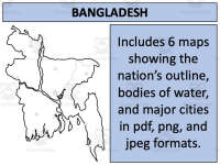
This resource consists of six distinct maps, available in pdf, jpeg, and png formats. This makes it usable across multiple platforms as per need. Each map showcases Bangladesh from a unique perspective:
Blank outlines for labeling exercises or tests.
Versions with bodies of water clearly marked for geographical studies.
Detailed maps highlighting major settlements for advanced studies.
Note: Some versions display Bangladesh both alone and alongside its neighboring countries to provide context. One standout feature of this teaching material is the permission to use these maps not only in your own classroom but also within your own educational products (as long as you follow provided instructions).
Suitability Across Grades
The content herein suits Social Studies classes among all age groups due to its versatile nature. From simple geographic outlines ideal for younger grades up through more detailed topographic details useful in an older student’s study - this tool covers it all!
Ease Access Across Devices
The resources are offered as zip file downloads that ease access across devices without any compromise on quality—a handy tool for effective lesson planning—both at school and home.
This Bangladesh Map Resources is ready to print and use!
0 Reviews
Check out these other great products