search
user.png
vertical menu

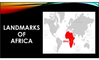
Landmarks and Landforms of Africa | Continent of Africa Unit Study | Geography Bundle

Landmarks and Landforms of Africa | Continent of Africa Unit Study | Geography Bundle preview
Landmarks and Landforms of Africa | Continent of Africa Unit Study | Geography Bundle preview 2
Landmarks and Landforms of Africa | Continent of Africa Unit Study | Geography Bundle preview 3
Landmarks and Landforms of Africa | Continent of Africa Unit Study | Geography Bundle preview 4

Look Inside · 10 pages

Africa postcard resource cover showing pyramid and Serengeti postcards plus sample photo and clue game cards
Cover of the Africa postcards and memory game resource
Resource instructions explain assembling and laminating postcards and attaching covers to memory game cards
Preparation and classroom-use instructions
Service project guidance describes supporting children in Uganda through sponsorship and school supplies
Service project opportunity accompanying the postcards
Metric System introduction asks teachers to choose cards using their classroom's preferred measurement system
Measurement-system notice before the metric postcards
Victoria Falls postcard front and back pair a waterfall photo with facts about the Zambezi River and mist
Victoria Falls postcard, metric version
Great Pyramid postcard front and back pair a Giza pyramids photo with facts about construction and chambers
Great Pyramid postcard, metric version
Great Sphinx postcard front and back pair its photo with facts about its lion body, human head, and limestone
Great Sphinx postcard from Giza, Egypt
Mount Kilimanjaro postcard front and back pair a mountain photo with facts about three volcanic cones and climbs
Mount Kilimanjaro postcard, metric version
Nile River postcard front and back pair a river photo from Uganda with facts about farming in ancient Egypt
Nile River postcard, metric version
Serengeti postcard front and back pair an elephant photo with facts about Tanzania's wildlife and migrations
Serengeti postcard, metric version
Attributes
Add To Collection
Add to collection Add to collection

About This Product

Enjoy 12 informative colorful postcards featuring famous landmarks and landforms found in Africa including Victoria Falls, The Great Pyramid, The Great Sphinx, Mount Kilimanjaro, Nile River, The Serengeti, Volcanoes National Park, Tabletop Mountain, Great Rift Valley, Namib Desert, Goree Island, and The Sahara Desert.. Each postcard is double sided with a beautiful photo on one side and a post-note on the other directed towards the students. Matching game with photos and clues to help students memorize and reinforce learning. Service opportunity included!


How To Use This:

Look through all the resources and decide which ones to use. Print the postcards double sided (or print and lightly glue). Laminate for re-use. Use these as resources to learn about countries, landmarks, or landforms. Use them to write reports, or give oral presentations. Color and cut out stamps to put in your "Passport" to show you've learned about that country! Play the "I have, Who has" game as review!


What You Get:

  • - 12 double-sided landmark and landform information cards using the metric system.

  • - 12 double-sided landmark and landform information cards using the imperial system.

  • - 24 memory game cards to play with your students, picture of each landmark on one card, clues about the landmark on the other.


Want More Africa Study Resources?:

*I have resources like this for every continent. So make sure to check them out if your'e trying to put together a comprehensive geography study!

Check out other resources from my store: Simply Schoolgirl!


I can be contacted for questions and concerns at simplyschoolgirl1@gmail.com

What's Included

1 zip file with:

-1 PDF with 38 ready to print pages

-Google Doc w/ product description

-Preview images

0 Reviews

Explore related searches