Physical Map of South America Unit Study




About This Product
Map Work for South America | Continent of South America Unit Study | Geography Bundle Description
The Map Work for South America | Continent of South America Unit Study | Geography Bundle is an extensive collection of resources aimed at educating students about the geography and distinct characteristics of this fascinating continent. This bundle includes a variety of engaging map work activities suitable for grades 3 to 7.
The primary focus is on project-based learning, motivating students to self-assemble their maps as they memorize the geographical details.
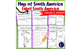
- A map-building guide coupled with a blank template fosters hands-on learning about countries' locations and terrain in the continent.
- A wide range of worksheets within this bundle deepen students’ understanding, such as "Labelling Countries Worksheet" along with its respective answer key.
- "Quick Facts - Half-sheet", an excellent tool prompting interactive classroom discussions while serving as enriching homework assignments too.
The resource set also includes memory-enhancement activities:
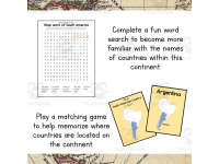
- A fun "South American Countries Word Search game".
- Innovative double-sided flashcards featuring 20 key locations—proven effective when teaching in groups.
To assist in illustrating geopolitical boundaries within the continent:
- Detailed political boundary outlines for every country are included, making it an invaluable visual aid during social studies classes. Note: Resources are not solely paper-based; they accompany as digital copies both as PDFs and Google Docs adding flexibility regarding sharing or printing tasks based on individual needs in classrooms or homeschool settings.
Suitability and Usage
Leverage these resources during any comprehensive geographical study involving active participation across diverse learning styles. Whether for whole group discussions or small group projects, the bundle can be extremely beneficial.Don’t forget to explore similar bundles based on other continents for a more globally-focused geography education!
What's Included
1 zip file with:
-1 PDF with 18 ready to print pages
-Google Doc w/ product description
-Preview images
Resource Tags
0 Reviews
Check out these other great products