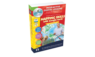
Mapping Skills with Google Earth - Digital Lesson Plan Gr. 6-8 - FLASH-PC


About This Product
Mapping Skills with Google Earth - Digital Lesson Plan Gr. 6-8 - FLASH-PC
Deepen the understanding of topographical comprehension with the Mapping Skills with Google Earth, an immersive and interactive digital lesson plan designed for sixth to eighth-grade students. This resource transcends basic map reading education through its comprehensive 80 screen-page digital format that's both stimulating and instructive.
The Progressive Learning Journey
The beauty of this tool lies in its progression. The educational journey starts from studying common weather and population maps to exploration tasks involving detailed mapping of their country, state or province, including capitals, cultural landmarks, geographical features, and beyond. It broadens into mapping their continent and eventually surveys the global theme.
This versatile platform is developed to be compatible with any brand of Interactive Whiteboard.
- Instructing a whole group
- Supplementary material for small groups
- A homework assignment – amplifying student engagement at every level.
Motivating Screen-Based Learning
Each ready-made screen offers an enriching blend of reading passages followed by pre-and post-read interactive activities designed to solidify knowledge while keeping learners motivated. The element that takes it a notch higher is a component leveraging technology via Google Earth™ which enhances spatial understanding through virtual navigation.
A Study Aid Extraordinaire!
Incorporated within are:
- Test prep materials: Followed by memory match games seeking reinforcement via repetition learning techniques along with crossword puzzles & word search activities aimed at improving vocabulary related to geography thereby making it ideal for studying Social Studies especially Geography subtopic in detail.
- Dual language support: The availability in English & Spanish Text-to-Speech adds versatility supporting ESL students as well as those who benefit from auditory learning - all alongside visual representation.
- Quizzes: Comprehension quizzes structured into design enhancing evaluative capability for teachers to gauge student comprehension periodically throughout usage.
In conclusion, all content provided links seamlessly back towards the State Standards, and each aspect is designed considering Bloom's Taxonomy.
A Conclusive Note!
This digital lesson plan navigates detailed mapping skills development using the allure of Google Earth™ interactive technology. Consequently, it fosters an originative, tech-savvy educational resource for grades 6-8.
What's Included
Contains 1 Product File
Resource Tags
0 Reviews
Check out these other great products