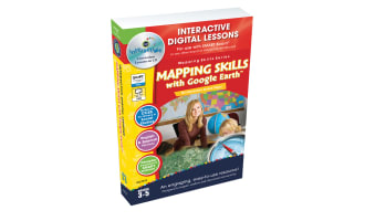
Geographical Features Map Skills, Grades 3-5


About This Product
Mapping Skills with Google Earth Gr. 3-5: Comprehensive Map Reading Resource
Mapping Skills with Google Earth Gr. 3-5 is a valuable tool designed for students from grades 3 to 5 that aims to enhance their map reading abilities. Tailor-made for educators who wish to extend their students' respective understandings of maps, this resource makes learning engaging and interesting.
Aiding Navigation Skills Development
This resource lends itself seamlessly in various learning environments and is effective, irrespective of the group size or setup, thus serving as requisite teaching assistance in modern educational setups that range from traditional classrooms to digital homeschooling facilities.
Anchored on State Standards and Bloom’s Taxonomy
The contents of the resource ensure alignment with State Standards while being written according to Bloom's Taxonomy—a dual-edge approach aimed at accomplishing enhanced student engagement alongside deeper knowledge accumulation about geography-related topics.
- Understanding latitude and longitude:
- Practical Use Cases:
- Tackling Climate Variations:
Perts pertaining to global climatic disparities get addressed via temperature-differential labeling methods practiced exclusively as a part of world mapping activities presented within this resource—an augmentation towards general environmental awareness among young minds today influenced by prevalent global warming phenomena worldwide.
In-depth presentations drawn from global perspectives involving latitude-longitude understanding via Google Earth™ imagery makes this material unique while ensuring critical comprehension about fundamental geographical concepts among its learners.
The application-driven method empowers active learning by translating theory-based map fundamentals into real-world scenarios thereby cultivating spatial awareness among students concerning diverse cultural influences on urban-rural dichotomies across the globe.
Additional Engaging Content
The resource also includes an array of learning supplements like crossword puzzles, word search games which serve both as fun learning tools and valuable means for periodic knowledge review prior to examinations.
Easy Accessibility
Presented in a universally accessible PDF format, Mapping Skills with Google Earth Gr. 3-5, stands as a compact yet potent addition to any teaching repertoire determined at extending map reading abilities among students today!
What's Included
Contains 1 Product File
Resource Tags
0 Reviews
Check out these other great products