Mauritius Map Resources


About This Product
Mauritius Map Resources
This Mauritius Map Resources is an essential teaching tool, our product is primarily aimed at educators in the public school sector as well as homeschoolers. The tool enhances a geography-focused lesson or project.
Key Features:
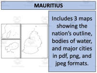
Includes three different map formats—pdf, jpeg, and png catering to various teaching styles or digital platforms.
Features blank outlines ideal for student drawings., thereby improving their motor skills while learning about Mauritius's geographical landscape.
Showcases bodies of water such as lakes, rivers and ocean surrounding Mauritius along with major settlements represented with marked points and named appropriately.
Complement your unit on Mauritius with these maps!
This interactive resource allows in-depth geographical understanding of Mauritius - a more engaging alternative compared to traditional reading or online videos.
Our non-grade-specific Mauritius Map Resources, tailored for Social Studies – particularly Geography across all grade levels is neatly organized into zip files for easy download.
Pave way for an engaging learning journey with our Mauritius Map Resources.
This Mauritius Map Resources is a ready to print and use resource which will save you time and help expand your student's knowledge!
For more maps and other resources to use in your Social Studies lessons, visit my store here!
Resource Tags
0 Reviews
Check out these other great products