Worldle Country of the Day – Geography Routine


- Grades
- Grades 3–7, Elementary, Middle School
- Pages
- 5
- File type
- Preparation
- Print ready


- Subject
- Social Studies, Geography
- Topic
- worldle, world geography
- Resource types
- Teacher Tools, Graphic Organizers
- Preparation
- Print ready
About this resource
What's inside this resource
Build world geography into a daily classroom routine with a reusable Country of the Day log for grades 3–6. Each day, students write the country and its continent, star it on a printed world map, decide whether it lies north or south of the equator, and name the closest ocean. They sketch the flag, explain what one color or symbol stands for, and say what the country's outline reminds them of.
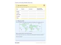
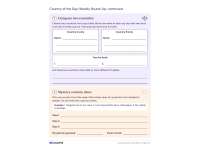
The second side of the daily log covers the capital city, a famous place, a food, an animal and how to say hello in a language spoken there. Students then add one surprising fact with its source, decide whether the country is worth a visit and why, and end with a question about the country. On Fridays, a two-page weekly round-up has them list the week's countries, number them on a map, compare two countries in an organizer, and write three mystery-country clues for a partner to guess.
The warm-up, where students guess the country from its outline alone, works much like a round of Worldle.
- Teacher guide: a 10-minute routine plan, a complete model entry for Peru, notes on what answers to accept and a class tally by continent
- Five pages: a two-page daily log and a two-page round-up, each designed to print back to back, plus the teacher guide
- Ready to print: color and grayscale printables
Related resources
More resources teachers may find useful
24 related resources were found using this product's title, contributor, categories and tags.


In the classroom
Teaching tips & learning objectives

Learning objectives
Locate a country on a world map and place it by continent and by its position relative to the equator
Find a capital, landmark, food, animal and greeting for a country using a reference source
Choose a surprising fact and record where it came from

Teaching tips
Pick the country and one kid-friendly source, such as an atlas, before class, as the teacher guide recommends
Open with the one-minute warm-up: show only the country's outline or give three clues and let students guess
Print pages 1–2 back to back as the daily sheet and save pages 3–4 for the Friday round-up

Skills covered
Map reading: students star each country on a world map and judge whether it lies north or south of the equator.
Country research: students record a capital, a famous place, a food, an animal and a greeting from the day's source.
Citing a source: each surprising fact is paired with the place the student found it.
Good to know
Questions teachers ask about this resource
How long does the daily routine take?
About 10 minutes: a one-minute guessing warm-up, seven minutes to fill in the log, and two minutes for a few students to read a surprising fact and its source.
Which countries can students research?
Any country works. The teacher picks the country of the day, and the teacher guide explains how to judge trickier answers, such as countries the equator crosses or countries with more than one capital.
What does the Friday round-up do with the daily logs?
Students look back over the week's logs to fill in a five-day table, number each country on a map, find the two that look farthest apart, compare two countries and write mystery clues for a partner.

No reviews yet
Downloaded this resource? Tell other teachers how it went.
Resource details
Concepts & topics
Core concepts
 Core concepts
world geography
countries
continents
map skills
equator
capitals
 Topics
Explore more
Categories this resource belongs to
Explore related searches
More to explore
You may also like