2,799 products added recently
Page 631 - Newest Teaching Resources

Nonfiction Reading comprehension
ELA, Reading, Reading Comprehension, Grade 1, 2, 3, 4, Activities
This under-the-sea reading comprehension contains 5 nonfiction reading passages. Each passage is presented four times in different complexities; starting from a simple version of the passage using multiple choice questions (picture-based) and moving on to a more complex passage that uses written questions. All questions to the passages test the student's comprehension of the passage through various questions. The objective of this activity is to help students practice their reading skills as well as their comprehension skills by using these short nonfiction passages. The teacher will have to: * Choose the level of comprehension the student can best complete. * Print out a worksheet for the relevant student. The student will have to: * Read the relevant comprehension * Answer the questions to the best of their abilities. Suggestion: * The passage can be accompanied as an activity while learning about nonfiction. * These passages can be used as a guided reading activity. These passages are best suited for a variety of age groups depending on reading level. However can be used in Grades 1, 2, 3 and 4. The best format this activity can be used in is as a printed-out worksheet. There is an answer sheet provided. Sea creatures included: Sea turtles Orca whales Dolphins Starfish Jellyfish If you are looking for lessons to accompany this exercise, find the link below to our under-the-sea nonfiction lessons, which are great to use as an introduction lesson or as a recap lesson as they are short and sweet. There are 23 pages. Nonfiction lessons: Nonfiction captions and labels Nonfiction Glossary Nonfiction table of contents Nonfiction title Nonfiction title page Nonfiction index Use: You are free to use and modify the material. Non-commercial use only You may not resell the material.
Author Ezee 101
Tags Nonfiction, Reading, Comprehention, Passages, Under The Sea

Carbohydrates and Lipids – 5E Lesson Bundle
Science, Life Sciences, Biology, Grade 7, 8, 9, 10, 11, 12, Teacher Tools, Lesson Plans
This 5E Lesson Bundle will cover everything you need to teach about Carbohydrates and Lipids. This lesson takes approximately 4-6 hours to complete and will be divided across multiple days. Students will consistently be engaged through scavenger hunt activities, learning videos, labs , and more. The teacher has the opportunity to assess their students with a quiz! This 5E Lesson Bundle will cover everything you need to teach about Carbohydrates and Lipids. This lesson takes approximately 4-6 hours to complete and will be divided across multiple days. Students will consistently be engaged through scavenger hunt activities, learning videos, labs , and more. The teacher has the opportunity to assess their students with a quiz! This 5E Lesson Bundle will cover everything you need to teach about Carbohydrates and Lipids. This lesson takes approximately 4-6 hours to complete and will be divided across multiple days. Students will consistently be engaged through scavenger hunt activities, learning videos, labs , and more. The teacher has the opportunity to assess their students with a quiz! This 5E Lesson Bundle will cover everything you need to teach about Carbohydrates and Lipids. This lesson takes approximately 4-6 hours to complete and will be divided across multiple days. Students will consistently be engaged through scavenger hunt activities, learning videos, labs , and more. The teacher has the opportunity to assess their students with a quiz!
Author Teach With Fergy
Tags Biology, Science, Lesson Plan, Lipids, Carbohydrates
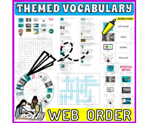
Vocabulary with Cards | Crossword Wordsearch Anagram WEB SHOP
Special Resources, ELA, Special Education Needs (SEN), Speech Therapy, Life Skills, Language Development, ESL, Writing, Handwriting, Spelling, Vocabulary, Not Grade Specific, Crosswords Puzzles, Worksheets, Worksheets & Printables
Word Games with Puzzles | Crossword Wordsearch Anagram | WEB SHOP . A resource designed especially for educators who value enhancing language skills in inventive ways . This pack provides a diverse set of word games and puzzles, all centered on the theme of WEB SHOP . Created to engage students meaningfully and rectify their knowledge about commonly used WEB SHOP-related words . Educators are provided with several varied activities: anagrams, copy words crossword, a blank writing board, lined writing board, word matching page, wheel chart and word search board . The chosen vocabulary words cater to useful WEB SHOP-related phrases, thus creating context-based learning . Versatility of the Resource . This versatile resource can be used in multiple ways . Kickstart the day with these activities as part of morning work routine or incorporate into teaching centers for active learning participation . Also use them as handouts or even as fun homework assignments which students would love to participate in! Beyond Classroom Applications . The application isn't just confined to the classroom alone; they are adaptable enough for therapy sessions too! Whether you are working on language development exercises like vocabulary enhancement or conversation prompts in group settings - these worksheets provide varied options that serve different purposes . You Receive : An easy-to-use package - an 24 pages pdf file combining worksheets and images ready for immediate use after printing! A non-grade specific resource- adaptable enough to be used by different grade levels conveniently! Note : These games not only concentrate on mastering language arts but also aid learners in understanding scientific and community concepts while assisting develop cognitive skills simultaneously! Conclusion : Enrich your teaching environment with this multi-faceted tool that aims not just at direct instruction but skill-building across various domains – a crucial aspect towards accomplishing holistic education! Included: 24 page PDF with word games worksheets and flash cards .
Author WORDS ASIDE
Tags Flash Cards, Esl, Thematic Vocabulary, Word Wall, Independent Work, Centers, Writing Expository, Community, Words Aside, Internet

Letter W Dot Painting
ELA, Creative Arts, Art, Language Development, Phonics, Kindergarten, Preschool, Activities, Crafts
Title: Letter W Dot Painting Embrace an innovative approach to learning letters and boosting fine motor skills with these letter W dot painting worksheets. With this comprehensive resource, educators can engage students effectively while nurturing creativity and early literacy development. This package contains a total of 9 pages dot painting worksheets 1 whale dotting page 1 watermelon dotting page 1 worm dotting page One capital letter dot painting page One lowercase letter dot painting page One dot painting page with both capital and lowercase letters Two worksheets for students to independently design their own letter W Ways to Use: Art or Literacy Center - The teacher can place these worksheets with paint and cotton swabs in the center for students to complete. Quiet Time Activity - For programs that utilize nap times, these dot painting worksheets are perfect for teachers to give to those who do not nap as an activity to complete quietly. Morning Work - These worksheets are perfect to put out as morning work for students to work on while classmates arrive to class. Sub Plans - These worksheets make great sub plans as they are easy to explain and implement in the classroom. The Skills Assessed by This Activity : Promotes letter recognition and letter sound knowledge. Fosters important skills like hand-eye coordination and stimulates creativity as they choose colors and patterns specific to their personalized artwork. Builds fine motor skills while maintaining a clean learning environment owing to its low-mess nature. The Process: The process behind these activities couldn't be easier! There’s no preparation needed on part of teachers—simply print out these pages from our PDF file type. Students will need to be provided paint of various colors and cotton swabs to complete each page. The letter W dot painting worksheets reinforce learning while nurturing imagination amongst early learners - creating joyous educational experiences right at your fingertips.
Author The Connett Connection
Tags Dot Painting, Fine Motor Skills, Creativity, Early Literacy, Q-tip Painting, Alphabet Worksheets, Letter W, Letter W Activities, Letter W Worksheets, Letter W Art

Vocabulary with Cards | Crossword Wordsearch Anagram WEATHER
Special Resources, ELA, Special Education Needs (SEN), Speech Therapy, Life Skills, Language Development, ESL, Writing, Handwriting, Spelling, Vocabulary, Science, Earth and Environmental Sciences, Earth Sciences, Physics, Not Grade Specific, Crosswords Puzzles, Worksheets, Worksheets & Printables
Word Games with Puzzles | Crossword Wordsearch Anagram | WEATHER . A resource designed especially for educators who value enhancing language skills in inventive ways . This pack provides a diverse set of word games and puzzles, all centered on the theme of WEATHER . Created to engage students meaningfully and rectify their knowledge about commonly used WEATHER-related words . Educators are provided with several varied activities: anagrams, copy words crossword, a blank writing board, lined writing board, word matching page, wheel chart and word search board . The chosen vocabulary words cater to useful WEATHER-related phrases, thus creating context-based learning . Versatility of the Resource . This versatile resource can be used in multiple ways . Kickstart the day with these activities as part of morning work routine or incorporate into teaching centers for active learning participation . Also use them as handouts or even as fun homework assignments which students would love to participate in! Beyond Classroom Applications . The application isn't just confined to the classroom alone; they are adaptable enough for therapy sessions too! Whether you are working on language development exercises like vocabulary enhancement or conversation prompts in group settings - these worksheets provide varied options that serve different purposes . You Receive : An easy-to-use package - an 24 pages pdf file combining worksheets and images ready for immediate use after printing! A non-grade specific resource- adaptable enough to be used by different grade levels conveniently! Note : These games not only concentrate on mastering language arts but also aid learners in understanding scientific and community concepts while assisting develop cognitive skills simultaneously! Conclusion : Enrich your teaching environment with this multi-faceted tool that aims not just at direct instruction but skill-building across various domains – a crucial aspect towards accomplishing holistic education! Included: 24 page PDF with word games worksheets and flash cards .
Author WORDS ASIDE
Tags Flash Cards, Esl, Thematic Vocabulary, Word Wall, Independent Work, Centers, Writing Expository, Community, Words Aside, Weather

Vocabulary with Cards | Crossword Wordsearch Anagram WATER ANIMALS
Special Resources, ELA, Special Education Needs (SEN), Speech Therapy, Life Skills, Language Development, ESL, Writing, Handwriting, Spelling, Vocabulary, Science, Life Sciences, Biology, Earth and Environmental Sciences, Earth Sciences, Not Grade Specific, Crosswords Puzzles, Worksheets, Worksheets & Printables
Vocabulary with Cards | Crossword Wordsearch Anagram WATER ANIMALS This 23-page PDF teaching resource helps students build vocabulary and knowledge about water animals through engaging word games and puzzles. Educators can use the varied activities - including anagrams, crosswords, word searches, and more - to reinforce language skills in fun new ways. The activities focus on water animal terminology and can be adapted for different grade levels. Use the games to kick off the morning, incorporate into centers , assign as homework, or bring into therapy sessions. The multi-purpose resource aims to boost vocabulary, reading, cognitive skills, and science understanding all at once.
Author WORDS ASIDE
Tags Flash Cards, Esl, Thematic Vocabulary, Word Wall, Independent Work, Centers, Writing Expository, Community, Words Aside, Water Animals
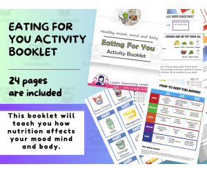
Healthy Mood, Mind, and Body Activity Booklet - Nutrition Activities
Life Studies, Grade 6, 7, 8, Workbooks, Worksheets & Printables
With this booklet you will learn all about how food and nutrition can affect your body. How food can affect your sleep. It will affect your mood, and can even affect your skin. Activities included in this activity booklet: Play games using some premade food cards that will help you learn which foods you should be eating and what items together will make a perfect meal. Do you know how much water you should drink each day? If not this activity booklet will help teach you how much to drink and what foods to eat to make your skin as healthy as possible. Learn more about sugar and how much sugar is in food you eat. This is a game that allows you to be a sugar detective to learn more about sugar and how its hidden in a lot of food we eat. You like family feud. If so this will be fun to play a nutrition feud game to learn more about what is healthy to eat and what is not. Play a game of Nutrition / exercise bingo to combine both things to make a better healthier you. If you have a Girl Scout troop this booklet will help your girls earn the Eating for You Cadette badge. It will fulfill all the requirements This is a PDF with 24 pages. It is a simple print and go activity booklet.
Author Leader Connecting Leaders
Tags Healthy , Mood, Mind, Body, Healthy Eating

Vocabulary with Cards | Crossword Wordsearch Anagram VEHICLES
Special Resources, ELA, Special Education Needs (SEN), Speech Therapy, Life Skills, Language Development, ESL, Writing, Handwriting, Spelling, Vocabulary, Not Grade Specific, Crosswords Puzzles, Worksheets, Worksheets & Printables
Vocabulary with Cards | Crossword Wordsearch Anagram VEHICLES This 24-page PDF teaching resource builds vocabulary and language skills using games and puzzles centered around vehicles. Educators can use the varied activities - including anagrams, crosswords, word searches, and more - to engage students meaningfully and expand their knowledge of common vehicle-related vocabulary. The chosen words create context-based learning focused on vehicle terminology. Teachers can incorporate these versatile activities into morning work, centers , assignments, and more. Beyond the classroom, they are adaptable for speech therapy and other sessions targeting language development, vocabulary building, and cognitive skills. With several game formats that serve different instructional purposes, this non-grade specific resource aims not just at direct instruction but at developing crucial skills across subjects. It provides an engaging, multi-faceted tool to enrich teaching and promote holistic education.
Author WORDS ASIDE
Tags Flash Cards, Esl, Thematic Vocabulary, Word Wall, Independent Work, Centers, Writing Expository, Community, Words Aside, Vehicles
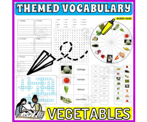
Vocabulary with Cards | Crossword Wordsearch Anagram VEGETABLES
Special Resources, ELA, Special Education Needs (SEN), Speech Therapy, Life Skills, Language Development, ESL, Writing, Handwriting, Spelling, Vocabulary, Not Grade Specific, Crosswords Puzzles, Worksheets, Worksheets & Printables
Vocabulary with Cards | Crossword Wordsearch Anagram VEGETABLES This 24-page PDF teaching resource helps students build vocabulary and literacy skills using engaging vegetable-themed word games and puzzles. Games include anagrams, crosswords, word searches, matching activities, and more. Educators can use these versatile activities in multiple ways - as morning work, center activities, homework, or in therapy sessions. The vocabulary focuses on useful vegetable-related words and phrases to promote context-based learning. Beyond building language arts skills, these activities also aid cognitive development and scientific/community concept understanding. The non-grade specific resource is adaptable across grade levels from elementary to high school. With this multi-faceted toolkit, enrich your teaching environment by accomplishing skill-building across various domains, not just direct vegetable-themed vocabulary instruction. This aids holistic student education focused on vocabulary, literacy, cognitive skills, and concept knowledge all in one engaging resource.
Author WORDS ASIDE
Tags Flash Cards, Esl, Thematic Vocabulary, Word Wall, Independent Work, Centers, Writing Expository, Community, Words Aside, Food

Vocabulary with Cards | Crossword Wordsearch Anagram UNIVERSITY
Special Resources, ELA, Special Education Needs (SEN), Speech Therapy, Life Skills, Language Development, ESL, Writing, Handwriting, Spelling, Vocabulary, Not Grade Specific, Crosswords Puzzles, Worksheets, Worksheets & Printables
Word Games with Puzzles | Crossword Wordsearch Anagram | UNIVERSITY . A resource designed especially for educators who value enhancing language skills in inventive ways . This pack provides a diverse set of word games and puzzles, all centered on the theme of UNIVERSITY . Created to engage students meaningfully and rectify their knowledge about commonly used UNIVERSITY-related words . Educators are provided with several varied activities: anagrams, copy words crossword, a blank writing board, lined writing board, word matching page, wheel chart and word search board . The chosen vocabulary words cater to useful UNIVERSITY-related phrases, thus creating context-based learning . Versatility of the Resource . This versatile resource can be used in multiple ways . Kickstart the day with these activities as part of morning work routine or incorporate into teaching centers for active learning participation . Also use them as handouts or even as fun homework assignments which students would love to participate in! Beyond Classroom Applications . The application isn't just confined to the classroom alone; they are adaptable enough for therapy sessions too! Whether you are working on language development exercises like vocabulary enhancement or conversation prompts in group settings - these worksheets provide varied options that serve different purposes . You Receive : An easy-to-use package - an 24 pages pdf file combining worksheets and images ready for immediate use after printing! A non-grade specific resource- adaptable enough to be used by different grade levels conveniently! Note : These games not only concentrate on mastering language arts but also aid learners in understanding scientific and community concepts while assisting develop cognitive skills simultaneously! Conclusion : Enrich your teaching environment with this multi-faceted tool that aims not just at direct instruction but skill-building across various domains – a crucial aspect towards accomplishing holistic education! Included: 24 page PDF with word games worksheets and flash cards .
Author WORDS ASIDE
Tags Flash Cards, Esl, Thematic Vocabulary, Word Wall, Independent Work, Centers, Writing Expository, Community, Words Aside, University
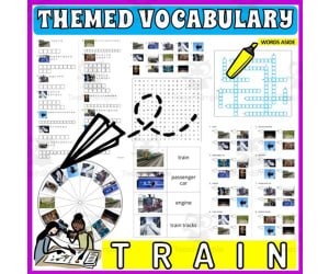
Vocabulary with Cards | Crossword Wordsearch Anagram TRAIN
Special Resources, ELA, Special Education Needs (SEN), Speech Therapy, Life Skills, Language Development, ESL, Writing, Handwriting, Spelling, Vocabulary, Not Grade Specific, Crosswords Puzzles, Worksheets, Worksheets & Printables
Word Games with Puzzles | Crossword Wordsearch Anagram | TRAIN . A resource designed especially for educators who value enhancing language skills in inventive ways . This pack provides a diverse set of word games and puzzles, all centered on the theme of TRAIN . Created to engage students meaningfully and rectify their knowledge about commonly used TRAIN-related words . Educators are provided with several varied activities: anagrams, copy words crossword, a blank writing board, lined writing board, word matching page, wheel chart and word search board . The chosen vocabulary words cater to useful TRAIN-related phrases, thus creating context-based learning . Versatility of the Resource . This versatile resource can be used in multiple ways . Kickstart the day with these activities as part of morning work routine or incorporate into teaching centers for active learning participation . Also use them as handouts or even as fun homework assignments which students would love to participate in! Beyond Classroom Applications . The application isn't just confined to the classroom alone; they are adaptable enough for therapy sessions too! Whether you are working on language development exercises like vocabulary enhancement or conversation prompts in group settings - these worksheets provide varied options that serve different purposes . You Receive : An easy-to-use package - an 24 pages pdf file combining worksheets and images ready for immediate use after printing! A non-grade specific resource- adaptable enough to be used by different grade levels conveniently! Note : These games not only concentrate on mastering language arts but also aid learners in understanding scientific and community concepts while assisting develop cognitive skills simultaneously! Conclusion : Enrich your teaching environment with this multi-faceted tool that aims not just at direct instruction but skill-building across various domains – a crucial aspect towards accomplishing holistic education! Included: 24 page PDF with word games worksheets and flash cards .
Author WORDS ASIDE
Tags Flash Cards, Esl, Thematic Vocabulary, Word Wall, Independent Work, Centers, Writing Expository, Community, Words Aside, Train

Vocabulary with Cards | Crossword Wordsearch Anagram TOOLS
Special Resources, ELA, Special Education Needs (SEN), Speech Therapy, Life Skills, Language Development, ESL, Writing, Handwriting, Spelling, Vocabulary, Not Grade Specific, Crosswords Puzzles, Worksheets, Worksheets & Printables
Word Games with Puzzles | Crossword Wordsearch Anagram | TOOLS . A resource designed especially for educators who value enhancing language skills in inventive ways . This pack provides a diverse set of word games and puzzles, all centered on the theme of TOOLS . Created to engage students meaningfully and rectify their knowledge about commonly used TOOLS-related words . Educators are provided with several varied activities: anagrams, copy words crossword, a blank writing board, lined writing board, word matching page, wheel chart and word search board . The chosen vocabulary words cater to useful TOOLS-related phrases, thus creating context-based learning . Versatility of the Resource . This versatile resource can be used in multiple ways . Kickstart the day with these activities as part of morning work routine or incorporate into teaching centers for active learning participation . Also use them as handouts or even as fun homework assignments which students would love to participate in! Beyond Classroom Applications . The application isn't just confined to the classroom alone; they are adaptable enough for therapy sessions too! Whether you are working on language development exercises like vocabulary enhancement or conversation prompts in group settings - these worksheets provide varied options that serve different purposes . You Receive : An easy-to-use package - an 24 pages pdf file combining worksheets and images ready for immediate use after printing! A non-grade specific resource- adaptable enough to be used by different grade levels conveniently! Note : These games not only concentrate on mastering language arts but also aid learners in understanding scientific and community concepts while assisting develop cognitive skills simultaneously! Conclusion : Enrich your teaching environment with this multi-faceted tool that aims not just at direct instruction but skill-building across various domains – a crucial aspect towards accomplishing holistic education! Included: 24 page PDF with word games worksheets and flash cards .
Author WORDS ASIDE
Tags Flash Cards, Esl, Thematic Vocabulary, Word Wall, Independent Work, Centers, Writing Expository, Community, Words Aside, Tools

Digital Technologies: For Years 1 - 2
Science, Technology, Grade 1, 2,
This book is an excellent resource for teaching an in-depth understanding of the Lower Primary Years Digital Technology curriculum, aimed at Year 1 and 2. It provides teaching information, ideas and resources for each curriculum area and activity pages to practise the concepts and skills: Understanding Technology and Digital Systems - This section explores how technology has evolved over time and helps the students reflect on the impact of technology in their everyday lives. It also explains simple digital systems and how they work, including computer parts, such as hardware and software. Data Collection and Pattern Recognition - This section explores data collection using digital systems and explains the importance of data and how it is sorted and displayed using patterns on a computer. Problem Solving with Algorithms - This section explores how digital systems are programmed with step-by-step instructions to help solve problems and do tasks such as display pictures on a screen. Applications of the Internet - In this final section, safe use of the internet and its role/functions is explored with a special focus on cyberbullying. Through an array of Digital Learning ideas and hands-on activities/worksheets as well as project ideas, the students gain a thorough understanding of Digital Technology covering the Year 1 and 2 Curriculum Standards. The tasks have cross-curricular links to subject areas of Mathematics, English, Visual Arts, Health, Design & Technology, Science and Social Studies. Authors: Elli Hayward & Alana Meuleman
Author Ready-Ed Publications
Tags Technology, Computing, Information Systems, Digital Systems, Computer Parts, Computer Software, Data Collection
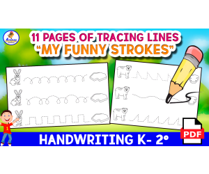
MY FUNNY STROKES - 11 Activity Page for Tracing Kids FREE
ELA, Writing, Handwriting, Kindergarten, Preschool, Grade 1, 2, Activities
1. Introduction As everyone knows, reviewing lines is a very beneficial activity for the development of our students' motor and cognitive skills. For this reason, today I have prepared this fascinating educational sheet that contains 11 beautiful pages for your students and/or children (in case you are a parent), to review these beautiful graphics, and at the same time entertain themselves, they They learn and improve their graphomotor skills. 2.Objective Some of the objectives of this fascinating worksheet are: - Develop fine motor skills: As you know, reviewing lines supports and helps children and/or students improve their hand-eye coordination and thus they will also strengthen the small muscles of their hands, which is very fundamental and essential for the development of their fine motor skills. Then, these types of skills are also an essential part so that they can later perform tasks such as writing, fastening buttons and even manipulating small objects in their daily life. - Improve coordination and control: As is known, the practice of reviewing lines contributes to the development of coordination between the non-dominant hand and the dominant hand, as well as the control of the pencil or crayon with which the child is writing. This set of skills is essential and crucial for the correct development of the writing process. -Encourage the improvement of concentration and attention: When your students and/or children follow the lines attentively, they improve their ability to pay attention and concentrate, which are essential skills for learning in the classroom as well as other daily activities in the classroom. daily life. - Stimulate the brain: When reviewing lines, different areas of the brain are being activated, including those related to motor coordination and visual perception. This will stimulate the connection between the brain and the hands, which will promote comprehensive brain development. - Preparation for writing: By reviewing lines, students are also preparing for formal writing. This will help students and/or children become familiar with the movement of the hand when holding a crayon or pencil, thus facilitating the transition to writing and then tracing letters and numbers. 3.Order, scheme and stages First, start with motivation, so that your students awaken their attention and interest in the programmed activity . Then enter the current token. 4.Grades or ages This sheet is aimed at children of 3, 4, 5, 6 and even 7 years old who are beginning their writing process and their first strokes. 5. Form of application This sheet can be applied individually and in groups. 6. Answer keys This game does not require answers. 7.Use text labels graphomotor skills, strokes, strokes and lines, lines, fine motor skills, stroke books, line books, first strokes, first lines, line and stroke activities. 8.Rules Specified above. 9.File types The archive is in PDF format. 10.Number of pages This document contains 11 pages.
Author EDITORIAL LAURA EDUCA
Tags Handwriting, Tracing, Strokes, Tracing Lines

Word Games with Puzzles | Crossword Wordsearch Anagram | TOOLS PAINTS
Special Resources, ELA, Special Education Needs (SEN), Speech Therapy, Life Skills, Language Development, ESL, Writing, Handwriting, Vocabulary, Not Grade Specific, Crosswords Puzzles, Worksheets, Worksheets & Printables
Word Games with Puzzles | Crossword Wordsearch Anagram | TOOLS PAINTS . Designed for usage across multiple grade levels, this teaching resource known as 'Word Games with Puzzles' seamlessly integrates essential vocabulary study with an engaging cleaning theme . This resource is incredibly versatile and adaptable to fit a variety of learning environments . It invites educators in public schools, or even those that teach in a homeschooling setting, to invigorate their Language Arts curriculum while catering to educational trends including Special Education Needs (SEN), Speech Therapy, ESL instruction, and Life Skills lessons . The primary contents of the package comprise : Anagrams centered around key terms relevant to TOOLS PAINTS such as screw, saw, brush etc. Copy words crossword puzzles that provide ample opportunity for learners to expand their vocabulary while indulging in interactive gameplay . The product also offers blank and lined writing boards perfect for handwriting practice . In addition, A word matching game ideal for reviewing new words picked up during the lesson or activity session . A wheel chart bundled within serves as an excellent tool for quick reference or review sessions conducted in small groups or one-on-one tutorial arrangements . A word search board challenges pupils further by letting them identify key keywords hidden amongst many irrelevant ones - offering both challenge and fun . Supplemental Materials include: Real photos along with whimsical illustrations serve dual purposes; they function not only as flashcards but also allow teachers to create visual folders thus adding versatility and creativity into everyday teaching circumstances . All elements included can double down both as part of your center 's resources library or can be handed out on individual bases hence serving multiple needs, from group-works to homework assignments . This brings you the valued flexibility everyone appreciates when it comes down classroom management - making this product extremely well-rounded. 11 page PDF file .
Author WORDS ASIDE
Tags Vocabulary Study, Interactive Gameplay, Handwriting Practice, Word Search, Visual Aids, Word Wall, Crossword, Esl, Independent Work, Words Aside

ESL Lesson Plan on Virtual Reality - Listening Comprejension + Writing
ELA, Language Development, ESL, Writing, Creative Writing, Reading, Reading Comprehension, Grade 7, 8, 9, 10, 11, 12, Teacher Tools, Lesson Plans
ESL Lesson Plan on Virtual Reality - Listening Comprejension + Writing Activity This Fantastic ESL EFL TESOL Virtual Reality Lesson (PDF Digital Lesson 14 slides) is Great to stimulate English Learning within Newcomers or any English Second Language Student. Ideal participants for this Activity are Foreign Languages Students at Middle School and early High School. This Product can also be Great for ESL Centers Abroad and ESL Tutors or private teachers. This ESL EFL TESOL Activity can be more than great for intermediate-advanced English as a Second or Foreign Language Students. This Stimulating ESL-EFL-TESOL Lesson Plan on Virtual Reality (13 slides + Answer Keys in the last slide) includes: a brief Introduction to Virtual Reality a Picture Description ESL EFL TESOL Activity given of 4 scenes (a doctor operating with VR, a meeting in the metaverse, a Virtual Reality Space and a giu buying a house with VR Technologies) 1 Listening comprehension Activity (with answers keys in the last slide) with QR Code-Linked YouTube Video 1 Writing Activity (describing a close future with vr technologies, by describing a typical day of yours if you had to live in such future) This ESL, EFL, TESOL, TEFL PDF Digital Teaching Resource (13 slides + answer keys in the last slide) can be great for Intermediate Advanced English as a second or foreign language learners. Its aim is to make students exercise and/or improve their Listening comprehesion and Writing English as a second language Skills. ESL with Alan is a Brand New ESL, EFL, TESOL Store whose aim is to help English as a Second or foreign Language Teachers, Educators and Tutors (be it online or offline) to achieve their teaching objectives while creating a fun and stimulating environment. Never Forget! Learning is fun, So should English! Always If you want to browse more of my PDF ESL, EFL, TESOL Teaching Resources, click here ESL with Alan!
Author Learning with Alan
Tags ESL, English Second Language, Teaching Resource, Virtual Reality, Lesson Plan, Intermediate, Advanced, English, Listening Comprehension, Writing

Vocabulary with Cards | Crossword Wordsearch Anagram THEATER
Special Resources, ELA, Creative Arts, Art, Special Education Needs (SEN), Speech Therapy, Life Skills, Language Development, ESL, Writing, Handwriting, Spelling, Vocabulary, Drama, Not Grade Specific, Crosswords Puzzles, Worksheets, Worksheets & Printables
Word Games with Puzzles | Crossword Wordsearch Anagram | THEATER . A resource designed especially for educators who value enhancing language skills in inventive ways . This pack provides a diverse set of word games and puzzles, all centered on the theme of THEATER . Created to engage students meaningfully and rectify their knowledge about commonly used THEATER-related words . Educators are provided with several varied activities: anagrams, copy words crossword, a blank writing board, lined writing board, word matching page, wheel chart and word search board . The chosen vocabulary words cater to useful THEATER-related phrases, thus creating context-based learning . Versatility of the Resource . This versatile resource can be used in multiple ways . Kickstart the day with these activities as part of morning work routine or incorporate into teaching centers for active learning participation . Also use them as handouts or even as fun homework assignments which students would love to participate in! Beyond Classroom Applications . The application isn't just confined to the classroom alone; they are adaptable enough for therapy sessions too! Whether you are working on language development exercises like vocabulary enhancement or conversation prompts in group settings - these worksheets provide varied options that serve different purposes . You Receive : An easy-to-use package - an 24 pages pdf file combining worksheets and images ready for immediate use after printing! A non-grade specific resource- adaptable enough to be used by different grade levels conveniently! Note : These games not only concentrate on mastering language arts but also aid learners in understanding scientific and community concepts while assisting develop cognitive skills simultaneously! Conclusion : Enrich your teaching environment with this multi-faceted tool that aims not just at direct instruction but skill-building across various domains – a crucial aspect towards accomplishing holistic education! Included: 24 page PDF with word games worksheets and flash cards .
Author WORDS ASIDE
Tags Flash Cards, Esl, Thematic Vocabulary, Word Wall, Independent Work, Centers, Writing Expository, Community, Words Aside, Theater

Country Study on Poland - Snakes and Ladders Board Game PDF Printable
Social Studies, Geography, History, History: Europe, Grade 7, 8, 9, 10, 11, 12, Worksheets, Worksheets & Printables
Country Study on Poland - Snakes and Ladders Board Game PDF Printable This Teaching Resource is a PDF Board game (Snakes and Ladders; 3 slides) on Poland (Europe). This Printable Resource can be great for Geography, European History and Social Studies Classes. Suitable Learners for this kind of lesson are students from 7th Grade to 12th Grade. This Geography + Social Studies game on Poland (Country Study) aims to test learners on their knowledge on Poland and Polish Culture (naming 4 Polish cities, telling about 3 history events, telling about your pawn's character, telling about Famous Polish individuals or telling what you would like to visit if you had to go to Poland). Some preparation on Poland, Polish Culture and History can be useful for this Social Studies Activity. Within this amazing Country Study on Poland (Europe) board game (snakes and ladders; 3 PDF Printable slides) it is offered: 1 board with questions and Speaking Prompts (ex. naming Polish Cities or telling about Poland's history events such as the Warsaw Uprising, the Polish-Lithuanian Commonwealth, Solidarność etc) 1 Printable Craft Die with numbers written 1 Printable Craft cone to make Game Pawns to play 5 Famous People from Poland such as (Nicolaus Copernicus, Joseph Conrad, Fryderyk Chopin, Maria Skłodowska Curie etc.) to stick on the players' printable craft cone This amazing and fun Social Studies + Geography Country Study on Poland (Europe) PDF Digital Teaching Resource (3 PDF Printable Slides) can be great for learners from 7th grade to 12th grade to test Poland and Polish Culture. Learning with Alan is a Brand New Teaching Resource, Educational Material Store whose aim is to help Teachers, Educators and Tutors to achieve their teaching objectives while creating a fun and stimulating environment. Never Forget! If you want to browse more of my Teaching Resources, click here Learning with Alan
Author Learning with Alan
Tags Poland, Europe, European History, Geography, Social Studies, Country Study, Snakes And Ladders, Board Game, Printable, Game

Country Study on Poland - Guess Who Cards Game on Famous Polish People
Social Studies, Geography, History, History: Europe, Grade 6, 7, 8, 9, 10, 11, 12, Activities, Games
Country Study on Poland - Guess Who Cards Game on Famous Polish People This Teaching Resource is a fun Guess Who Game PDF Presentation (1 slide, 30 cards) on Famous Polish People. This Printable Resource can be great for Geography, European History and Social Studies Classes. Suitable Learners for this kind of lesson are students from 6th Grade to 12th Grade. This Geography + Social Studies Guess Who Game on Famous People from Poland (Country Study) aims to introduce learners to Poland and its most famous Poles (leaders, kings, scientists writers etc.). Little Preparation is needed for this Social Studies + Geography Activity. Some of the Polish People selected for this Geography + Social Studies + European History Country Study on Poland are: Nicolaus Copernicus (Scientist) Fryderyk Chopin (Composer) John Paul II (Pope) Jan III Sobieski (King) Lech Wałęsa (Founder of Solidarność and Polish President) Maria Skłodowska-Curie (Scientist and Nobel Prize Laureate for Physics and Chemistry) Andrzej Sapkowski (Author of "The Witcher") Stanisław Lem (Science Fiction Writer, author of Solaris) Adam Mickiewicz (Author of Pan Tadeusz) Irena Sendler (Humanitarian Worker, nurse who saved many Jews during World War 2) Joseph Conrad (English Literature Writer, Polish-speaking Pole born in Poland) Marian Rejewski (Mathematician) and many more! a very fun and engaging way to play this "Guess Who on Famous People from Poland" (country study on Poland) game can be the following: all Learners sit on the floor in a circle every Learner has a Flash Card on their face every Learner/player asks a question about their Flash Card 's famous Pole This Social Studies + Geography Country Study on Poland PDF Printable Teaching Resource (1 slide, 30 cards for 30 Famous People from Poland) can be great for learners from 6th grade to 12th grade to introduce Poland and its Culture through its most important and celebrated people. Learning with Alan is a Brand New Teaching Resource/Educational Material Store whose aim is to help Teachers, Educators and Tutors to achieve their teaching objectives while creating a fun and stimulating environment. Never Forget! If you want to browse more of my Teaching Resources, click here Learning with Alan!
Author Learning with Alan
Tags Poland, Guess Who, Cards, Game, Printable, Famous People, Geography, Europe, European History, Social Studies

Country Study on Poland - Research Project - Worksheet + Cards
Social Studies, Geography, History, History: Europe, Research, Grade 7, 8, 9, 10, 11, 12, Projects, Activities
Country Study on Poland - Research Project - Worksheet + Cards This Teaching Resource is a PDF research project (10 Slides) on Poland. This Printable Resource can be great for Geography, European History and Social Studies Classes. Suitable Learners for this kind of lesson are students from 7th Grade to 12th Grade. This Geography + Social Studies Research Project on Poland (Country Study) aims to make learners discover Poland (history, geography, economy, Warsaw and culture). Little preparation can be helpful. Within this Country Study on Poland Research Project, it is offered: 2 worksheets to write research outcomes 64 Cards to fish for this Research Project on Poland How does this Country Study on Poland Teaching Resource work? learners (or groups) fish a Research Topic card of each color (black for history, blue for geography, orange for economy, Red for Warsaw and green for Polish Culture) each student or group makes their personalized Research on Poland, by focusing on their fished topic cards (ex. fished black card on history on "Warsaw Uprising in 1944", blue card on geography on "Bisons in Poland", orange card on economy on "Tertiary Sector", Red Cards on Warsaw on the Royal Castle and a green card on Polish Culture on Fryderyk Chopin) Learners stick their fished cards on their research worksheet and write their Research outcomes Learners make a presentation on their personalized rersearch on Poland teacher evaluates research given learner or group's research outcomes written on worksheets Why is this Teaching Resource worth using? By fishing topic cards, students have a chance to: make unique randomized research projects focus on specific topics only and discover more the research country in "non-superficial" ways Connect their own Research outcomes with their peers' This Social Studies + Geography Country Study on Poland PDF Printable Research Project Teaching (10 slides) can be great for learners from 7th grade to 12th grade to introduce Poland and its Culture. Learning with Alan is a Brand New Teaching Resource/Educational Material Store whose aim is to help Teachers, Educators and Tutors to achieve their teaching objectives while creating a fun and stimulating environment. Never Forget! If you want to browse more of my Teaching Resources, click here Learning with Alan!
Author Learning with Alan
Tags Poland, Europe, European History, Geography, Social Studies, Research Project, Printable, Worksheet, Project, Cards

Country Study Presentation on Poland
Social Studies, Geography, History, History: Europe, Grade 7, 8, 9, 10, 11, 12, Teacher Tools, Presentations
Country Study Presentation on Poland This Teaching Resource is an Introductory PDF Presentation (15 Slides) on Poland. This Digital Resource can be great for Geography, European History and Social Studies Classes. Suitable Learners for this kind of lesson are students from 7th Grade to 12th Grade. This Geography + Social Studies Presentation on Poland (Country Study) aims to introduce learners to Poland (its most important and basic facts, language, history, environment, economy and basic Polish vocabulary). No or little preparation is needed. Within this Introductory Presentation on Poland (PDF Country Study Teaching Resource) it is offered: a first slide with greetings in Polish Language (Dzień Dobry + cześć) with QR Codes and link to YouTube Video to learn how to pronounce it properly in Polish language 2 slides on Poland + its basic geography and borders (Google Maps Link directed to Poland's geographical location included) a "quick data on Poland" slide (currency, population, kind of government etc) 2 slides on Polish Language (one as an introduction to Polish and a second one with basic Polish Language Vocabulary) 2 slides with Poland's History timeline (from the Conversion to Christianity to Lech Wałęsa and Solidarność) 1 Slide on Geographical facts (size, kind of territory and weather) 1 on Polish Economy 1 on Warsaw 1 on other cities in Poland (little map of Germany with Poland cities such as Kraków, Gdańsk and Łódź etc.) 1 slides on Polish Culture (Polish Cuisine and famous Polish Composers (Fryderyk Chopin), Scientists (Nicolaus Copernicus and Maria Skłodowska-Curie) and writers (Andrzej Sapkowski with "The Witcher" and Stanisław Lem with Sci-Fi novels Solaris and Fiasco) 1 last slide with Goodbye written in Polish (Do Widzenia) with QR Code-Linked YouTube Video on how to pronounce it This Social Studies + Geography Country Study on Poland PDF Digital Teaching Resource (15 slides) can be great for learners from 7th grade to 12th grade to introduce Poland and its Culture. Learning with Alan is a Brand New Teaching Resource/Educational Material Store whose aim is to help Teachers, Educators and Tutors to achieve their teaching objectives while creating a fun and stimulating environment. Never Forget! If you want to browse more of my Teaching Resources, click here Learning with Alan!
Author Learning with Alan
Tags Poland, Europe, European History, Geography, Social Studies, Country Study, Presentation, Teaching Resource, Culture, European Countries

Vocabulary with Cards | Crossword Wordsearch Anagram SWIMMING
Special Resources, ELA, P.E. & Health, Special Education Needs (SEN), Speech Therapy, Life Skills, Language Development, ESL, Writing, Handwriting, Spelling, Vocabulary, Physical Education, Not Grade Specific, Crosswords Puzzles, Worksheets, Worksheets & Printables
Word Games with Puzzles | Crossword Wordsearch Anagram | SWIMMING . A resource designed especially for educators who value enhancing language skills in inventive ways . This pack provides a diverse set of word games and puzzles, all centered on the theme of SWIMMING . Created to engage students meaningfully and rectify their knowledge about commonly used SWIMMING-related words . Educators are provided with several varied activities: anagrams, copy words crossword, a blank writing board, lined writing board, word matching page, wheel chart and word search board . The chosen vocabulary words cater to useful SWIMMING-related phrases, thus creating context-based learning . Versatility of the Resource . This versatile resource can be used in multiple ways . Kickstart the day with these activities as part of morning work routine or incorporate into teaching centers for active learning participation . Also use them as handouts or even as fun homework assignments which students would love to participate in! Beyond Classroom Applications . The application isn't just confined to the classroom alone; they are adaptable enough for therapy sessions too! Whether you are working on language development exercises like vocabulary enhancement or conversation prompts in group settings - these worksheets provide varied options that serve different purposes . You Receive : An easy-to-use package - an 24 pages pdf file combining worksheets and images ready for immediate use after printing! A non-grade specific resource- adaptable enough to be used by different grade levels conveniently! Note : These games not only concentrate on mastering language arts but also aid learners in understanding scientific and community concepts while assisting develop cognitive skills simultaneously! Conclusion : Enrich your teaching environment with this multi-faceted tool that aims not just at direct instruction but skill-building across various domains – a crucial aspect towards accomplishing holistic education! Included: 24 page PDF with word games worksheets and flash cards .
Author WORDS ASIDE
Tags Flash Cards, Esl, Thematic Vocabulary, Word Wall, Independent Work, Centers, Writing Expository, Community, Words Aside, Swimming

Vocabulary with Cards | Crossword Wordsearch Anagram SWEETS
Special Resources, ELA, Special Education Needs (SEN), Speech Therapy, Life Skills, Language Development, ESL, Writing, Handwriting, Spelling, Vocabulary, Not Grade Specific, Crosswords Puzzles, Worksheets, Worksheets & Printables
Vocabulary with Cards | Crossword Wordsearch Anagram SWEETS This 24-page PDF teaching resource builds vocabulary and language skills using the theme of sweets. Educators are provided with a diverse set of word games and puzzles, including anagrams, crosswords, word searches, and more. Students will engage with context-based learning featuring commonly used sweets-related vocabulary. Use these printable games for morning work, literacy centers , homework, or in therapy settings targeting skills like vocabulary, language development, and conversation skills. With multiple activity types that serve different learning goals, this versatile resource is easily adapted across grade levels and settings. Students will not only strengthen language arts skills but also understand scientific and community concepts while developing cognitive abilities.
Author WORDS ASIDE
Tags Flash Cards, Esl, Thematic Vocabulary, Word Wall, Independent Work, Centers, Writing Expository, Community, Words Aside, Food
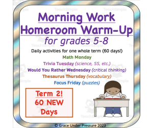
Term 2 Critical Thinking: Morning Work Warm-Ups: 60 More Days!
Social Studies, Resources for Teachers, Grade 5, 6, 7, 8, Worksheets & Printables, Word Problems, Activities
Morning Work: Homeroom Warm-Up for Grades 5-8: Term 2 Start the day with a bit of fun and a consistent routine. This will set the tone for the learning to come! This resource is a helpful tool for your morning routine with intermediate/middle school students! Students can have a special notebook that they use each day for this task, they could use mini whiteboards, or whatever routine works best for your group. This powerpoint presentation includes activities for each day of the week with enough for one whole term (60 days!). The slides are editable, so you can make more for future terms. You could also ask students to help make more slides as an activity for early finishers. Questions address many areas of the curriculum: Math Monday: On Monday your students will encounter word problems and prompts about ratio, area, money math, patterns, logic puzzles, and more! These will be a great review for previously learned information or they could prompt a quick mini-lesson for new material. Trivia Tuesday for Science and Social Studies On Tuesday your students will be asked questions about geography, grammar, biology, financial literacy and more! Each question is designed to address an area of the curriculum from prior or future years. Would You Rather Wednesday for critical thinking Wednesday might become your students' favourite. These prompts will stimulate some great class debates and discussions and help students see issues from both sides. There is no right answer, students just need to provide evidence for their opinions. Thesaurus Thursday to increase vocabulary On Thursday your students will work to think of synonyms for over-used words: like the dreaded "nice". Focus Friday with puzzles and games End your week with fun puzzles and games that will get kids thinking and collaborating with one another. If you want another term (60 days) of this routine, check it out here!
Author Grace Under Pressure
Tags Critical Thinking, Morning Work, Warm-ups, Vocabulary, Math, Homeroom, Classroom Routine, Middle School, Term 2, Trivia