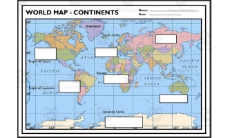
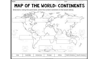
Continents & Oceans Map – Cut and Paste Worksheet


- Grades
- Not Grade Specific
- Pages
- 2
- File type
- Answer key
- Included


- Subject
- Social Studies, Geography
- Topic
- MAP, GEOGRAPHY
- Resource types
- Activities
- Answer key
- Included
About this resource
What's inside this resource
Cut and Paste Continents and Oceans - World Map Continents and Oceans
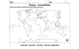
Cut and Paste Continents and Oceans - World Map Continents and Oceans is a fun and interactive worksheet that helps improve fine motor skills and promotes knowledge of the world's Continents and Oceans. Students are encouraged to actively participate in discovering and identifying the various Continents and Oceans on a global world map through this practical exercise.
Students will carefully cut out the labels for the Continents and Oceans of the world Europe, North America, South America, Africa, Antarctica, Asia, Australia, Indian Ocean, Arctic Ocean, Southern Ocean, Atlantic Ocean, and Pacific Ocean, then carefully paste them onto the appropriate regions of the blank globe map on the worksheet. This tactile method improves manual dexterity and hand-eye coordination in addition to reinforcing geography information.
Students are more likely to remember facts about the Continents and Oceans of the world and their locations if they actively participate in the cutting and pasting process.
The Continents and Oceans of the world : Europe, North America, South America, Africa, Antarctica, Asia, Australia, Indian Ocean, Arctic Ocean, Southern Ocean, Atlantic Ocean, and Pacific Ocean.
Answer key is provided to allow for self-assessment and immediate feedback, encouraging students to take ownership of their educational journey.
Implementation Format: Letter size, landscape.
File types: pdf
Number of Pages: 2
Grades or ages: Grade 3, Grade 4, Grade 5, Grade 6, Grade 7, and Grade 8.
Related resources
More resources teachers may find useful
24 related resources were found using this product's title, contributor, categories and tags.


In the classroom
Teaching tips & learning objectives

Learning objectives
Students identify and correctly place the seven continents on a world map.
Students identify and correctly place the five oceans (Arctic, Atlantic, Pacific, Indian, Southern) on a world map.
Students cut and paste small labels with precision as a fine-motor task alongside the geography content.

Teaching tips
Have students cut out all twelve labels before pasting any of them, so they can compare and place labels by process of elimination.
Keep the answer-key page visible or available for self-checking once students have finished pasting.
Provide glue sticks rather than liquid glue given the small size of the twelve cut-out labels. After labeling the continents and oceans, use this continents and oceans lesson to reinforce the names through songs and map activities.

Skills covered
World geography labeling — students place all seven continents correctly on a blank world map.
Ocean identification — students place five oceans (Arctic, Atlantic, Pacific, Indian, Southern) correctly on a blank world map.
Fine-motor cutting and pasting — students cut twelve small labels and paste each into position, a tactile alternative to writing labels directly.
Good to know
Questions teachers ask about this resource
Are the continent and ocean labels printed together, or separated by category?
Together — both the blank map page and the completed reference page print the same set of twelve labels, continents and oceans mixed, in one row along the bottom.

No reviews yet
Downloaded this resource? Tell other teachers how it went.
Resource details
Concepts & topics
Core concepts
 Core concepts
continents
oceans
world map
cut and paste
Topics
 Topics
Explore more
Categories this resource belongs to
Explore related searches
More to explore
You may also like