search
user.png
vertical menu

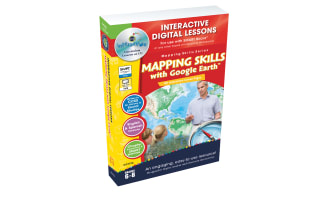
Mapping Skills with Google Earth Gr. 6-8

Mapping Skills with Google Earth Gr. 6-8 preview
Mapping Skills with Google Earth Gr. 6-8 preview 2
Mapping Skills with Google Earth Gr. 6-8 preview 3
Mapping Skills with Google Earth Gr. 6-8 preview 4

Look Inside · 10 pages

Critical thinking reference connects six mapping chapters to Bloom’s skills, from remembering to creating.
Thinking skills reference for the six mapping chapters
Contents lists teacher guidance, six mapping chapters, puzzles, a quiz, an answer key, maps, and mini posters.
Contents guide to lessons and supporting materials
Assessment rubric defines four levels for understanding concepts, text responses, and applying interests.
Four-level rubric for evaluating student responses
Teacher guide explains reading activities, Google Earth tasks, map activities, assessment, and the answer key.
Teacher introduction and resource organization
Teacher reference explains Bloom’s six thinking levels and lists mapping vocabulary, including latitude and scale.
Bloom’s taxonomy guidance and mapping vocabulary
Map Elements prereading questions check symbols, legends, scale, latitude, longitude, and time zones.
Before-reading questions for the Map Elements chapter
Map Elements reading introduces symbols, legends, compass directions, and scale using two aerial map examples.
First reading passage page in Map Elements
Map Elements reading explains TODALSIGS, coordinates, and time zones, followed by a Google Earth task.
Second reading page and Greenwich exploration task
Map Elements practice uses Google Earth coordinates to identify 10 countries, six bodies of water, and mountains.
After-reading coordinate searches for Map Elements
Map Elements follow-up asks about legends, scale, directions, the equator, and the prime meridian, plus research.
Written responses and research for Map Elements
Attributes
Grades

Grade 6, 7, 8

File

PDF

Editable
No
Rating
Add To Collection
Add to collection Add to collection

About This Product

Mapping Skills with Google Earth Gr. 6-8: A Comprehensive Teaching Resource

Mapping Skills with Google Earth Gr. 6-8 is a dynamic teaching resource designed for educators seeking adaptive strategies to enhance middle school students' map reading skills using the innovative platform, Google Earth™.

Potential users might include public school teachers desiring to make social studies more engaging or homeschooling parents who need a comprehensive and user-friendly solution for teaching geography.

  • The key features focus on helping students understand complex aspects like coordinates and population demographics over time.
  • A variety of practical exercises are integrated into the learning process, such as locating countries using coordinates on Google Earth™
  • This tool encourages active learning through various tasks that test comprehension and stimulate critical thinking.

An Additional layer of Engagement:

  1. This resource facilitates a comparative study between world maps and globes through platforms like Google Earth™.
  2. Learners also get an opportunity to improve their linguistic abilities through crossword puzzles and word search games incorporated in this package.
  3. A comprehension quiz aligned with state standards helps reinforce knowledge while tracking improvement.
To cater to stress-free implementation:
    An answer key is included to provide educators easy reference for verifying learner responses coupled with clear instructions presented as a PDF file for an effective application no matter what your tech literacy level may be!
In conclusion, 'i>Mapping Skills with Google Earth Gr. 6-8'' proves an optimal resource for addressing geographical knowledge cultivation required in grades 6 through 8 social studies curriculum across various education setups.

What's Included

Contains 1 Product File

Resource Tags

0 Reviews

Explore related searches