Palau Map Resources


About This Product
Palau Map Resources
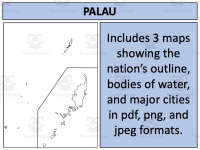
Palau Map Resources is a versatile teaching tool that enhances geography-related lessons and activities. Available in pdf, jpeg, and png formats, these maps can be seamlessly integrated into various teaching methods.
The Resource Pack Includes:
A clean outline of the island for blank canvas applications
A detailed portrayal of bodies of water
An identification of major settlements for social studies explorations.
These multifaceted views are excellent for students working on geography assignments or projects involving Palau- a Pacific Island nation. Use these maps to incorporate visual learning and deepen the understanding of world geography. The wide range file format allows teachers to utilize them directly during lessons or include them in student homework tasks, quizzes or project works connecting different disciplines such as history or societal studies.
This Palau Map Resources enriches any lessons underpinning Social Studies curriculum particularly those centered around Geography as primary focus area.
This classroom resource is not grade-specific - making it adaptable across varied age groups facilitating customization based teacher discretion thereby simplifying geographical study while piquing learner curiosity about diverse global destinations. Successfully transform your lesson plans with comprehensive Palau Map Resources —a simplified yet thorough educational aid that positively impacts pedagogical outcomes.
Resource Tags
0 Reviews
Check out these other great products