2,801 products added recently
Page 628 - Newest Teaching Resources

Country Study on China - Research Project - Worksheet + Cards
Social Studies, Geography, History, History: Asian, Research, Grade 7, 8, 9, 10, 11, 12, Projects, Activities
Country Study on China - Research Project - Worksheet + Cards This Teaching Resource is a PDF research project (9 Slides) on China. This Printable Resource can be great for Geography, Asian History and Social Studies Classes. Suitable Learners for this kind of lesson are students from 7th Grade to 12th Grade. This Geography + Social Studies Research Project on China (Country Study) aims to make learners discover China (history, geography, economy, Beijing and culture). Little preparation can be helpful. Within this Country Study on China Research Project, it is offered: 2 worksheets to write research outcomes 56 Cards to fish for this Research Project on China (Continental China) How does this Country Study on China Teaching Resource work? learners (or groups) fish a Research Topic card of each color (black for history, blue for geography, orange for economy, Red for Beijing and green for Chinese Culture) each student or group makes their personalized Research on China, by focusing on their fished topic cards (ex. fished black card on history on "Chinese Dynasties", blue card on geography on "Rice Production in China", orange card on economy on "Tertiary Sector", Red Card on Beijing on Tiananmen Square and a green card on Chinese Culture on Confucius) Learners stick their fished cards on their research worksheet and write their Research outcomes Learners make a presentation on their personalized rersearch on China teacher evaluates research given learner or group's research outcomes written on worksheets Why is this Teaching Resource worth using? By fishing topic cards, students have a chance to: make unique randomized research projects focus on specific topics only and discover more the research country in "non-superficial" ways Connect their own Research outcomes with their peers' This Social Studies + Geography Country Study on China PDF Printable Research Project Teaching (9 slides) can be great for learners from 7th grade to 12th grade to introduce China (Continental) and its Culture. Learning with Alan is a Brand New Teaching Resource/Educational Material Store whose aim is to help Teachers, Educators and Tutors to achieve their teaching objectives while creating a fun and stimulating environment. Never Forget! If you want to browse more of my Teaching Resources, click here Learning with Alan!
Author Learning with Alan
Tags China, Asia, Asian History, Geography, Social Studies, Research, Project, Cards, Worksheet

Country Study on China - Guess Who Game Cards on famous Chinese people
Social Studies, Geography, History, History: Asian, Grade 7, 8, 9, 10, 11, 12, Activities, Games
Country Study on China - Guess Who Game Cards on famous Chinese people This Teaching Resource is a fun Guess Who Game PDF (1 slide, 15 cards) on Famous Chinese People. This Printable Resource can be great for Geography, Asian History and Social Studies Classes. Suitable Learners for this kind of lesson are students from 7th Grade to 12th Grade. This Geography + Social Studies Guess Who Game on Famous People from China (Country Study) aims to introduce learners to China and its most famous Chinese People (leaders, writers, thinkers, actors, martial artists etc.). Little Preparation is needed for this Social Studies + Geography Activity. Some of the Chinese People selected for this Geography + Social Studies + Asian History Country Study on China are: Confucius (Founder of Confucianism) Sun-Tzu (thinker and military strategist; author of "The Art of War") Wu Cheng En (author of "The Journey to the West") Xi Jinping (Chinese President) Liu Cixin (Sci Fi Author of "The Three Body Problem" Jackie Chan (Actor) Bruce Lee (Martial Artist) and many more! A very fun and engaging way to play this "Guess Who on Famous People from China" (country study on China) game can be the following: all Learners sit on the floor in a circle every Learner has a Flash Card on their face every Learner/player asks a question about their Flash Card 's famous Chinese character This Social Studies + Geography Country Study on China PDF Printable Teaching Resource (1 slide, 15 cards for 15 Famous People from China) can be great for learners from 7th grade to 12th grade to introduce China and its Culture through its most important and celebrated people. Learning with Alan is a Brand New Teaching Resource/Educational Material Store whose aim is to help Teachers, Educators and Tutors to achieve their teaching objectives while creating a fun and stimulating environment. Never Forget! If you want to browse more of my Teaching Resources, click here Learning with Alan!
Author Learning with Alan
Tags Asia, China, Guess Who, Game, Cards, Printable, Geography, Chinese, Social Studies, Asian History

Country Study on China - Snakes and Ladders Board Game PDF Printable
Social Studies, Geography, History, History: Asian, Grade 7, 8, 9, 10, 11, 12, Worksheets, Worksheets & Printables
Country Study on China - Snakes and Ladders Board Game PDF Printable This Teaching Resource is a PDF Board game (Snakes and Ladders; 3 slides) on China (Asia). This Printable Resource can be great for Geography, Asian History and Social Studies Classes. Suitable Learners for this kind of lesson are students from 7th Grade to 12th Grade. This Geography + Social Studies game on China (Country Study) aims to test learners on their knowledge on China and Chinese Culture (naming Chinese cities, telling about history events, telling about your pawn's character, telling about Famous Chinese individuals or telling what you would like to visit if you had to go to China). Some preparation on China, Chinese Culture and History can be useful for this Social Studies Activity. Within this amazing Country Study on China (Asia) board game (snakes and ladders; 3 PDF Printable slides) it is offered: 1 board with questions and Speaking Prompts (ex. naming Chinese Cities or telling about China's history events such as the 1989 Tiananmen Protests, the Cultural Revolution etc) 1 Printable Craft Die with numbers written 1 Printable Craft cone to make Game Pawns to play 5 Famous People from China (Jackie Chan, Bruce Lee, Sun Tzu, Confucius etc.) to stick on the players' printable craft cone This amazing and fun Social Studies + Geography Country Study on China (Continental China) PDF Digital Teaching Resource (3 PDF Printable Slides) can be great for learners from 7th grade to 12th grade to test China and Chinese Culture. Learning with Alan is a Brand New Teaching Resource, Educational Material Store whose aim is to help Teachers, Educators and Tutors to achieve their teaching objectives while creating a fun and stimulating environment. Never Forget! If you want to browse more of my Teaching Resources, click here Learning with Alan
Author Learning with Alan
Tags Asia, China, Social Studies, Geography, Asian History, Game, Teaching Resource, Printable, Snakes And Ladders, Board Game

Country Study Presentation on China
Social Studies, Geography, History, History: Asian, Grade 7, 8, 9, 10, 11, 12, Teacher Tools, Presentations
Country Study Presentation on China This Teaching Resource is an Introductory PDF Presentation (15 Slides) on China (People's Republic of China; Continental China). This Digital Resource can be great for Geography, Asian History and Social Studies Classes. Suitable Learners for this kind of lesson are students from 7th Grade to 12th Grade. This Geography + Social Studies Presentation on China (Country Study) aims to introduce learners to China (its most important and basic facts, language, history, environment, economy and basic Mandarin Chinese vocabulary). No or little preparation is needed. Within this Introductory Presentation on China (PDF Country Study Teaching Resource) it is offered: a first slide with greetings in Standard Chinese Language (你好) with QR Codes and link to YouTube Video to learn how to pronounce it properly in Mandarin Chinese 2 slides on China (Continental China) + its basic geography and borders (Google Maps Link directed to China's geographical location included) a "quick data on China" slide (currency, population, kind of government etc) 2 slides on the Languages spoken in China (Standarn Chinese introduction + Chinese Characters introduction + other minority languages such as Cantonese, Korean, Mongolian etc. + basic vocabulary and phrases in Mandarin Chinese) 2 slides with China's History timeline (from first settlings to 1989 Tiananmen Square Protests) 1 Slide on Geographical facts (size, kind of territory and weather) 1 on Chinese Economy 1 on Beijing 1 on other cities in China (little map of China with cities such as Shanghai, Chongqing, Guangzhou etc.) 1 slides on Chinese Culture (Chinese Cuisine +introduction to Chinese Inventions) 1 last slide with Goodbye written in Chinese language (再见) with QR Code-Linked YouTube Video on how to pronounce it This Social Studies + Geography Country Study on China (People's Republic of China) PDF Digital Teaching Resource (15 slides) can be great for learners from 7th grade to 12th grade to introduce China and its Culture. Learning with Alan is a Brand New Teaching Resource/Educational Material Store whose aim is to help Teachers, Educators and Tutors to achieve their teaching objectives while creating a fun and stimulating environment. Never Forget! If you want to browse more of my Teaching Resources, click here Learning with Alan!
Author Learning with Alan
Tags Asia, China, Country Study, Presentation, Geography, Asian History, Timeline, Social Studies, Teaching Resource, Culture

Letter M Flower Craft
ELA, Language Development, Phonics, Kindergarten, Preschool, Crafts, Activities
Enhance the teaching and learning of the beginning sound of letter M with our unique and interactive flower craftivity. This educational tool is designed to facilitate the understanding and recognition of the letter M sound with common, easy to recognize images. Our resource contains three different letter M flower templates to practice both beginning sounds as well as letter recognition. What's Included: There are two different templates that allow students to create a flower focused on recognizing the beginning sound of the letter M. There is one template that allows students to create a flower focused on letter recognition of both capital and lowercase forms of the letter M. Utilizing this Resource: Simply print the flower templates, and then allow the students to color, cut out, and assemble into a flower on colored construction paper. You can also print the flower design onto colored card stock to create a sorting activity . The flower will need to be cut and laminated. This can function as interactive materials in a literacy center, where students can match pictures to the correct letter M flower. Mix and match these with flowers of other letter flower crafts to encourage sorting and classification exercises. Possible Applications: Literacy Centers Classroom decorations or bulletin board displays Creative or Craft Sessions Individual Work Group-based Activities Supplementary Homework These flower craft templates are a perfect fit for educators seeking no-prep resources. All that is required is to print the craft page and distribute it to the students. Basic craft materials such as coloring tools, scissors, glue, and a base paper for the flower craft are needed. Each craft prints on a single page, promoting paper conservation, which aligns with an eco-friendly classroom. Skills Addressed: Identification of the beginning sound of the letter M Recognizing the capital and lowercase letter M Development of Scissors Skills Improvement of Direction Following abilities
Author The Connett Connection
Tags Flower Craft, Preschool Craft, Kindergarten Craft, Beginning Sounds, Letter Recognition, Letter M, Letter M Craft, Letter M Activities
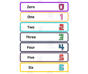
Numbers from 0 to 100 in English - Flashcards for Classroom
Math, Early Math, Numbers, Not Grade Specific, Worksheets & Printables, Flashcards
Numbers from 0 to 100 in English - Flashcards for Classroom You'll get: 15 pages ready to print pdf file, with 7 cards per page. Presenting 'Vibrant Numbers from 0 to 100 in English Flashcards ,' an exciting and visually appealing teaching resource designed to make the journey of learning numbers an engaging experience for learners of all ages. This comprehensive set of flashcards injects a burst of color into the world of numeracy, combining eye-catching visuals with clear, easily readable digits, ensuring an immersive and enjoyable learning experience. Each flashcard features a vibrant representation of the numeral alongside its corresponding English digit, creating a multisensory approach to mastering counting from 0 to 100. The bold and colorful design enhances retention and captivates learners, making it an ideal resource for diverse educational settings. These flashcards are not only educational but also a celebration of the joy of learning. The incorporation of bright colors and visually appealing designs adds an element of fun to the counting process, making it an ideal tool for educators, parents, and learners alike. Packed with energy and creativity, these flashcards turn every counting session into a vibrant adventure, fostering a love for numeracy and language acquisition excitingly. Elevate your English language learning experience with these visually captivating and educationally enriching flashcards , making numbers come alive in a truly colorful manner. Visit our Store Homeschoolingprints for more language, different designs and sizes, and other Vocabulary resources.
Author Homeschoolingprints
Tags Numbers, 0 To 100 In English, English Numbers, Counting In English, Numbers Sight Words, Numbers Flashcards, Word Wall Numbers
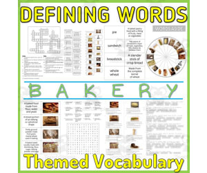
Reading Writing Games | Word Definitions 3
Special Resources, ELA, Special Education Needs (SEN), Speech Therapy, Reading, Reading Comprehension, Language Development, ESL, Writing, Handwriting, Vocabulary, Grade 2, 3, 4, 5, Activities
This series of PDF resources focuses on identifying noun concepts, with engaging visualizations ( pictures and graphic arrangements ) of vocabulary by topic. The activity materials in this assignment are designed to help students develop their vocabulary and reading comprehension skills through interactive activities and real-life examples. It includes clear definitions of words from common categories and can also serve as discussion prompts to encourage critical and analytical thinking, deepen your understanding of the language, and improve your communication skills . This resource is designed to be accessible and engaging to all students . Ideal for teaching English as a Second Language and intervention sessions on learning difficulties. Clear and concise language, visual aids and interactive activities help students easily understand and remember information, integrating visual and kinesthetic elements. You can choose from a variety of worksheets that suit your student's level, interests, and printing preferences. Each category topic includes : 2 sets of Flash cards ( definition sentence / image, image / definition sentence ) 2 sets of Flash cards ( definition word / phrase, definition phrase / word ) 3 Anagram strings ( mixed letters of single words or in definition text ) 1 Crossword ( word definition ) 2 sets of linked activities Draw a Line ( definition / image, image / definition ) 2 sets of matching activities Draw a line ( word / definition, definition / word ) 2 series of Quizzes ( definition / image, image / definition ) 2 series of Quizzes ( word / definition, definition / word ) 3 Wheels of Fortune ( words, definitions, images ) 1 Word Search page for ( word definition ) 2 Writing Boards ( words, definitions ) 2 Blank Boards ( words, definitions ) * Use as-is or create your own board games, like Snap, Memory, Match to Sample, and Knowledge Races . Distribute it as morning exercises, quiet time and focus activities, independent workbooks, or fun homework . 42 PDF Pages
Author WORDS ASIDE
Tags Esl, Word Defining, Semantics, Word Search, Anagram, Flash Cards, Centers, Crossword, Category Vocabulary, Words Aside
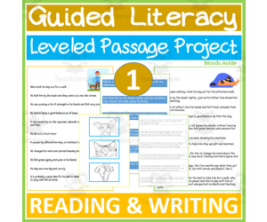
Reading and Writing | Leveled Passage 1
Special Resources, ELA, Special Education Needs (SEN), Speech Therapy, Reading, Reading Comprehension, Language Development, ESL, Writing, Handwriting, Spelling, Strategies, Grade 1, 2, 3, Literacy Readers, Teacher Tools
A great resource for your students to work on reading fluency / comprehension and writing practice through versatile ways of presenting text. A dual leveled text for literacy activities with worksheets, cards and strips for : - reading . - handwriting ( dot to dot and tracing ) . - word ordering . - sentence sequencing . - correcting spelling mistakes . - filling in the gaps . - finding the other half of the sentence . - role playing the scenario . - taking notes . With this material you focus on grammar, syntax, reading comprehension / reasoning, working memory and self organising strategies, with the hands on participation of the student, whether one-to-one or in a small classroom or session group . The two ( 2 ) different levels give the opportunity to students with varying literacy performance to work parallel or cooperatively on the same project and promote inclusion . In addition, it is a great way for the same student to "level up" his / her literacy game ! Furthermore, the card strips allow for games of : - text-based questions and answers . - choral and ordinal reading . - cut and paste activities . - "titles" for custom made drawings or notes . - spot the word differences / what is added or missing . - memory . - copying . - move around the classroom activities . - hide and find . and many more ! 1 pdf fle of 42 NO - PREP pages . You can beneficially use this versatile material from 1st through 3rd grade . Use it as an intervention resource in learning difficulties sessions as suited . For many many more free to download and immediately use materials on language, basic math, cognitive and perceptual skills, you can visit my store page by clicking HERE .
Author WORDS ASIDE
Tags Reading Fluency, Comprehension, Writing Abilities, Inclusive Practice, Diverse Classroom Settings, Guided Literacy, Guided Writing, Homework, Words Aside

Printable Times Tables Charts for Multiplication Fact Fluency in Grades 2-7
Math, Patterns, Early Math, Multiplication and Division, Division, Grade 3, 4, 5, 6, Worksheets, Worksheets & Printables
This is a ready-to-go resource designed to enhance students' multiplication skills. It serves as an instructional bridge from grade 2 up till grade 7, ideal for both conventional classrooms and special education environments. Features: The resource comes with color-coded times tables charts that are also available in black and white format. Each chart presents the initial twelve facts for a specific multiplication table, ranging from 0 to eleven. These charts contain helpful hints like "double-double" for the four times table. To aid learning and pattern recognition, all facts from the same times table are labeled in the same color across different charts. Multiple Uses: Classroom Decorative Aids: Full-page color prints can be used as educational posters or anchor charts around your teaching area. Personal Learner's Guide: Reduce them into six-per-page size black & white copies (preferably printed back-to-back) for students' personal use in their bind or math notebook. Scheduled Lessons Aid: In scenarios where each multiplication table is taught individually over time, you may print out separate pages while introducing a new set of multiplication facts. Updated: I have now included the charts with blanks as well so you can use them as a simple worksheet or place them in a plastic sleeve to use as a math center. The linear arrangement of these times tables makes it easy for learners to grasp the concept better than traditional grid-style presentation, increasing their chances of correctly identifying answers and recognizing patterns within number sets. Besides supporting learners to achieve Standard 3.OA.A7—"Fluently multiply and divide within hundred", this tool aids precise comprehension of early math patterns, helping to impart deeper understanding behind the relationship between multiplication and division. What's Included: This package includes 36 charts—12 in full color, 12 black & white versions, and 12 with the answers removed—all available in an easy-to-use PDF format.
Author Grace Under Pressure
Tags Times Tables, Multiplication Facts, Fluency, Math Patterns, Multiplication, Times Table Grid, Multiplication Grid, Multiplication Chart, Math Facts, Multiplication Fact Chart
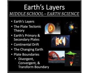
Earth's Layers - Middle School Earth Science Lesson
Science, Earth and Environmental Sciences, Earth Sciences, Environmental Science, Grade 6, 7, 8, 9, Teacher Tools, Lesson Plans
Earth's Layers - Middle School Earth Science Lesson Your lesson covers the different layers of Earth. In order, the lesson teaches about; Earth’s Layers, the Inner Core, the Outer Core, Planet Formation, Earth’s Magnetic Field, the Mantle, the Asthenosphere and Lithosphere, the Crust, and an introduction to Tectonic Plates. Your lesson includes the teacher and student version of the presentation, SIX embedded videos, an auto-graded exit ticket, and a student lesson handout so the students can record the notes on a more condensed medium. This lesson is designed to be your go-to resource, whether you're in a traditional classroom or a virtual one. With both a teacher version and a student version, it seamlessly fits into your lesson plans, making learning engaging and adaptable. Assessment made easy We've included an auto-graded Exit Ticket and a quiz with an answer key because I know you don't have an excess of time. I know you don't, because I don't and I know I'll do whatever I can to reduce my grading time. Whether you use PowerPoint or Google Slides, prefer Word or Google Docs, this lesson has you covered. This lesson comes in both Office and Google formats for your convenience. The student version of the presentation has strategically placed blanks for them to fill in as you're teaching. It keeps them active and engaged, encourages discussion, and leaves more time for those "aha" moments.
Author Teach With Fergy
Tags Earth’s Elliptical Path , Earth’s Motion Around The Sun , The Seasons , Earth’s Tilt , Earth’s Revolution , Equinox , Perihelion , Aphelion
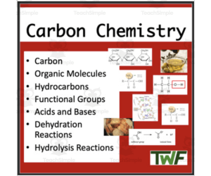
Chemistry Chemistry Introduction Lesson
Science, Life Sciences, Biology, Grade 11, 12, Teacher Tools, Lesson Plans
Carbon Chemistry - Senior Bio-Chemistry Lesson Your lesson covers carbon chemistry and how it relates to living things. In order, the lesson teaches about; Carbon molecules, Organic Molecules, Hydrocarbons, Functional Groups, Acids and Bases, Dehydration Reactions, and Hydrolysis Reactions. Your lesson includes the teacher and student version of the presentation, two embedded videos, an auto-graded exit ticket, and a student lesson handout so the students can record the notes on a more condensed medium. This lesson is designed to be your go-to resource, whether you're in a traditional classroom or a virtual one. With both a teacher version and a student version, it seamlessly fits into your lesson plans, making learning engaging and adaptable. Assessment made easy We've included an auto-graded Exit Ticket and a quiz with an answer key because I know you don't have an excess of time. I know you don't, because I don't and I know I'll do whatever I can to reduce my grading time. Whether you use PowerPoint or Google Slides, prefer Word or Google Docs, this lesson has you covered. This lesson comes in both Office and Google formats for your convenience. The student version of the presentation has strategically placed blanks for them to fill in as you're teaching. It keeps them active and engaged, encourages discussion, and leaves more time for those "aha" moments.
Author Teach With Fergy
Tags Carbon Chemistry, Biology, Senior Biology, Organic Molecules, Hydrocarbons, Functional Groups, Acids And Bases, Dehydration Reactions, Hydrolysis Reactions
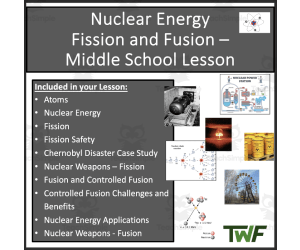
Nuclear Energy
Fission and Fusion – Middle School Lesson
Science, Physics, Grade 5, 6, 7, Teacher Tools, Lesson Plans
Nuclear Energy - Fission and Fusion - Middle School Physical Science Lesson Your lesson covers looks at the atom and how it can be split through fission or combined via fusion to release a great deal of energy and what that energy can be used for. In order, the lesson teaches about; Atoms, Nuclear Energy, Fission, Fission Safety, the Chernobyl Disaster Case Study, Nuclear Weapons – Fission, Fusion and Controlled Fusion, Controlled Fusion Challenges and Benefits, Nuclear Energy Applications, and Nuclear Weapons - Fusion. Your lesson includes the teacher and student version of the presentation, FOUR embedded videos, an auto-graded exit ticket, and a student lesson handout so the students can record the notes on a more condensed medium. This lesson is designed to be your go-to resource, whether you're in a traditional classroom or a virtual one. With both a teacher version and a student version, it seamlessly fits into your lesson plans, making learning engaging and adaptable. Assessment made easy We've included an auto-graded Exit Ticket and a quiz with an answer key because I know you don't have an excess of time. I know you don't, because I don't and I know I'll do whatever I can to reduce my grading time. Whether you use PowerPoint or Google Slides, prefer Word or Google Docs, this lesson has you covered. This lesson comes in both Office and Google formats for your convenience. The student version of the presentation has strategically placed blanks for them to fill in as you're teaching. It keeps them active and engaged, encourages discussion, and leaves more time for those "aha" moments.
Author Teach With Fergy
Tags Nuclear Energy, Energy, Fission, Fusion, Electricity, Science Lesson, Middle School Science Lesson, Middle School Energy

Human Digestion and the Digestive System-Reading Comprehension Article
Science, Life Sciences, Biology, Grade 9, 10, 11, Activities
Human Digestion and the Digestive System-Reading Comprehension Article Delve into the intricate world of our digestive system with this comprehensive educational reading designed for students in the 9th grade and beyond. This educational tool is crafted to enlighten learners on the fascinating processes that fuel our bodies, from the initial intake of nutrients to their final journey within us. Key Learning Points: The Fundamentals of Digestive Processes The Complex Structure of the Digestive Network The Dynamics of Digestive Mechanics and Biochemical Breakdown The Role of Digestive Catalysts in Nutrient Breakdown The Pathway of Nutrient Assimilation The Cycle of Waste Disposal Strategies for Managing Digestive Health and Nutritional Well-being Embark on the Digestive Voyage The remarkable journey of digestion represents the body's natural mechanism for distilling nourishment from our intake. It initiates in the oral cavity, where edibles undergo preliminary processing via mastication and enzymatic action within the saliva. As food descends through the esophagus, it ventures into the gastric region, where further digestion occurs under the influence of stomach secretions. Advancing into the intestinal region, the core of digestive activity, various enzymes help break down our food into fundamental molecules ready for cellular uptake. This intricate process fuels our bodies and allows us to survive. Indigestible remains are sent to the large intestine and rectum where it is eventually released from the system. This intricate voyage from ingestion to excretion showcases the harmonious interplay between physical and biochemical digestion, enzyme functionality, and the collective effort of digestive organs to sustain life.
Author Teach With Fergy
Tags Teaching Resource, Health Education, Digestive, Digestive System, Human Digestion, Digestion Reading

Work and Energy - Lab Station
Science, Basic Science, Physics, Grade 9, 10, 11, Activities
Work and Energy - Lab Station Activity This lab station activity allows students to apply their understanding of work, energy, joules, and power by moving around the classroom and conducting hands-on investigations. Designed for middle and high school science classrooms, it can be used to introduce or assess key physics concepts surrounding energy transfer. Students will rotate through stations focused on calculating work, identifying energy transfers, relating joules to everyday examples, and more. Assign specific stations for groups to complete or have students tackle several. Easy to implement and grade within a class period, these physics lab stations encourage peer learning and sparks students' interest in energy concepts. Adjustable for whole-class, small group, or individual work, making it versatile for various teaching approaches.
Author Teach With Fergy
Tags Lab Safety, Science Safety, Classroom Lab Safety, Lab Safety Lab Station, Lab Station Activity

Lab Safety - Lab Station Activity
Science, Basic Science, Grade 6, 7, 8, 9, Labs, Experiments, Activities
Lab Station Activity - Classroom Lab Safety. This activity will get your students moving around the room, and applying what they've learned regarding the scientific method. This activity was designed for high school and middle science students. You can either use it to introduce the topic or assess their understanding of the scientific method. This resource covers the following topics: Lab Safety Equipment Basic Emergency Procedures How To Keep Safe in a Lab Setting Lab Station Activity - Classroom Lab Safety. This activity will get your students moving around the room, and applying what they've learned regarding the scientific method. This activity was designed for high school and middle science students. You can either use it to introduce the topic or assess their understanding of the scientific method. Lab Station Activity - Classroom Lab Safety. This activity will get your students moving around the room, and applying what they've learned regarding the scientific method. This activity was designed for high school and middle science students. You can either use it to introduce the topic or assess their understanding of the scientific method. I also have many other lab stations in my store. Please have a look. They cover topics within all branches of science including chemistry, physics, biology, general science, and space science. They work well in middle as well as high school classrooms. If you have any questions, please send me an email - devon@teachwithfergy.com
Author Teach With Fergy
Tags Lab Safety, Science Safety, Classroom Lab Safety, Lab Safety Lab Station, Lab Station Activity
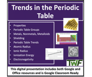
Trends In The Periodic Table - Senior Chemistry lesson
Science, Chemistry, Grade 10, 11, 12, Teacher Tools, Lesson Plans
Trends In The Periodic Table - Senior Chemistry Lesson Your lesson covers the different trends in the periodic table. In order, the lesson teaches about; Properties, Periodic Table Groups, Metals, Nonmetals, Metalloids, Shielding, Periodic Table Trends, Atomic Radius, Ionic Radius, Ionization Energy, and Electronegativity. Your lesson includes the teacher and student version of the presentation, an auto-graded exit ticket, and a student lesson handout so the students can record the notes on a more condensed medium. This lesson is designed to be your go-to resource, whether you're in a traditional classroom or a virtual one. With both a teacher version and a student version, it seamlessly fits into your lesson plans, making learning engaging and adaptable. Assessment made easy We've included an auto-graded Exit Ticket and a quiz with an answer key because I know you don't have an excess of time. I know you don't, because I don't and I know I'll do whatever I can to reduce my grading time. Whether you use PowerPoint or Google Slides, prefer Word or Google Docs, this lesson has you covered. This lesson comes in both Office and Google formats for your convenience. The student version of the presentation has strategically placed blanks for them to fill in as you're teaching. It keeps them active and engaged, encourages discussion, and leaves more time for those "aha" moments.
Author Teach With Fergy
Tags Chemistry Lesson, Periodic Table Groups, Periodic Table Trends, Atomic Radius, Ionization Energy, Electronegativity

Doodle Art Prompts Critical Thinking Drawing Activities
Creative Arts, Art, Fine Arts, Not Grade Specific, Drawing Templates & Outlines, Worksheets & Printables
Get your learners excited about drawing by using these doodle prompts with this low prep and simple creative resource. There are 25 different doodle prompts to integrate into your learning day as an individual or group time activity. The prompts are open ended to allow your learners to explore their imagination without restrictions. This versatile resource is perfect for individual art time, brain breaks, sub-days, homeschool art, group work, and more making it effortlessly adaptable to various teaching scenarios. These doodle prompts are also a great resource to deviate from your current lessons to add a simple but fun creative activity. Not only will students have fun with drawing , they will be engaged and excited to see their finished work. For more creative ideas, visit Doodle Thinks Website. What are the benefits of drawing doodles? There are many benefits such as improving memory, increasing creativity, reducing stress, increasing focus, improving mood, regulating emotions, and overall just fun. Not only will your learners benefit from fine motor practice but doodling is beneficial to the brain by keeping it active. Included in this download: 25 Doodle Prompts. 1 Intro/Cover Page. For Personal and Educational Use Only. Like this resource?Check out more drawing prompts: Copy Cat (Echo Art) Drawing Prompts Summer Mini Grid Drawing Prompts Water Dot and Splash Drawing Prompts Thank you for downloading Doodle Thinks resources and have fun drawing !
Author Doodle Thinks
Tags Doodle Prompts, Drawing Prompts, Drawing, Imagination
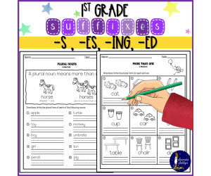
First Grade Suffixes
ELA, Writing, Handwriting, Reading, Grade 1, 2, Worksheets & Printables, Worksheets
Suffix Practice for First Graders This educational material focuses on various suffixes: -s, used for plural (indicating more than one) -es, plural form (indicating more than one) Students will: Form the plural of nouns Express the plural form for depicted pictures/objects Read sentences and transform underlined words into their plural forms Rewrite sentences, modifying underlined words to their plural forms Complete a table depicting images and corresponding nouns, converting them into their plural forms -ing, action/process Students will: Compose action words that denote ongoing actions Understand that when a base word ends with "e," the "e" is dropped and replaced with "ing" Employ images and words to illustrate the elimination of the "e" Apply "-ing" and add a double consonant to C-V-C words -ed, past tense indicator Students will: Fill out a table showcasing present tense words converted into past tense Rewrite sentences, transforming them into past tense This resource includes an answer key for reference. Integrate this exercise into your teaching plan to introduce or reinforce these acquired skills. Explore the provided thumbnails to understand how this resource can benefit your classroom. Suffix Practice for First Graders | Suffix Practice for First Graders | Suffix Practice for First Graders | Suffix Practice for First Graders | Suffix Practice for First Graders |
Author Soumara Siddiqui
Tags First Grade, First Grade Suffixes, Suffixes

Watercolor Dot and Splash Doodle Art Drawing Prompts
Creative Arts, Art, Fine Arts, Not Grade Specific, Drawing Templates & Outlines, Worksheets & Printables
These 14 colorful watercolor dots and splashes drawing prompts are a fun and unique way to introduce your learners to drawing , creativity, and problem solving skills. Learners will use the watercolor image and create a unique picture with it. This is an open ended drawing resource that will allow your learners to complete this activity without much restriction, which will allow them to be free to create, explore their imagination, and share it visually. For more creative ideas, visit Doodle Thinks website. What are the benefits of drawing and doodling? There are many benefits to drawing and doodling such as improve concentration, focus and memory, a tool for relaxation and calm (use during morning time or for brain breaks), igniting creativity and confidence, pencil grip practice for younger artists, and practicing the skill to convey ideas and images visually. Included in this download: 14 Colorful Watercolor Dots and Splashes Drawing Prompts. 1 Instruction and Tips Page. For Personal and Educational Use Only. If you like this drawing resource check out more drawing prompts: All About Me Artist Set Creative Quick Doodle Monthly Word Drawing Prompts - (free to download) Keyhole Drawing Prompts Copy (Echo) Art Drawing Prompts Imagination Workout Set 1 Drawing Prompts There are many ways to use this resource such as during morning work, brain breaks, homeschool art, independent work, just for fun and so much more! Also, as a group activity, encourage your learners to share their final drawings and give positive feedback to one another. Have fun and happy drawing !
Author Doodle Thinks
Tags Drawing Prompts, Doodle Prompts, Watercolor Dots, Watercolor Splashes, Watercolor Prompts

Art Fun Add It! Drawing and Writing Prompts
Creative Arts, Art, Fine Arts, Preschool, Grade 1, 2, 3, 4, 5, 6, Writing Prompts, Worksheets & Printables
Let your students' imagination expand with these fun drawing prompts that will initiate critical thinking skills and creativity. Challenge your learners to think critically while they draw , create, and problem solve. After they are finished with the drawing, have them add color using crayons, color pencils, or markers. I also included a creative writing page for each drawing prompt. Your learners will have a lot of fun writing about their drawing. For more creative ideas, visit Doodle Thinks website. What are the benefits of drawing prompts?There are many benefits such as promoting critical thinking and problem solving skills, nurturing creativity, encouraging imagination, igniting creativity and confidence, pencil grip practice for younger artists, and practicing the skill to convey ideas and images visually. Included in this download: 10 Drawing Prompts. 10 Companion Writing Pages. For Personal and Educational Use Only. If you like this drawing resource check out more drawing prompts: All About Me Artist Set Creative Quick Doodle Monthly Word Drawing Prompts - (free to download) Keyhole Drawing Prompts Copy (Echo) Art Drawing Prompts Imagination Workout Set 1 Drawing Prompts There are many ways to use this resource such as during morning work, brain breaks, homeschool art, independent work, just for fun and so much more! Also, as a group activity, encourage your learners to share their final drawings and give positive feedback to one another. Have fun and happy drawing! Thank you for supporting Doodle Thinks and downloading this resource!
Author Doodle Thinks
Tags Drawing, Drawing Prompts, Writing, Critical Thinking, Creative Writing, Coloring
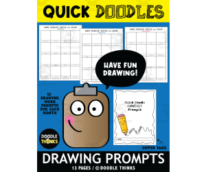
Quick Doodle Art Monthly Word Drawing Prompts
Creative Arts, Art, Fine Arts, Not Grade Specific, Drawing Templates & Outlines, Worksheets & Printables
Use this resource for early finishers, art days, brain breaks, art centers , homeschool art, independent work, just for fun and so much more!. There are 192 word drawing prompts to complete. Students will enjoy these as drawing starters. Make sure they complete these sketches quickly and then go back and color when a page is complete. There are 12 pages total, one for each month. Also, as a group activity, encourage your learners to share their final drawings and give positive feedback to one another. For more creative ideas, visit Doodle Thinks website. Have fun and happy drawing! What are the benefits of drawing prompts?There are many benefits such as promoting critical thinking and problem solving skills, nurturing creativity, encouraging imagination, igniting creativity and confidence, pencil grip practice for younger artists, and practicing the skill to convey ideas and images visually. Included in this download: A PDF File of 13 Printable Pages. 12 Pages of Monthly Doodle Prompts. 1 Cover Page If you like this drawing resource check out more drawing prompts: All About Me Artist Set Creative Quick Doodle Monthly Word Drawing Prompts - (free to download) Keyhole Drawing Prompts Copy (Echo) Art Drawing Prompts Imagination Workout Set 1 Drawing Prompts Imagination Workout Set 2 Drawing Prompts Thank you for supporting Doodle Thinks and downloading this resource!
Author Doodle Thinks
Tags Drawing, Drawing Prompts, Draw, Doodle

U.S. History Formative Assessment: Unit 1 - New Worlds Meet
Social Studies, History, History: USA, Grade 8, 9, 10, 11, Lesson Plans, Teacher Tools
Formative assessments are integral in creating a responsive and dynamic learning environment, promoting continuous improvement for both students and educators. They serve as valuable tools for guiding instruction, fostering student growth, and ensuring that learning remains an ongoing, adaptive process. Students receive immediate feedback on their performance, guiding them in understanding their strengths and weaknesses. This feedback aids in self- assessment and helps students develop effective learning strategies. Additionally, educators use formative assessments to gauge the effectiveness of their teaching methods and make necessary adjustments to optimize learning experiences for students. These assessments often involve interactive and engaging activities that encourage participation, fostering a more active learning environment. This assessment , for instance, can be completed on Google Forms on any computer during the school day. The following quiz will test the students' knowledge on the following topics: 1. Peopling and migration into the the Americas 2. Native American societies that flourished in North America prior to European arrival 3. European arrival in the Americas All the quizzes are organized around Bloom's Taxonomy, meaning the foundational recall knowledge is found first in the quiz and that higher levels of thinking are required for the other questions.Ready to use - minimal prep. Let's get to learning!
Author EduPal Learning
Tags Quiz, Formative Assessment, U.S. History, European Explorers, Christopher Columbus, Native Americans, Worlds Meet

Tiny Art Doodles Drawing Prompts | Critical Thinking Activities
Creative Arts, Art, Fine Arts, Not Grade Specific, Drawing Templates & Outlines, Worksheets & Printables
Tiny Doodles Drawing Prompts are a great way to introduce critical thinking activities and are. This drawing and writing activity will enhance your students creativity and increase critical thinking skills, while promoting concentration and imagination. There are also two writing pages that will help guide your students in art reflection and practice communication skills through writing. Use throughout the year! Let your students' imagination expand with these fun drawing prompts that will initiate their imagination. Challenge your learners to think critically while they draw, create, and problem solve. After they are finished with the drawing, have them add color using crayons, color pencils, or markers. Make this activity a bit more challenging by setting a timer for 5-10 minutes to see what they will come up with. What are the benefits of drawing prompts?There are many benefits such as promoting critical thinking and problem solving skills, nurturing creativity, encouraging imagination, igniting creativity and confidence, pencil grip practice for younger artists, and practicing the skill to convey ideas and images visually. Included in this download: 1 Doodle Page. 1 Art Reflection Page. 1 Observation Page. For Personal and Educational Use Only. If you like this drawing resource check out more drawing prompts: Imagination Workout Set 2 Drawing Prompts All About Me Artist Set Creative Quick Doodle Monthly Word Drawing Prompts - (free to download) Keyhole Drawing Prompts Copy (Echo) Art Drawing Prompts Thank you for supporting Doodle Thinks and downloading this resource! Have fun drawing!
Author Doodle Thinks
Tags Drawing Prompts, Doodle Page, Art Relection, Doodles, Drawing
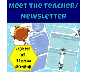
Under the sea meet the teacher and newsletter templates
, Not Grade Specific, Templates, Teacher Tools
The best part about decorating your classroom with this Under the Sea Meet the teacher and newsletter templates is picking and choosing your favourite designs that best appeal to your students, the idea behind this classroom decoration is to give you as a teacher the opportunity to pick your favorited under the sea inspired designs to create your very own masterpiece of a classroom. This Under the Sea Meet the teacher and newsletter template is to create a great classroom community, these templates help create a class theme. The templates can be used for your meet the teacher and can be sent out to parents or printed and stuck up on the door. The newsletter templates can be used to let parents and students what is up and coming in the week to come while sticking to your class theme. This Under the Sea meet the teacher and newsletter template download the PDF print in full-color laminate and paste it on walls or sent out to parents. These posters are suitable for all grades however in specific pre-k as well as grades; R,1, 2 and 3. If you like this Under the Sea meet the teacher and newsletter template classroom decoration be sure to have a look at the rest of this edition's decoration: Number posters - Alphabet posters - Birthday chart - Daily Calendar - Focus wall - Voice level posters - Months of the year - Days of the week - Color posters This download contains a total of 12 pages DIRECTIONS: The files are all PDFs. Print and laminate the pages to use in the classroom. If you would like anything specific to be added please let me know and I’ll be happy to do so when I am able to. Use: You are free to use and modify the material. For similar or other resources, visit my store here!
Author Ezee 101
Tags Classroom Community, Classroom Theme, Class Teme, Class Newsletter, Meet The Teacher, Under The Sea