search
user.png
vertical menu

Northwest territories

Northwest territories preview

Look Inside · 9 pages · answer key included

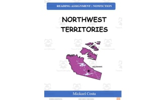
Geography packet cover naming the Canadian territory studied and identifying Mickael Costa as the author
Cover of the territory geography packet
Table of contents lists symbols, information, questions, answer keys, illustration activities, and credits
Contents guide to the packet's sections
Territory symbols reference identifies the shield, coat of arms, jack pine, mountain avens, gyrfalcon, and flag
Symbols and location reference sheet
Territory information sheet covers Yellowknife, 2019 population, landforms, industries, rivers, and history
Information reading for the question pages
Questions 1–7 ask about industries, Confederation, First Nations, largest city, highest point, regions, and rivers
First seven of the 13 geography questions
Questions 8–13 ask about peak height, major lakes, the capital, area, name origin, and population in 2019
Final six of the 13 geography questions
Symbols activity asks students to label seven pictures from a word bank and locate the territory on a Canada map
Symbol labeling and territory location activity
History illustration activity asks students to draw six statements about explorers, trading companies, and land
First history-and-facts illustration page

Answer key included

Answer key included
Attributes
Grades

Grade 3, 4, 5

File

PDF

Editable
No
Rating
Add To Collection
Add to collection Add to collection

About This Product

Northwest Territories Geography Learning Resource This informative 30-page PDF teaches students in grades 3-5 key geography facts about Canada's Northwest Territories. After introducing the territory's symbols like the flower, tree, and bird, the resource provides a concise information sheet detailing the capital, area, population, history, industries, land regions, and more. Students then apply their knowledge by answering engaging grade-level questions, labeling maps, matching vocabulary terms, and illustrating history concepts. Teachers can implement this versatile resource through whole-group lessons, small-group review, independent practice, or homework to build students’ Canadian geography literacy. The answer key supports self-directed learning.

What's Included

1 pdf and 14 pages

0 Reviews

Explore related searches
you may also like...

Check out these other great products