



World History Through Maps | Geography & Map | Grades 6–8 | 100 Pages




About This Product
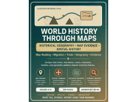
World History Through Maps – Historical Geography & Map Skills Activities
Grades 6–8 | Middle School World History & Social Studies | 100 Pages | Answer Key Included
Bring world history to life through the power of maps!
World History Through Maps is a 100-page educational resource designed to help middle school students explore historical geography, migration, trade routes, natural resources, population patterns, and the relationships between people and their environments.
Instead of simply memorizing historical dates and locations, students develop a deeper understanding of how geography influenced historical events, human decisions, economic development, and connections between civilizations.
This resource combines historical thinking, geographic reasoning, map interpretation, and evidence-based analysis to encourage students to investigate the past from a spatial perspective.
What Students Will Explore
1. Historical Map Reading
Students explore maps, symbols, legends, directions, and scale while developing essential geographic interpretation skills.
2. Migration and Human Movement
Investigate how people moved between regions and how geographical features influenced migration routes, settlement patterns, and cultural connections.
3. Trade Routes and Global Connections
Explore the importance of trade networks, transportation routes, and geographical barriers in connecting historical communities and civilizations.
4. Rivers, Mountains, and Natural Resources
Examine how physical geography shaped settlement locations, agricultural development, transportation, and historical decision-making.
5. Borders and Population Patterns
Analyze how geographical boundaries, population distribution, and regional characteristics influenced historical societies.
6. Map Evidence and Historical Reasoning
Use geographical information to support historical interpretations, compare patterns, and develop evidence-based conclusions.
Key Skills Developed
Historical map interpretation
Geographic literacy and map-reading skills
Spatial thinking and reasoning
Understanding migration and settlement patterns
Analyzing historical trade networks
Identifying geographical relationships
Comparing historical regions and environments
Recognizing cause-and-effect relationships
Interpreting map-based evidence
Supporting conclusions with historical and geographic information
Critical thinking and problem-solving
What's Included?
100 pages of educational material
Historical geography and world history activities
Map-reading and spatial reasoning practice
Topics involving migration, trade, geography, and resources
Opportunities for historical evidence analysis
Activities designed for Grades 6–8
Answer key on pages 89–98
Perfect For
Middle school world history classes
Social studies lessons
Historical geography units
Map skills and geographic literacy practice
Independent classroom activities
Small-group investigations
Homeschool history instruction
History enrichment and extension activities
Cross-curricular history and geography lessons
Supplementary classroom resources
Why Teachers Will Appreciate This Resource
Maps are more than illustrations of places. They are valuable tools for understanding how people interacted with their environments and how geographical conditions influenced historical developments.
World History Through Maps encourages students to look beyond individual historical events and examine the connections between geography, human movement, trade, resources, and cultural development.
By combining historical inquiry with spatial thinking, students can build transferable analytical skills while developing a stronger understanding of world history.
The resource is suitable for teachers who want to incorporate geographic reasoning and map-based investigation into their history and social studies instruction.
Explore the past. Analyze the evidence. Connect the world. Understand history through maps!
Resource Tags
0 Reviews
Check out these other great products


