search
user.png
vertical menu

Discover The Continents of the World Printable Workbook

Discover The Continents of the World Printable Workbook preview
Discover The Continents of the World Printable Workbook preview 2
Discover The Continents of the World Printable Workbook preview 3
Discover The Continents of the World Printable Workbook preview 4
Discover The Continents of the World Printable Workbook preview 5

Look Inside · 10 pages

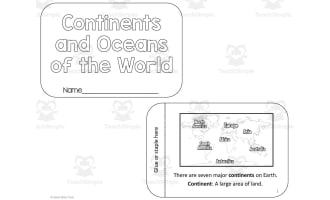
Cover of Discover The Continents of the World from Twin Sisters Digital Media, with a welcome note to teachers
Front page to print before handing out the set
Meet the Continents: students read about the seven continents on a labeled world map and answer how many there are
Opening lesson to introduce continent names
Meet the Oceans and Seas: students fill in missing letters to spell Atlantic, Pacific, Arctic and Indian beside a world map
Spelling practice for naming the major oceans
Directions: students use a compass rose to answer facing-north questions and mark four compass statements true or false
Mini-lesson on cardinal and intermediate directions
Hemispheres: students read about the equator and color Northern and Southern Hemisphere continents on a globe outline
Map-coloring follow-up to an equator discussion
Longitude and Latitude: students read about the Prime Meridian and Date Line, then solve a circled-letter word puzzle
Reading passage with a vocabulary review puzzle
Discover North America: students study a labeled map of countries and answer 7 multiple-choice location questions
Map-reading check for North American countries
Where are They? North America map labeling: students write the number marking each of 10 places such as Hudson Bay
Quick review after the North America map page
Discover South America: students use a labeled country map to answer questions on size, landlocked countries and oceans
Map-reading questions for South American countries
Where are They? South America map coloring: students color 13 countries on an outline map using a color code
Coloring review to reinforce country locations
Attributes
Add To Collection
Add to collection Add to collection

About This Product

Reviewed, evaluated, edited, and creatively written by teaching professionals, this Social Studies-focused digital resource implements current teaching strategies and aligns with grade-level standards to teach about the world map. With the ability to print the pages over and over, your child can complete the activities again and again until the skills have been mastered.

Learn about:
• The Continents
• Oceans and Seas
• Hemispheres
• Directions
• Latitude and Longitude

What's Included

A 22-page printable packet with activities for discovering the continents of the world

0 Reviews

Explore related searches
you may also like...

Check out these other great products