US State Study Guide Worksheets on Massachusetts

- Grades
- Grades 7–12, Middle School, High School
- Pages
- 2
- File type
- Preparation
- Print ready


- Subject
- Social Studies, Economics, First Peoples (Native), Geography, Government, History, History: USA
- Topic
- Social Studies, Geography
- Resource types
- Worksheets & Printables, Worksheets
- Preparation
- Print ready
About this resource
What's inside this resource
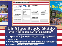
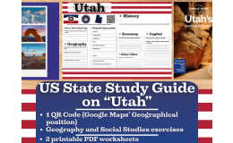
Bring the rich history, geography, and cultural identity of Massachusetts to life with this US State Study Guide on Massachusetts—a dynamic printable teaching resource tailored for Grades 7 through 12. Perfect for Geography, Social Studies, and US History classes, this ready-to-use 2-page PDF worksheet pack engages students with interactive, standards-aligned activities that promote state-specific learning in a meaningful, creative way.
What’s Included:
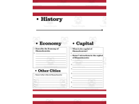
✅ 2 Printable PDF Worksheets – Easy-to-print and classroom-ready, designed with clear sections and visually engaging layouts.
✅ QR Code Integration – Instantly transport your students to Massachusetts' geographic location on Google Maps to visually explore its position within the United States.
✅ Etymology Activity – Dive into the origin and meaning of the name “Massachusetts”, connecting linguistic history with cultural understanding.
✅ General State Information Task – Guide students to summarize key facts about Massachusetts, including nickname, motto and more.
✅ Geography-Focused Questions – Students will write down the names of the states bordering with Massachusetts and they will write about its climate and territory
✅ History Timeline – Includes a blank timeline for learners to research and record major historical events, from early statehood to modern milestones.
✅ Economy Exploration – This activity lets students examine Massachusetts’ economic sectors, such as agriculture, manufacturing, aerospace, and tech industries.
✅ Capital City Focus: writing the name of the capital city + 7 sights
✅ Top 5 Cities Activity – Learners will research and list five major cities in Massachusetts
This Massachusetts US State study consists of 2 PDF printable worksheets, perfect for engaging students in grades 7th-12th as they explore the history and geography of this US State
Learning with Alan is dedicated to supporting teachers, educators, and tutors in achieving their teaching goals while fostering an engaging learning environment. Learning is Fun. Never Forget!
For more of my Teaching Resources, click here Learning with Alan
Related resources
More resources teachers may find useful
24 related resources were found using this product's title, contributor, categories and tags.
In the classroom
Teaching tips & learning objectives

Learning objectives
Locate and record a US state's core statistics - capital, largest city, population, area and population density - from reference sources
Explain where the name Massachusetts comes from
Name the states that share a border with Massachusetts and describe the state's territory and climate in writing

Teaching tips
Two fields date quickly - Current Governor and Current Lieutenant Governor - so point students at an official state source rather than a textbook, and expect to reprint or re-answer these after an election
Population, area and population density work as a set: have students find the first two and calculate the third rather than looking all three up, which turns a lookup into a computation
The capital is asked twice, once as a fact-column field and once as a question on the second page; use the second as a checkpoint before the attractions list rather than treating it as a new question

Skills covered
Research and source-finding - every field on both pages is blank, so students locate each fact rather than reading it off a supplied passage.
Reading and recording quantitative data - population, area and population density are collected side by side, which invites comparison and calculation.
Physical geography description - separate prompts ask students to describe the state's territory and its climate in continuous prose.
Good to know
Questions teachers ask about this resource
Does the pack supply the facts, or do students find them?
Students find them. Every field is a labelled blank line - capital, largest city, population, area, population density, nicknames, motto, governor - and every prose prompt has empty rules beneath it. No passage, map or fact sheet is printed, so the pack works as a research frame rather than a reading exercise.
Which answers will need refreshing over time?
Two in particular: Current Governor and Current Lieutenant Governor change with each election cycle, and the population, area-based density and largest-city figures shift with each census. The name origin, borders, territory, climate and motto fields stay stable.
How much writing does the second page ask for?
More than it looks. Beyond the seven-line economy paragraph, the attractions task allocates two lines to each of seven entries, which invites a name plus a short description rather than a single word, and the five-cities list runs full page width.

No reviews yet
Downloaded this resource? Tell other teachers how it went.
Resource details
Concepts & topics
Core concepts
 Core concepts
State research
US geography
State government
Economy
Reference skills
 Topics
Explore more
Categories this resource belongs to
Explore related searches
More to explore
You may also like