


9,404 products added recently
Page 1005 - Newest Teaching Resources

 Show filters


Lesson on Cold War in Asia
Social Studies, History, History: USA, Grade 9, 10, 11, 12, Lesson Plans, Teacher Tools
Comprehensive Lesson on the Cold War in Asia This comprehensive lesson, dedicated to exploring the Cold War in Asia, is specially crafted for 9th to 12th-grade students. It beautifully integrates into your existing social studies curriculum and sheds light on significant chapters of American history. This resource is available in a convenient downloadable zip file, rendering it remarkably user-friendly. A Unique Approach to Learning This lesson explores the impacts of Asian communism on the USA's foreign policy - containment. Major historical events such as the Communist Revolution in China, Korean War and Vietnam War, are communicated effectively through an engaging teaching methodology implemented within this resource module. Involving Students at Every Step The activity-based learning approach encourages students' active participation and involvement. Students are regrouped into one of three groups, each focusing on a different aspect related to communism's impact during that era within Asia – The Communist Revolution or either war (Korean or Vietnam).\n The Power of Peer Learning A distinct feature embedded within this teaching tool emphasizes peer learning where each group transforms into expert 'lecturers' post their research phase. Critical thinking among young minds gets stimulated as they not only assimilate deep knowledge about their respective topics but also learn from their classmates who become responsible for educating others except their group members over those too. In short, This robust educational module manages to simplify complex factors impacting foreign policies, ignite curiosity among today's youth and transform them into thoughtful global ambassadors capable enough Of discerning past international relationships thereby strongly influencing present diplomatic choices too. Get your hands now on our meticulously prepared Lesson concerning the Cold War in Asia designed not merely for imparting thorough historical knowledge but also for kindling analytical thinking in tomorrow's leaders.
Author Jason Stein
Tags Cold War, Communism Impact, Asian History, Containment Policy, Group Learning

Brazil Map Resources
Social Studies, Geography, Not Grade Specific, Worksheets & Printables, Worksheets
Brazil Map Resources As educators, we are often on the lookout for reliable and relevant resources to aid in our lessons. This comprehensive set of Brazil Map Resources promises to be just that. An invaluable addition to your teaching toolbox, these materials are focused towards social studies classes with a sub-focus on geography. This product offers an extensive collection of twelve different map sheets featuring various aspects of Brazil's geographical layout. The maps are available in pdf, jpeg, and png formats, making them compatible with a wide variety of mediums – from digital displays to printable handouts Each map within this resource set serves a distinct purpose. Blank outlines provide room for student activity. The maps highlighting bodies of water or major settlements can create engaging class discussions around Brazil's geographical features or social demographics. To expand your lesson's scope beyond just one nation, the collection also includes detailed maps displaying Brazil’s geopolitical context among its neighboring countries - lending a broader perspective to students regarding regional characteristics and relationships. A specialty feature about these resources is their adaptability. As an educator you can seamlessly incorporate these maps into your own educational material while maintaining compliance with the guidelines provided in the preview sheet. Finally, this product isn’t grade-specific; it allows great flexibility when adapting it into curriculum plans from early education up through secondary level classes. In summary: The Brazil Map Resources provide comprehensive coverage linked with versatility - enabling educators like us to enhance our social studies/geography presentations and assignments effectively while facilitating engaged learning for our students.
Author Mr Gray History
Tags Brazil Map, Geography Resources, Social Studies, Educator Tools, Hands-on Learning

Botswana Map Resources
Social Studies, Geography, Not Grade Specific, Worksheets & Printables, Worksheets
Botswana Map Resources: An Excellent Teaching Tool The Botswana Map Resources is an invaluable resource in studying various Social Studies subjects, especially Geography. This tool houses twelve different map sheets of Botswana, from blank outlines to maps displaying prominent water bodies and major settlements. Users can conveniently access these maps in three formats: pdf, jpeg, and png. A Holistic Understanding of Geography An exclusive feature of this resource - presenting Botswana both independently and within the context of its neighboring nations - provides students with a comprehensive understanding of geographical location and boundaries. This detailed perspective fosters knowledge about Botswana's interconnectedness with nearby countries. Versatile Usage & Exciting Offers The versatility of the Botswana Map Resources allows users to include these maps in their products. However, they must follow certain guidelines outlined on the attached preview sheet. A free download link for a map of United States is also provided alongside as part their offerings. If you're interested in teaching more global geography, there is a cost-effective bundle offer available that includes maps for over 194 different nations! Suitable for Various Age Groups & Efficient Storage No specific grade preference has been considered while designing these resources implying usability across different age groups according to their understanding levels. The worksheets are stored efficiently using Zip format maintaining content quality while saving space. In Conclusion... To conclude, the Botswana Map Resources, serves as an effective educational instrument that supplements social studies lesson plans well by intriguing students curiosity about global communities and making lesson delivery easier for educators.
Author Mr Gray History
Tags Botswana Geography, Map Resource, Teaching Tool, Social Studies, World Understanding

Bosnia Map Resources
Social Studies, Geography, Not Grade Specific, Worksheets & Printables, Worksheets
Product: Bosnia Map Resources Are you an educator looking for a comprehensive and versatile teaching resource? Look no further; the "Bosnia Map Resources" provides a high-quality geographical solution. This educational resource is not grade specific, meaning it can be used in multiple classrooms to create lessons tailored to students' unique learning needs. The main subject focus is Social Studies, specifically honing in on Geography. Features: "Bosnia Map Resources" boasts 24 individual map sheets available in zip format that includes pdf, jpeg, and png formats for flexibility and ease of use. These maps highlight various geographical aspects of Bosnia which include but are not limited to blank outlines, bodies of water, major settlements and its location regarding surrounding nations. The resources assist in creating an enriching visual environment where students gain a better understanding of geography dynamics by vividly showcasing Bosnia's physical positioning among other countries. Note: One unique aspect of this set is the usage policy; educators can incorporate these maps into their original educational products according to the provided guidelines on the preview sheet ensuring copyright compliance while promoting creative academic content development—proof that learning about world geography doesn't have to be bland or uninspiring! This package can prove beneficial not only as part of your core study plan but also as a background tool for broader topics discussions or global current events reflections—it carries adaptability at its core. In short, these Bosnia Map Resources act as versatile tools offering enriched location context fostering deeper student engagements regardless if you teach public-school classes or guide homeschooled students' progress through global understanding—an essential addition towards shaping well-informed global citizens.
Author Mr Gray History
Tags Bosnia Geography, Map Resources, Social Studies, Major Settlements, Educational Tools
Bolivia Map Resources
Social Studies, Geography, Not Grade Specific, Worksheets & Printables, Worksheets
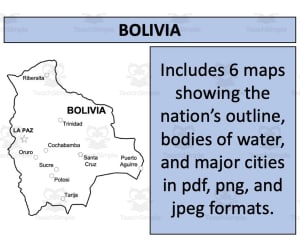
The Bolivia Map Resources The Bolivia Map Resources is an encompassing teaching tool aimed at educators in various learning environments. It consists of twelve individual map sheets that provide a comprehensive view of Bolivia and its geographical context. It's an excellent resource for students to deepen their understanding of geography. Multiple Formats, Versatile Use With this tool, you'll find map formats available in pdf, jpeg, and png versions for your convenience. What makes these files truly versatile is they are not grade-specific— they cater to students ranging from kindergarteners to middle schoolers with ease. Educational Incorporation Ideally, teachers can integrate these maps into lesson plans or activities focused on social studies or geography. This can promote student interaction through note taking or annotation exercises - this active involvement enhances geographic literacy considerably around Bolivian context. A Resource Beyond Classrooms An exceptional feature: legal use extends beyond personal classrooms when specific guidelines are adhered to; serving as a sharing mechanism among global teacher communities. Making Geography Accessible & Exciting! Learning has never been more practical and interconnected with real-world dynamics than with our Bolivia Map Resources package. A prudent investment towards equipping students with essential geographical literacy skills – catalyzing quality education always!
Author Mr Gray History
Tags Bolivia Geography, Map Resources, Teacher Tool, Social Studies, World Geography

Bhutan Map Resources
Social Studies, Geography, Not Grade Specific, Worksheets & Printables, Worksheets
Bhutan Map Resources This teaching resource, known as "Bhutan Map Resources", is a detailed collection of mapping tools intended for educational use. It's an incredibly versatile tool, suitable for teaching Social Studies or Geography at any grade level. The package features six individual map sheets available in three convenient formats: pdf, jpeg, and png. This offers adaptability based on the user's technical abilities and preferences. Map Details: The included maps provide both blank outlines and complex depictions of water bodies and major settlements in Bhutan. Teachers can use these to focus on Bhutan alone or its connections with neighbouring countries, offering opportunities to discuss geopolitical relationships in context of geographical features. Creative Permissions: Beyond just being instructional materials, purchasers are allowed to leverage these maps for creative purposes - like projects or presentations. This may involve using them as foundational elements onto which they can layer their own designs. However, certain usage rules must be followed (see preview sheet). All files are neatly packed into a simplified zip format available for instant download upon purchase completion. Lastly but importantly: Beyond focusing on Geography, these maps can boost creativity skills – making it equally valuable resource not only for geography teachers but all imparting education across disciplines!
Author Mr Gray History
Tags Bhutan, Map Resources, Social Studies, Major Settlements, Geopolitical Relationships

Bermuda Map Resources
Social Studies, Geography, Not Grade Specific, Worksheets & Printables, Worksheets
Bermuda Map Resources If you're in search of a useful educational tool that can provide an in-depth overview of the country of Bermuda, our Bermuda Map Resources product could be just what you need. This resource is not bound by grade levels making it an incredibly versatile addition to both public and homeschooling lessons. It fits perfectly under the subject area of Social Studies, especially geography. The product comprises six distinct map sheets for educators. Each map sheet is available in pdf, jpeg, and png formats catering to different teaching or learning preferences. The variety allows space for creativity and customization. Blank Outline Maps: Ideal for memory drilling or labelling exercises. Natural Features Maps: These focus on natural features such as bodies of water within Bermuda. Detailed Settlements Maps: Providing practical knowledge about population distribution across the island which can aid discussions around economy, culture and society within Bermuda. We've also ensured that one version shows Bermuda in relation with its neighboring nations. Viewing how these countries relate geographically can instigate broader discussions on international relationships or regional ecosystems etc. This resource allows flexibility if you desire creating derivative products using these maps (for example integrating them into flashcards or interactive slides), there's scope for doing exactly that! Just keep in mind there are usage instructions provided on the preview sheet which should guide any adaptations. Navigating teaching resources doesn't have to be complicated; keep things simple yet effective with our content-rich 'Bermuda Map Resources' product.
Author Mr Gray History
Tags Bermuda, Geography, Map Resources, Social Studies, Educational Tool
Benin Map Resources
Social Studies, Geography, Not Grade Specific, Worksheets & Printables, Worksheets
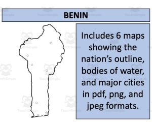
Product Title: Benin Map Resources The Benin Map Resources is a comprehensive teaching resource, specifically crafted with educators in mind. This product serves as an invaluable tool for those teaching Social Studies, particularly the subtopic of Geography. It’s not grade specific, thus it can be efficiently utilized by teachers of different grade levels to give learners an in-depth understanding of the geographic layout and distinctive features of Benin. The key content includes six distinct map sheets presented in three essential formats: pdf, jpeg, and png. The variety ensures that teachers can use them across various platforms depending on their preference or teaching environment requirements. The maps present multiple aspects including blank outlines for student exercises or assessment purposes; Bodies of water which accurately depict water masses such as lakes and rivers within Benin; Major settlements that point out significant cities or population-rich locations. This resource showcases Benin independently as well as along with its neighbor nations. This aids learners to place the country within its larger context continentally and grasp its physical connections with surrounding regions. Though primarily meant for instructional purposes within your classrooms or homeschooling scenarios, these maps offer flexibility too! With some user guidelines (found on the preview sheet), you’re allowed to utilize these maps in creating your own products – a feature valuable for teacherpreneurs in education marketplaces. In sum up, this product provides sophisticated yet accessible geographical insight into Benin's landscape that will enrich any related lesson plan while tandemly offering possibilities towards creating resources commercially.
Author Mr Gray History
Tags Benin Geography, Map Resources, Social Studies, Teaching Toolkit, Global Studies

Belize Map Resources
Social Studies, Geography, Not Grade Specific, Worksheets & Printables, Worksheets
Belize Map Resources A comprehensive teaching tool catering to the needs of educators in public, private schools or homeschooling environments. This resource is not grade-specific and is ideal for Social Studies classes focusing on geography. In-depth look into Belize This Belize Map Resources offers an in-depth look into various maps featuring Belize. These are not just ordinary maps but a collection of twelve distinct map sheets in easy-to-use PDF, JPEG and PNG formats. The range of diversity featured here is significant: Blank outlines that can be customised according to your lesson plans. Bodies of water to give students an understanding of Belize's aquatic geographies. Major settlements that highlight the populated areas within the country. Furthermore, these Belize Map Resources also feature Belize as a standalone nation with borders defined clearly. A broader perspective is offered by including detailed representations showing its placement with respect to surrounding countries. Versatile Usage & Easy Accessibility This Belize Map Resources come neatly packed within hassle-free zip files for easy download and use. Whether you want them printed for physical workbooks or digitized for online learning - this product has got you covered! Elevate Your Teaching Experience with the Belize Map Resources Today! These come ready to print and use!
Author Mr Gray History
Tags Belize Maps, Geography Teaching, Educational Resources, Map Collections, Social Studies

Belgium Map Resources
Social Studies, Geography, Not Grade Specific, Worksheets & Printables, Worksheets
Belgium Map Resources This Belgium Map Resources teaching resource is a comprehensive and versatile package designed to enhance geography lessons. Crafted eloquently, it's adaptable across different age ranges and academic levels. The product provides twelve distinct map sheets that come in jpeg, pdf, and png formats; convenient for various teaching styles. Each map sheet includes diverse features: Blank outlines for student interaction Marked bodies of water and major settlements for detailed study Includes 12 maps showing the nation's outline, bodies of water, and major cities. A highlight is the presentation of Belgium Map Resources both individually for focused study as well as within its surrounding nations; encouraging comprehension about its geopolitical connections. Educators can incorporate these resources into their personal materials or projects. The Belgium Map Resources serves primarily within Social Studies curriculums under Geography subcategory but carries multifunctional educational potential that can be adjusted as per specific learning objectives or outcomes. Note: Delivery via zip file type ensures easy accessibility. Incorporate visual learning into your curriculum – not only does it increase student engagement but also makes complex ideas simpler! This Belgium Map Resources is ready to print and use with your students individually, in small groups, or the whole class!
Author Mr Gray History
Tags Belgium, Geography Resources, Map Sheets, Digital Teaching Tool, Social Studies

Belarus Map Resources
Social Studies, Geography, Not Grade Specific, Worksheets & Printables, Worksheets
Belarus Map Resources: An Overview The Belarus Map Resources product is a comprehensive collection of maps that focus on the Eastern European country of Belarus. The resources are designed to be flexible, offering diverse teaching possibilities for educators aiming to enhance their geography lessons with real-world reference materials. What’s included? A total of twelve distinct maps are included in this resource, each one presented in pdf, jpeg or png formats for optimal convenience and usability across multiple platforms. The following types of maps are provided: Blank outlines suitable for labeling activities or memorization assignments Detailed maps highlighting significant bodies of water and other crucial geographic features Maps charting major settlements within the nation Broad context views featuring Belarus both as an isolated entity and positioned amongst neighboring nations Note: This product allows teachers to use these resources not only in classroom instruction but also incorporate them into their original education products. All these materials are offered as a zip file download ensuring easy acquisition and organization thereby simplifying preparation efforts considerably while lending professional depth any well-rounded lesson should have. User flexibility: Open for all educators! Maintaining its non-grade-specific nature makes it adaptable across different education levels from early learning up until advanced studies allowing teachers scaling complexity based on learners’ capacity or curriculum goals. Excellent usability benefits public school teachers seeking fresh approaches towards teaching complex subjects; perfect even for dedicated homeschoolers trying to customize learning experiences around unique learner's interest.
Author Mr Gray History
Tags Belarus Geography, Map Resources, Teaching Aids, Geopolitical Study, Environment Dynamics

Barbados Map Resources
Social Studies, Geography, Not Grade Specific, Worksheets & Printables, Worksheets
Barbados Map Resources An Ideal companion for any social studies or geography curriculum. Specially designed for students and educators, this is an easy-to-use tool that can enhance your lessons about Barbados. About the Maps Our product provides a comprehensive set of maps showcasing the island nation of Barbados. It includes three separate sheets in PDF, JPEG, and PNG formats for ease of use on different platforms. The first map outlines the coastal contours and interior details, The second map focuses on bodies of water making it useful for demographic studies or climate discussions, The third one highlights major settlements thereby critical information when discussing socio-economic aspects. Precision and Versatility Each map has been created with precision and clarity to allow a clear understanding of various geographical features. This multi-format offering allows you to integrate these maps into presentations or interactive activities effectively. A Resource Appropriate Across Different Levels This versatile geography aid fits smoothly into various lesson plans - from simple country identification exercises to complex demographic debates irrespective of grade levels - tailor-fit even in public school classes or homeschool setups. Digital Convenience At Your Service! Easily-downloadable zip-file-based resource accessible anytime anywhere; learning about Americas Caribbean neighbor has never been so engaging fun straightforward thereby ultimately meaning enhanced academic outcomes enriched education experiences overall personality growth setting up future leaders aptly strongly!
Author Mr Gray History
Tags Barbados, Geography, Map Resources, Social Studies, Lesson Tools

Bangladesh Map Resources
Social Studies, Geography, Not Grade Specific, Worksheets & Printables, Worksheets
Bangladesh Map Resources: An Educator's Practical Tool This resource consists of six distinct maps, available in pdf, jpeg, and png formats. This makes it usable across multiple platforms as per need. Each map showcases Bangladesh from a unique perspective: Blank outlines for labeling exercises or tests. Versions with bodies of water clearly marked for geographical studies. Detailed maps highlighting major settlements for advanced studies. Note: Some versions display Bangladesh both alone and alongside its neighboring countries to provide context. One standout feature of this teaching material is the permission to use these maps not only in your own classroom but also within your own educational products (as long as you follow provided instructions). Suitability Across Grades The content herein suits Social Studies classes among all age groups due to its versatile nature. From simple geographic outlines ideal for younger grades up through more detailed topographic details useful in an older student’s study - this tool covers it all! Ease Access Across Devices The resources are offered as zip file downloads that ease access across devices without any compromise on quality—a handy tool for effective lesson planning—both at school and home. This Bangladesh Map Resources is ready to print and use!
Author Mr Gray History
Tags Bangladesh Map, Geography Teaching, Map Resources, Social Studies, Educational Product

Bahrain Map Resources
Social Studies, Geography, Not Grade Specific, Worksheets & Printables, Worksheets
Bahrain Map Resources This Bahrain Map Resources is a comprehensive teaching resource designed to make teaching social studies and geography more engaging. The maps come in portable formats such as pdf, jpeg, and png for compatibility with various digital devices. The educational resource includes six different map sheets that present a wide range of geographical data about Bahrain. These include: Blank outlines for student activities or examinations Detailed maps indicating major bodies of water Maps highlighting key settlements Furthermore, it portrays Bahrain in isolation as well as juxtaposed with neighboring nations. This aspect is critical for studying geopolitical relations. The content is versatile enough to suit all grade levels and complexity gradients in your lessons. This Bahrain Map Resources is a great resource to have handy in the class for when studying Bahrain. These maps may be handed one by one, or all at once depending on how the unit is designed. Educators can use these maps within their own material provided they adhere to guidelines noted on the preview sheet. This flexibility allows you to personalize your lesson plan in alignment with specific curriculum needs or student learning styles. This product was designed not only for school teachers but also homeschoolers looking robust learning tools ensuring deeper engagement during geography lessons.
Author Mr Gray History
Tags Bahrain Map, Geography Education, Teaching Resource, Lesson Planning, Social Studies

Azerbaijan Map Resources
Social Studies, Geography, Not Grade Specific, Worksheets & Printables, Worksheets
Azerbaijan Map Resources These Azerbaijan Map Resources are designed to assist educators in enriching their social studies and geography curriculums. This collection includes twelve different map sheets of varying formats including pdf, jpeg, and png so that they can be incorporated efficiently into various lesson plans. The Barbados Map Resources in this resource set not only feature blank outlines for flexibility but also include details on bodies of water and major settlements. This enables teachers to create a customized learning environment that fully supports their teaching objectives. Versatile Teaching Tool: The resources let students explore Azerbaijan's geographical context by showcasing the country both individually and within its surrounding nations. Furthermore, these maps can also be used within the educators' own produced materials such as worksheets or project handouts - if instructions found on the preview sheet are adhered to carefully. This Barbados Map Resources is created with utmost precision ensuring these adaptable materials cater appropriately across grades making it functional yet flexible enough for diverse teaching needs. Note: Since this product file type is zip ensure your device or computer system supports relevant software or applications necessary to unzip files in order extract content within properly. After unzipping, it is ready to print and use!
Author Mr Gray History
Tags Azerbaijan, Geography Resources, Map Tools, Social Studies, Lesson Planning

Austria Map Resources
Social Studies, Geography, Not Grade Specific, Worksheets & Printables, Worksheets
Austria Map Resources These are an excellent teaching tool for educators and homeschoolers alike, specially designed to assist in the subject of Social Studies with a focus on Geography. Resource pack comprises: Twelve distinct map sheets formatted in pdf, jpeg, and png for broad compatibility across diverse platforms. Versatile tools featuring different illustrative styles of Austria's map including blank templates, maps showing bodies of water and major settlements across Austria. Included resources showcasing Austria's geographic placement among neighboring countries for a broader perspective. This resource bundle makes mapping out lessons conducive! Fostering engaging student interaction that makes learning geography fun and practical – teaching should feel simplified not complicated! Please note that this product is not grade specific; it serves an expansive scope reaching students at differing levels within their educational journey aiming higher academic standards through customizable content adaptability based on individual educational needs – showing once more its flexibility as a tool in every educator's quiver. This Austria Map Resources is ready to use. All you have to do is print and go. If you'd like for your students to engage with these maps one at a time, you can do so. Otherwise, make sure you make the sets before handing out!
Author Mr Gray History
Tags Austria Map, Geography Education, Teaching Resources, Social Studies, Interactive Learning

Australia Map Resources
Social Studies, Geography, Not Grade Specific, Worksheets & Printables, Worksheets
Australia Map Resources An excellent educational tool for both public school teachers and homeschoolers. The Australia Map Resources comprises of six individual sheets of Australia maps, available in diverse formats including pdf, jpeg, and png. Catering to a range of teaching requirements, the map types include: Blank outlines – to facilitate active learning. Bodies of water maps – for comprehensive introduction to aquatic geography. Major settlements maps - crucial for human geography studies. Please Note: These resources align with fair-use policies and can be integrated into your personal instructional materials provided the guidelines detailed on the preview sheet are strictly adhered. Grade applicability and Subject Focus The resource is not grade-specific but aims at a broad spectrum of learners at different stages. It mainly assists in social studies instruction with strong emphasis on geography—perfect for learners exploring continents or tackling Australian history/geographic features. Diversity & Flexibility The types offered are primarily worksheet-oriented, seamlessly weaving into existing curriculum structures while enabling opportunities for independent study. Note: Easily downloadable zip file types are included; just download and extract! In conclusion, having readily accessible tools like these offer educators an avenue to make students more engaged in understanding global geography. They equally reinforce understanding regarding Australia's distinct geographical topography applying detailed visuals coupled with interactive tasks.
Author Mr Gray History
Tags Australia Maps, Geography Resource, Social Studies, Interactive Learning, Major Settlements

Armenia Map Resources
Social Studies, Geography, Not Grade Specific, Homeschool Resources, Worksheets & Printables, Worksheets
Armenia Map Resources: An Excellent Teaching Tool Our product, the Armenia Map Resources, is a fantastic teaching resource for educators in both public schools and homeschools. This product, available as a zip file, offers twelve map sheets of Armenia. These geography-related resources have been designed keeping interest of learners and convenience of teachers in mind. Variety In Map Formats PDF format: Perfect for printing or displaying on a digital board. JPEG Format: Allows easy incorporation into PowerPoint presentations or other multimedia platforms. PNG Format: Offers transparency feature making them blend seamlessly with different backgrounds. Diverse Features For Enriched Learning The map sheets cast spotlight upon various geographical elements like : Blank outlines permitting personal coloring or testing geographical knowledge, Mappings highlighting major settlements facilitating lessons on political geography Underlying Principle Of Our Product The essence of our products lies in the experiential learning that they induce. Instead of rote memorization methods these maps invite interaction from learners through activities like labeling, coloring & spatial analyses. Whether you are starting off instruction about world geographies with significant countries like Armenia or expanding it - detailed Armenian map worksheets can be an impactful addition to your toolkit! Let's empower every teaching moment with substantive educational products today!
Author Mr Gray History
Tags Armenia Maps, Geography Lessons, Homeschool Resources, Physical Geography, Political Geography

Argentina Map Resources
Social Studies, Geography, Not Grade Specific, Worksheets & Printables, Worksheets
Argentina Map Resources This resourceful collection of Argentina Map Resources was designed specifically for educators in schools and homeschoolers. It is optimal for personal as well as teaching purposes. This Argentina Map Resource beyond traditional classroom settings making it an excellent addition for anyone seeking in-depth geographic knowledge about Argentina. Made up of twelve separate map sheets, this product provides a widespread overview of Argentina's geographical diversity. The maps are available in multiple formats such as pdf, jpeg, and png ensuring adaptability based on your requirements. Detailed maps with features like blank outlines useful for learning or testing purposes. Bodies of water outlined to understand natural water resources within the nation. Pinning of major settlements to learn about significant urban areas in Argentina. This Argentina Map Resource further includes resources showing Argentina isolated as well as alongside its neighboring nations providing a wider context for learning about geo-politics and international relations. Instructions are present on the preview sheet facilitating users looking to incorporate these map resources into their products/classroom materials. Note: These educational geographical tools provided aren't specific to any grade level - any social studies educator can utilize them across diverse grades maximizing their efficiency. The zip file format contains worksheets predominantly aiming at fostering abundant understanding of geography among students through captivating activities facilitating systematic learning. This product greatly delivers value due its vast inclusivity promoting comprehensive geographic education accessible according to user’s preferred format delivering unmatched flexibility meeting tailored needs effectively.
Author Mr Gray History
Tags Argentina Geography, Map Resources, Teaching Tools, Geographic Education, Educational Maps

Antigua and Barbuda Map Resources
Social Studies, Geography, Not Grade Specific, Homeschool Resources, Worksheets & Printables, Worksheets
Antigua and Barbuda Map Resources An exceptional educational tool that can significantly enhance geography lessons for all grade levels, this product is a complete collection of six different map sheets for both Antigua & Barbuda. Available in multiple formats including pdf, jpeg, and png, it provides flexibility to cater to individual preferences or needs. Purpose and Types of Maps Blank Format Maps: Ideal for testing geographical knowledge or practicing handwriting skills. Detailed Maps: Showcase bodies of water for deeper geographical understanding. Habitat & Settlements: Highlight major settlements to support lessons focused on societal structures and settlement patterns. The versatility of this resource makes it seamlessly blend into any curriculum structure. It extends practical use beyond social studies into several other subjects, supporting teachers effortlessly with their teaching materials while promoting active engagement from students during lessons. An added benefit is the inclusion of rights allowing these maps to be incorporated into other products This versatile resource is provided as a zip file type for easy downloading without compromising quality rendering maximum pedagogical benefits suitable across distinct utility purposes: assignment creations, tests preparation, project work etc. Acquire this practical learning tool today & open doors towards explorative & interactive geographical learning tomorrow!
Author Mr Gray History
Tags Antigua And Barbuda Maps, Geography Resources, Educational Tools, Social Studies Materials, Homeschooling Resources

Angola Map Resources
Social Studies, Geography, Not Grade Specific, Homeschool Resources, Worksheets & Printables, Worksheets
Angola Map Resources The Angola Map Resources is a comprehensive teaching tool designed for public school educators and homeschoolers, serving as an engaging addition to any geography or social studies curriculum. The product isn't grade-specific, making it adaptable for a diverse range of students. This versatile resource offers twelve individual map sheets in easily accessible pdf, jpeg, and png formats. Detailed Features: Maps highlighting different features of Angola including blank outlines perfect for exercises requiring students to fill in essential details. Captures elements such as major bodies of water and cities or settlements that would assist students in gaining detailed knowledge about the country's geographical makeup. Illustrations displaying the geographical context surrounding this African nation. The Angola Map Resources package also presents illustrations displaying the geographical context surrounding this African nation. By seeing Angola not only as an isolated unit but also within its regional boundaries alongside neighboring countries, it aids learners in developing a more holistic understanding. Adhering to teachers' needs for flexibility with their material usage policy; customers can freely incorporate these maps into their own educational products provided that they follow guidelines specified on the preview sheet. Educational resources need not be expensive but valuable and fun at every stage! Ideal for teaching Geography under Social Studies across multiple grades; these worksheets come highly rated both for information accuracy and learner engagement. This file type being Zip makes sure you have all your teaching gear safely stored all under one fold - making your digital workspace neat & clean while you unlock new pathways into geographic enlightenment together using the Angola Maps Resources.
Author Mr Gray History
Tags Angola Geography, Map Resources, Social Studies, Teaching Tool, Homeschooling

Andora Map Resources
Social Studies, Geography, Not Grade Specific, Worksheets & Printables, Worksheets
Andora Map Resources Offering a comprehensive toolkit for educators, the Andora Map Resources can significantly enhance geography teaching lessons. Although this product is particularly beneficial for social studies teachers in public schools or those homeschooling students, it's effective for all grade levels. Diversity and Detail of Maps Multiple Formats: The resource comprises twelve map sheets. Each sheet is available in various formats — PDF, JPEG and PNG — thereby ensuring maximum versatility and convenience. Detailed Outlines: These maps are highly detailed featuring blank outlines to test students' grasp over geographical shapes and borders. Bodies of water have also been marked explicitly providing nuanced information about geography of Andora. Included Settlements: To aid understanding of human geography patterns, these maps showcase major settlements increasing awareness about inhabitants' locations within geographical features. Context Maps: The set includes standalone views as well as variants that contextually show Andora with neighboring nations- an excellent point of discussion when covering regional geopolitics or historical topics. Educator Advantage Listed below are some unique benefits offered by the product specifically tailored towards educators- Versatility: The flexibility here lies in the fact that not only can these resources be directly used in lessons but if adhered to certain guidelines(administrated in preview sheet), these resources could be incorporated into their own products enhancing overall adaptability quotient of our materials. An accessible tool through zip files, our offering stands ready to enrich your educational endeavors whether you're aiming at improving your social studies lectures or wish introducing cross-curricular connections between geography and other subjects with high-quality worksheet solutions.
Author Mr Gray History
Tags Andora Map, Geography Teaching, Social Studies Resources, Human Geography, Regional Geopolitics
Algeria Map Resources
Social Studies, Geography, Not Grade Specific, Worksheets & Printables, Worksheets
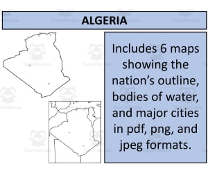
Algeria Map Resources: An Educational Package This teaching aid, not specific to any grade, consists of six varied map sheets. It's designed with compactness in mind, coming as a Zip file for easy storage and handling. The material encompasses PDFs, JPEGs, and PNG formats for flexibility. Includes maps that portray Algeria alone or along with neighboring nations Variety in map types—blank outlines for memory testing or filled variants displaying key features like major bodies of water and principal settlements Permits use in personal products following the instructions on the preview sheet—a valuable feature for educators creating custom resources Bonus & Bundled Offers: If you're looking to broaden your mapping resources beyond Algeria, you also get access to United States Maps at no extra cost. For those interested in comprehensive geography studies—there's an opportunity to access maps from 194 different nations at a discounted rate within the complete bundle. Potential Users: This product is particularly relevant among public school teachers drafting lesson plans related to international studies/geography lessons. In addition, homeschoolers can benefit by infusing their curriculum with world geography through such handy worksheets. This Algeria Map Resources is a ready to use resource and all you have to do is print!
Author Mr Gray History
Tags Algeria Map, Teaching Aid, Geography Resources, International Studies, Social Studies

Albania Map Resources
Social Studies, Geography, Not Grade Specific, Worksheets & Printables, Worksheets
Albania Map Resources Albania Map Resources is an all-inclusive educational tool that caters to educators across different grade levels who teach geography. This well-developed resource is composed of twelve individual map sheets, available in several formats - PDF, JPEG, and PNG files. Features: Each sheet offers a unique perspective of Albania's geography to aid varied aspects of instruction. Certain maps present blank outlines ideal for evaluating students' understanding of the country's shape and boundaries. In contrast, other maps depict bodies of water and chief settlements enabling students to familiarize themselves with paramount geographical features of Albania. The maps can be smoothly integrated into various activities such as schoolwork or projects; they supplement lessons about Albania's geography by providing excellent visual aids - enhancing comprehension considerably in comparison with merely text-based lessons. As a result, this feature can facilitate engaging classroom discussions or incite insightful queries during homeschooling sessions. A Distinguishing Feature: An exclusive characteristic this resource offers is the portrayal of Albania isolated on one map sheet alongside another sheet presenting its neighboring countries' relative positions. This layout allows students to understand how the national connectivity fits within broader regional concepts. In essence, Albania Map Resources are crafted not just as worksheets but also as tools promoting intellectual curiosity among students while guiding their scholarly journey across the globe—right from your classroom or home tutoring spaces!
Author Mr Gray History
Tags Albania, Geography Instruction, Map Worksheets, Comparative Studies, Interactive Learning