All About Canada - Map & Crossword Activity



- Grades
- Grades 3–7, Elementary, Middle School
- Pages
- 6
- File type
- Answer key
- Included


- Subject
- Social Studies, Geography
- Topic
- Canada, All about
- Resource types
- Crosswords Puzzles, Worksheets, Worksheets & Printables
- Answer key
- Included
About this resource
What's inside this resource
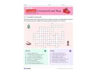
This Canada crossword and map set gives students a full review of Canadian geography in four printable pages. It starts with a 15-clue Canadian crossword puzzle covering the capital, the three oceans, Hudson Bay, Niagara Falls, the loonie, the beaver, the Mountie and other national symbols.
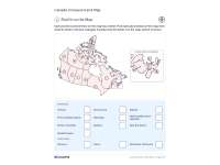
From there, students move to the map. Each of the 13 provinces and territories carries a letter on an outline map of Canada, with an enlarged close-up so the three small Maritime provinces are easy to read. Students:
- write the map letter for each province and territory
- match all 13 capitals using a word bank
- answer four Map Detective questions, such as which two provinces have no coastline
- put six provinces in order for a road trip from British Columbia to Nova Scotia
- explain the difference between a national capital and a provincial capital
- choose a place to visit and describe where it is
Two answer key pages show the filled crossword grid, the lettered map with a place and letter table, every capital, and sample answers for the writing tasks. The set suits grades 3 to 7 social studies and can be downloaded in color or in black and white for easy copying.
Related resources
More resources teachers may find useful
24 related resources were found using this product's title, contributor, categories and tags.


In the classroom
Teaching tips & learning objectives

Learning objectives
Locate each of Canada's ten provinces and three territories on an outline map
Match every province and territory to its capital city
Use the map to compare locations, coastlines and relative size

Teaching tips
Start with the crossword to warm up the vocabulary, then move on to the map pages.
Point out the example line on the map page so students know to write the map letter, not the place name, in each box.
Remind students that the Map Detective questions ask about provinces only, since Yukon sits farther west than British Columbia but is a territory.

Skills covered
Map reading: students find each province and territory by its letter on an outline map, using an enlarged inset for the smallest provinces.
Geography vocabulary: crossword clues build familiarity with Canada's capital, oceans, landmarks and national symbols.
Spatial reasoning: students compare positions, coastlines and sizes to answer questions about the map.
Good to know
Questions teachers ask about this resource
Does the crossword ask for province names?
No. The 15 crossword answers cover Canada's capital, oceans, landmarks, symbols and culture, so the province and capital names are practiced on the map pages instead.
How are the small Atlantic provinces shown?
A dashed box on the map marks the east coast, and an enlarged close-up beside it shows Nova Scotia, New Brunswick and Prince Edward Island with their letters.
Is there an answer key?
Yes. Two key pages give the completed crossword, every map letter, all 13 capitals, the road trip order and sample answers for the writing tasks.
Is it printable?
Yes. It comes as a full color PDF and a black and white PDF for easy copying, and students fill in the crossword squares and map pages by hand.

No reviews yet
Downloaded this resource? Tell other teachers how it went.
Resource details
Concepts & topics
Core concepts
 Core concepts
Canadian provinces and territories
Capital cities
Map skills
Physical geography
National symbols
 Topics
Explore more
Categories this resource belongs to
Explore related searches
More to explore
You may also like