



United States Geography Worksheets


- Grades
- Grades 3–5, Elementary
- Pages
- 9
- File type
- Preparation
- Print ready


- Subject
- Social Studies, Geography
- Topic
- United States, States and Capitals
- Resource types
- Worksheets & Printables, Worksheets
- Preparation
- Print ready
Product description
From the author
Reviewed, evaluated, edited, and creatively written by teaching professionals, this Social Studies-focused digital resource implements current teaching strategies and aligns with grade-level standards to teach about United States geography. With the ability to print the pages over and over, your child can complete the activities again and again until the skills have been mastered.
Includes activities that focus on:
• The United States of America
• Other U.S. Properties
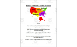
• Regions
• Capitals
• Landmarks
Related resources
More resources teachers may find useful
24 related resources were found using this product's title, contributor, categories and tags.


In the classroom
Teaching tips & learning objectives

Learning objectives
Locate and identify all 50 US state names in a word-search puzzle.
Match Northeast states and capitals, find Midwest capital names, and answer South-region geography questions.
Identify US territories (Puerto Rico, Guam, Northern Mariana Islands, US Virgin Islands) and describe their relationship to the United States.

Teaching tips
Assign one region's worksheet per class period (Northeast, Midwest, South) to break the pack into shorter geography mini-lessons.
Use the state-name word search as a warm-up before introducing the regional capital-matching pages.
Pair the True/False page with a wall map so students can verify or correct false statements about capital cities.

Skills covered
US states and capitals recall -- students match Northeast capitals and use regional maps and puzzles to review other state and capital names.
Map and word-search skills -- students locate all 50 state names hidden in a word-search grid.
Regional geography classification -- students group states into the Northeast, Midwest, and South regions and identify defining physical or cultural features, such as the Appalachians or Midwest corn/soybean production.

No reviews yet
Downloaded this resource? Tell other teachers how it went.
Resource details
Concepts & topics
Core concepts
 Core concepts
US geography
State capitals
US regions
Map skills
 Topics
Explore more
Categories this resource belongs to
Explore related searches
More to explore
You may also like


